Catskill Mountaineer
 
MENU
WEATHER

Click for Forum

catskill mountaineer facebook link

faq for catskill mountains

Links and Information for hiking in the catskill mountains

USGS topo maps of the Catskill Mountains

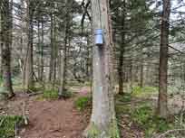
Slide Mountain Wilderness Map

Slide Mountain Wilderness map
 
 
cornell mountain and wittenberg mountain
Balsam Cap Mountain & Friday Mountain - 7.69 mile trip - 7.00 hours. Difficult. This is a BUSHWHACK! Spectacular views from the summit of Balsam Cap Mountain. This hike has elevation gain of 2,800'.


difficult snowshoeing catskill mountains
 
 
breath hill
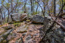
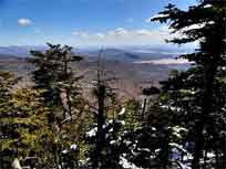
Breath Hill from Peekamoose Road - 3.54 mile trip - 2.5 hours. BUSHWHACKING required for part of the trip to the summit. Moderate. Good views from beginning of the trail.


intermediate snowshoeing catskill mountains
 
 
slide and cornell mountain
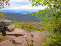
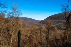
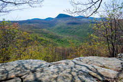
Cornell & Slide Mountains - 10.26 mile trip - 7 hours. Difficult. 4 view spots. East side of Slide Mountain has challenging rock scrabbles. Slide is the highest mountain in the Catskill Mountains..


difficult snowshoeing water source campground catskill mountains
 
 
giant ledge panther mountain
Giant Ledge & Panther Mountain (from GIANT LEDGE PA) - 6.87 mile trip - 4.75 hours. Moderate. Spectacular views from Giant Ledge. Panther Mountain also has nice views.


intermediate snowshoeing water source campground catskill mountains
 
 
giant ledge panther mountain
Giant Ledge & Panther Mountain (from SLIDE MOUNTAIN PA) - 10.22 mile trip - 6-7 hours. Easy. Spectacular views from Giant Ledge. Panther Mountain also has nice views.


intermediate snowshoeing water source campground catskill mountains
 
 
giant ledge panther mountain
Giant Ledge & Panther Mountain (from WOODLAND VALLEY PA) - 10.60 mile trip - 6-7 hours. Moderate. Spectacular views from Giant Ledge. Panther Mountain also has nice views.


easy snowshoeing water source campground catskill mountains
 
 
lone and rocky mountain
Lone Mountain & Rocky Mountain - 10-14 miles depending upon the routep - 8:00-to-12.00 hours. Difficult. This is a BUSHWHACK! Limited views from the summits in the Winter. In the Summer these views are poor. This hike has elevation gain of 1,525'.


difficult snowshoeing catskill mountains
 
 
table peekamoose mountain
Peekamoose Mountain from the Peekamoose Valley - 7.90 mile trip - 5 hours. Moderate. Good views from Table Mountain and Peekamoose Mountain. .


intermediate snowshoeing water source campground catskill mountains
 
 
table peekamoose mountain
Peekamoose & Table Mountain from the Neversink - 9.10 mile trip - 6 hours. Moderate. Good views from Table Mountain and Peekamoose Mountain. .


intermediate snowshoeing water source campground catskill mountains
 
 
mt pleasant & wittenberg mountains
Phoenicia East Branch (Phoenicia to Woodland Valley) - 11.62 miles - 8 hours. Easy. 6 view points. Two view points are excellent. This hike has elevation gain of 1,760'.


moderate snowshoeing catskill mountains
 
 
mt pleasant & wittenberg mountains
Phoenicia East Branch (Entire Trail) - 21.49 miles - 3 Day BACKPACK. Moderate. Fairly level hike. 6 view points. Two view points are excellent. This hike has elevation gain of 1,760'.


easy snowshoeing catskill mountains
 
 
lone mountain and rocky mountain
Rocky Mountain & Lone Mountain - 10-14 miles depending upon the route - 8:00-to-12.00 hours. Difficult. This is a BUSHWHACK! Limited views from the summits in the Winter. In the Summer these views are poor. This hike has elevation gain of 1,525'.


difficult snowshoeing catskill mountains
 
 
romer mountain
Romer Mountain from Phoenicia - 7 miles - 4 hours. Easy. No views. This hike has elevation gain of 1,389'.


easy snowshoeing catskill mountains
 
 
romer mountain
Romer Mountain & Mt Pleasant from Phoenicia - 10 miles - 6-7 hours. Easy. 3 view points. One view point is excellent. This hike has elevation gain of 1,760'.


easy snowshoeing catskill mountains
 
 
mt pleasant & wittenberg mountains
Romer, Mt Pleasant, Cross, Woodland Valley from Phoenicia - 11.62 miles - 8 hours. Easy. 6 view points. Two view points are excellent. This hike has elevation gain of 1,760'.


moderate snowshoeing catskill mountains
 
 
slide mountain
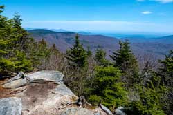
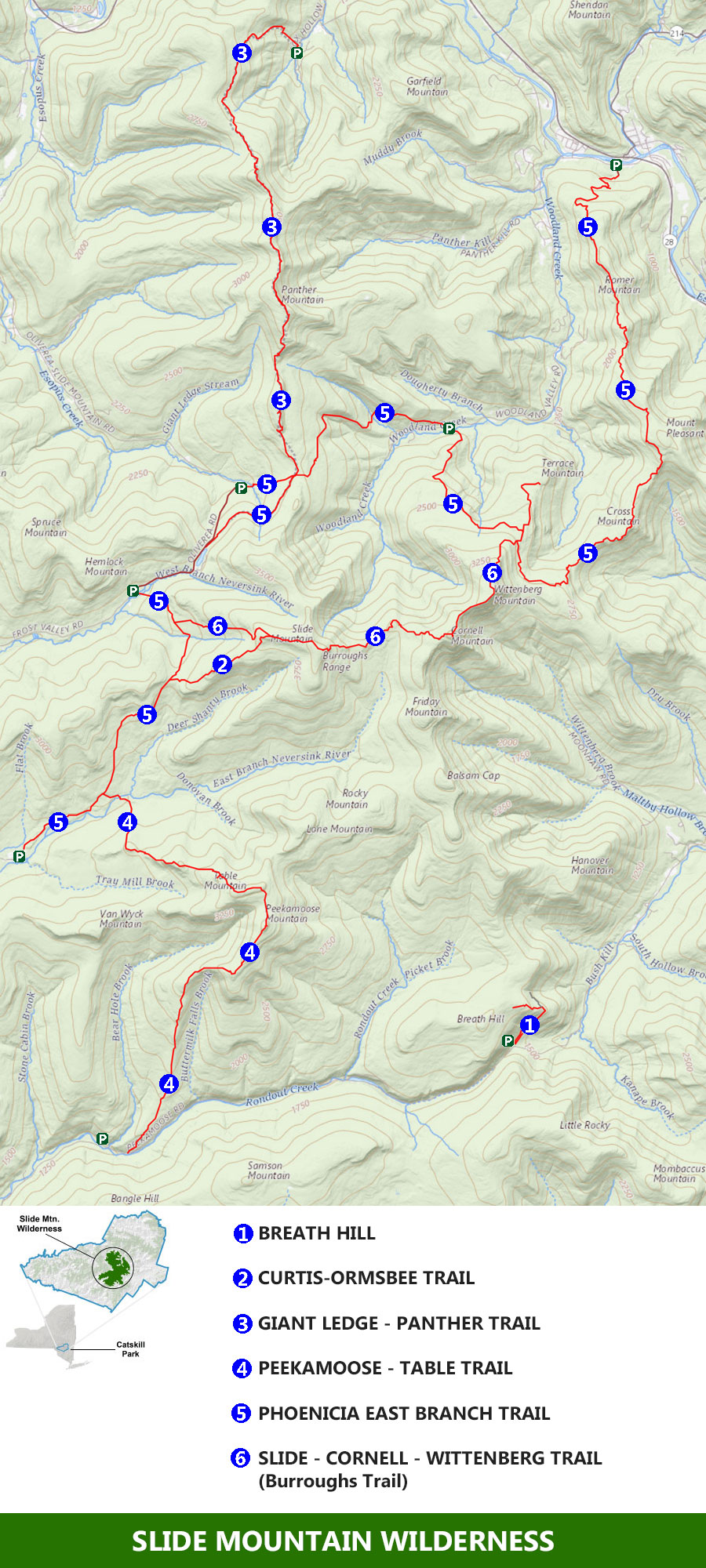
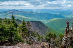
Slide Mountain - 5.86 mile trip - 3.50 hours. Moderate. Good views from the summit of Slide Mountain. Slide is the highest mountain in the Catskill Mountains..


intermediate snowshoeing water source campground catskill mountains
 
 
slide mountain by the curtis-ormsbee trail
Slide Mountain (via Curtis-Ormsbee Trail) - 6.90 mile trip - 4.50 hours. Difficult. Good views from the summit of Slide Mountain and along the Curtis-Ormsbee Trail. Slide is the highest mountain in the Catskill Mountains..


difficult snowshoeing water source campground catskill mountains
 
 
slide and cornell mountain
Slide and Cornell Mountain - 10.26 mile trip - 7 hours. Difficult. 4 view spots. East side of Slide Mountain has challenging rock scrabbles. Slide is the highest mountain in the Catskill Mountains..


difficult snowshoeing water source campground catskill mountains
 
 
cornell mountain and wittenberg mountain
Wittenberg and Cornell Mountains from Woodland Valley - 8.85 mile trip - 6.75 hours. Very Difficult. Spectacular views from the summit of Wittenberg Mountain. This hike has the third highest elevation gain of the hikes in the Catskill Mountains.


very difficult snowshoeing water source campground catskill mountains


  S E C T I O N S


  W E A T H E R


  O T H E R

Copyright 2001-2024 www.catskillmountaineer.com ALL RIGHTS RESERVED