Hike Slide Mountains |
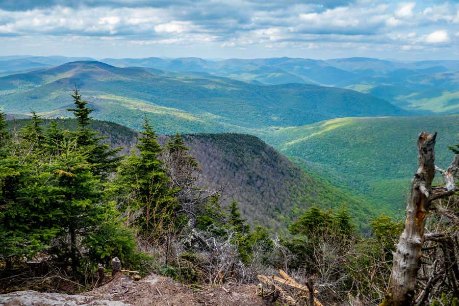 |
| View from Slide Mountain |
| |
| |
|
OVERVIEW |
| | Trail Name: |  Phoenicia East Branch Trail (Slide PA to Slide-Cornell-Wittenberg Trail)
 |
| | Trail Name: |  Curtis-Ormsbee Trail (PEB Trail to Cornell Mtn)
 |
| | Trail Name: |  Slide-Cornell-Wittenberg Trail (PEB Trail to Cornell Mtn)
 |
| | | |
| | Parking Area : | Slide Mountain Parking Area off Rt 47 (Oliverea Road) |
| | Winter Access: | Parking Area is Plowed in the Winter |
| | Camp sites: | 3 Camp Site locations |
| | | |
| | Trail Length: | 6.76 (round-trip) |
| | Trail Type: | Single-track trail |
| | Hiking Time: | Average 4.5 hours round trip |
| | Slide Elevation: | 4,182' (A) |
| | Elevation Gain (Slide): | Gain of 1,749' |
| | Views : | 4 view spot |
| | Difficulty: | Intermediate |
| | | |
| | Slide Mtn Summit: | 41.999067, -74.38595 (WGS84) |
| | Slide Mtn Summit: | N42 00 04 W74 21 22 (Degree, Min, Sec) |
| | Slide Mtn Summit: | N 41 59.944, W 74 23.157 (GPS) |
| | Slide Mtn Summit: | 18N 550855 4649855 (UTM) |
| | | | |
| | USGS Map: | USGS Shandaken Quad Maps |
| | | | |
| | USGS Map: | USGS Phoenicia Quad Maps |
| | | | |
| | USGS Map: | USGS Peekamoose Quad Maps |
| | | | |
| | DEC Trail Map: | DEC Slide Mountain Wilderness Map (free) |
| | | | |
| | Digital Mapper: |
Topo
Terrain
Satellite |
|
|
Maps for Slide Mountain |
 |
|
|
| | DIRECTIONS to Slide Mountain Parking Area |
| | Slide Mountain Parking Area WGS84 (DEC): 42.00893, -74.427704 - Elevation is approximately 2,435 feet |
| | Slide Mountain Parking Area Deg/Min/Sec: N42 00 32, W74 25 39 - Elevation is approximately 2,435 feet |
| | Slide Mountain Parking Area GPS: N 42 00.536, W 74 25.662 - Elevation is approximately 2,435 feet |
| | Slide Mountain Parking Area UTM: 18N 547390 4650926 - Elevation is approximately 2,435 feet
|
| |
|
| | Get off New York State Thruway at Exit 19 (Kingston). |
| | Take a RIGHT out of the NYS Thruway onto Route 28 West. |
| | Go approximately 30.4 miles on Rt 28 West |
| | Take a LEFT onto Rt 47 in Big Indian |
| | Go approximately 9.3 miles on Rt 47 |
| | DEC Parking Area is on the LEFT side of the road. Large Parking Area - Holds 40 cars |
|
|
|
| | Notes About Hiking to Slide Mountain |
|
| | TRAIL |
|
| |
The names of the trails can confuse some people. The Slide-Cornell-Wittenberg Trail is sometimes called the Burroughs Trail because the trails runs over the Burroughs Range. Some people call the Phoenicia East Branch Trail, the Winnisook Trail. This is because the trail originally ran from the Never sink to Winnosook Lake. The trail now is diverted down to the Slide Mountain Parking Area. The trail to Winnisook Lake is private property, so do not hike over to the lake. You can easily see the lake from Rt 47.
The hike up the Curtis Ormsbee Trail is more difficult, but has some interesting climbs. The view points look in the direction of DoubleTop Mountain. It is a nice view on a clear day. After the view points the trail tapers off to an easy incline. This trail is not used as much as the regular jeep trail up Slide Mountain.
| |
| | STREAM CROSSING |
|
| |
After a big rain storm there are two streams right near the trailhead that can get 1-2 feet deep. In the Spring and after a significant amount of rain, the two streams are unpassable. Water levels can get 5-6' deep and raging. In the dry part of the summer, they are just a trickle.
| |
| | CAMPSITES |
|
| |
There is a campsite at the trail junction of the Phoenicia East Branch Trail and the Curtis-Ormsbee Trail. Very few people do camp there, but it is a good campsite.
| |
| | PARKING |
|
| |
Parking at the Slide Mountain Parking Area off Rt 47 is often full on weekends in the summer months. The parking area is too small. So, you need to arrive early. If your backup plan is to park at the Giant Ledge Parking Area off Rt 47, you will be surprised that this parking area is even busier then the Slide Mountain Parking Area.
| |
| | VIEW POINT |
|
| |
There is 1 view point on the Curtis-Ormsbee Tree, and the view is excellent. 3 of the view points near the summit of Slide Mountain, and they are excellent. The view point from Burroughs Rock is now poor because of the trees have become overgrown. The DEC did not keep it cut back over the years.
| |
| | OTHER INFORMATION |
|
| |
Around 50 years ago, Slide Mountain had a metal fire tower on the top of the mountain. At the summit you can still see some of the concrete pads the fire tower sat on. Prior to the metal fire tower, there was a wood fire tower. Many years ago, the beginning of the Slide-Cornell-Wittenberg Trail to the summit of Slide Mountain was a jeep trail for the rangers who ran the fire tower. After the fire towers closes, the DEC put a metal gate around 3,700'. Recently, the gate was removed by the DEC.
|
|
|
MILEAGE CHART for Slide Mountain |
| | Mile Point | Altitude | Notes |
| | 0.00 | 2,421' | Slide Mountain Parking Area |
| | 0.41 | 2,700' | Slide Mtn TH to Trail Junction with Winnisook |
| | 0.60 | 2,755' | Water source from pipe |
| | 0.68 | 2,776' | Straight past Trail Junction for Slide-Cornell-Wittenberg Trail |
| | 1.65 | 3,090' | Left at Trail Junction for Curtis-Ormsbee Trail |
| | 3.26 | 3,915'' | Right Trail Junction for Slide-Cornell-Wittenberg Trail |
| | 3.77 | 4,186' | Summit of Slide Mtn |
| | 3.97 | 3,908' | John Burroughs Rock |
| | 4.68 | 3,915' | Trail Junction for Slide-Cornell-Wittenberg Trail |
| | 6.08 | 3,090' | Straight past Trail Junction for Curtis-Ormsbee Trail |
| | 6.35 | 2,700' | Slide Mtn TH to Trail Junction with Winnisook |
| | 6.76 | 2,421' | Slide Mountain Parking Area |
|
 |
When you arrive at the slide Mountain Parking Area, take a LEFT into the parking area. The Slide Mountain Trailhead is located in the Middle of the Parking Area by the Kiosk. The Registration Box is located in the Kiosk.
|
|
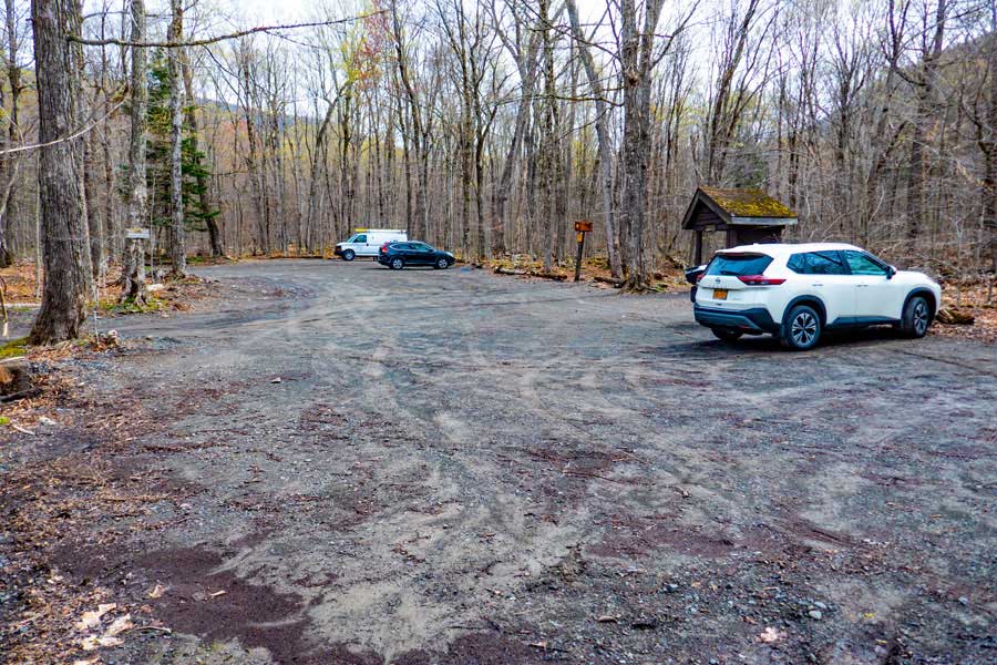 |
The Slide Mountain Parking Area has room for approximately 40 cars. This is a fairly busy parking area in the summer months. The Kiosk is just past the white car.
|
|
 |
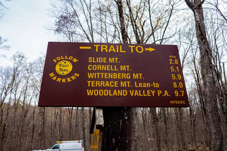
Go to the Slide Mountain Parking area kiosk, and register for your hike. NYS Rangers and Search-and-Rescue ("SAR") will use this information to try and find you. Additionally, maintenance funds are allocated by the the number of people who register.
Once you have registered, the Trailhead for this hike is to your left of the registration box.
|
|
 |
This is the mileage (one-way) for the Burroughs Range. The Phoenicia East Branch Trail goes around the Burroughs Range (Slide, Cornell, and Wittenberg Mtns). You will be bypassing these mountains.
|
|
 |
You will need to cross this stream to continue your hike. After storms, the water level will rise, and this might make it difficult to get across. The trail continues behind the sign you see on the other side of the stream.
If you need water for this hike, this is the best place to get it.
|
|
 |
Please read the Rules for hiking and camping in the Slide Mountain Wilderness. NYS Rangers will ticket you if you violate the rules. Anything you bring in, you need to return with those items. You may not store items in the woods, except your camping items at primitive camp sites.
|
|
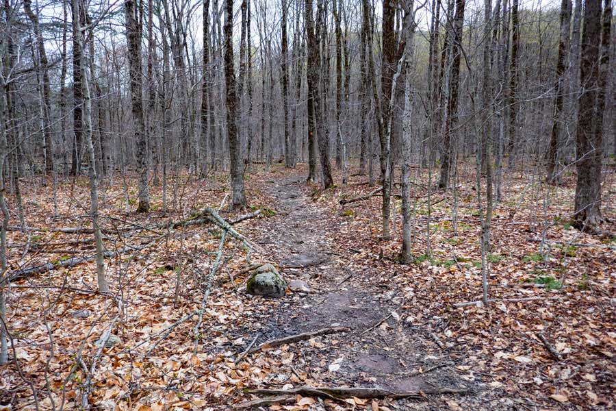 |
The hike will start out on fairly flat and level land. But, this is just for a short distance. This section of the trail is approximately 4/10 of a mile long.
|
|
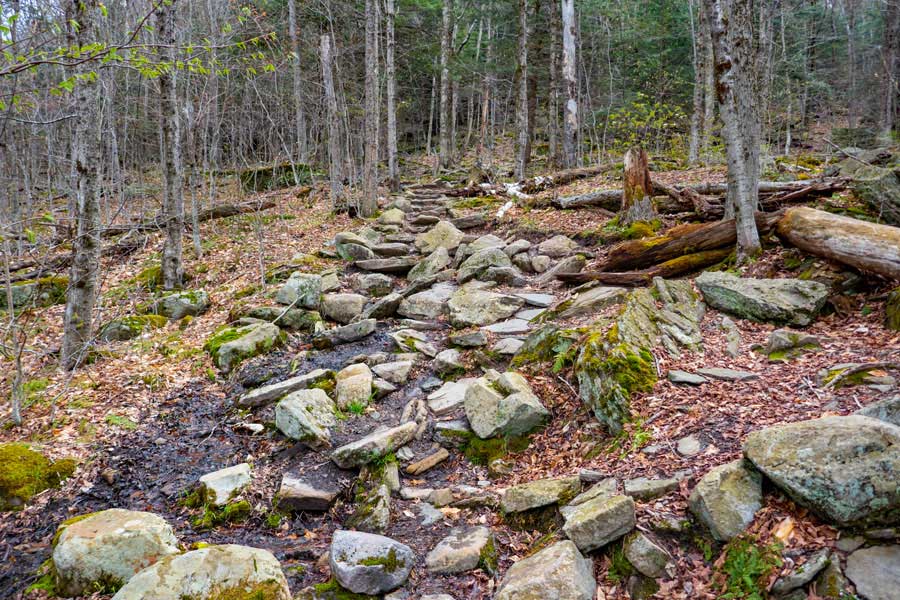 |
After a little ways, the trail will start to climb in elevation. It will also become rocky in places. In some areas there are rock steps built into the trail.
|
|
 |
After climbing up 350' of elevation, you will come to a Trail Junction. You want to take a RIGHT. This is the old Winnisook Trail, which is now called the Phoenicia East Branch Trail. The Winnisook Trail (actually an old road), was a road between Winnisook Lake and the Neversink (Denning). You will follow this trail to the next Trail Junction, which is approximately 1/4 mile.
|
|
 |
After approximately a 1/4 mile of hiking along the Phoenicia East Branch Trail, you will come to the next Trail Junction. You want to go STRAIGHT.
LEFT will take you to the summit of Slide Mountain, Cornell Mountain, and Wittenberg Mountain on the Burroughs Range.
|
|
 |
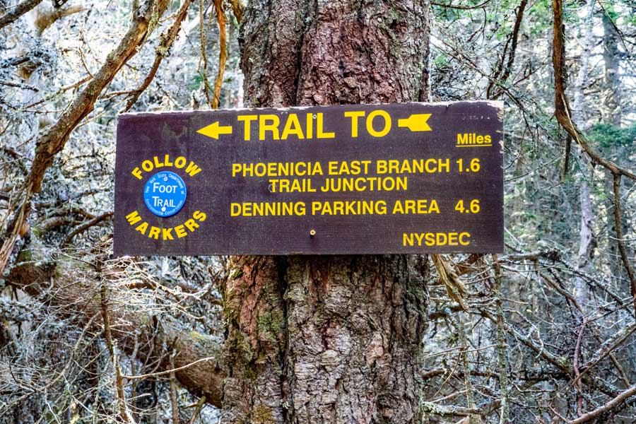
This is the DEC sign at the Slide Mountain Trail Junction on the Phoenicia East Branch Trail. At this point you have less then 4 miles left to your hike. You are heading towards the Denning PA.
|
|
 |
After another 1/4 mile past the Slide-Wittenberg Trail Junction, you will encounter this bridge over a small brook.
|
|
 |
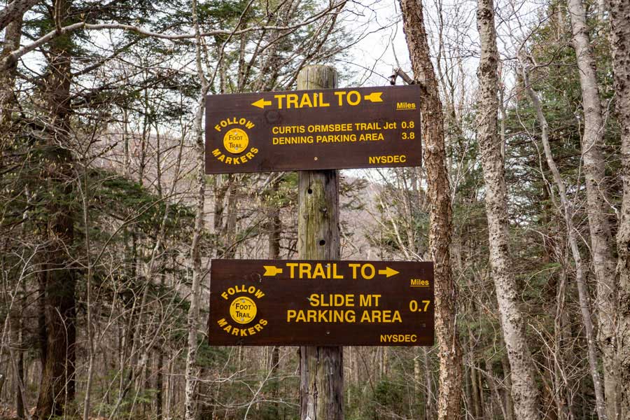
After about 6/10 of a mile past the bridge, you will come to the Trial Junction for the Curtis Ormsbee Trail on the Phoenicia East Branch Trail. You want to go STRAIGHT.
Left would take you to the summit of Slide Mountain via the Curtis Ormsbee Trail.
50 feet past this trail junction, on the Phoenicia East Branch Trail, is a side trail (on your right) for another Primitive Campsite.
|
|
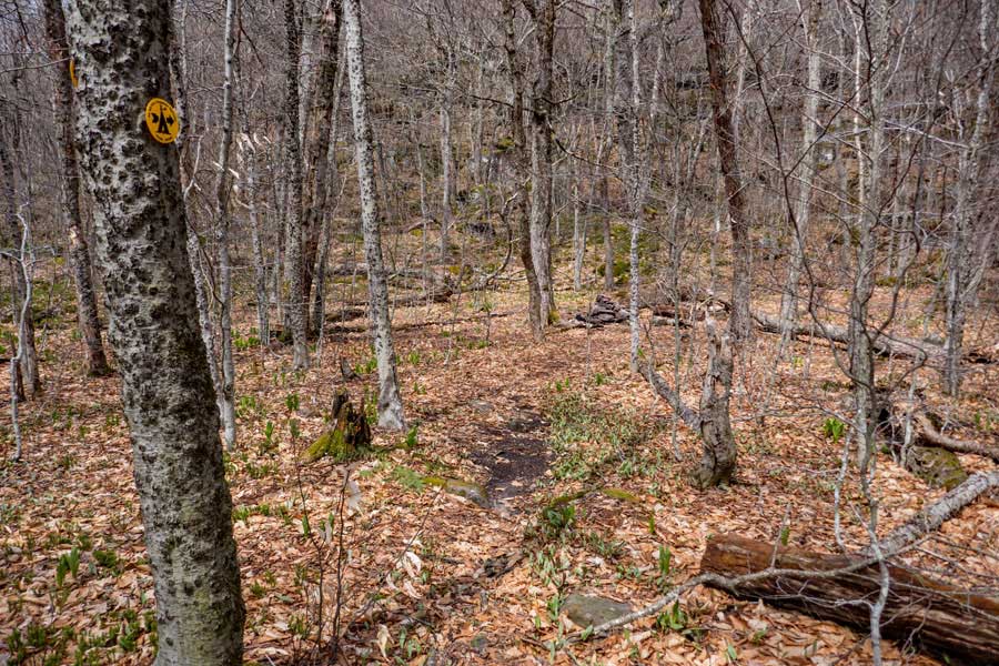 |
The is the side trail for another Primitive Campsite. There is no known water source at this campsite.
|
|
 |
This is the DEC Primitive Campsite by the Curtis Ormsbee Trail Junction. It can hold a couple tents. There is no known water source at this campsite. So, bring water with you.
|
|
 |
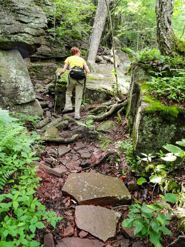 |
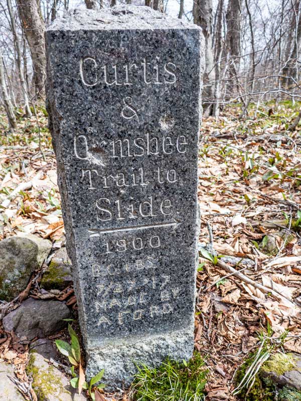
At the Intersection of the old carriage road and the Curtis-Ormsbee Trail is a granite monument marking the Curtis-Ormsbee Trail. |
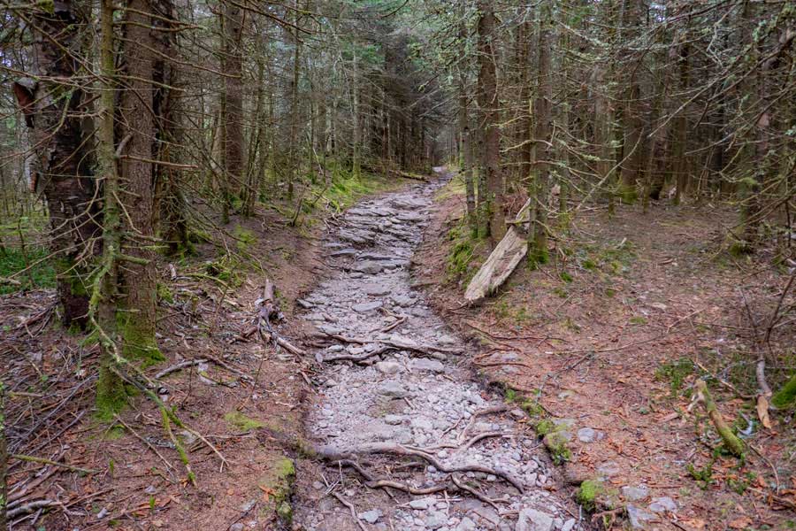
At the Intersection of the old carriage road and the Curtis-Ormsbee Trail is a granite monument marking the Curtis-Ormsbee Trail. | This trail is a little more challenging then the Jeep Trail up to the summit of Slide Mountain. The picture on the right shows you what the trail is like for a portion of the trail. As you proceed higher, the trail does level off.
|
 |
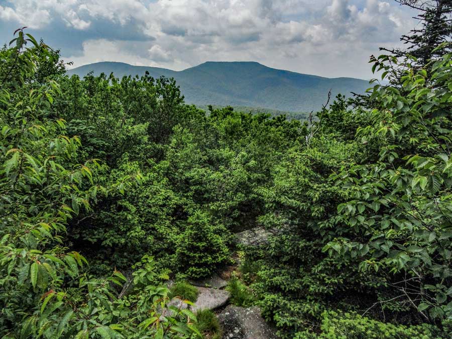
This is the first view point up the Curtis-Ormsbee Trail. The view point will be overgrown in a couple of years if it is not cleared. This picture was taken in 2011. |
|
 |
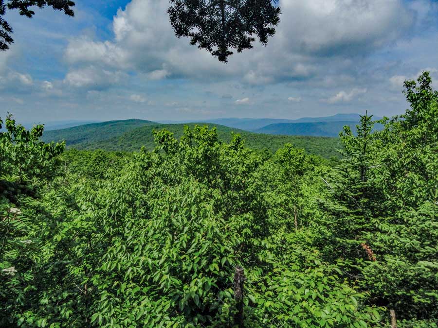
This is the second view point up the Curtis-Ormsbee Trail. The mountain in the background is Double Top Mountain. It is on private property. The view point will be overgrown in a couple of years if it is not cleared. This picture was taken in 2011.
|
|
 |
At 3.26 miles you will come to the trail junction of the Slide-Cornell-Wittenberg Trail (Burroughs Trail). Take a RIGHT to continue to the summit of Slide Mountain. |
|
 |
The trail will continue to climb at a slight incline for the next 3/4 of a mile. In some places the trail is smooth, and in other places, the trail is rough.
|
|
|
Just before you reach Slide Mountain summit, there are two view point to the north that have a very nice view. The second view spot is better then the first view spot. The view spots can be quite crowded on summer weekends.
|
|
 |
The actual summit is sometimes hard to determine. But, it is located near the old fire tower that used to be on Slide Mountain
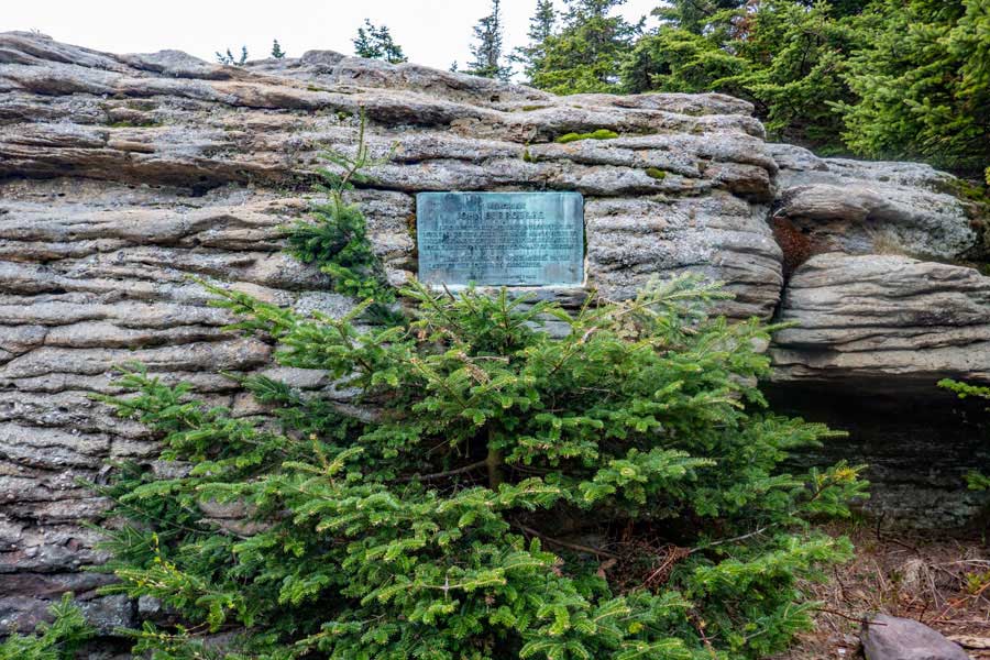
Shortly after you pass Slide Mountain summit, you will reach John Burrough's Plaque Rock. There used to be an excellent view of the Ashokan Reservoir, but the DEC did not keep the view cut open, so there is very little view left.
|
|
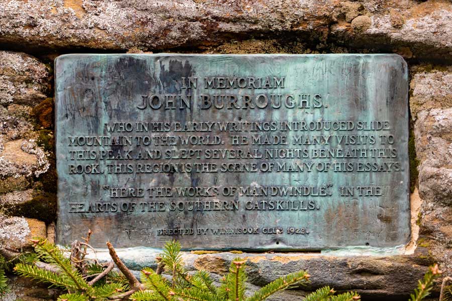 |
You can hike the side trail below John Burroughs Rock and look at the plaque that was installed in 1922 by the Winnisook Club. John Burroughs spent a lot of time on the Burroughs Range (Slide Mtn, Cornell Mtn, and Wittenberg Mtn).
|
|
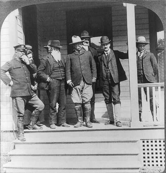 |
In this picture, John Burroughs (long white beard) is seen standing next to Teddy Roosevelt in Yellowstone National Park.
|
|
|
S E C T I O N S
|
W E A T H E R
|
O T H E R
|