Palenville Overlook & Indian Head - North/South Lake Region
|
|
|
|
Overview of this Hike: |
| Distance: 8.12 round trip from parking lot by South Lake overflow. Add 2 miles if hiking from Scutt Road DEC Parking lot. |
| Time: 6 hours round trip (hiking time) |
| Elevation Loss: 571' loss from parking lot |
| Side Trips: Kaaterskill Hotel Site & Rip Van Winkle House |
| Best Time to Hike: Anytime |
| Elevation:2321-to-1750-to-2321' |
| Digital Mapper: Topo
Terrain
Satellite
DEC-Trail-Map (pdf)
DEC-GIS-Map
Greene-County-Property-GIS-Map |
| Difficulty: Easy-to-moderate |
| Attractions: Good views from Palvenville Overlook and Indian Head. |
| Attractions: Nice walk around North/South lake |
| Access Methods: Foot, snowmobile, snowshoeing. Skiing on some trails. |
>| NOTES: Please be aware that there are many trails in this region. Some are official trails and others are non-DEC trail. It is very easy to get lost in this region. So, bring a map with you! |
|
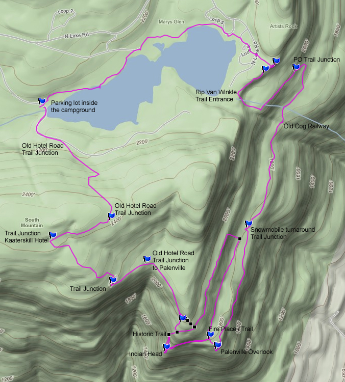
Maps, Profile, and GPS files |
 |
|
|
Directions to Trail Head from New York State Thruway (Easist, not the shortest): |
| Take New York State Thruway to Exit 21 (Catskill). |
| Take a left out of the NYS Thruway entrance road. |
| Go approximately 1/4 mile |
| Take a right onto Route 23 West |
| Go approximately 6.6 miles to Cairo, NY |
| Take a LEFT onto Rt 32. McDonalds Rest. on corner. |
| Go approximately 7.7 miles on Rt 32 |
| Take a RIGHT onto Rt 23A |
| Go appoximately 7-8 miles to the intersection of Rt 23a and North-South Lake Road. |
| Climb up the windy mountain road (Rt 23A). When you reach the top, you will then be in Haines Falls. |
| Take a RIGHT onto North Lake Road (DEC sign on corner of road). |
| Follow North Lake Road until you almost reach the DEC booths. |
| In the summer you must pay to enter into North/South Lake |
| After going thru the DEC booths - Go right down the hill - Park by the lake in the parking lot |
| Alternate Parking: Take a RIGHT onto Scutt Road. |
| Take a RIGHT into the DEC parking lot. The parking lot fills up quickly. If the parking lot is full, you can park on the side of the road. Do NOT park down by the two houses. |
| Mile Post | Altitude | Notes |
| 0.00 | 2,130 | Parking lot by South Lake Overflow. You can also park at the Scutt Road DEC Parking Lot. |
| 2,130'' | Follow the old railroad tracks on the NORTH side of the lake. The railroad tracks no longer have railroad ties, but the trail is very flat. It will have Yellow trail markers. Follow the trail markers and stay close the to lakes. It should be noted that the trail is very poorly marked with markers. Keep following the lake shore until you get to the East most point of North Lake. . |
| 2,150' | The next trail junction LEFT of the old cog railroad, but RIGHT of the chain link fence for the Escarpment Trail. Look for a wide trail the slopes down the hill. This trail will take you to the old Rip Van Winkle House site. N42 11.836 W74 02.072 |
| 2,058' | Trail Junction. Going straight will take you to the Rip Van Winkle Home Site. Right will take you to Palenville Overlook and Indian Head. Take RIGHT down the hill to Palenville Overlook. N42 11.919 W74 01.790 |
| 1,935' | Part way down you will cross the old Otis Cog Railway. |
| 1,789' | Then you will come to the Snowmobile Loop Trail. You can take either path. The east path is wetter then the west trail, but has a better view. N42 11.334 W74 02.025 |
| 4.33 | 1,767 | Palenville Overlook N42 10.884 W74 02.186 - You will see three stone chairs in front of the ledge. |
| 4.39 | 1,804 | Walk up the steep bank by the old stone foundation and continue around the loop trail another 300 feet. You will see a stone fire place. Next to the fireplace is a faint unmarked trail. This is the trail to Indian Head Ledge. There are trees across the trail. |
| 4.60 | 1,742 | Indian Head Ledge. N42 10.873 W74 02.441 |
| | | You can return two ways. You can walk up the slope from Indian Head and find the opening in the ledge (small 3-4' climp up the ledge). There is a small rock cairns on top of the ledge N42 10.945 W74 02.378. This will save you 1.25 miles and is about the same amount of effort. This is the old trail before the Snowmobile trail was put in. Or, you can take the west side of the snowmobile trail back. This way will add another 1.25 miles to the hike. Our chart will explain the way back thru the Snowmobile trail. The maps shows both ways. |
| 4.81 | 1,804' | Return back to the fireplace. Then take the West side of the snowmobile trail |
| 5.29 | 1,802 | Trail Junction - N42 11.294 W74 02.061 - Go up the very steep hill |
| 5.35 | 1,976 | Top of very steep hill |
| 6.52 | 1,986 | Trail Junction - Left will take you down to Palenvile VIA the old Hotel Road. Go Straight up the hill. |
| 6.69 | 2,245 | Trail Junction - Take a RIGHT up the hill. |
| 7.12 | 2,445 | Trail Junction - Take a RIGHT towards Boulder Rock |
| 7.40 | 2,462 | Trail Junction - Take a LEFT onto the unmarked trail - This will take you down to North/South Lake. |
| | 2,160 | North/South Lake Road - Take a LEFT back to the parking lot |
| 8.12 | 2,130 | Parking Lot. |
|
|
Hike to the Southwestern part of the Escarpment Trail in the North/South Lake Region |
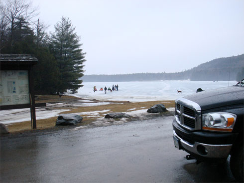 |
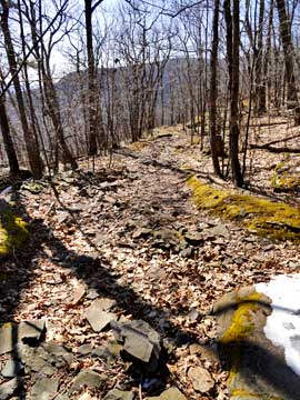
The picture on the left is from the parking lot inside the North/South Lake campground. This parking lot is by the outlet of South Lake.
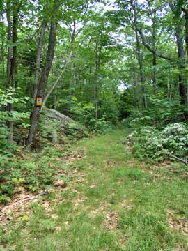
This hike starts on the left of this picture. This is part of the old rail road system. It is poorly marked with yellow trail markers. It basically follows the lake shores.
To find the entrance to the trail, walk towards the easterly Escarpment Trail. The trail is just south of chain linked fence and north of the old cog rail way up the mountain. It is marked with snowmobile markers. This is called the Rip Van Winkle Trail. The trail will take you to the old Rip Van Winkle House/Farm site (House burned down many years ago). We are going down the trail part of the way.
Part way down the Rip Van Winkle Trail, you will come to a Trail Junction at GPS: N42 11.919 W74 01.790 . You want to take a RIGHT at the trail junction at start heading south towards Palenville Overlook. If you are traveling in the afternoon in the early spring, you can sometimes hear Barred Owls that nest just east of the trail. If you want carefully, you can see them flying around.
|
|
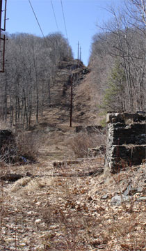 |
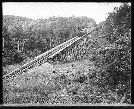
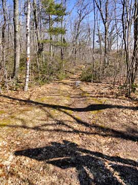
Part way down the trail, you will come upon the old Cog Railway System. On the left is what it looks like today. On the right is what it looked like 100 years ago.
After passing the Cog Railway, you will come to another Trail Junction. This is the snowmobile loop. You can take either path. The lower path tends to have more water on the trail. |
 |
|
|
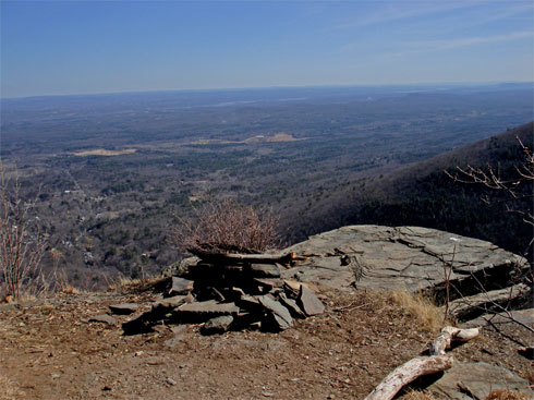
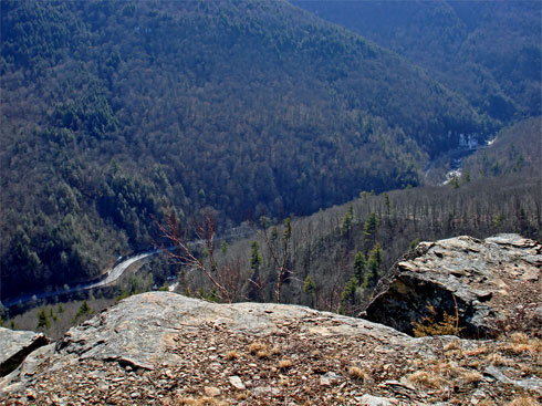
At mile post 4.33, you will come to Palenville Overlook. In the background you can see the Hudson River. This picture is looking southeast.
|
|
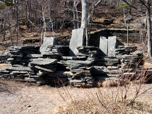 |
The "Chairs" at Palenville Overlook. Behind the chairs is the foundation of a house.
|
|
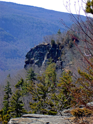 |
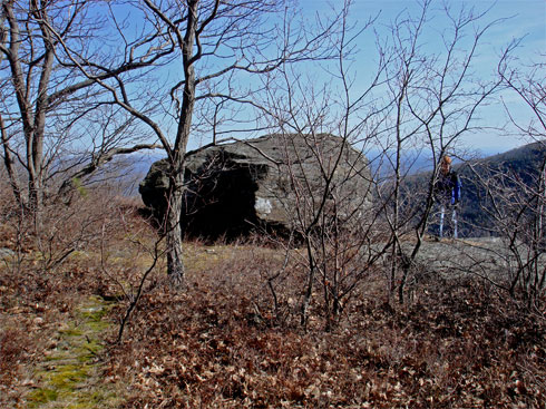
While standing at Palenville Overlook, look westward. You will see the same image that is in the picture on the left. This is Indian Head. The rocks look like an Indian head, hence the name Indian Head.
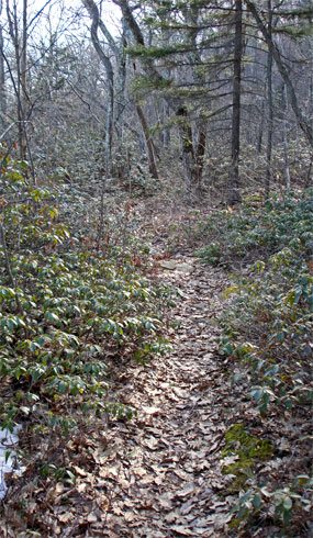
If you walk from Palenville Overlook up the upper loop trail, you will see a fireplace about 300 feet from Palenville Overlook. On the left side of the fireplace is a faint trail (pictured on RIGHT). This non-DEC trail will take you to Indian Head. This trail is 0.21 miles long. The trail can be difficult to follow sometimes. There are some smaller trees across the trail.
|
 |
|
 |
This is the view from Indian Head looking westward. Below is the lower section of Rt 23A. Obviously, the view from Indian Head is better then the view from Rt 23A.
|
|
 |
This is the view from Indian Head looking south. There is a boulder on top of Indian Head, just like Boulder Rock 700 feet higher above.
|
|
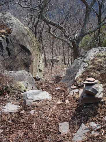 |
Once you are done enjoying the views from Indian Head, you can return two ways. (1) You can reverse your path and take the upper snowmobile loop. Once you get across the loop, you will come to a trail Junction. Left will take you up a very steep hill. (2) You can walk up the steep "pile of rocks" and find the notch in the ledge and climb up the ledge. This way will save you about 2 miles of hiking. The picture on the LEFT is the notch. There is a small rock cairn on the right side (you can see in the picture).
|
|
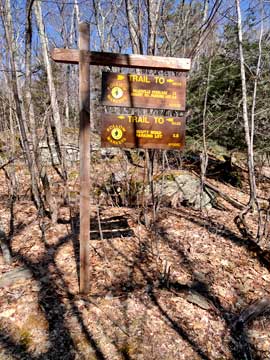 |
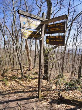
After a short distance of about 1/4 mile, you will come to a new trail junction. On your left is the trail junction for the Harding Trail. You want to take continue STRAIGHT towards the Escarpment Trail.
This is the view at the beginning of the Harding Road Trail. |
 |
|
 |
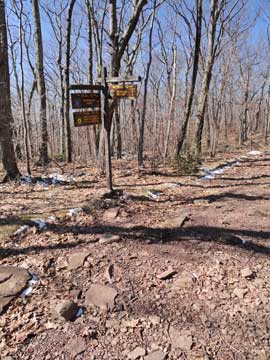
After another 0.17 miles, you will come to another Trail Junction. You want to take a RIGHT up the hill.
This is a picture of the trail you want to take. |
 |
|
 |
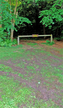
You will then hike up the hill approximately 1/2 mile. Near the top of the hill, you will encounter another trail junction. If you are parked at South Lake you want to take a RIGHT. If you are parked at Scutt Road or Laurel House Road (Kaaterskill Falls), then you want to continue for about 100' and take a LEFT.
After hiking another 1/4 mile, you will see an unoffical trail on the left. You want to take this LEFT. The picture on the RIGHT shows the entrance to this non-DEC trail. This trail will lead you to South Lake parking area. About 1/4 mile down this old road you will come to a horseshoe turn. You will see a trail on the right. Do NOT take this right. Continue around the horseshoe turn. Once you reach the North Lake Road, you want to take a LEFT. This will lead you back to the South Lake parking area. |
 |
|
 |
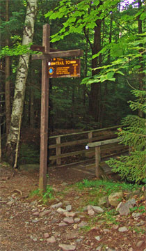
As you are walking down the North Lake Road, on your left you will see this trail in the picture on the left. This trail will will take you to Scutt Road and Laurel House Road parking areas. If you are parked at the South Lake parking area continue STRAIGHT on the North Lake Road. You are almost at the South Lake parking area.
The picture on the right shows the entrance to the Scutt Road parking area.
|  |
|
|
|
Copyright 2001-2017 www.catskillmountaineer.com
ALL RIGHTS RESERVED
|