Pics to follow my Hard drive RAID crashed this weekend so My pictures is being rebuilt. I don't want to download my SDcard yet.Jon wrote:Hi folks! sorry i couldn't make it to the hike today. I hope it was good and everyone got back OK!
Anyway I am going backpacking this weekend up the escarpment trail, and wanted to know about the plane crash. I think we're doing the whole escarpment and if I could plug the plane into my GPS before we go it could be cool to show the guys.
Let me know what you think if you've done the trail or not.
I think he said it was 20+ miles. I thought he was talking about devil's path, but turns out it was escarpment.
So We went on the escarpment hike. The team-leader actually works for the DEC but he's only recently come to the area and is starting the 3500. He wanted instead of going the extent of the Escarpment, to go over black dome and thomas cole. We parked 1 car at the other side of camel's hump on Barnum rd. I decided to park my car at lake Colgate in case anyone decided to bail 1/2 way through from dutcher notch. We started on the trailhead at Schutt Rd, and met up with some girls that the team leader had invited. We had a pretty decent party, 6 of us +1 dog. Two of them were WFR (wilderness first responders), another was a combat medic in the army, and then there was me and a dog LOL. The hike leader had wanted to start from the bottom of the wall in palenville and hike up it "like they used to do", but I talked him out of it. Good thing too because we got our butts kicked just doing the part that we did!
From leyman's lookout we got a bit of a view of 23A, and on two or three of the ledges after that. We could see some of the falls on Katterskill HP but nothing above that, and not the peak itself. By the time we got to Boulder rock (or Rock rock as we called it) there was just a cloud, and it started to pour. Everytime we stopped we just got cold. We put our rain coats on, and then it would stop raining for a bit and we'd get too hot. Then we'd stop and take the rain coats off, then start hiking again and it would pour. We finally just gave up and plowed through with the raincoats off, since we were soaked through and through and just didn't feel like stopping. We got down to the old site of the hotel by the north lake parking lot, and it just looked like a field with a blank white sheet next to it. No 5 star views. Nothing. Just more rain.
As we passed N/S lake campground up past all the stars on the NY/NJ trail map, there was 0 views of the Hudson valley floor. Most of the crew I was with had done a lot of long distance hiking (AT/PCT/ Others outwest) so they were used to hiking fast. Like faster than I normally hike with daypacks fast. So I struggled to keep up with them, and they all seemed to have no want or need to stop in the pouring rain. We made it to Badman's cave, for lunch, and were just completely soaked through. There were about 1/2 dozen dayhikers from N/S lake huddled in there waiting for the rain to subside. I think they saw how much worse off our position was and they gave us a lot of room in the cave so we could get our packs off and sit for some lunch. Eventually they left, and after about 1/2 hour break we started up for North Point. The rain calmed down at this point, and we just hiked in a light fog up to North Point.
The clouds only parted momentarily when we got to north point, but only allowed a view of North Lake and a bit of South mountain. I felt bad for everyone else on the hike who has never seen those views. I was telling them all they HAD to return when it was nice out to see it. You just can't imagine the view when you're walking past the edge of the cliff and it's just a white abyss. It makes it an entirely different hike.
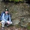
After North point the rain started driving hard all the way to stoppel . I told them not to wait for me, since I knew they would just start to shiver in the pouring rain, and I wasn't going to move fast and risk fatigue. I'm used to hiking solo anyways, and this was an area I basically knew. They sped up ahead of me and I meandered solo over up the trail to Stoppel point. The spruce forest was magnificent as always, even though it was pouring it seemed to be a bit quieter and calmer in there (as always) and was just a bit more peaceful. I stopped at the rock where I lost my glasses 2 years ago, and searched around the base for them. They weren't there, and the rain was just running down the trail all over and I could just think of Irene and how well those glasses might have stayed put during that blast. I gave up on finding them and carried on to find the rest of the group. I didn't see them again until almost by stoppel where that sign is by the viewpoint (of the white abyss). We passed the airplane, but at that point none of them cared much about anything but finding a camping spot. I stopped for a few shots of the wreckage, and they were all long gone down the trail by the time I had my camera back in. I don't know if we passed the milt's lookout, because any ledge was just a view of the clouds.
By the time I found them they were all sitting on the trail around the dutcher notch area, maybe about .25-.5 miles away from it. We were still in the Conifer forest. It was about 3:30 and just pouring rain, they were all shivering and trying to decided if there would be a better site or not. The team-leader had hiked off the trail to scout out what looked like a nice site. I went and looked at it and said it was huge for sites in the catskill's and we did have like 4 tents and a hammock to fit. Everyone was cold and wet and done with hiking, and I didn't want us to carry on and then not find anything better. There was no way anyone would make it to that field down by the lake. It seemed like we were in dire need of just hunkering down for the rest of the rain so I just started stringing up my hammock and made the decision easier for them. We set up camp in the pouring rain. I found a nice spot over some roots and mud that I could float above on my hammock. Everyone else decided on which moss sponge or puddle of pine needles they liked best and set their tents up.
Everyone got out of their wet clothes and I got in my warm fleece and sleeping bag and started to warm up. I laid in the hammock for a while with an empty gatorade bottle and as my rainfly filled up with water I would pull on the edge down into the bottle. I was pretty much down to my last litre and figured I could filter this and not have to hike down to cook my dinner. I did that while everyone else fell asleep. Eventually after about 2 hours the rain slowed down and stopped. I saw some blue sky and my legs were cramping up like crazy. My calf muscles looked like I had an alien worm inside of them so I decided to stretch out. The site we picked actually was pretty nice, it had a fire ring already there, so I decided to start a fire. I got my super secret sure-fire way to start a fire out, and blammo had a little fire going in 20 minutes. The team leader came out and was shocked that I had one going. We warmed up, I sawed up a bunch of wood and we started making some dinner.
I have one of those little pocket stove things with the canisters, and I started boiling my water for a mountain-meal pouch, then my stove went out. I burned my hand trying to re-adjust it and wound up getting huge blister. Then I read the instructions on the meal-packet and it said to add COLD water. Gotta remember to read those things before I go out! I could have saved some weight and left the whole contraption at home! Wound up with chicken soup instead of chicken salad but it was still delicious. We started to see more blue sky, and took a little walk back to the trail. We headed over the other side of it and went as close as we could to the escarpment and found a rock we could stand on and get a bit of a view. We could just make out below the clouds the valley floor and a bit of the Hudson river. This was the best view from the escarpment that any of us got that day.
Eventually the girls woke up and were again shocked that I had started burning things. They all sat around the fire as the sun went down, and I retired to my hammock. Every bit of clothing that I had worn was soaked, my raincoat was soaked, my camera was soaked, my camera bag was soaked, my gaiters were soaked, but my boots were pretty OK. I just shoved everything in the pack and then put the rain cover on it. I laughed as I did this because there was no way that anything could get any wetter. I guess it's just habit from what I normally do.
When the sun went down a cloud moved in. I woke up a couple of times during the night and heard some coyotes down in the valley. They were probably somewhere by Capri or Colgate lake. I imagined them going insane at the smell of an italian sub in my car at Colgate lake and howling for others to come and break into my car. Later I heard an owl from about the same trajectory, it was north and west of us, maybe somewhere on the Blackhead range. I woke up again at some point in the night and it was pouring rain again. I looked around for a bottle to collect more rainwater with, but I had nothing close at hand and just went back to sleep.
Early morning we woke up in a cloud. I decided that the fire had been rained out, and I was going to leave it that way since I didn't feel like wasting any water to put it out again. We had breakfast, some people cooked the pouches. We packed all our gear up, made sure we didn't leave any litter and hit the trail early. We saw no views on the last little bit down to Dutcher notch. The only thing we saw was Arizona getting larger and larger in front of us. We stopped at the intersection of dutcher notch, and 2 people downhiked to the spring to fill up the party's water bottles.
I re-assesed my situation. Normally the pack is a bit lighter on day 2. Usually out of water and less food. This time however everything was just a bit heaver. Rain coat was a couple lbs heaver from being soaked inside and out. The camera bag was thoroughly soaked so even if there was a view, I couldn't get a good shot. My bag of soaked clothes from the day prior was just a lead brick I had to throw in my backpack (invention Idea- firestarter hiking shorts. Make them out of firestarter material, so at the end of the day, just strip off your shorts, light a fire and presto- one less thing you have to pack out). Anyways my load went from 40ish to 50-60 lbs. I knew what the blackhead range was all about and decided against lugging this wet mess over all of that. I had my car at colgate and told the group leader I was gonna take the bail-out. Two of the girls looked at the rain clouds coming in and decided to come with me. One of them was 3500 aspirant but she had already been up the blackhead range. She said she didn't mind the elevation, but just couldn't hike in the pouring rain anymore. I mean we hadn't had a view the entire time, what was the point in killing ourselves if we might get poured on again? We said our goodbye's and wished the rest of the team luck, and we headed down the yellow trail.
Now from what mike said he made it seem like that field is close. There is no way we were gonna make it down there in the pouring rain! That is gotta be at least over a mile away from the notch. It is a nice spot to camp (if you have tents...hammocks don't work in fields too well) Also there are tons of rivers and streams and mud and everything all over the valley which made getting out a wet muddy mess. We passed the field and saw the mountains for the first time. Well we saw the bottom of the mountains, the tops were in a cloud. I spoke with the hike leader after he got done, and he said they got freezing rain on top of blackhead.
I think I found the waterfall that Mike was talking about, the one just off of the yellow trail. However a tree has fallen in front of it, and blocks the left portion from a nice shot. We saw some spectacular beaver dams further down the trail. It turns the entire thing into a flooded mess, we were basically squishing on muck and sticks and tree roots to get across a large flooded portion. Finally we came to the beaver dam that was about 4-5 feet high and was holding all this water up. We took a bunch of pictures of it then headed out. The trail meanders around the valley, but there is not much elevation gain so the miles are pretty easy. The only difficulty was the occasional super muddy section which we would sink into quite deep with the packs.
We made it to the car by about 11:30. I dropped the girls off at Schutt rd. where their car was parked and started to head down 23A. It started to HAIL/SLEET/POUR everything just dumped on me. It just made me even more confident of my decision to bail, as I was happy the glass and metal was getting pounded and not me.
All together it seemed like a wash, but I did have a lot of fun and did a decent 14-15 miles (didn't download the GPS yet). We didn't make it to the end of the escarpment, but oh-well. We can always try again next time. Definitely a fun time camping in the rain!


