Stoppel Point |
 |
|
|
Overview of this Hike: |
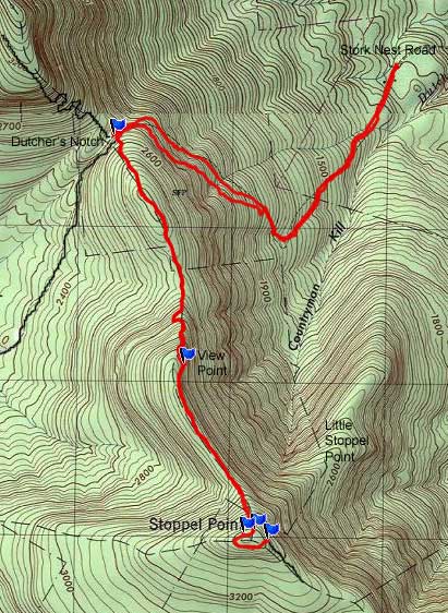
| Distance: 8.13 mile trip from the end of Stork Nest Road to Ducher's Notch and to Stoppel Point. |
| Time: 6 hours (hiking time) |
| Elevation Gain: 2,287' gain from parking lot (1,130' to 3,417') |
| Best Time to Hike: Any time of day |
| Difficulty: Moderate |
| Peak Elevation: 3,417' |
| Digital Mapper:
Topo
Terrain
Satellite
| | Access Methods: Foot and Snowshoeing. |
|
Maps |
 |
|
|
Directions to Trail Head from New York State Thruway (Easist, not the shortest): |
| Take New York State Thruway to Exit 21 (Catskill). |
| Take a left out of the NYS Thruway entrance road. |
| Go approximately 1/4 mile |
| Take a right onto Route 23 West |
| Go approximately 10.7 miles on Rt 23 (past Cairo, NY and up the hill towards Windham) |
| Take a left onto Route 31 to Round Top, NY |
| Go approximately 3.7 miles on Rt 31 |
| Take a RIGHT onto Maple Lawn Road |
| Go approximately 1.3 up Maple Lawn Road. |
| At the top of the hill take a LEFT onto Floyd Hawver Road. |
| Go approximately 200' |
| Take a RIGHT onto Stork Nest Road |
| Follow Stork Nest Road to the very end (0.6 miles) |
| Park on the left side - Do NOT go up the driveway. |
| Parking lot holds 5 cars. |
| GPS: N42 15.177 W74 03.199 WGS84: 42.25295,-74.053317 UTM: 578091, 4678295 for Parking Lot
|
| Mile Post | Altitude | Notes |
| 0.00 | 1,130 | GPS: N42 15.177 W74 03.199 WGS84: 42.25295,-74.053317 UTM: 578091, 4678295 for Parking Lot |
| 0.30 | 1,270' | DEC registration box. |
| 0.79 | 1,620' | NYS Land on both sides of the trail. |
| 1.81 | 2,371' | Dutcher's Notch. |
| 3.00 | 3,079' | View Point to Countryman Kill / Winter Clove ridge line |
| 3.85 | 3,400' | Plane Crash |
| 3.86 | 3,400' | View Point to the Blackheads |
| 4.07 | 3,417' | Summit of Stoppel Point |
| 8.13 | 1,130 | Return to Parking Lot |
|
Notes about this Hike |
The hike to Dutcher Notch and finally to Stoppel Point is in Greene county. The trail to Stoppel Point follow the old Cairo and East Kill Turnpike. The East Kill Turnpike was built in 1836. It was used by farmers in the East Kill Valley to transport the farmers produce and live stock to market in the Village of Catskill. The Cairo and East Kill Turnpike runs from the Old Soul Church in Onteora Park to Cairo, New York. Some people also refer to the road as the old Colgate Carriage Road. The land was owned by the Colgate Family after they were refused ownership in Onteora Park. Good chance of seeing wildlife.
This hike can be rough after a large rain storm. The old Colgate Carriage Road has a lot of water running down it. The rocks are round so they can be difficult to hike on. When the rocks are wet it can be quite slippery.
At the beginning of the hike, you will be hiking up someone's driveway. You will be on private property. PLEASE respect the home owner.
The DEC registration box is a ways from the parking area. Please register. Should you get lost, the first place the Ranger look is the registration box. Your life may depend upon it. You have to hike up a ways before you come to land that is owned by the state on both sides of the road. So, please stay on the trail.
As you approach the Eastern Escarpment, the trail will get steep. The trail will turn to the right and go up the Eastern Escarpment at a diagonal. As you approach Dutcher's Notch (2 miles later), the trial will level off. Dutcher's Notch is not that big, but you can stop and have lunch there. There is not a place to camp at this point.
At Dutcher's Notch you want to take a LEFT onto the Escarpment Trail. At first the trail climbs up in elevation. It will climb about 200' in elevation before the trail levels off for about a 1/2 mile. Then it will start to climb up in elevation again. Once you reach a level section again, you will be at approximately 3,000'. The forest will change to a conifer forest. You will also come to a beautiful view point. There is a nice rock on the other side of the trail to sit on. Nice place for lunch or a break. After the view point is another 1/2 mile of flat hiking through a nice conifer forest.
Then you will climb up to Stoppel Point. When you get to the top of the rise, you will see a plane crash right next to the trail. About 50' past the plane crash there is another good view point. It overlooks the Blackhead Mountain range. You will then do a U loop around the summit of Stoppel Point. Once at the summit there is another great view point. Once done, you will reverse your tracks back to your car on Stork Nest Road.
This hike does have a lot of wildlife. During the Fall and Winter, you can see Barred Owls if you get lucky. Deer and bears will also roam through this area. There are also lots of Warblers along the Eastern Escarpment Trail.
|
|
|
Hike to Stoppel Point from Round Top |
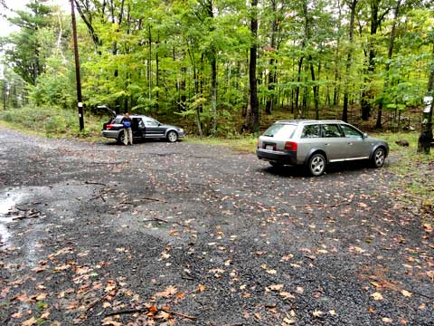 |
This picture of the parking lot at the end of Stork Nest Road. It will hold about 5 cars. View from the trail looking backwards towards the parking lot. Do not block the driveway to a private residence. |
|
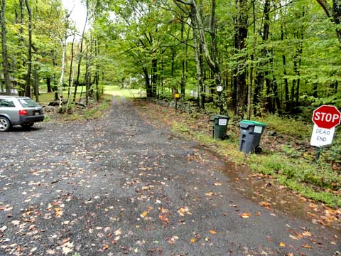 |
View of the trail from the parking lot. The trail runs over the driveway to the house. Do NOT drive up the driveway. Please respect the home owner. Do NOT walk off the driveway or annoy the home owner. |
|
 |
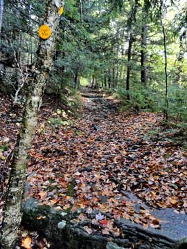
There is a DEC sign at the beginning of the trail.
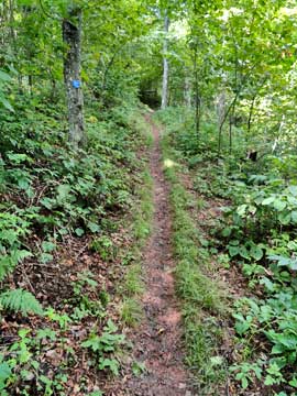
This is the trail leading up to the forest. A real nice walk. |
 |
|
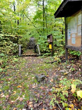 |
When you walk up the old Cairo and East Kill Turnpike after the private residence you will encounter the DEC registration box. Please register. There is a small bridge that goes over a small stream by the registration box.
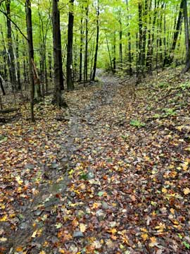
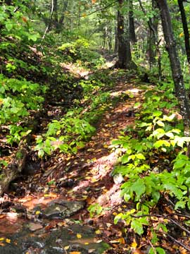
You have to walk quite a ways before the land on both sides of the trail are owned by NY State DEC. As you walk up the trail, you will see that the old road is heavily indented from the past car traffic and water erosion. After a large rain storm, the trail looks like a stream. |
 |
|
 |
As you approach the eastern escarpment, the trail will shift to the north-west. The trail will also become steeper. There are a few sections where there is some exposure. But, since this was an old road there is plenty of room to hike safely.
As you approach Dutcher's Notch the trail will start to level off. |
 |
|
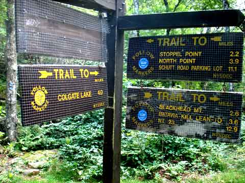 |
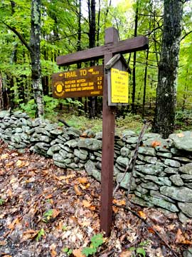
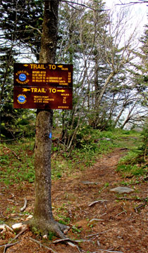
When you get to Dutcher Notch, you will come to a 4-way intersection of trails. Right will take you to Arizona Mountain and Blackhead Mountain. Left will take you to Stoppel Point and North Mountain. Straight will take you to East Kill Falls and Colgate Lake. We want to turn LEFT and hike south on the Escarpment Trail. |
|
 |
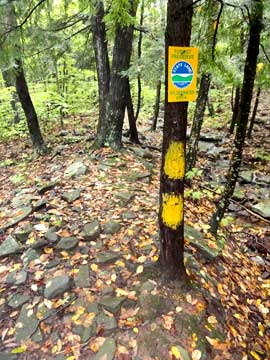
When you reach Dutcher's Notch on the Colgate Carriage Road, you want to take a LEFT. This will take you towards Stoppel Point. This picture shows the beginning of the trail. This part of the trail is on the Eastern Escarpment Trail.
At the beginning of the trail, it will head uphill for about 200 vertical feet. The trail will then level out for a nice walk for about a 1/2 mile. |
 |
|
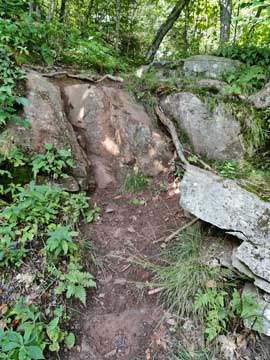 |
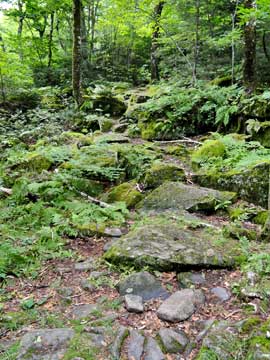
The trail will then head uphill again. This is the most difficult part of the trail, which isn't that difficult. This rock is about 3' high. Fairly easy to get up.
As you approach 3,000' the forest will start to change to a conifer forest, and the trail will level off again for another 1/2 mile. |
 |
|
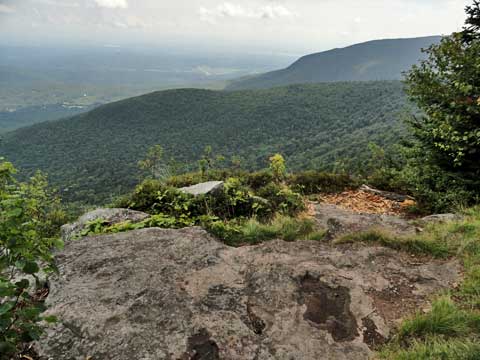 |
This is the view point between Dutcher's Notch and Stoppel Point. It over looks Countryman Kill Valley. The ridge in the background is Little Stoppel Point. Over Little Stoppel Point is Winter Clove Valley. The far reaching mountian is North Mountain. |
|
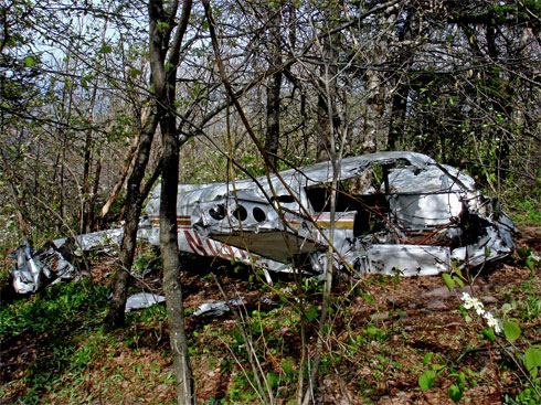 |
Just before you reach Stoppel Point, you will encounter a plane crash. The picture on the LEFT is the plane crash that is right next to the trail. You are at Mile Post 4.40 (end of hike). You can't miss it. If the pilot has been 25 higher, he would have not crashed. If you have a GPS, you can track it with "Air Crash 2" on geocaching.com. The pilot was John T Grace flying the pictured Piper PA-28 (#N1316T). He crashed on May 25th 1983 at 9:40 AM. He was killed in the crash. He left Poughkeepsie at 9:12 AM and was flying to Watertown, NY. He had a revoked student pilot's licence. He didn't file a flight plan.
There is a second plane crash that is Northeast of Stoppel Point at elevation of 2,800 feet. It is located in a VERY difficult and steep section of the mountain. It is accessible from the valley by following up the stream. From the top, it can only be accessed with climbing gear and ropes. This crash was piloted Timothy Burns, who was a very good pilot. The crash occured on December 15, 1989 and killed 6 people. The plane was a Piper Navajo with registration #N45CH. He was flying in a snowstorm, and was flying NVR. |
|
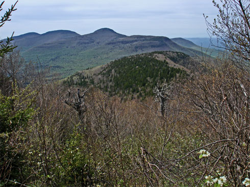 |
The picture on the left is the view just after the Plane Crash #1. In this picture you can see Acra Point, Dutcher Notch, Blackhead Mtn, Blackdome Mtn, and Thomas Cole.
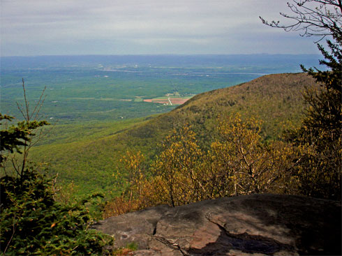
The picture on the right is the DEC trail marker at Stoppel Point. This is at mile post 4.07. The picture on the top of this page is the view from Stoppel Point. It overlooks Cairo, NY.
|
 |
|
|
This is the view point from Stoppel Point. It overlooks Little Stoppel Point in the ridge on the left side. In the center is Winter Clove Valley. On the right is North Mountain. |
|
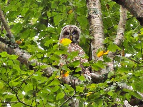 |
During the Fall and Winter, sometimes a few lucky people will see Barred Owls. Barred Owls nest in the Durham Valley and lower eastern escarpment. After they are done nesting, they often move up to the Eastern Escarpment. The Eastern Escarpment has lots of chipmunks and rabbits for them to prey on. If you hear birds screaming and mobbing in a tree, look for an owl. In the Fall and Spring you can sometimes see Saw-Whet Owls during their migration. |
|
S E C T I O N S
|
W E A T H E R
|
O T H E R
|