Buttermilk & Wildcat Ravines
Posted: Mon Aug 22, 2011 10:39 pm
This summer has been tough to get out and hike. Either we had overwhelming heat, or some other event got in our way. Finally, both Rich and I had clear schedules. We decided that we would explore the upper Buttermilk Ravine for further waterfalls, and look at starting to explore the lower ravine. We also wanted to look at Wildcat Ravine.
At Wildcat Ravine we look at the upper water fall and Wildcat waterfall itself. Here are two pictures of those waterfalls:
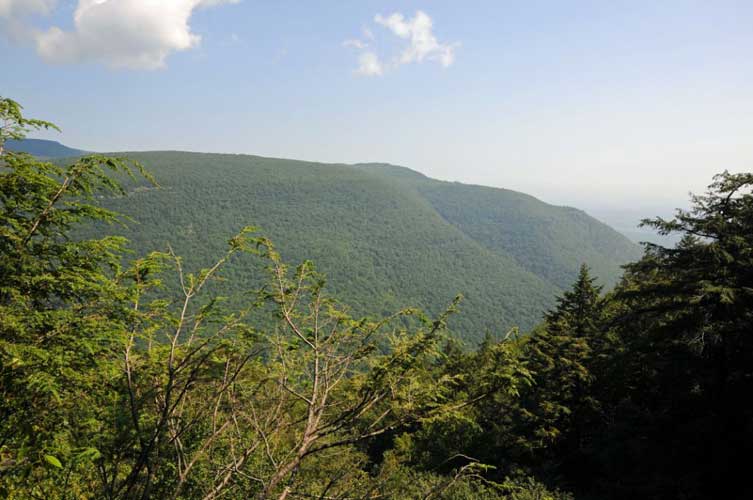
View from the top of Wildcat Falls - just off the trail
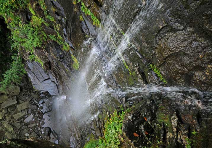
Picture taken from the top of Wildcat Falls - Look straight down to the bottom
It was around 12:30 pm. Time was marching on, and we still had quite an agenda to complete. Next we headed down the trail towards Buttermilk Falls. Our next plan was to go down one set of ledges and get to the bottom of Buttermilk Falls #1 and take pictures. For those who don't know, the entire south rim of Kaaterskill Clove has a difficult rim to ascend or descend. On a previous trip, we found a reasonable route down the rim. The series of Buttermilk Falls have a number of difficult rim ledges that make up the Buttermilk Falls. We descended down a couple. We believe that this would bring us down to the bottom of the Falls #1. Walking across the rim ledges was very easy. There were well established herd trails from animals. Each ledge was 50-100' wide. Encounter a bear here, and it might become ugly. Once you get to Buttermilk Ravine, you cannot go to the other side.
When we approached the Buttermilk Ravine, the terrain got difficult and ugly. The slope changed to a 45 degree incline on mossy rocks and dirt. Slip and fall here, and you side down the ravine. At the lower end of ravine are drops 40-100'. Fall here and you can die. While moving across the ravine, Rich had an animal hiss at him loudly. It scared the crap out of him! We didn't stay around to find out what kind of animal it was.
We move very carefully down to the bottom of one of the waterfalls. At first we believed that we were at the bottom of Buttermilk Falls #1. But, when we got there we discovered that we were wrong. Then we believed that we were at the bottom of Buttermilk Falls #2. But, we later learned that we were at the bottom of Buttermilk Falls #3 and the top of Buttermilk Falls #4. We also learned that Buttermilk Falls consist of six waterfalls comprising about 500' vertical feet. Being there was awe inspiring and scary at the same time. The drop was so extreme that we could not see the waterfalls above us. Looking down Buttermilk Water Falls #4, we could see the largest drop #5. We believe that Buttermilk #5 was somewhere around 250-300' drop. The top of Buttermilk Falls #1 was 2190'. We were between 1950-1965'.
While at the bottom of Buttermilk Falls #3 and at the top of Buttermilk Falls #4, it is difficult to move around. One Hemlock tree that was 4' in diameter had died naturally, and snapped off at the base. There was a second hemlock that had also died. Getting over them is difficult. Additionally, the rocks were very slippery. Even the dry ones. The rocks are ground smooth by the water. There is also lichens, moss, and algae on the rocks. Additionally, some of the rocks are large and at steep angles. You can get injured or killed very easy. Moving a short distance in the stream bed takes lots of time. You can only move on the dry rocks.
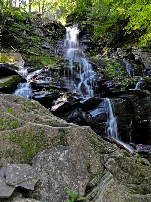
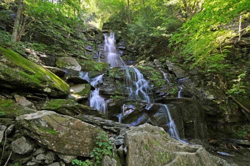
Looking up at Buttermilk Falls #3, there is a ledge rock overhanging the steam. At the right angle it looks like the water is flowing thru the rock. Awesome looking. We were also lucky at timing. The sunlight was flowing thru the hole by the ledge rock hanging over the top of the falls. We estimate that these falls are 60-80' high. We also encountered nettles in the ravine. Every possible danger existed.
It should be noted that it is possible to get into the basins without ropes. But, it is highly risky. You should use ropes and harness to gain access to the ravines. You should NEVER go in alone! You get injured here, and it may be many months before another person comes by. If you yell for help, no one will hear you. the noise of the water will block your voice. Rich and I had a hard time talking to each other when we were 15-20' away.
Here are some pictures:
Picture taken from the top of Buttermilk #4
Picture taken from the top of Buttermilk #4
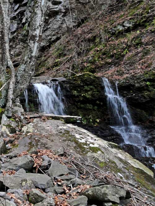
Picture of Buttermilk Falls #3 from the bottom - camera is tilted up

Picture of Buttermilk Falls #3 from the bottom - camera is tilted up
We then started to hike back up out of Buttermilk Ravine. And, let me tell you how difficult this was. Once we got out of the ravine, we hiked for close to a 1/2 mile east to find an easy access up the rim ledge. After an hour we finally made it back to the DEC trail. We then headed to the top of Buttermilk Falls #1. Here are a couple of pictures:
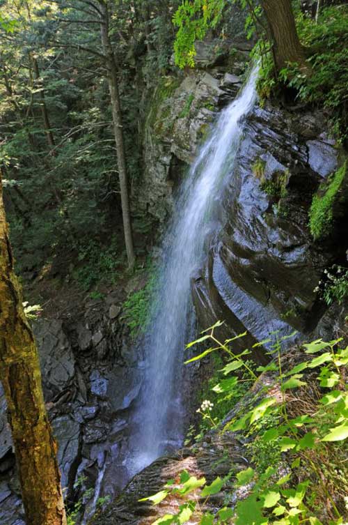
Picture of Buttermilk Falls #1 from a dangerous side view - not recommended w/o ropes
From there we moved 250' south to the upper Buttermilk Ravine to Paradox Falls. What a beautiful waterfall:
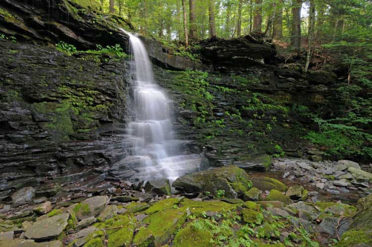
Picture of Paradox Falls at low water
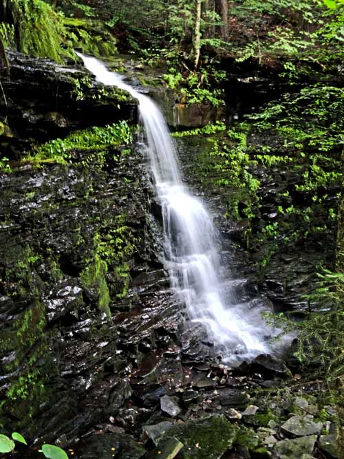
Picture of Paradox Falls at low water
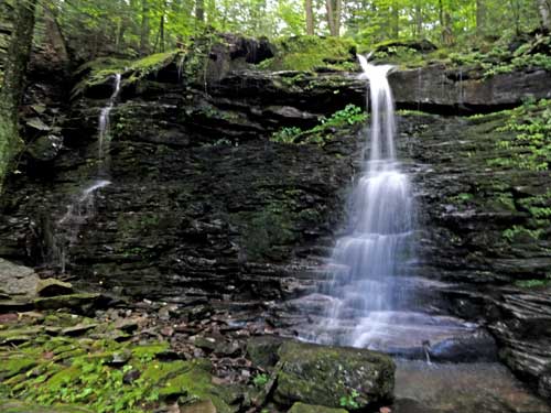
Picture of Paradox Falls at low water
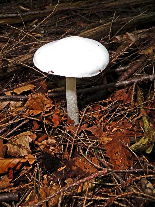
We then climbed up the upper Buttermilk Ravine looking for more waterfalls. Unfortunately, we didn't find more. We then hiked back down the trail. Here is a mushroom we found:
Exhausted we retreated to the car.
At Wildcat Ravine we look at the upper water fall and Wildcat waterfall itself. Here are two pictures of those waterfalls:
View from the top of Wildcat Falls - just off the trail
Picture taken from the top of Wildcat Falls - Look straight down to the bottom
It was around 12:30 pm. Time was marching on, and we still had quite an agenda to complete. Next we headed down the trail towards Buttermilk Falls. Our next plan was to go down one set of ledges and get to the bottom of Buttermilk Falls #1 and take pictures. For those who don't know, the entire south rim of Kaaterskill Clove has a difficult rim to ascend or descend. On a previous trip, we found a reasonable route down the rim. The series of Buttermilk Falls have a number of difficult rim ledges that make up the Buttermilk Falls. We descended down a couple. We believe that this would bring us down to the bottom of the Falls #1. Walking across the rim ledges was very easy. There were well established herd trails from animals. Each ledge was 50-100' wide. Encounter a bear here, and it might become ugly. Once you get to Buttermilk Ravine, you cannot go to the other side.
When we approached the Buttermilk Ravine, the terrain got difficult and ugly. The slope changed to a 45 degree incline on mossy rocks and dirt. Slip and fall here, and you side down the ravine. At the lower end of ravine are drops 40-100'. Fall here and you can die. While moving across the ravine, Rich had an animal hiss at him loudly. It scared the crap out of him! We didn't stay around to find out what kind of animal it was.
We move very carefully down to the bottom of one of the waterfalls. At first we believed that we were at the bottom of Buttermilk Falls #1. But, when we got there we discovered that we were wrong. Then we believed that we were at the bottom of Buttermilk Falls #2. But, we later learned that we were at the bottom of Buttermilk Falls #3 and the top of Buttermilk Falls #4. We also learned that Buttermilk Falls consist of six waterfalls comprising about 500' vertical feet. Being there was awe inspiring and scary at the same time. The drop was so extreme that we could not see the waterfalls above us. Looking down Buttermilk Water Falls #4, we could see the largest drop #5. We believe that Buttermilk #5 was somewhere around 250-300' drop. The top of Buttermilk Falls #1 was 2190'. We were between 1950-1965'.
While at the bottom of Buttermilk Falls #3 and at the top of Buttermilk Falls #4, it is difficult to move around. One Hemlock tree that was 4' in diameter had died naturally, and snapped off at the base. There was a second hemlock that had also died. Getting over them is difficult. Additionally, the rocks were very slippery. Even the dry ones. The rocks are ground smooth by the water. There is also lichens, moss, and algae on the rocks. Additionally, some of the rocks are large and at steep angles. You can get injured or killed very easy. Moving a short distance in the stream bed takes lots of time. You can only move on the dry rocks.
Looking up at Buttermilk Falls #3, there is a ledge rock overhanging the steam. At the right angle it looks like the water is flowing thru the rock. Awesome looking. We were also lucky at timing. The sunlight was flowing thru the hole by the ledge rock hanging over the top of the falls. We estimate that these falls are 60-80' high. We also encountered nettles in the ravine. Every possible danger existed.
It should be noted that it is possible to get into the basins without ropes. But, it is highly risky. You should use ropes and harness to gain access to the ravines. You should NEVER go in alone! You get injured here, and it may be many months before another person comes by. If you yell for help, no one will hear you. the noise of the water will block your voice. Rich and I had a hard time talking to each other when we were 15-20' away.
Here are some pictures:
Picture taken from the top of Buttermilk #4
Picture taken from the top of Buttermilk #4
Picture of Buttermilk Falls #3 from the bottom - camera is tilted up
Picture of Buttermilk Falls #3 from the bottom - camera is tilted up
We then started to hike back up out of Buttermilk Ravine. And, let me tell you how difficult this was. Once we got out of the ravine, we hiked for close to a 1/2 mile east to find an easy access up the rim ledge. After an hour we finally made it back to the DEC trail. We then headed to the top of Buttermilk Falls #1. Here are a couple of pictures:
Picture of Buttermilk Falls #1 from a dangerous side view - not recommended w/o ropes
From there we moved 250' south to the upper Buttermilk Ravine to Paradox Falls. What a beautiful waterfall:
Picture of Paradox Falls at low water
Picture of Paradox Falls at low water
Picture of Paradox Falls at low water
We then climbed up the upper Buttermilk Ravine looking for more waterfalls. Unfortunately, we didn't find more. We then hiked back down the trail. Here is a mushroom we found:
Exhausted we retreated to the car.