One of the guys didn't have snowshoes so I let him borrow my uphill snowshoes and was using my trail ones. I was slipping frequently because of the lack of crampon on those shoes, and the going was pretty tough. We made it up in fairly good time, about 2 hours, and sliding down took only an hour. Next time I would bring a cheap light sled, as this would be extremely fun with one of those. I think too many turns for a snowtube, unless you were really good at turning. It's called the "thunderbolt" since there are two major turns, the first being "the needle eye" and the second being "the big bend". Since it's a ski slope, all the pitches are named such as "The Bumps", or "The Steps".

We drove up to the "theil Road" in Adams, MA but it was closed off for the winter. We wound up having to hike an extra 1/2 mile just to get to the trailhead.
Here the view of Mt. Greylock from where we parked. You can see the small tiny statue for soldiers is at the top.

Thunderbolt trail marker

Here was a small dip where the trail goes down for a bit before going up. It's a banked turn and he skiied away quickly down it. I stood at the top and just snapped a photo before they started climbing the hill on the other side

Ravi had my hill climbing snowshoes, and Jurgen wore skis with skins on the bottom so he could ski straight up hill. He could take hugely steep inclines with those things, stuff I wouldn't even try with snowshoes.

Climbing up the slopes was difficult. It was very wide so switchbacking was an option, however as you went up or across you would change from hard snow pack, to soft powder. The powder my shoes would just start digging holes, and the hard snowpack my crampons would just slice through and not grip at all. There was a happy medium on some of the pitches, but nothing lasted more than a few feet.

The view was spectacular and just kept getting better as we got higher. Every once in a while I would look behind, but the sun was right in the way so I couldn't get many shots.

Here is when we got to the top of "the Steps" and before we started up the Big Bend

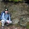
Stopping for a break the wall behind Jurgen is the Big Bend. It was nearly vertical.

This was an image grab from my cellphone video, you can see Ravi is standing verically, and the angle of the slope behind him.

This is once we got to the halfway point on the Big Bend. It's actually like 3 smaller pitches with an overall large curve to it.

As we climbed it there is the promise always that this is the last pitch, and then once you get 1/2 way up that, another portion comes into view.

View from the top of the Big Bend


Road that crosses the trail

There is a snow hut by the appalachian trail

The three of us by the monument at the top. Boy is it huge!

Shot by the viewpoint which was inredible, despite the low hanging clouds

AT

We hung out in the hut for a while. Tried to get our water thawed but nothing worked. We decided to make the downhill run on the thunderbolt. I put my Nikon away and only took video with my cellphone. Here are some screen grabs


Making cool jumps

Faceplanting after a jump

Last shot view from the car before heading home

