Hike to the Ashland Pinnacle Knob |
 |
| |
| |
|
OVERVIEW |
| | Trail Name: |  Ashland Knob Trail (DEP)
(DEP PA to West Cave Mtn)
Ashland Knob Trail (DEP)
(DEP PA to West Cave Mtn) |
| | Trail Name: |  Bushwhack to The Knob
(South of Ashland Pinnacle)
Bushwhack to The Knob
(South of Ashland Pinnacle) |
| | | |
| | Forest : | Ashland Pinnacle Wild Forest |
| | Parking Area : | DEP Ashland Knob Parking Area of Rt 10 |
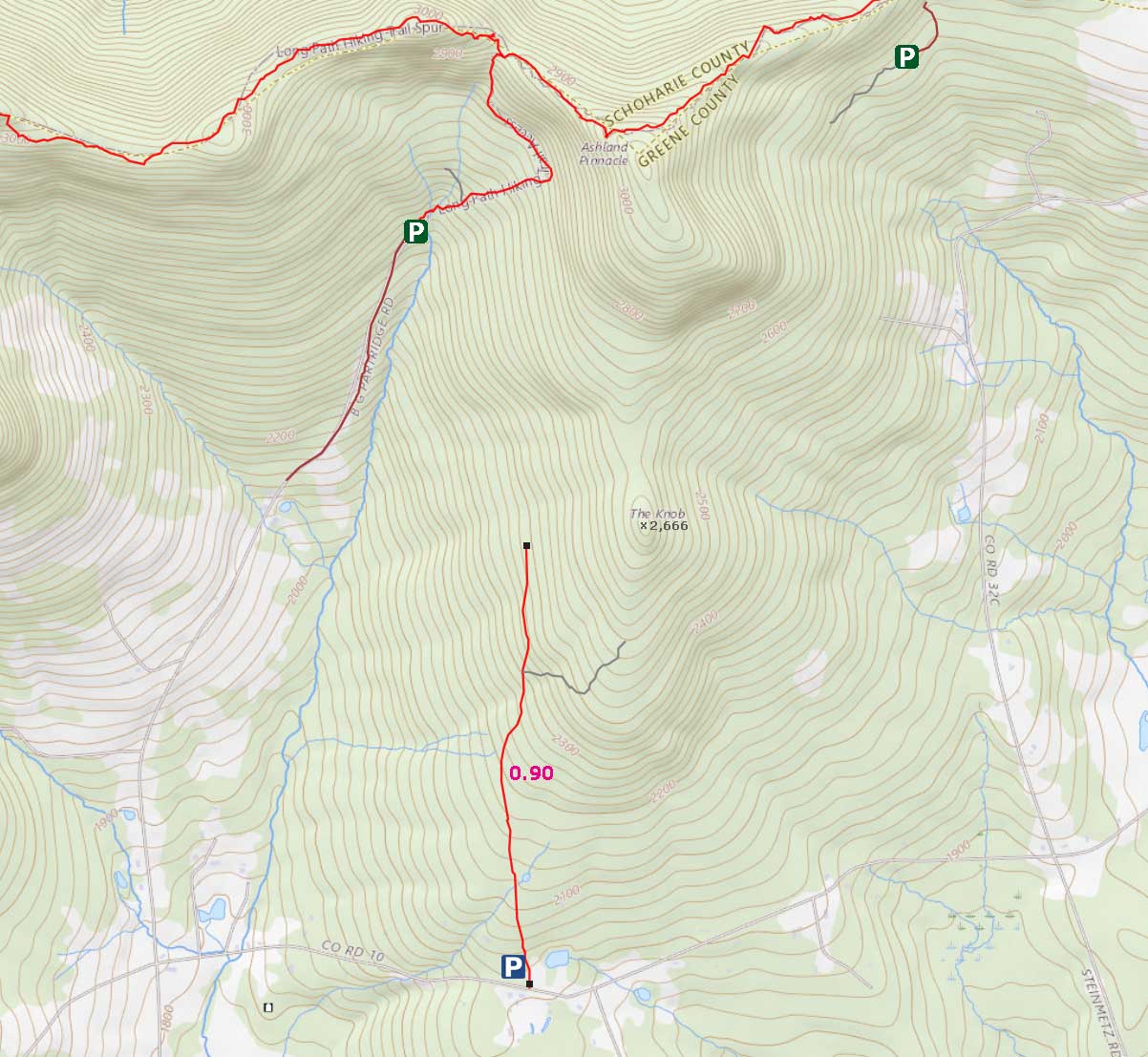
| | Distance: | 2.50 miles (round-trip) from DEP parking lot off Rt 10 |
| | Permit Required: | DEP Permit NOT Required |
| | Time: | Average 2-3 hours (round trip) |
| | Winter Access: | Unknown |
| | Camp sites: | NO Camp Site locations |
| | Lean-to sites: | NO Lean-to |
| | Access: | Hike or snowshoe |
| | Elevation Gain: | 625 feet from parking lot to The Knob |
| | Best Time to Hike: | Spring or Fall |
| | Difficulty: | Easy |
| | Peak Elevation: | 2,666' |
| | |
| | | USGS Official Map: | Ashland Topographical Map (free) |
| | |
| | | Digital Mapper: |
Topo
Terrain
Satellite |
| | |
| | | Access Methods: | Foot and snowshoe. |
|
|
Maps |
 |
|
|
| | DIRECTIONS TO TRAILHEAD |
| | DEP Parking Lot WGS84 (DEC): 42.333583, -74.316733 - Elevation is approximately 2,024feet |
| | DEP Parking Lot Deg/Min/Sec: N42 20 00, W74 19 00 - Elevation is approximately 2,024feet |
| | DEP Parking Lot GPS: N42 20.015, W74 19.004 - Elevation is approximately 2,024feet |
| | DEP Parking Lot UTM: 18N 556290 4687041 - Elevation is approximately 2,024feet |
| |
|
| |
|
| | Directions to Trail Head from New York State Thruway (Easist, not the shortest): |
| | GPS Coordinates for the Parking Lot on the DEC Pisgah Road: N42 22.411 W74 15.792 - Elevation 2,811 feet |
| | Take New York State Thruway to Exit 20 (Catskill). |
| | Take a LEFT out of the NYS Thruway toll booths. |
| | Take a RIGHT onto Rt 23 westbound |
| | Go 22.2 miles on Rt 23 (just before Windham) |
| | Take RIGHT on to Mitchell Hollow Road (Rt 21) |
| | Go 4.2 miles to Rt 10 |
| | Take a sharp LEFT onto Rt 10 |
| | Go approximately 4.7 miles on Rt 10 |
| | Take RIGHT into DEP Parking Area (on right side of road) |
| | The DEP Parking Area is slightly west of Case Road) |
| | Take RIGHT into DEP Parking Area (holds 3 cars) |
| | Look for Blue DEP sign on tree - Entrance is between two houses |
|
|
|
| | Notes About Hiking the Cave Mountain Trail |
|
| | TRAIL |
|
| |
This trail is not hiked in the winter months. The trail is easy hiking with a good tread.
The hike up from the valley up to The Ashland Pinnacle Knob ("The Knob") is on DEP property. 75% of the hike is on a nice easy logging road. The last 25% requires bushwhacking up to The Knob.
The hike from the DEP road to The Knob requires some navigational skills to avoid hiking onto private property. Some parts of the property lines are marked.
You should be aware that there are ticks on this hike. So, try to avoid high grass. In the Summer months the DEP has high grass and ticks. Most people hike this trail in the Spring and Fall. We do not know if the parking area is plowed in the Winter months. Most likely it is NOT plowed.
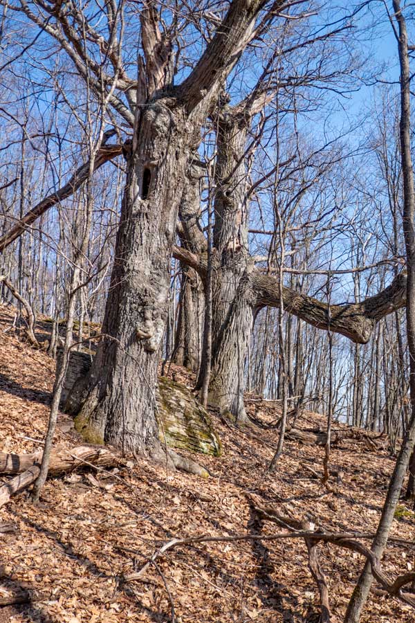
Just southeast of the summit is a small grove of old Oak Trees that are 3-5 feet in diameter.
| |
| | PARKING |
|
| |
Parking at the DEP Parking Area is limited to 3 cars. The Parking Area is empty most of the time. This DEP Parking Area has not been plowed in past Winters.
The hardest part is finding the DEP Parking Area. Just follow our instructions, and you should be able to find it. You can also use the GPS coordinates in your cell phone maps program.
| |
| | OTHER INFORMATION |
|
| |
You should have cell phone service on some parts of this hike.
There are not any water sources on this hike.
|
|
|
MILEAGE CHART |
| | Distance | Mile Point | Altitude | Notes |
| | 0.00 | 0.00 | 2,023' | Entrance to DEP Parking Lot (holds 3 cars). |
| | 0.05 | 0.05 | 2,057' | DEP Gate |
| | 0.85 | 0.90 | 2,401' | End of DEP Road |
| | 0.35 | 1.25 | 2,666' | Summit of The Knob |
|
|
Hike to the Ashland Pinnacle Knob |
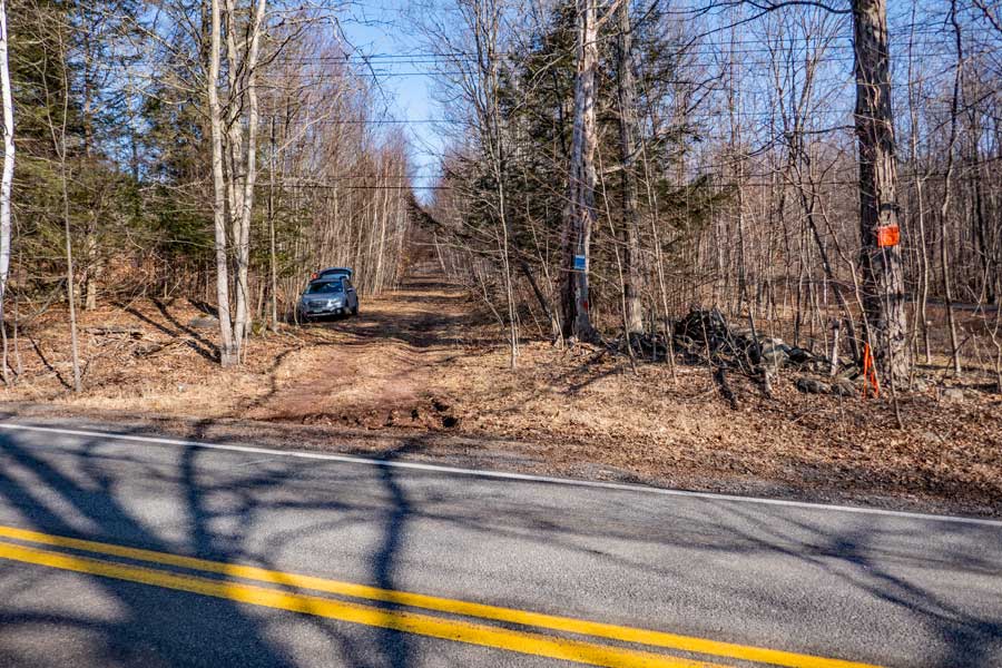 |
This is the DEP Parking Area entrance. Look for the DEP Blue/white sign on the tree. It is just past Case Road on the right.
|
|
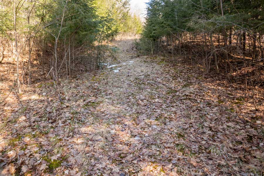 |
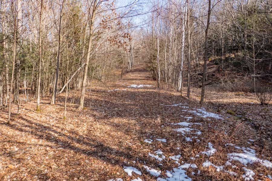
This is probably the narrowest section of the DEP road that runs for 9/10 of a mile.
|
|
 |
When you get about 1/2 way up the DEP road the property line becomes narrow, so stay on the DEP road
|
|
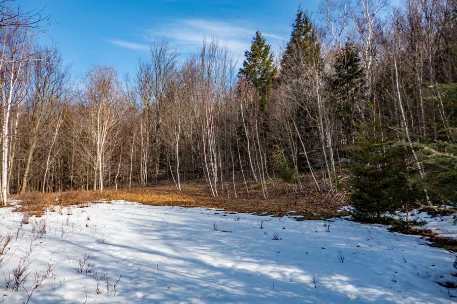 |
When you get almost to the end of the DEP road you will come to this opening. Walk across the opening to continue down the final part of the road
|
|
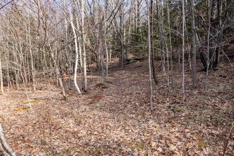 |
You will continue down the trail for a short distance before the DEP road will come to an end.
When it comes to an end, turn 90 degrees to the right and start hiking up the hill.
|
|
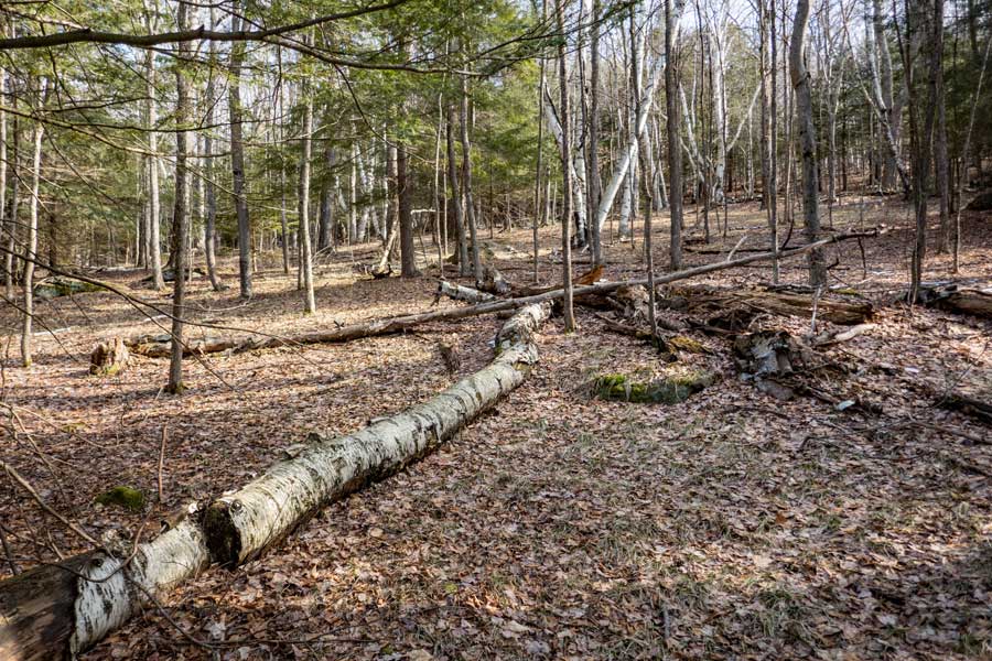 |
The walk up the hill is fairly easy. Continue to hike up the hill while avoiding drifting off onto private property. There are DEP markers near the property line, but it is still possible to miss the signs.
|
|
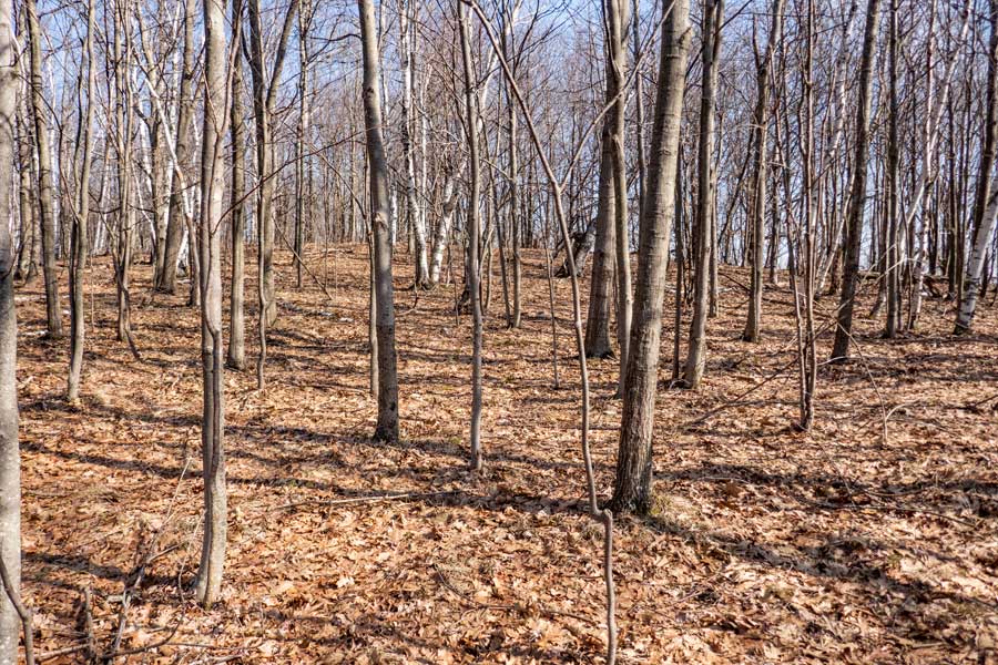 |
As you hike up the hill move towards the highest point. As you hike up the hill there will appear to be a false summit. But, as you approach it, you will see a higher point. Move towards the higher point.
|
|
|
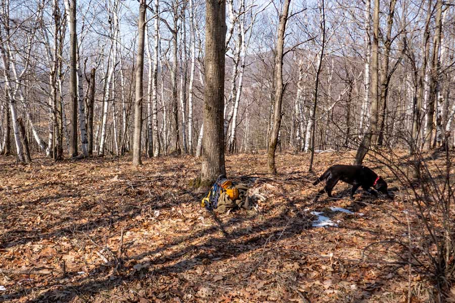
This is the Ashland Pinnacle Knob, or sometimes called "The Knob". The top is fairly flat so it can be difficult to find the exact highest point.
Many hikers then hike down to the southeast end of the Knob to see some large Oak trees that are 3-5 feet in diameter. Obviously, you can skip the Oak Trees, and head back to your car.
|
|
 |
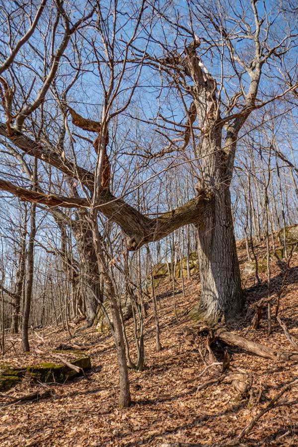 |
These two pictures show some of the large Oak Trees. There is some private land to the east of the trees. The property line is marked with DEP markers.
|
|
|
S E C T I O N S
|
W E A T H E R
|
O T H E R
|