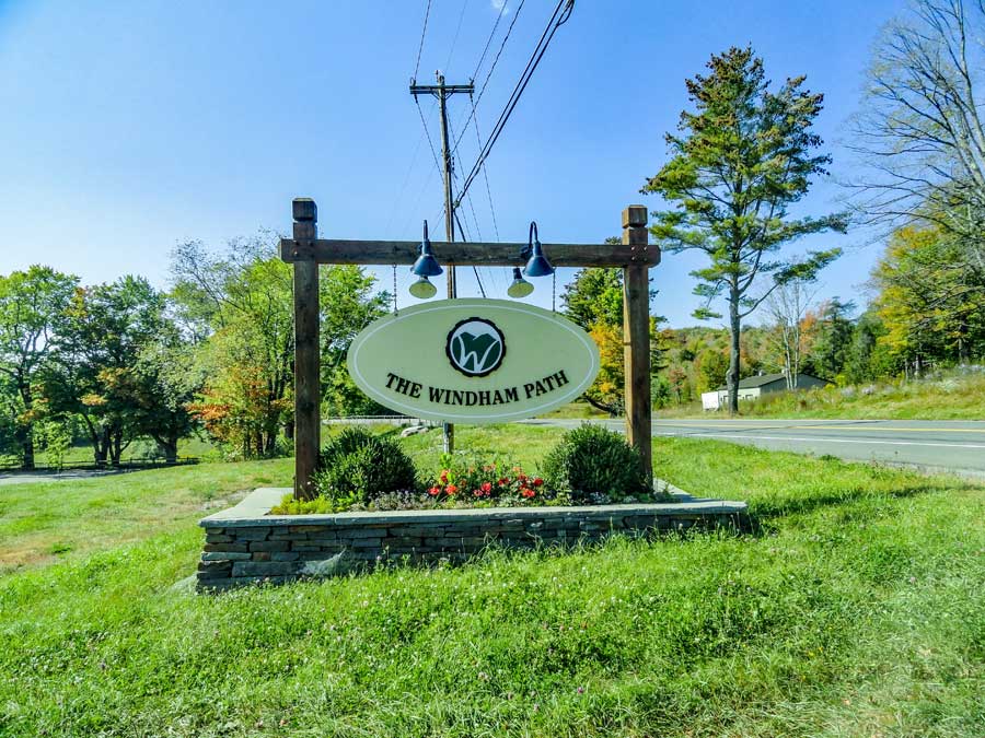
The Windham Path |
 |
| |
| |
|
OVERVIEW |
| | Trail Name: |  The Windham Path & Spur (Public)
 |
| | |
| | | Forest : | Hunter-Tanersville-Windham Valley |
| | Parking Area : | The Windham Path Parking Area |
| | Distance: | 1.47 w/o spur - 2.24 w/w spur |
| | Permit Required: | Free to public - no permit needed |
| | Time: | Average 1 hours (round trip) |
| | Winter Access: | Plowed |
| | Access: | Hike, Bike or snowshoe |
| | Elevation loss: | 67 feet from parking lot to trail by creek |
| | Best Time to Hike: | Anytime |
| | Difficulty: | Easy |
| | Peak Elevation: | 1,655' |
| | |
| | | USGS Official Map: | Hensonville Topographical Map (free) |
| | Digital Mapper: |
Topo
Terrain
Satellite |
| | |
| | | Access Methods: | Foot, bike or snowshoe. |
|
|
Maps |
 |
|
|
| | DIRECTIONS to The Windham Path Parking Area on Rt 23 |
| | The Windham Path Parking Lot WGS84 (DEC): 42.304883, -74.219767 - Elevation is approximately 1,655 feet |
| | The Windham Path Parking Lot Deg/Min/Sec: N42 18 17, W74 13 11 - Elevation is approximately 1,655 feet |
| | The Windham Path Parking Lot GPS: N 42 18.293, W 74 13.186 - Elevation is approximately 1,655 feet |
| | The Windham Path Parking Lot UTM: 18N 564308 4683923 - Elevation is approximately 1,655 feet |
| |
|
| | Take New York State Thruway to Exit 21 (Catskill). |
| | Take a LEFT out of the NYS Thruway entrance road onto Rt 23b |
| | Go approximately 0.4 on Rt 23b |
| | Take a RIGHT onto Rt 23 (west) |
| | Go approximately 20.9 miles on Rt 23 |
| | Take a LEFT into The Windham Path Parking Area |
|
|
| | DIRECTIONS to The Windham Path Parking Area on Rt 296 |
| | The Windham Path Parking Lot WGS84 (DEC): 42.3042, -74.228683 - Elevation is approximately 1,605 feet |
| | The Windham Path Parking Lot Deg/Min/Sec: N42 18 15, W74 13 43- Elevation is approximately 1,605 feet |
| | The Windham Path Parking Lot GPS: N 42 18.252, W 74 13.721 - Elevation is approximately 1,605 feet |
| | The Windham Path Parking Lot UTM: 18N 563574 4683840 - Elevation is approximately 1,605 feet |
| |
|
| | Take New York State Thruway to Exit 21 (Catskill). |
| | Take a LEFT out of the NYS Thruway entrance road onto Rt 23b |
| | Go approximately 0.4 on Rt 23b |
| | Take a RIGHT onto Rt 23 (west) |
| | Go approximately 21.6 miles on Rt 23 |
| | Take a LEFT onto Rt 296 |
| | Go approximately 0.3 miles on Rt 296 |
| | Take a LEFT into The Windham Path Parking Area & Parking Lot |
| | The Windham Path Parking Area is at the end of the Parking Lot |
|
|
|
| | Notes About Hiking to The Windham Path |
|
| | TRAIL |
|
| |
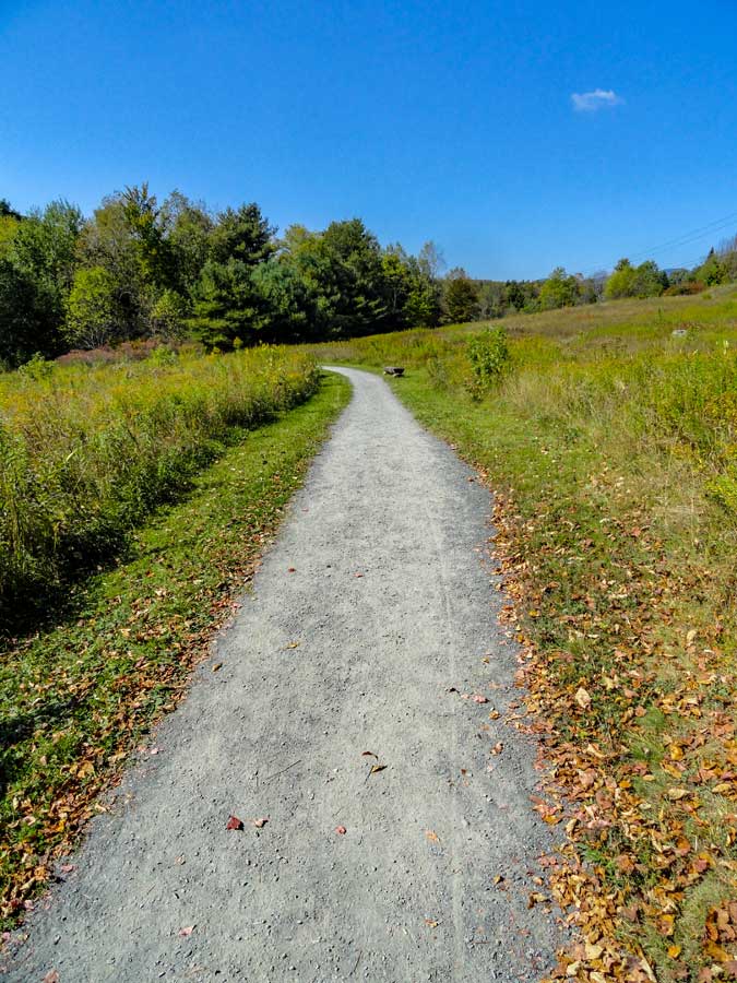
The Windham Path is a nice 1-1/2 mile walk. Adding the spur trail from Rt 296 Parking Area adds another 3/4 of a mile. It is commonly used by the local residents of Windham and the surrounding area. The entire path has crushed bluestone dust, which makes walking on it very easy.
For those who would like to see the wild flowers along the path, you should visit between the 1st and 3rd weeks in June.
If you want to walk off the path into the grassy areas, beware of deer and dog ticks. They do mow paths into the center section of the path.
Dogs are allowed on the path, but must be on a leash.
There is DEP property on the east side of the park.
There are places to fish in the Batavia Kill Creek near the bridge and at the end of the field. After large storms, water can overflow the banks on the western and south side of the path.
You can use Mountain Bikes on The Windham Path. But, with numerous walkers, you will find it difficult to bike.
There are numerous park benches where people can stop and rest.
After a large rain storm, this path is not recommended for small children. The Batavia Kill Creek can get quite violet after large storms.
| |
| | PARKING |
|
| |
Parking for The Windham Path Parking Area off Rt 23 holds about 12 cars, and can fill up at times. This parking area is very easy to find.
Parking at the Rt 296 parking area is more difficult to find. And, there is a lot more parking there. This parking area would be the preferred parking area when there is snow on the ground.
| |
| | OTHER INFORMATION |
|
| |
You should be cell phone service on some parts of The Windham Path.
|
|
|
MILEAGE CHART - Windham Path Loop w/o Spur Trail |
| | Distance | Mile Point | Altitude | Notes |
| | 0.00 | 0.00 | 1,655' | Parking Lot off Rt 23 |
| | 1.39 | 0.61 | 1,607' | Covered Bridge over Batavia Kill Creek |
| | 0.41 | 1.47 | 1,655' | Back at Parking Lot off Rt 23
|
|
MILEAGE CHART - Windham Path Loop w/o Spur Trail |
| | Distance | Mile Point | Altitude | Notes |
| | 0.00 | 0.00 | 1,655' | Parking Lot off Rt 23 |
| | 0.61 | 0.61 | 1,607' | Covered Bridge over Batavia Kill Creek |
| | 0.39 | 1.00 | 1,605' | Parking Lot off Rt 296 |
| | 0.38 | 1.38 | 1,607' | Back at Covered Bridge over Batavia Kill Creek
| | | 0.86 | 2.24 | 1,655' | Finish Loop at Parking Lot off Rt 23 |
|
 |
This is the entrance to The Windham Path Parking Area from Rt 23. If you are travelling from East-to-West, it is on the LEFT side of the road.
There is second parking area off Rt 296 near the shopping businesses. There are more options for parking there. But, harder to find the trailhead. This is your best option when there is snow on the ground.
|
|
 |
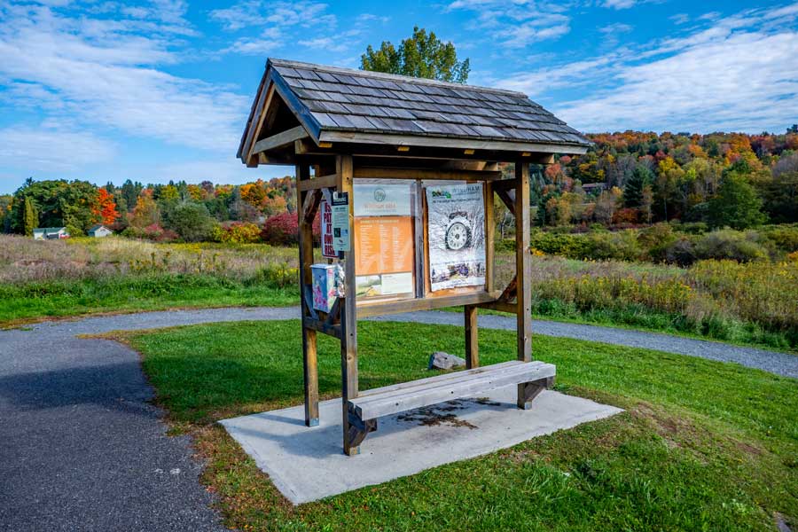
This is the Trailhead for The Windham Path off Rt 23 in Windham. Behind the Kiosk is the parking area. It holds about 12 cars. This parking area does fill up.
If this parking area is full or inaccessible, there is a second parking area off Rt 296, which has many more parking spots for cars. The parking area off Rt 296 is where you should park in the Winter months.
|
|
|
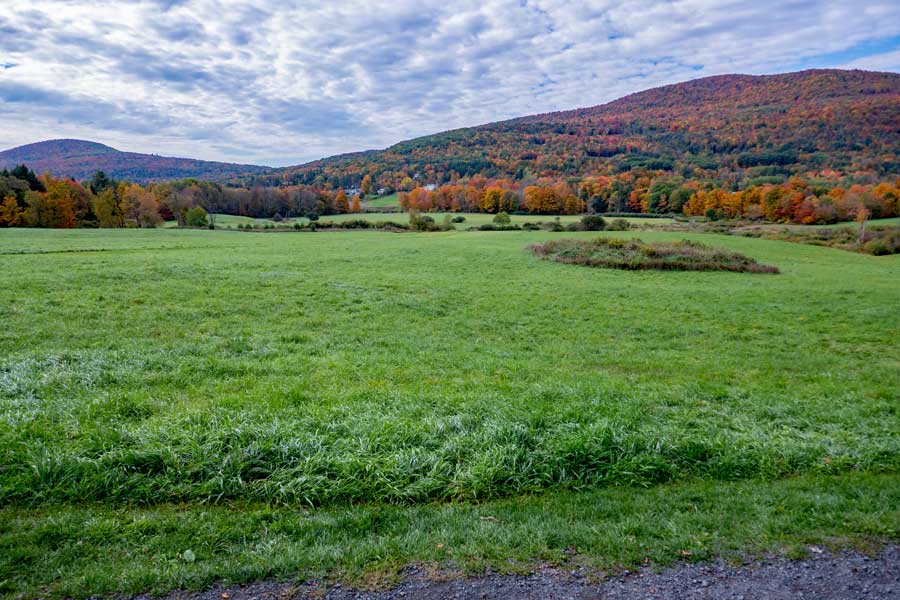
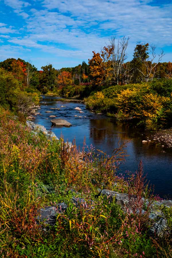
This picture was taken from the Kiosk by The Windham Path Parking Area. The Windham Path extends down the the trees at the base of the Cave Mountain Range. The southern end of The Windham Path runs next to the Batavia Kill Creek. You are free to walk anywhere in this park.
|
|
 |
This is the beginning of The Windham Path from the Rt 23 parking area. It runs in a westerly direction before slowly turning south. The mountain in the distance is East Cave Mountain with an elevation of 3,098'. The parking area is about 1,500' lower then the summit of East Cave Mountain.
|
|
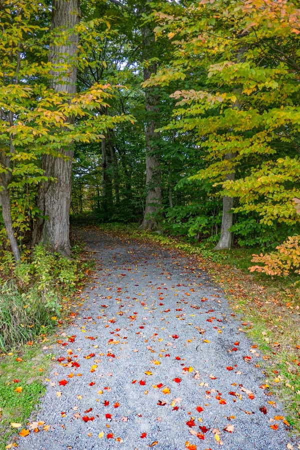 |
After a short distance from trailhead, off Route 23, is a small forest section you will walk through.
When you come out of the forest section, there is a section of the path where wild flowers grow in June each year.
|
 |
|
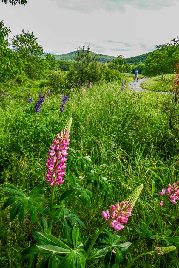 |
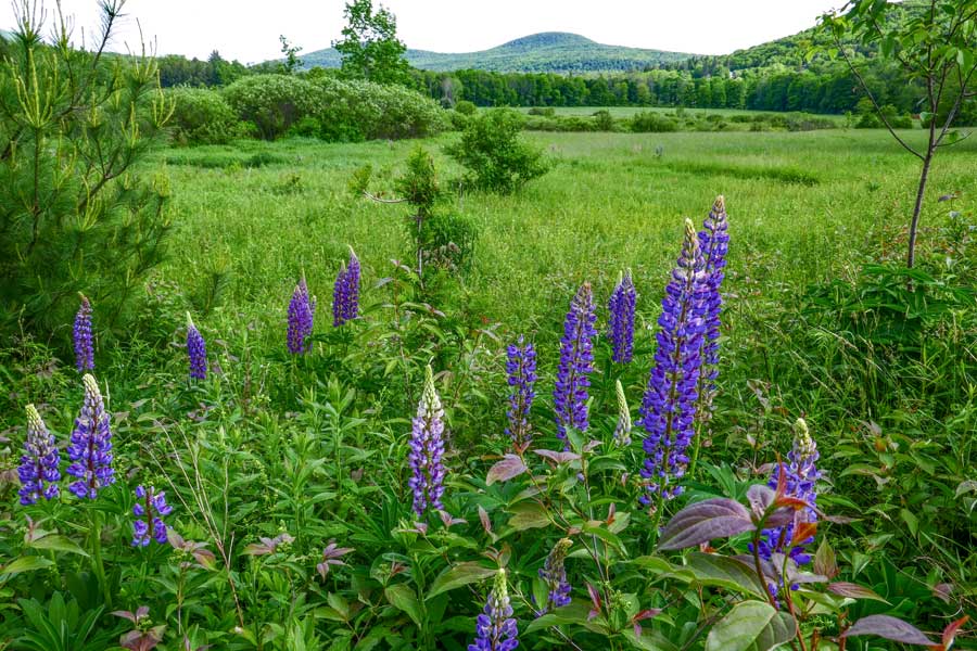
On the western side of the forest section of The Windham Path is a section where wild flowers grow and bloom every June. You will mainly see Lupine flowers.
After the wild flower section, the trail turn to the west again until it approaches the Batavia Kill Creek.
|
 |
|
 |
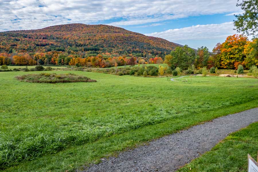
More Lupine Flowers looking towards the south. Sometimes they mow grass trails into the interior of this park at this location.
|
|
 |
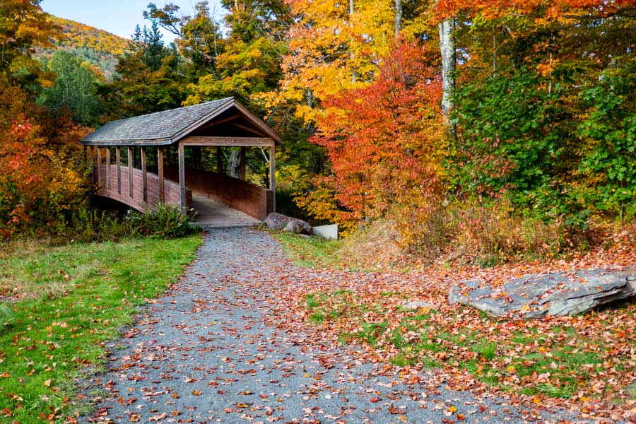
After walking about 6/10 of a mile from the parking area off Rt 23, you will come to this beautiful covered bridge.
This is the spur trail to Rt 296 Trailhead. It is a little less then 4/10 of a mile to the Rt 296 trailhead.
|
|
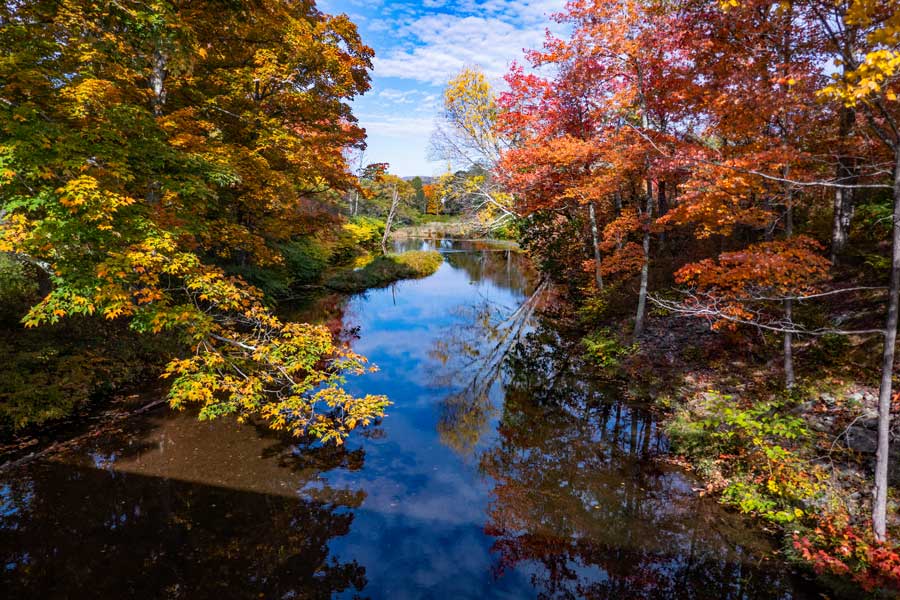 |
This is the view south towards Windham from the Covered Bridge on the Spur Trail off the Windham Path Loop. The view north is also excellent.
|
|
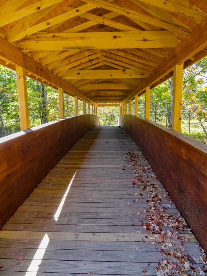 |
This is the view of the covered bridge as you are crossing it. This is the most beautiful hiking bridge in the Catskill Mountains. Exceptionally beautiful.
If you are only hiking The Windham Path Loop, turn around and go back to the path you were hiking.
If you want to hike the Spur Trail to Rt 296 trailhead, continue over the covered bridge and continue walking up the Spur Trail.
|
 |
|
 |
As you continue to walk up the Spur Trail of the Windham Path, the path will run next to the Batavia Kill Creek.
The Batavia Kill Creek can get quite violent after a big rain storm, so children may not be recommended for this section of the path after a big rain storm.
|
 |
|
 |
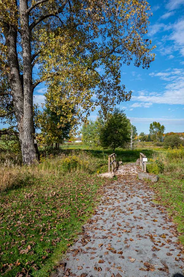
This is the kiosk at the Trailhead of the Spur Trail off The Windham Path Loop off Rt 296 parking area. It is located on the south side of the shopping businesses about 3/10 of a mile up Rt 296 from Rt 23.
Once you reach the Trailhead off Rt 296, you can turn around and hike back to the Covered Bridge.
|
|
 |
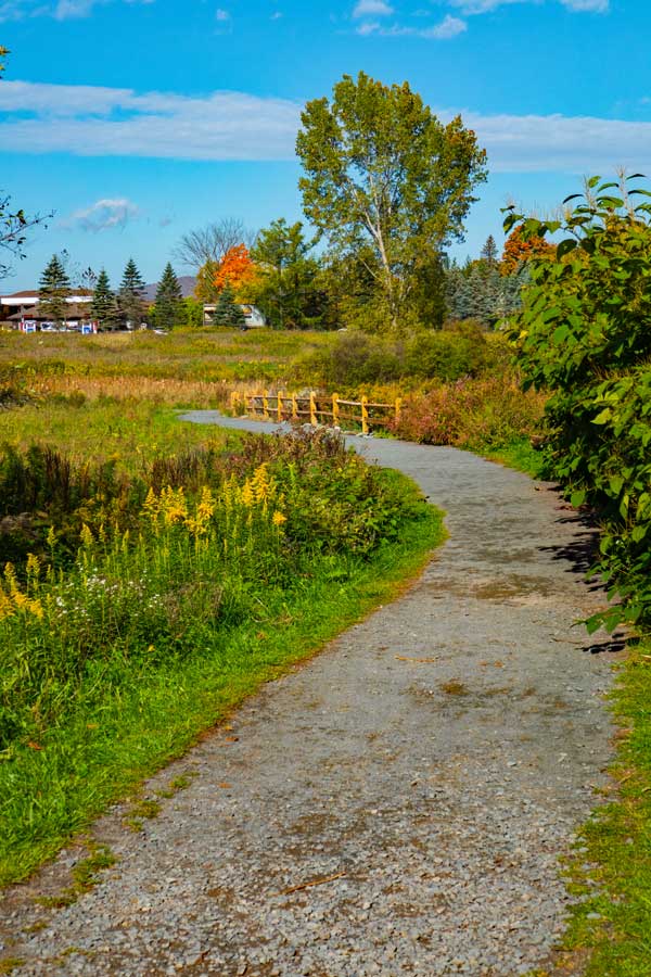
Once you return back to the Covered Bridge, you want to take a RIGHT and continue south on The Windham Bike Path.
|
|
 |
As you continue south on The Windham Bike Path, you will cross a nice long bridge with a tributary of the Batavia Kill Creek.
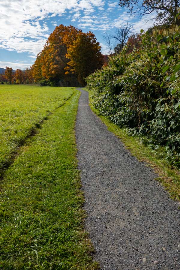
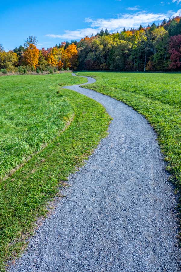
Once past the bridge the path becomes quite flat. On your right is the Batavia Kill Creek. In the beginning there is a hedgerow on the right.
Once you reach the end of the southerly end of the park, the path will turn to the east for a short distance, and then turn back to the north.
|
 |
|
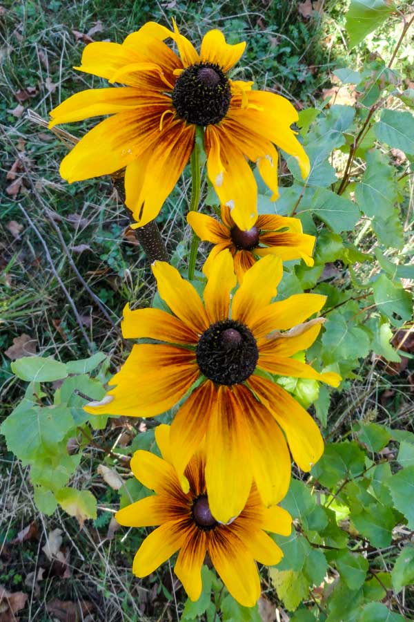 |
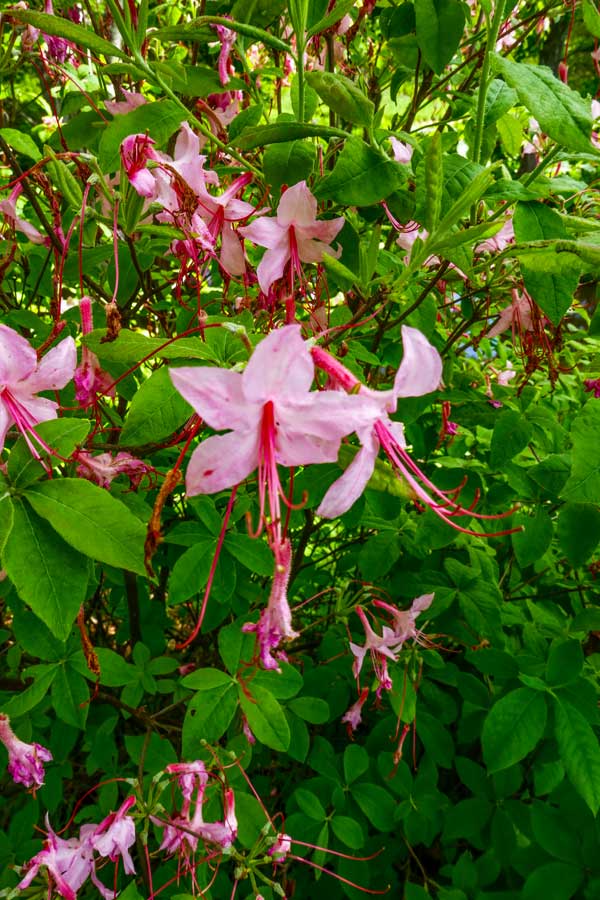
You will also find some more wild flowers in the summer region of The Windham Bike Park. These bloom in the August-September-October time period each year.
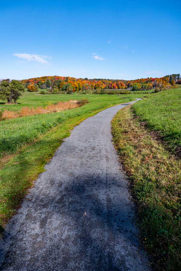
As you head further north the trail starts to have a slight incline.
|
 |
|
 |
As the trail turns north back towards the parking area off Rt 23, you will go over some small bridges.
As you head further north the trail takes some nice turns to make sure you don't get bored.
There is another park bench on eastern side of the path.
|
 |
|
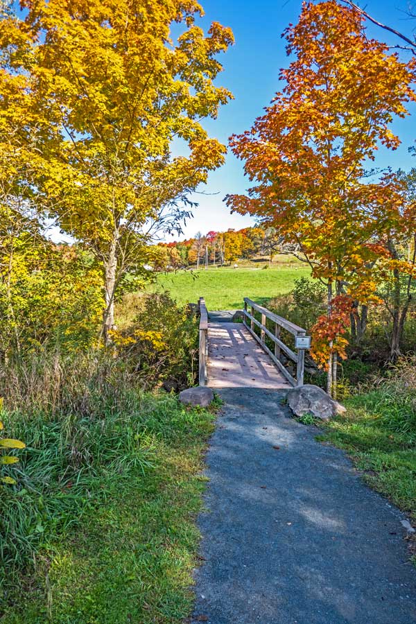 |
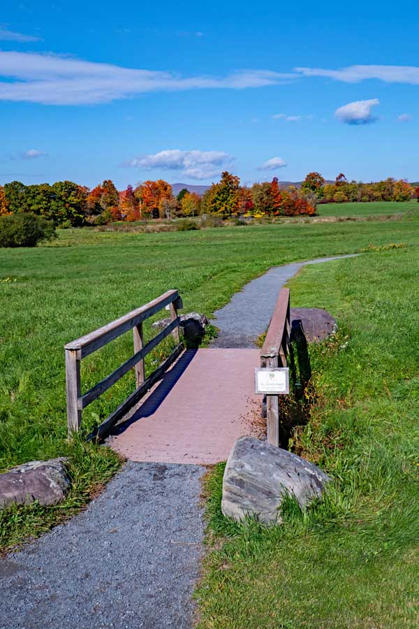
This is the last bridge you will cross before you arrive back at the Route 23 Parking Area for The Windham Path.
This path is exceptionally beautiful in the beginning of October when the leaves are changing on a beautiful clear fall day.
|
|
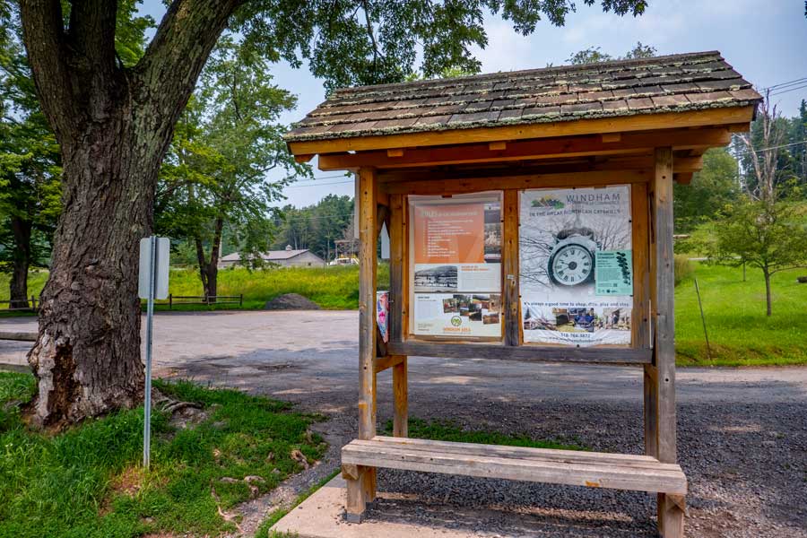 |
You have now finished The Windham Path Loop. This is the Kiosk at the Route 23 Parking Area. Hope you enjoyed this hike as much as we did.
|
|
|
S E C T I O N S
|
W E A T H E R
|
O T H E R
|