Hike to Cave Mountain |
 |
| |
| |
|
<OVERVIEW |
| | Trail Name: |  West Cave Trail (DEP)
(DEP PA to West Cave Mtn)
West Cave Trail (DEP)
(DEP PA to West Cave Mtn) |
| | Trail Name: |  Peak-to-Peak Trail (Windham Mtn Ski Center)
(West Cave Mtn to Cave Mtn)
Peak-to-Peak Trail (Windham Mtn Ski Center)
(West Cave Mtn to Cave Mtn) |
| | | |
| | Forest : | Hunter-Tanersville-Windham Valley |
| | Parking Area : | DEP West Cave Parking Area |
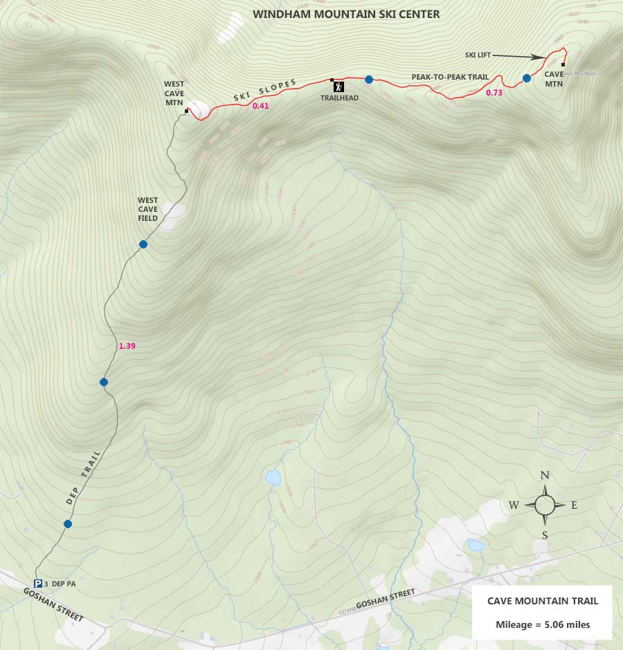
| | Distance: | 5.06 miles (round-trip) from DEP parking lot Goshen Street |
| | Permit Required: | DEP Permit NOT Required |
| | Time: | Average 3 hours (round trip) |
| | Winter Access: | NOT Plowed |
| | Camp sites: | NO Camp Site locations |
| | Lean-to sites: | NO Lean-to |
| | Access: | Hike or snowshoe |
| | Elevation Gain: | 1,010 feet from parking lot to Cave Mtn Summit |
| | Best Time to Hike: | When leaves are not on trees |
| | Difficulty: | Easy |
| | Peak Elevation: | 3,098' |
| | |
| | | USGS Official Map: | Ashland Topographical Map (free) |
| | |
| | | USGS Official Map: | Hensonville Topographical Map (free) |
| | |
| | | Digital Mapper: |
Topo
Terrain
Satellite |
| | |
| | | Access Methods: | Foot and snowshoe. |
|
|
|
| | DIRECTIONS TO TRAIL HEAD |
| | DEP Parking Lot WGS84 (DEC): 42.267783, -74.271767 - Elevation is approximately 2,088 feet |
| | DEP Parking Lot Deg/Min/Sec: N42 16 04, W74 16 18 - Elevation is approximately 2,088 feet |
| | DEP Parking Lot GPS: N 42 16.067, W 74 16.306 - Elevation is approximately 2,088 feet |
| | DEP Parking Lot UTM: 18N 560057 4679765 - Elevation is approximately 2,088 feet |
| |
|
| | Take New York State Thruway to Exit 21 (Catskill). |
| | Take a LEFT out of the NYS Thruway entrance road onto Rt 23b |
| | Go approximately 0.4 on Rt 23b |
| | Take a RIGHT onto Rt 23 (west) |
| | Go approximately 20.6 miles on Rt 23 |
| | Take a LEFT onto Rt 65 towards Hensonville |
| | Go approximately 0.9 miles on Rt 65 (until it ends in Hensonville) |
| | Take LEFT onto the Rt 296 in Hensonville |
| | Rt 296 Goes RIGHT in 500 feet! |
| | Go approximately 1.8 on Rt 296 - |
| | Take RIGHT onto Rt 14 (Goshen Street) |
| | Go approximately 1.6 miles on Goshen Street |
| | At Intersection Rt 14 (Goshen St) goes RIGHT |
| | Go approximately 0.2 miles on Rt 14 (Goshen Street) |
| | Take RIGHT into DEP Parking Area (holds 3 cars) |
| | Look for Blue DEP sign on tree - Entrance looks like a driveway |
|
|
|
| | Notes About Hiking to Cave Mountain Trail |
|
| | TRAIL |
|
| |
This trail is not hiked in the winter months. The trail is easy hiking with a good tread.
The hike up from the valley up to West Cave Mountain is on DEP property. Once you get near near the summit of West Cave Mountain, you will enter Windham Ski Center property. And, you will stay on their proper to the summit of Cave Mountain.
You should be aware that there are ticks on this hike. So, try to avoid high grass. Many people like to hike this trail in the Spring and Fall months.
Once you reach West Cave Mountain, you will need to hike down UPPER WRAPAROUND ski trail across part of the ridge. In some areas the incline can be steeper then might expect. Look for the Trailhead marker. Please be aware that there are Mountain Bike Trails in this area. So, mistake the mountain bike trails for the hiking trail. Look for the Trailhead sign.
| |
| | PARKING |
|
| |
Parking at the Cave Mountain Trail Parking Area is limited to 3 cars. The Parking Area is empty most of the time. The Cave Mountain Trail Parking Area has not been plowed in past Winters.
| |
| | OTHER INFORMATION |
|
| |
You should have cell phone service on some parts of Cave Mountain Trail.
|
|
|
MILEAGE CHART |
| | Distance | Mile Point | Altitude | Notes |
| | 0.00 | 0.00 | 2,088' | DEP Parking Lot (holds 3 cars). |
| | 1.39 | 1.39 | 3,024' | West Cave Mountain Summit |
| | 0.41 | 1.80 | 2,804' | Trailhead for Peak-to-Peak Trail (right side of ski slope)
| | | 0.73 | 2.53 | 3,098' | Summit of Cave Mtn (leave trail by ski lift to get to summit) |
|
|
Hike to West Cave Mountain and Cave Mountain |
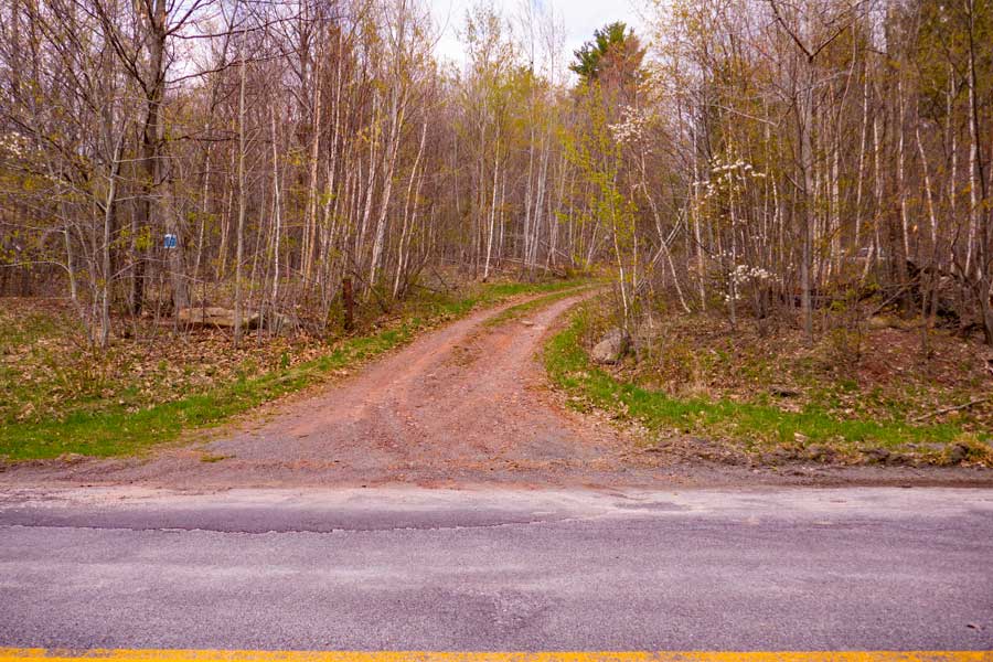 |
This is the DEP Parking Area entrance. Look for the DEP Blue/white sign on the tree. It is 2/10 of a mile from the Road Junction.
|
|
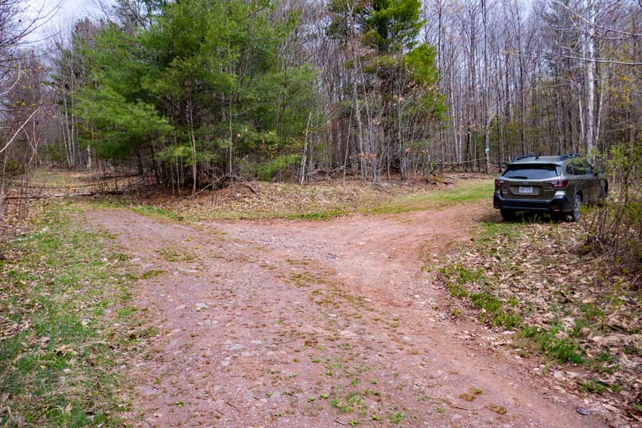 |
This is the DEP Parking Area for hiking West Cave Mountain and Cave Mountain. The road in the left side of the picture is for the West Cave Mountain Trail. You can also access the West Cave Mountain Trail on the right side of the Parking Area. This parking area holds 3 cars if they park appropriately.
|
|
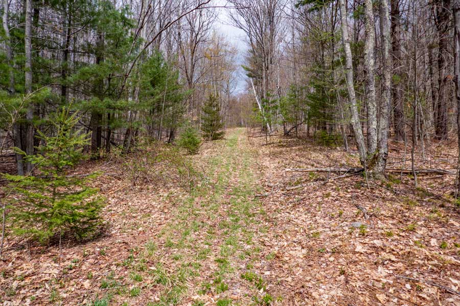 |
The beginning of the West Cave Mountain Trail has grass on it. This trail does not get a lot of traffic because very few hikers know about it.
|
|
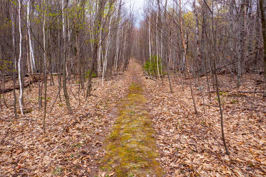 |
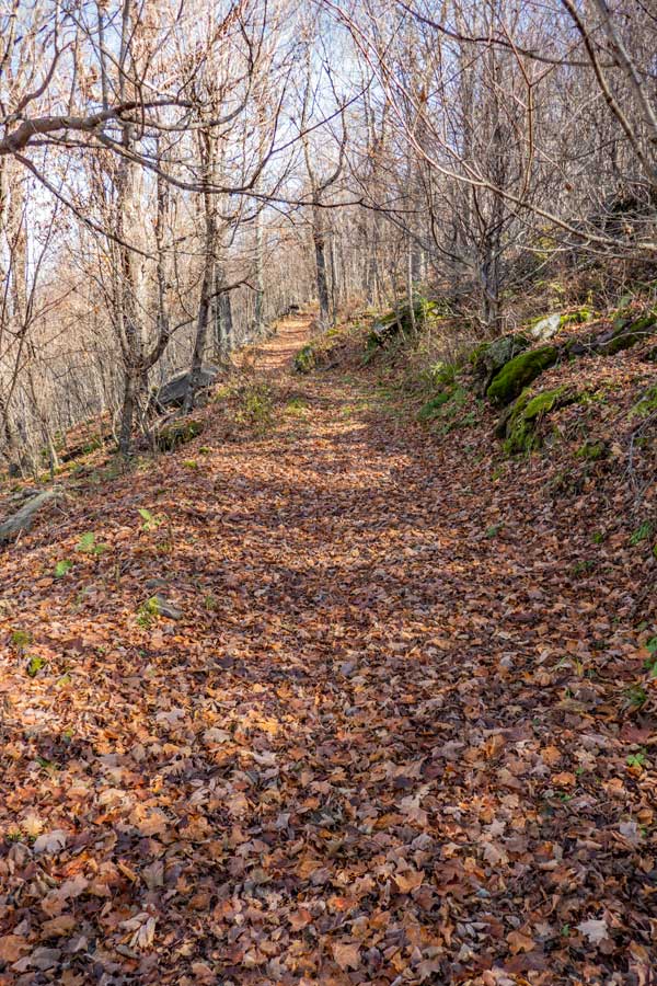
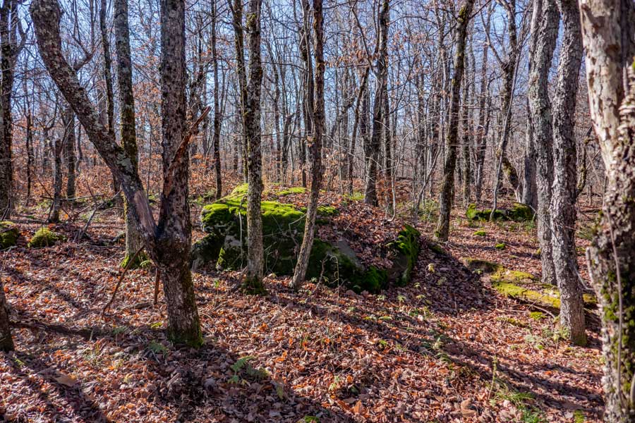
As you climb further up the West Cave Trail, the trail base will turn mossy and in some areas dirt. A little ways past this point the incline to the trail will increase for a short period of time, and then level off some.
|
|
|
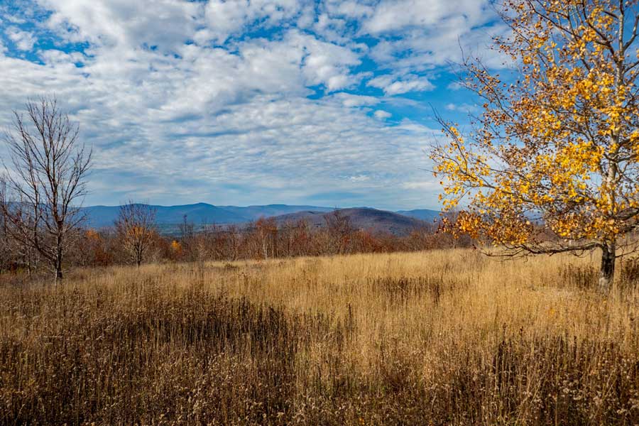
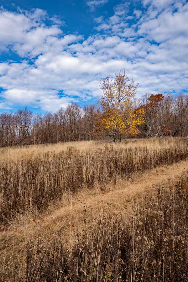
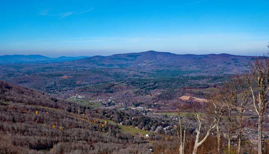
About 3/4 of the way up the trail you will encounter the West Cave Field. This field give you an excellent over the mountains south of the Pisgah Mountain Range. Beware that ticks do exist here.
|
|
 |
This is another view looking north towards the West Cave Mountain Summit. This is the West Cave Field.
The picture on the right is the view of Windham High Peak. This is looking towards the east.
After visiting the West Cave Field, continue up the trail. When you arrive at the Slope of Windham Mountain Ski Center, take a RIGHT and hike down the ski slope on your RIGHT ("UPPER WRAPAROUND" slope). Continue to walk past some of the ski slopes and Mountain Bike Trails.
|
 |
|
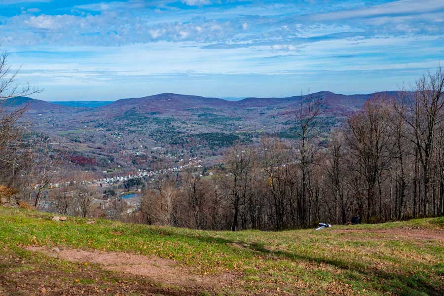 |
As you hike down the ski slope, UPPER WRAPAROUND, you will see some great views to the north of the Pisgah Mountain Range. To the left of center of the picture is Huntersfield Mountain. To the right of center of the picture is Ashland Pinnacle.
|
|
 |
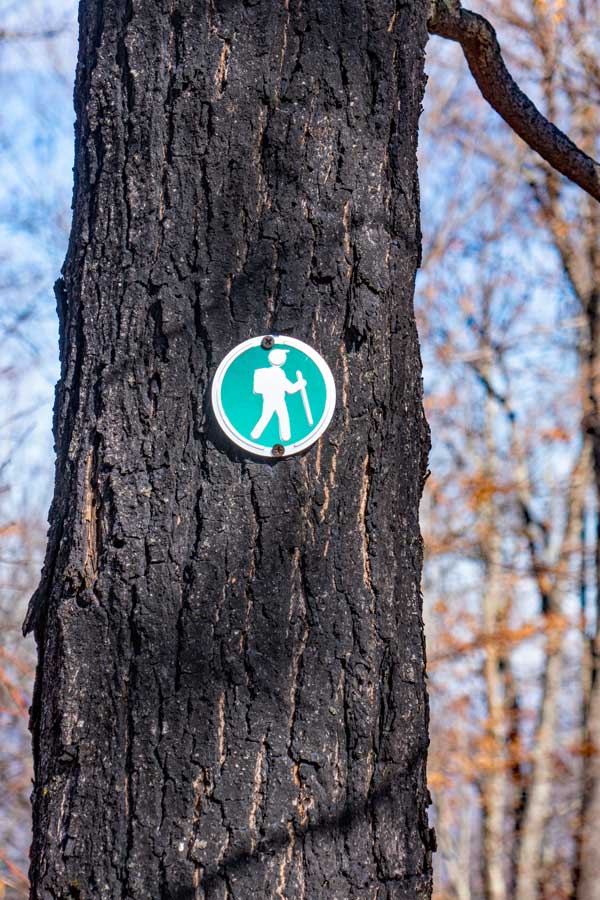
After about 4/10 of a mile from West Cave Mountain, you will see this sign on the right side of the ski slope (Upper Wraparound). You want to take a RIGHT and go up the Peak-to-Peak Hiking Trail.
This is the green trail markers used on the Peak-to-Peak Trail.
|
 |
|
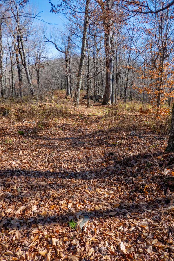 |
The Peak-to-Peak Trail will start out level.
As you proceed down the trail, the incline of the trail will increase. The trail will turn a couple times, so pay attention to where the trail is going.
|
 |
|
 |
As you come to the summit of Cave Mountain, you will exit the woods to a clearing where there will be a ski lift. After the ski lift, you will need to bushwhack into the woods on right to find the summit. Maybe 100-200 feet into the woods will be the summit.
|
|
 |
This is considered to the be the summit of Cave Mountain. It is not far from the ski lift. When done reverse your course back to your car. Hope you enjoyed the hike with beautiful views over the Windham Valley.
|
|
|
S E C T I O N S
|
W E A T H E R
|
O T H E R
|