Hike or Bike the Wintergreen Region of Bluestone Wild Forest |
 |
| One of several waterfalls off the Quilty, Wintergreen, and Straight Shot Trails |
| |
| |
|
OVERVIEW |
| | Type of Trails: | 100% DEC Trails |
| | Parking Area : | Jockey Hill - Wintergreen DEC Parking Area - 5 cars - NOT plowed in Winter |
| | Winter Access: | At the end of Jockey Hill Road |
| | | |
| | | Trail : |  Woods Road Trail (From Parking Area to Private Property) Woods Road Trail (From Parking Area to Private Property) |
| | Trail : |  Quilty Trail Quilty Trail |
| | Trail : |  Wintergreen Trail Wintergreen Trail |
| | Trail : |  Bear Trail Bear Trail |
| | Trail : |  Bear Connector Trail Bear Connector Trail |
| | Trail : |  Cub Trail Cub Trail |
| | Trail : |  Meyers Road Trail Meyers Road Trail |
| | Trail : |  Straight Shot Trail Straight Shot Trail |
| | | |
| | | Access Methods: | Mountain Bike, Foot, ski, snowmobile and Snowshoe |
| | Best Time to Hike: | Anytime |
| | Best Time to Bike: | Anytime |
| | Difficulty: | Easy |
| | | |
| | | DEC Trail Map: | DEC Bluestone Wild Forest Map (free) |
| | | |
| | | Digital Mapper: |
Topo
Terrain
Satellite |
|
|
Maps for Wintergreen Region of the Bluestone Wild Forest |
 |
 Bluestone Loop Trail (lakes) Bluestone Loop Trail (lakes) |
 Red Elf Trail(lakes) Red Elf Trail(lakes) |
 Onteora Lake Loop (lakes) Onteora Lake Loop (lakes) |
| Woods Road (wintergreen) |
 Turnpike Trail (lakes) Turnpike Trail (lakes) |
 South Central Trail (southern) South Central Trail (southern) |
| Quilty Trail (Wintergreen) |
 |
 |
| Wintergreen Trail (Wintergreen) |
 Pickerel Pond (lakes) Pickerel Pond (lakes) |
 Suzukimoto or Kneecap Trail (southern) Suzukimoto or Kneecap Trail (southern) |
| Bear Trail (Wintergreen) |
 |
 Groove Trail (southern) Groove Trail (southern) |
| Bear Connector Trail (Wintergreen) |
 |
 Guaniana or Close-to-the-Edge Trail (southern) Guaniana or Close-to-the-Edge Trail (southern) |
| Cub Trail (Wintergreen) |
 Quarry Trail (lakes) Quarry Trail (lakes) |
 Skull Trail (southern) Skull Trail (southern) |
| Meyers Road Trail (Wintergreen) |
 Quik Loop Trail (lakes) Quik Loop Trail (lakes) |
 Mushroom Trail Trail (southern) Mushroom Trail Trail (southern) |
| Straight Shot Trail (Wintergreen) |
 |
 Scott's Trail Trail (southern) Scott's Trail Trail (southern) |
|
|
|
Notes About the Bluestone Wild Forest |
The way the DEC marked the trails in the Bluestone Wild Forest is very different then anywhere else in New York State. In the beginning, when there were only a few trails, they were marked with the traditional Blue, Red, and Yellow Trail Markers. When they Open Space Institute acquired more land for the Bluestone Wild Forest in June of 2020, they had to come up with another way of marking the trails.
So,the Lakes Region would have Blue, Red, and Yellow Trail Markers. Some Trails have numbers (1 to 9) on the trail Markers.
The Southern Region would have ONLY Yellow Trail Markers with number (1-to-9) on them.
The Wintergreen Region would have ONLY Red Trail Markers with numbers (1-to-9) on them. But, recently they started to mix colors in the Wintergreen Region.
All the trails now have names, and most people just look for the Trail Name. It is a little confusing, but the Trail Name seems to work best. But, some people use both the Trail Marker color/number and/or the Trail Name.
|
Notes About the Wintergreen Region of the Bluestone Wild Forest |
In Early 2023, there was a small change to this region. The Quilty Trail now has standard DEC YELLOW Trail Markers. The Yellow trail markers do NOT have numbers on it. And, part of the Wintergreen Trail is also showing YELLOW Trail Markers on it. In the past, the Woods Road and all trails north of Woods Road had BLUE Trail Markers. So, this change is confusing to many visitors.
Another confusing problem is where the Wintergreen Trail approaches the Meyers Road Trail. A short distance before they reach the Trail Junction between the two trails, the Wintergreen Trail comes within 10' of another section of the Wintergreen Trail. Now, there is a link between the two. People believe this is the true trail junction between Wintergreen Trail and Meyers Road Trail. People then get confused and become disorientated.
| Parking Areas in the Bluestone Wild Forest |
Onteora Lake - DEC Outer Parking Area Holds 30 cars. Plowed in Winter. 41.9815, -74.085567
Onteora Lake - DEC Inner Parking Area Holds 15 cars. Not plowed in Winter. 41.984033, -74.0829
Morey Hill Road - Public Roadside Parking Area Holds 15 cars. Plowed in Winter. 41.9743, -74.0685
Morey Hill Road - DEC Parking by Gate to Quarry Road Holds 1 car. Not plowed in the Winter. 41.9803, -74.065267
Jockey Hill Road - DEC Parking Area Holds 5 cars. Do NOT block gate. Plowed in the Winter. 41.97605, -74.04875
|
|
|
| | Directions to Jockey Hill - Wintergreen DEC Parking Area from Exit 19 Kingston |
| | Jockey Hill - Wintergreen DEC Parking Area WGS84 (DEC): 41.97605, -74.04875 - Elevation is about 488 feet |
| | Jockey Hill - Wintergreen DEC Parking Area Deg/Min/Sec: N41 58 33, W74 02 55 - Elevation is about 488 feet |
| | Jockey Hill - Wintergreen DEC Parking Area GPS: N 41 58.563, W 74 02.925 - Elevation is about 488 feet |
| | Jockey Hill - Wintergreen DEC Parking Area UTM: 18N 578810 4647555 - Elevation is about 488 feet |
| |
|
| | Take New York State Thruway to Exit 19 (Kingston). |
| | Take a RIGHT out of the NYS Thruway to Route 28 West. |
| | Go approximately 0.6 miles on Rt 28 West |
| | Take a RIGHT on to exit ramp for Rt 209 NORTH |
| | Go approximately 2.1 miles on Rt 209 North |
| | Take a RIGHT on to exit ramp for Sawkill Road |
| | Take a LEFT at end of exit ramp onto Sawkill Road |
| | Go approximately 2.6 miles on Sawkill Road |
| | Take a LEFT onto Jockey Hill Road |
| | Go approximately 0.9 miles on Jockey Hill Road (30 MPH speed limit) |
| | At the end of the PAVED portion of Jockey Hill Road - go down the dirt road (Woods Road) |
| | NOTE: Woods Road (unpaved) is on the LEFT of the telephone pole |
| | NOTE: At a certain point you will see "NO TRESSPASSING" signs - IGNORE them and continue down the dirt road |
| | Go approximately 0.7 miles on Woods Road (dirt road - unpaved) |
| | when you come to a Yellow DEC gate there are 5 parking spaces |
| | NOTE: You CANNOT park anywhere on Woods Road (dirt) until you reach DEC land - Do NOT block road! |
|
|
| | Directions to MOREY HILL ROAD - PARKING AREAS from Exit 19 (Kingston) |
| | Morey Hill Road Parking Area WGS84 (DEC): 41.9743, -74.0685 - Elevation is about 499 feet |
| | Morey Hill Road Parking Area Deg/Min/Sec: N41 58 27, W74 04 06 - Elevation is about 499 feet |
| | Morey Hill Road Parking Area GPS: N 41 58.458, W 74 04.110 - Elevation is about 499 feet |
| | Morey Hill Road Parking Area UTM: 18N 577176 4647342 - Elevation is about 499 feet |
| |
|
| | Take New York State Thruway to Exit 19 (Kingston). |
| | Take a RIGHT out of the NYS Thruway to Route 28 West. |
| | Go approximately 3.0 miles on Rt 28 West |
| | Take a RIGHT into Morey Hill Road (easy to miss, so pay attention) |
| | Go approximately 0.4 miles on Morey Hill Road to Roadside Parking Area on left side of road |
| | |
| | There is a single parking space by the DEC gate 0.4 mile further on LEFT side of road (hard to find) |
|
|
|
Hike or Bike the Wintergreen Region of the Bluestone Wild Forest |
Finding the Jockey Hill Parking Area |
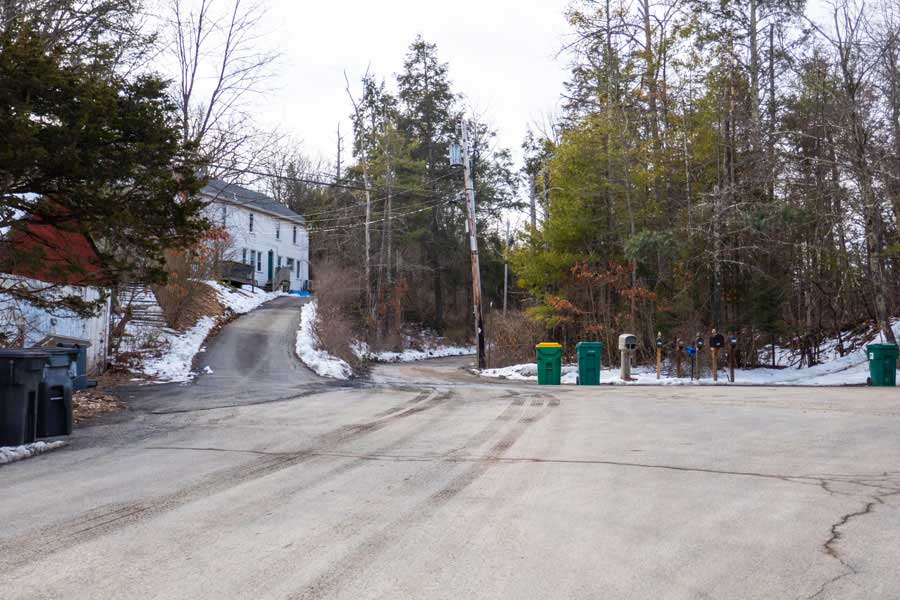 |
This image shows the end of Jockey Hill Road. Woods Road is the dirt road on the LEFT of the telephone pole and garbage cans. You will go 0.7 miles down Woods Road to reach the Jockey Hill - Wintergreen DEC Parking Area. The Woods Road on DEC land provide access to both the Wintergreen Region and the Southern Region.
You CANNOT park on the side of Woods Road until you reach DEC land (0.6 miles down Woods road). Some people do park on the side of paved Jockey Hill Road.
NOTE: About half way down Woods Road you will see "NO TRESPASSING" signs nailed to the trees on both sides of the road. IGNORE THEM! Continue down the road.
|
|
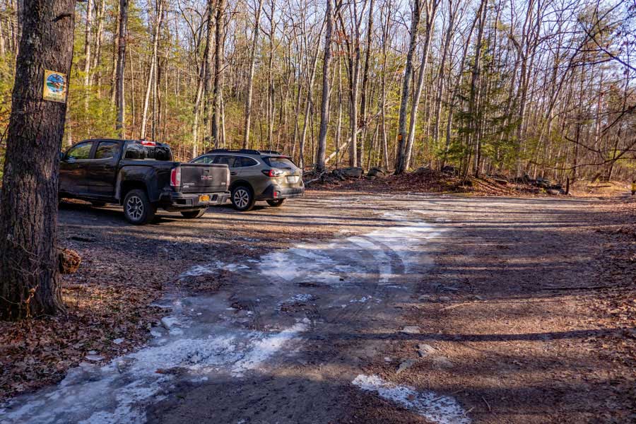 |
This is the Jockey Hill - Wintergreen parking area in the Bluestone Wild Forest. It provide access to both the Wintergreen Region, as well as, the Southern Region of the Bluestone Wild Forest.
There is enough room for approximately 5 cars. This Parking Area needs to be expanded to handle 100 cars in the summer months. It is woefully too small. Even in the Winter it is often full.
|
|
 |
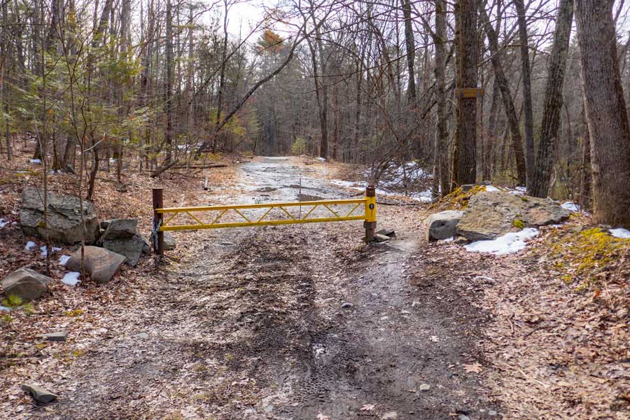
The DEC gate that you see is the limit for motorized vehicles. Even if it is open, you cannot drive further down the Woods Road. It is sometimes open for Search-and-Rescues (SAR) and maintenance.
|
|
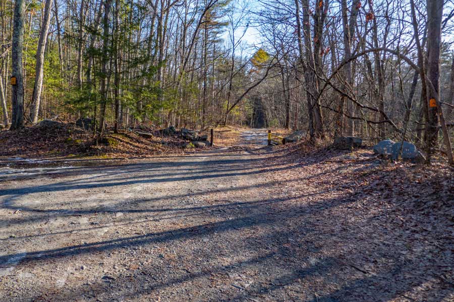
WOODS ROAD TRAIL |
 |
From this DEC gate forward, you may only travel by foot, ski, or mountain bike. This is the beginning of the Woods Road Trail.
The Woods Road is 1.16 miles long
|
|
 |
Not far from the DEC gate by the Jockey Hill - Wintergreen parking area are two deep drainage trenches dug into the road. Only high-clearance 4WD can get past this spot. You are not allow to drive at this spot anyway.
|
|
 |
This is what most of the Woods Road looks like in the Bluestone Wild Forest. It is a very nice road.
|
|
 |
This is the end of the Woods Road on public property. You also cannot access the Bluestone Wild Forest from this side of the Woods Road.
|
|
QUILTY TRAIL |
 |
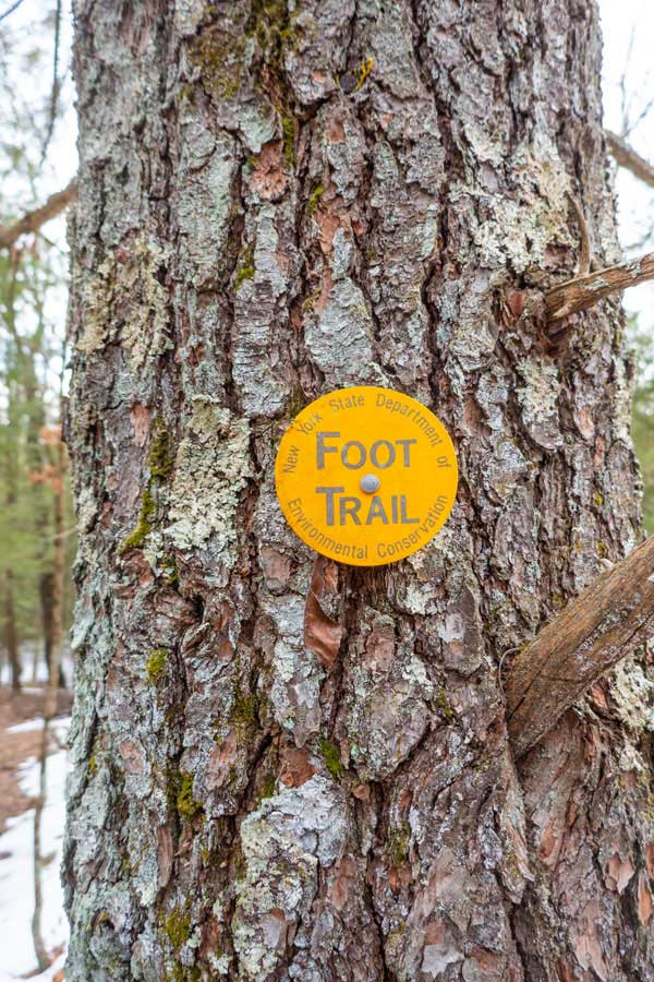
The Quilty Trail is suppose to be marked with BLUE Trail Markers with the number "3" in the middle. But, in early 2023, Yellow Trail Markers were put up on this trail. Hopefully in the future they will be changed back to #3 BLUE Trail Markers.
The Trail Head for the Quilty Trail is 0.17 miles from the Jockey Hill - Wintergreen DEC parking area on the LEFT side of the road. The trail head is 150' past the two water trenches that cross the Woods Road.
|
 |
|
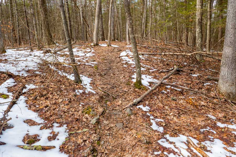 |
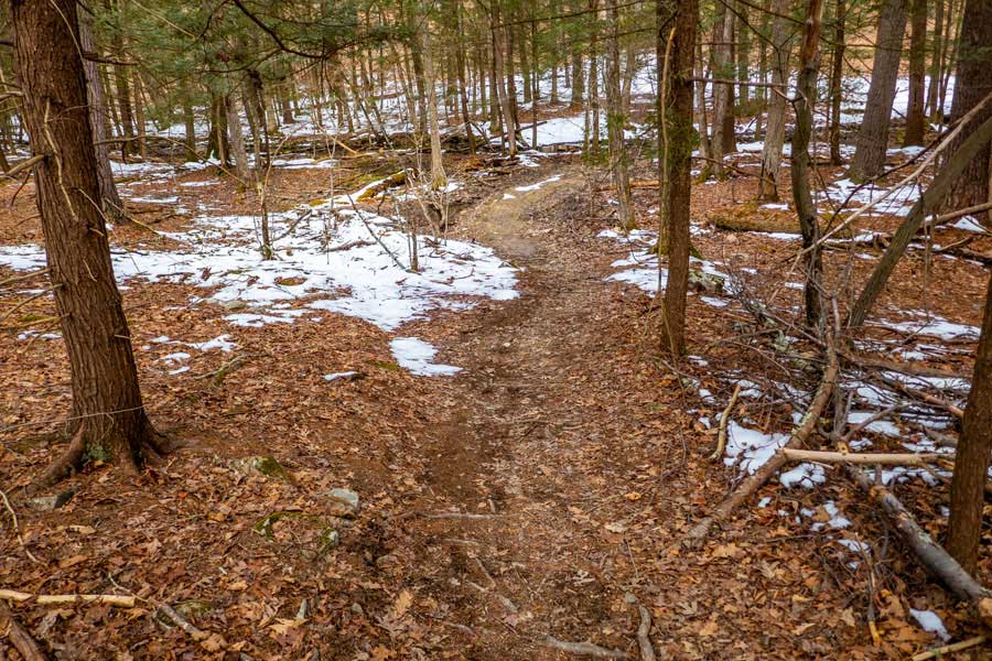
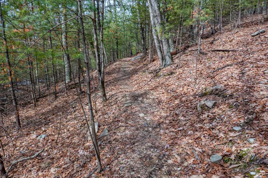
This image shows a small section of the Quilty Trail. In some sections, the trail can be narrow.
|
|
 |
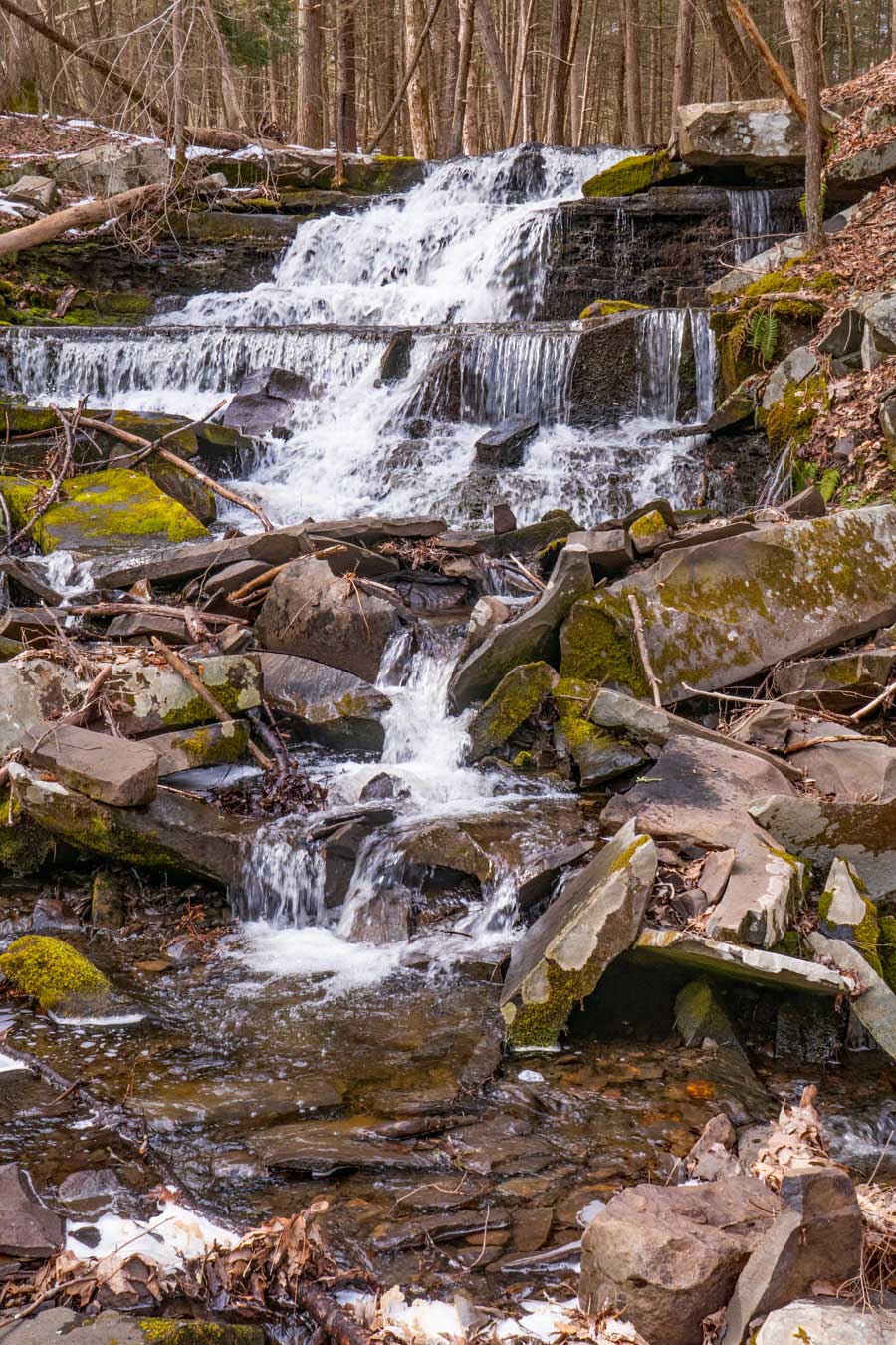
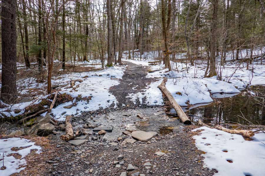
This is the middle section of the Quilty Trail in the Wintergreen Region. There is a small creek that runs parallel to the Quilty Trail. If you were to follow this creek, it will end in a small waterfall into a larger creek. In that region are a number of small waterfalls. The large creek eventually empties into the Sawkill Creek.
|
|
 |
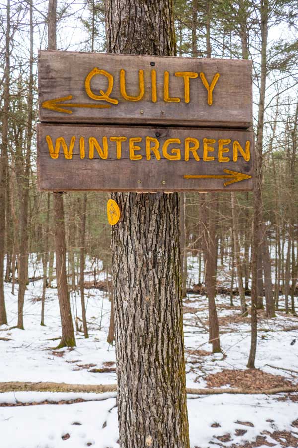
As you approach the end the Quilty Trail, it will turn to the left. As you approach the main trail up into the Wintergreen Region, there is a side trail on your right. This is a short spur trail that can take you back to the Woods Road.
|
|
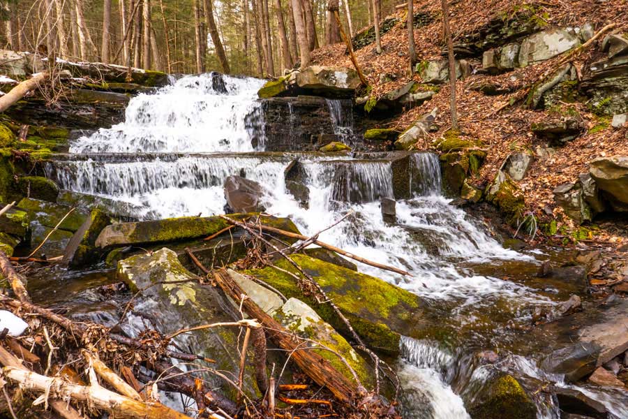 |
To see this waterfall you have to travel off the Quilty Trail. If the side creek is flowing well, then the waterfalls will be good. Otherwise you will probably be disappointed. Generally, the Spring is best time to visit it. When you come to a wide crossing where water flows down, leave the trail and follow the water downhill. As you get down further, you will see a waterfall on your right, and a little ways further on your left. The left one is larger and shown in the image above.
|
|
WINTERGREEN TRAIL |
 |
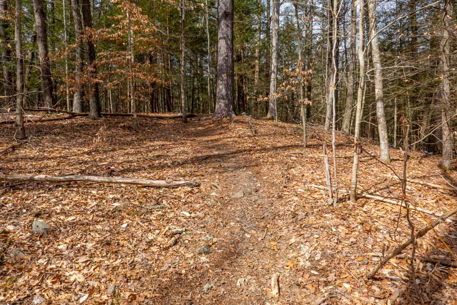
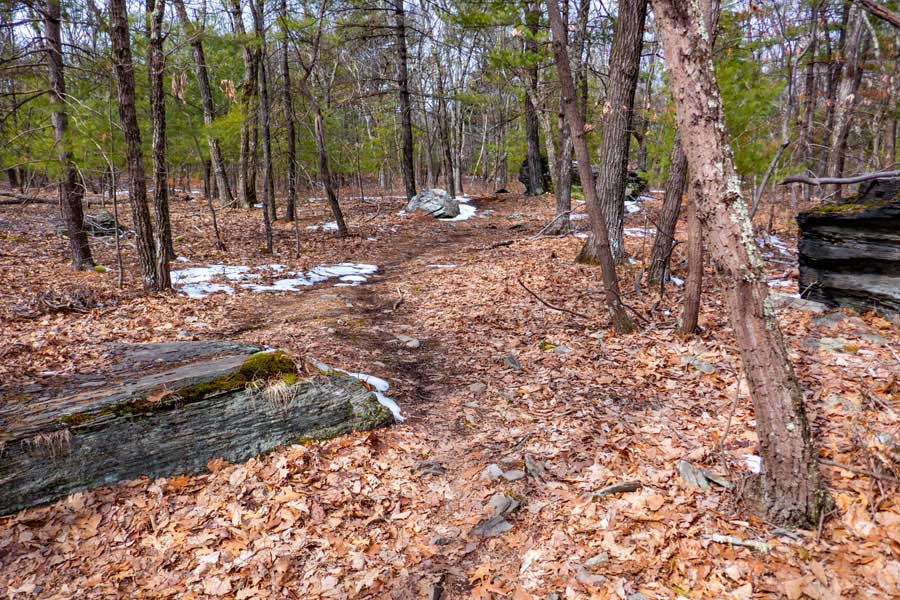
The Wintergreen Trail starts at Woods Road and winds it's way up the Jockey Hill. It is actually a very long loop of 3.01 miles long. This image shows the entrance off of Woods Road. The first third of the trail has a slow but steady uphill climb. When you get past the Cub Trail, it heads downhill for a ways.
|
|
 |
This image shows the beginning of the Wintergreen Trail off of Woods Road.
|
|
 |
This image shows the trail just after passing the Meyers Road Trail. For a little ways it is fairly flat, but then has a slow downhill incline until you reach the Trail Junction for Straight Shot Trail.
|
|
 |
As you head back towards the Woods Road, you will pass through some nice conifer forest. On your right will be a drop off deep into the ravine of the creek. If the waterfalls are running well, you can hear the water running over the waterfalls.
|
|
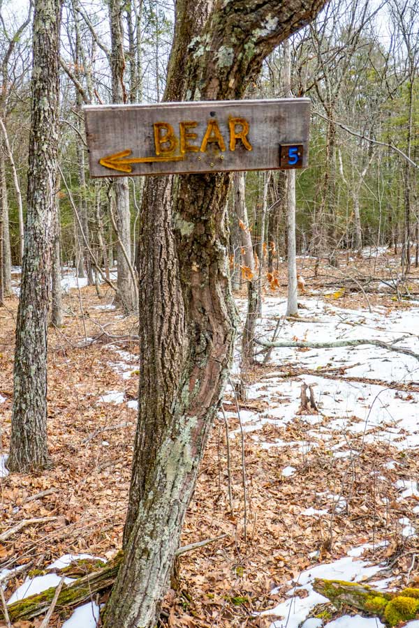
BEAR TRAIL |
 |
The Bear Trail starts at Woods Road
It winds it's way up the southeastern side of Jockey Hill.
The Bear Trail is 1.25 miles long.
While hiking this trail you will encounter BEAR CONNECTOR TRAIL and the CUB TRAIL.
The Bear Connector Trail will bring you over to the WINTERGREEN TRAIL.
|
|
 |
Bear Trail starts by going downhill to a small creek. Once you ford your way across the creek, it then starts going uphill.
|
|
 |
It then winds it's way up the hill in a zig-zag manner. Not hard to hike up.
|
|
 |
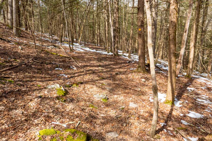
During this climb, you will be in a nice long-needle pine forest with nice smooth trails. Soon you will reach the connectors for the Wintergreen Trail. The Bear trail will then go towards the east. Part way across, you will encounter the Cub Trail. The Cub Trail has an incline all the way up to the Wintergreen Trail. Most Mountain Bikers like to ride the Cub Trail from the Wintergreen Trail down to the Bear Trail.
|
|
 |
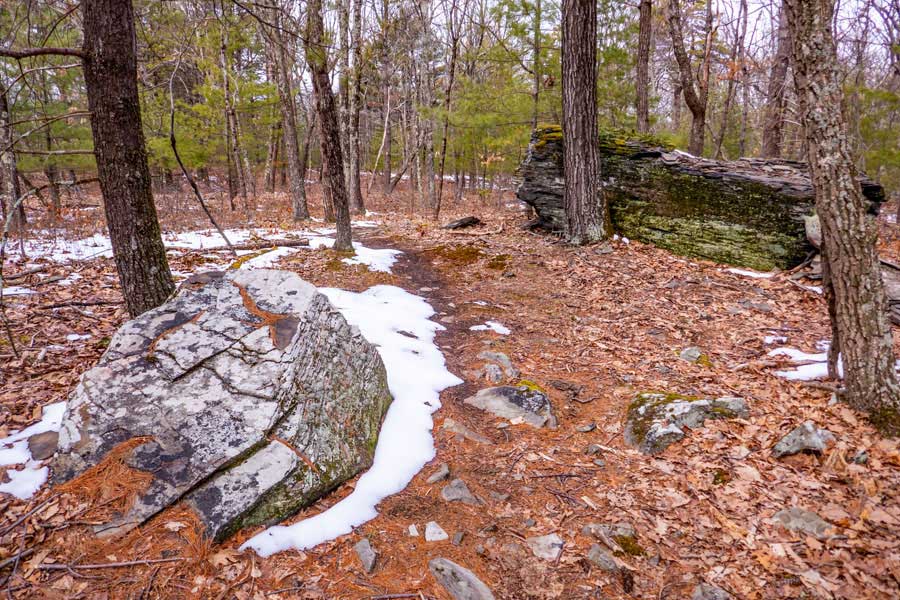
Near the end of the Bear Trail, you will encounter a few nice erratics from the glacier period. The erratics make nice resting or lunch spots.
|
|
 |
Just past this spot the trail will turn into the Wintergreen Trail. There is no obvious trail junction. So, if you want to follow the Wintergreen trail north, look carefully on your right for the trail junction.
|
|
BEAR CONNECTOR TRAIL |
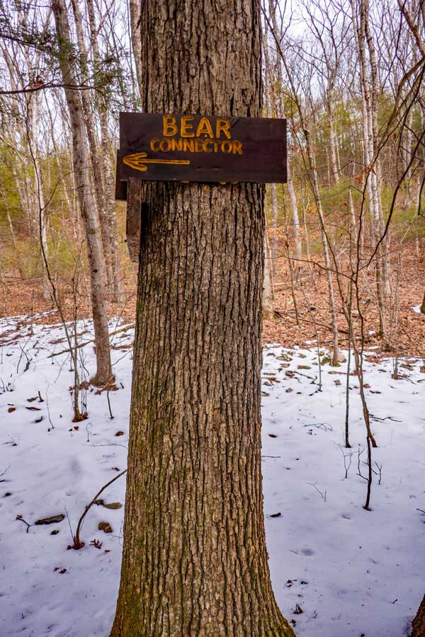 |
The Bear Connector Trail starts at Bear Trail and goes over to the Wintergreen Trail
The Bear Trail is 0.16 miles long.
|
|
 |
The Bear Connector Trail starts at the Bear Trail and goes to the Wintergreen Trail. The trail is almost flat all the way to the Wintergreen Trail.
|
|
CUB TRAIL |
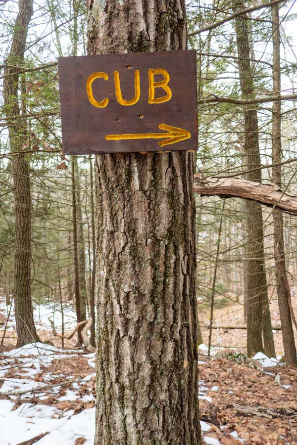 |
The Cub Trail starts at the Wintergreen Trail and goes down to the Bear Trail.
It winds it's way down the southeastern side of Jockey Hill. The trail is not used as much as some of the other trails.
The Cub Trail is 0.48 miles long.
|
|
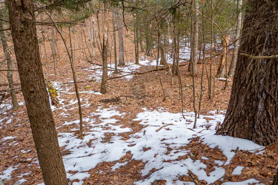 |
This image was taken from the Bear Trail and at the end of the Cub Trail.
|
|
 |
The Cub Trail runs through some long-needle pine trees. This is typical of what most of the trail looks like.
|
|
MEYERS ROAD TRAIL |
 |
The Meyers Road Trail starts at the Meyers Road. There is a very narrow land access to the Bluestone Wild Forest. After you hike in about 250' the land on both sides of the trail will become New York State land.
The beginning of the Meyers Road Trail, Straight Shot Trail, and part of the Wintergreen Trail use to be the old Wintergreen Road.
There is no known parking on Meyers Road.
The Meyers Road Trail is 1.98 miles long.
|
|
 |
This image was taken from Meyers Road. The Meyers Road Trail Head starts by the DEC sign. Please try to respect the adjacently land owners.
There is NO known vehicle parking at this Trail Head.
|
|
 |
After hiking in approximately 1/4 mile, you will come to an trail junction. If you are hiking in from Meyers Road, you most likely will not realize that the trail does almost a complete 180 degree turn. So, watch for this trail junction.
This picture was taken from Straight Shot Trail. The trail on the LEFT is Meyers Road Trail that goes to Meyers Road. The trail on the RIGHT is also Meyers Road Trail, and it goes up Jockey Hill for 1.71 miles until it reaches the Wintergreen Trail.
NOTE: It is EASY to miss this trail junction when you are hiking down Straight Shot Trail or from the other direction (Meyers Road). Many people get lost here. There are NO signs at this 180 degree turn in the trail!
|
|
 |
After hiking up the 1-3/4 miles up and around Jockey Hill, you will finally reach the trail junction for the Wintergreen Trail.
The 1-3/4 miles up and around Jockey Hill has some real interesting things to see, and a diverse terrain.
|
|
STRAIGHT SHOT TRAIL |
 |
The Straight Shot Trail is between the Wintergreen Trail and Meyers Road Trail. It is around 1/4 mile long. It starts where the Wintergreen Trail takes a right and goes up Jockey Hill, and it stops when it reaches the 180 degree turn of the Meyers Road Trail. It used to be part of the Old Wintergreen Road.
The Straight Shot Trail is 0.27 miles long.
|
|
 |
The Straight Shot Trail gets it's name from the trail being fairly straight.
|
|
|
S E C T I O N S
|
W E A T H E R
|
O T H E R
|