Hike or Bike the Lakes Region of Bluestone Wild Forest |
 |
| |
| |
|
OVERVIEW |
| | Type of Trails: | 100% DEC Trails |
| | Parking Area : | Onteora Lake - inner Parking Area - 15 cars |
| | Parking Area : | Onteora Lake - outer Parking Area - 30 cars |
| | Parking Area : | Onteora Lake - Morey Hill Road Roadside Parking - 15 cars |
| | Parking Area : | Onteora Lake - Morey Hill Road DEC gate to Quarry Road - 1 car |
| | Camp sites: | (Several) near western shoreline of Onteora Lake |
| | Camp sites: | (Several) above ledge of western Onteora Lake |
| | Camp sites: | (2) at junction of Red Elf Loop |
| | Camp sites: | (2) at end of Onteora Lake Loop by shoreline |
| | Winter Access: | Onteora Lake - Outer Parking Area |
| | Winter Access: | Morey Hill Road - Roadside Parking |
| | | |
| | | Trail : |  Onteora Lake Trail Onteora Lake Trail |
| | Trail : |  Red Elf Trail Red Elf Trail |
| | Trail : |  Bluestone Loop Bluestone Loop |
| | Trail : |  Turnpike Trail (runs from Onteora Lake inner parking area TO Morey Hill Road) Turnpike Trail (runs from Onteora Lake inner parking area TO Morey Hill Road) |
| | Trail : |  Pickerel Pond Trail Pickerel Pond Trail |
| | Trail : |  Hidden Pond Trail (Runs from SE end of Pickerel Pond to SE Bluestone Loop Hidden Pond Trail (Runs from SE end of Pickerel Pond to SE Bluestone Loop |
| | Trail : |  Quarry Loop Quarry Loop |
| | Trail : |  Quik Loop Quik Loop |
| | | |
| | | Access Methods: | Mountain Bike, Foot, ski, snowmobile and Snowshoe |
| | Best Time to Hike: | Anytime |
| | Best Time to Bike: | Anytime |
| | Difficulty: | Easy |
| | | |
| | | DEC Trail Map: | DEC Bluestone Wild Forest Map (free) |
| | | |
| | | Digital Mapper: |
Topo
Terrain
Satellite |
|
|
Maps for Lakes Region of the Bluestone Wild Forest |
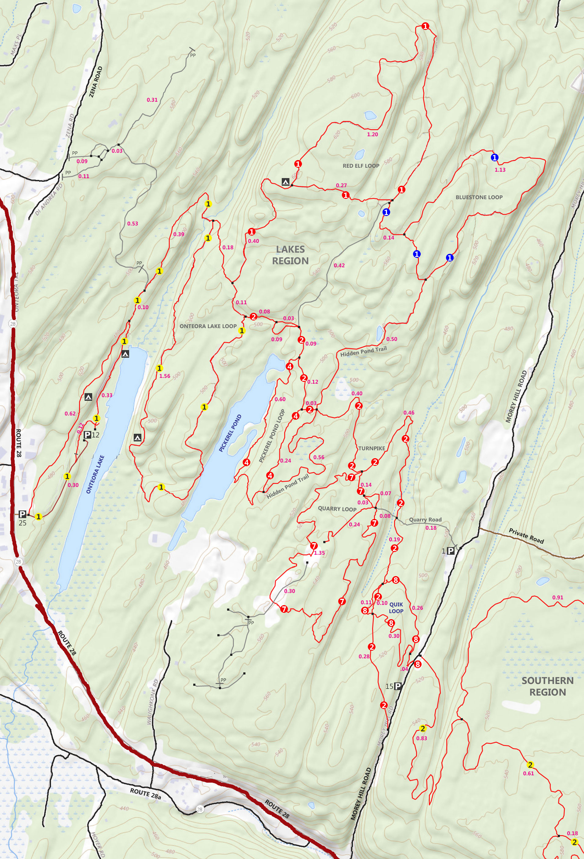 |
| Bluestone Loop Trail (lakes) |
Red Elf Trail(lakes) |
Onteora Lake Loop (lakes) |
 Woods Road Trail (wintergreen) Woods Road Trail (wintergreen) |
Turnpike Trail (lakes) |
 South Central Trail (southern) South Central Trail (southern) |
 Quilty Trail (Wintergreen) Quilty Trail (Wintergreen) |
 |
 |
 Wintergreen Trail (Wintergreen) Wintergreen Trail (Wintergreen) |
Pickerel Pond (lakes) |
 Suzukimoto or Kneecap Trail (southern) Suzukimoto or Kneecap Trail (southern) |
 Bear Trail (Wintergreen) Bear Trail (Wintergreen) |
 |
 Groove Trail (southern) Groove Trail (southern) |
 Bear Connector Trail (Wintergreen) Bear Connector Trail (Wintergreen) |
 |
 Guaniana or Close-to-the-Edge Trail (southern) Guaniana or Close-to-the-Edge Trail (southern) |
 Cub Trail (Wintergreen) Cub Trail (Wintergreen) |
Quarry Trail (lakes) |
 Skull Trail (southern) Skull Trail (southern) |
 Meyers Road Trail (Wintergreen) Meyers Road Trail (Wintergreen) |
Quik Loop Trail (lakes) |
 Mushroom Trail Trail (southern) Mushroom Trail Trail (southern) |
 Straight Shot Trail (Wintergreen) Straight Shot Trail (Wintergreen) |
 |
 Scott's Trail Trail (southern) Scott's Trail Trail (southern) |
|
|
|
Notes About the Bluestone Wild Forest |
The way the DEC marked the trails in the Bluestone Wild Forest is very different then anywhere else in New York State. In the beginning, when there were only a few trails, they were marked with the traditional Blue, Red, and Yellow Trail Markers. When they Open Space Institute acquired more land for the Bluestone Wild Forest in June of 2020, they had to come up with another way of marking the trails.
So, the Lakes Region would have Blue, Red, and Yellow Trail Markers. Some Trails have numbers (1 to 9) on the Trail Markers.
The Southern Region would have ONLY Yellow Trail Markers with number (1-to-9) on them.
The Wintergreen Region would have ONLY Red Trail Markers with numbers (1-to-9) on them. But, recently they started to mix colors in the Wintergreen Region.
All the trails now have names, and most people just look for the Trail Name. It is a little confusing, but the Trail Name seems to work best. But, some people use both the Trail Marker color/number and/or the Trail Name.
|
Parking Areas in the Bluestone Wild Forest |
Onteora Lake - DEC Outer Parking Area Holds 30 cars. Plowed in Winter. 41.9815, -74.085567
Onteora Lake - DEC Inner Parking Area Holds 15 cars. NOT plowed in Winter. 41.984033, -74.0829
Morey Hill Road - Public Roadside Parking Area Holds 15 cars. NOT Plowed in Winter. 41.9743, -74.0685
Morey Hill Road - DEC Parking by Gate to Quarry Road Holds 1 car. NOT plowed in the Winter. 41.9803, -74.065267
Jockey Hill Road - DEC Parking Area Holds 5 cars. Do NOT block gate. NOT Plowed in the Winter. 41.97605, -74.04875
|
|
|
| | Directions to ONTEORA LAKE DEC PARKING AREAS from Exit 19 (Kingston) |
| | Onteora Lake OUTER Parking Area WGS84 (DEC): 41.9815, -74.085567 - Elevation is approximately 473 feet |
| | Onteora Lake OUTER Parking Area Deg/Min/Sec: N41 58 53, W74 05 08 - Elevation is approximately 473 feet |
| | Onteora Lake OUTER Parking Area GPS: N 41 58.890, W 74 05.134 - Elevation is approximately 473 feet |
| | Onteora Lake OUTER Parking Area UTM: 18N 575753 4648127 - Elevation is approximately 473 feet |
| |
|
| | Onteora Lake INNER Parking Area WGS84 (DEC): 41.984033, -74.0829 - Elevation is approximately 441 feet |
| | Onteora Lake INNER Parking Area Deg/Min/Sec: N41 59 02, W74 04 58 - Elevation is approximately 441 feet |
| | Onteora Lake INNER Parking Area GPS: N 41 59.042, W 74 04.974 - Elevation is approximately 441 feet |
| | Onteora Lake INNER Parking Area UTM: 18N 575971 4648410 - Elevation is approximately 441 feet |
| |
|
| | Take New York State Thruway to Exit 19 (Kingston). |
| | Take a RIGHT out of the NYS Thruway to Route 28 West. |
| | Go approximately 3.8 miles on Rt 28 West |
| | Take a RIGHT into Bluestone Wild Forest - Onteora Lakes |
| | When you exit Rt 28, this is the OUTER DEC Parking Area |
| | Go approximately 0.3 miles more into Park to the INNER DEC Parking Area |
|
|
| | Directions to MOREY HILL ROAD - PARKING AREAS from Exit 19 (Kingston) |
| | Morey Hill Road Parking Area WGS84 (DEC): 41.9743, -74.0685 - Elevation is approximately 499 feet |
| | Morey Hill Road Parking Area Deg/Min/Sec: N41 58 27, W74 04 06 - Elevation is approximately 499 feet |
| | Morey Hill Road Parking Area GPS: N 41 58.458, W 74 04.110 - Elevation is approximately 499 feet |
| | Morey Hill Road Parking Area UTM: 18N 577176 4647342 - Elevation is approximately 499 feet |
| |
|
| | Take New York State Thruway to Exit 19 (Kingston). |
| | Take a RIGHT out of the NYS Thruway to Route 28 West. |
| | Go approximately 3.0 miles on Rt 28 West |
| | Take a RIGHT into Morey Hill Road (easy to miss, so pay attention) |
| | Go approximately 0.4 miles on Morey Hill Road to Roadside Parking Area on left side of road |
| | |
| | There is a single parking space by the DEC gate 0.4 mile further on LEFT side of road (hard to find) |
|
|
MILEAGE CHART for Common Hikes in the Lakes Region |
| | Hike Description | Onteora-OUTER PA | Onteora-INNER PA | Morey Hill Road PA |
| | Red Elf & Bluestone Loops | 5.68 | 6.26 | |
| | | Onteora & Pickerel Lake Loops | 4.85 | 5.43 | |
| | Turnpike (Onteora Lake to Morey Hill & back) | 6.36 | 6.36 | |
| | | Quarry Loop from Morey Hill PA | | | 2.76 |
|
|
Hike or Bike the Lake Region of the Bluestone Wild Forest |
ONTEORA LAKE Inner PARKING AREA |
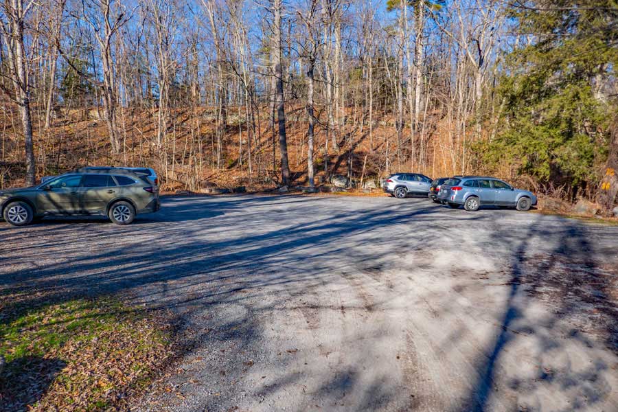 |
This is the INNER parking area by Onteora Lake. It is owned by the DEC and is also the Trail Head for access into the Lakes Region. It holds 15 cars.
|
|
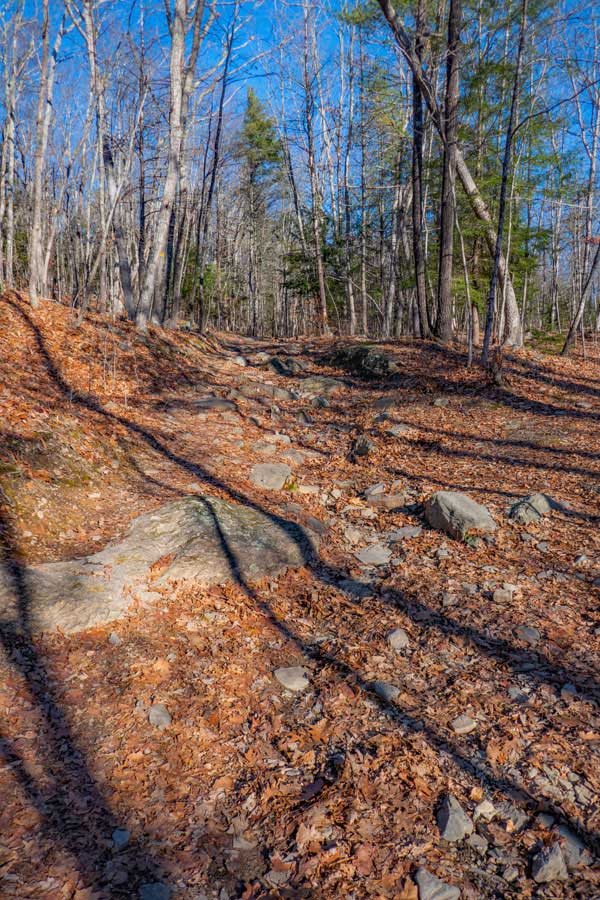
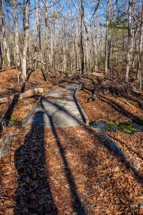
LAKES REGION TRAIL HEAD |
 |
The image on the left is the Trail Head into the Lakes Region of the Bluestone Wild Forest. The trail starts out with nice crushed bluestone with a number of beautiful view points.
After approximately 1/4 mile it turns into a regular hiking trail. Most trails in the Bluestone Wild Forest are smooth. But there are a few small sections where it is rocky.
If you are parking in the OUTER Parking Area, there is an unmarked Trail perpendicular to the DEC road (near gate). It is shorter, and easier to hike on.
|
 |
|
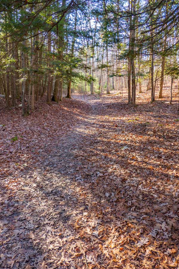
ONTEORA LAKE LOOP TRAIL |
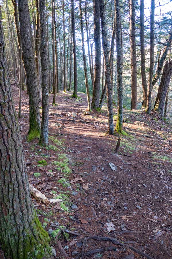 |
The image on the left is the beginning of the Onteora Lake Trail. It takes you through nice conifer forest with views of Onteora Lake in certain section off the trail.
Some sections have some mini hills. Most of these can be avoided with alternate side trails. The alternate side trails were designed for mountain bikes, but hikers are allowed to use them too. The image on the right is an example of a mini-hill.
|
 |
|
 |
Both images were taken from the eastern part of the Onteora Lake Trail. Both provide a very nice view of Pickerel Pond where the water is open.
|
 |
|
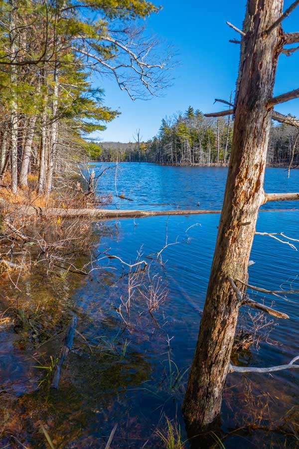
PICKEREL LAKE LOOP TRAIL |
 |
This is one of the nicer spots of Pickerel Pond Trail (sometimes called Pickerel Lake). This picture is take near the end of the loop.
|
|
 |
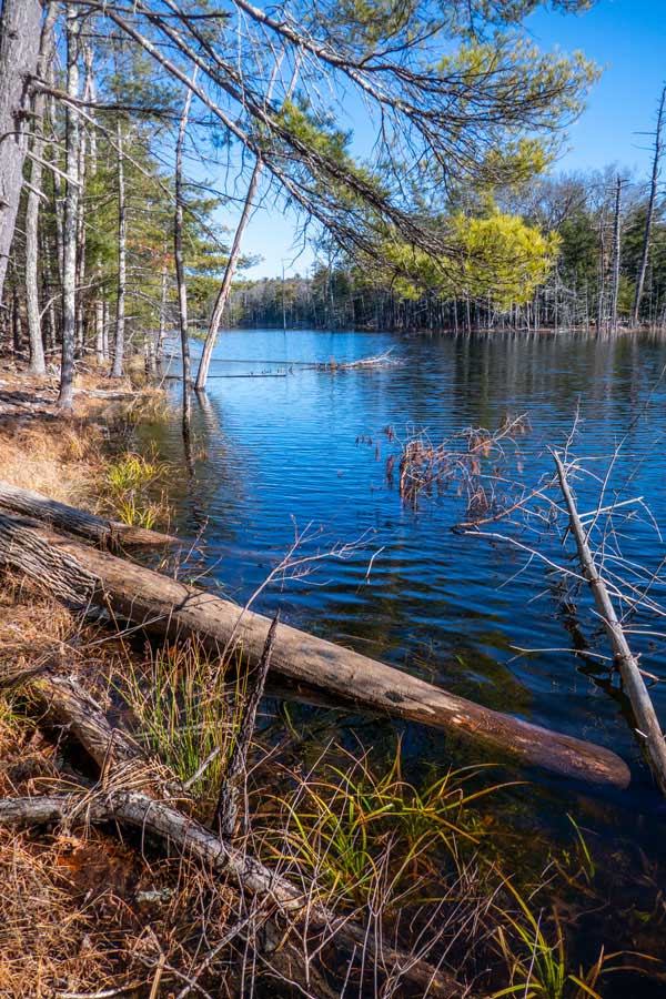
This is the upper end of Pickerel Pond. This section tends to resemble a flooded swamp. But, still nice to view. The picture was taken from the east side of Pickerel Pond.
|
|
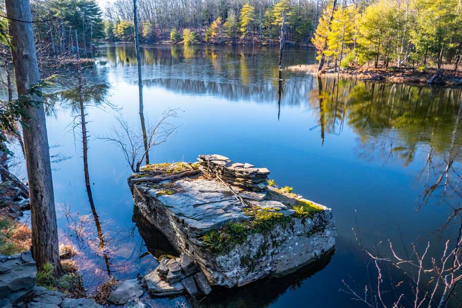 |
This is the middle section of Pickerel Pond. The picture was taken from the east side of the Pickerel Pond.
|
|
RED ELF TRAIL |
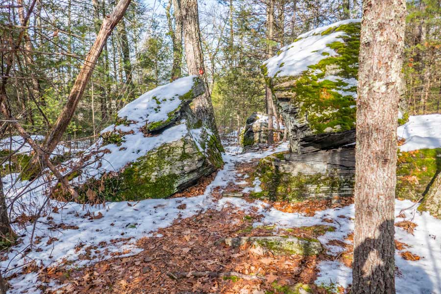 |
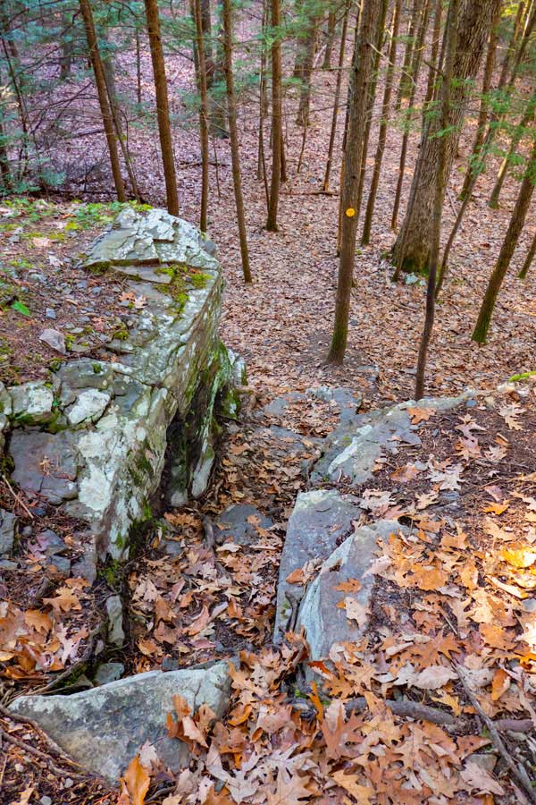
This image is of the Red Elf Trail. There are a few unique spots on the trails that are nice to see. Both the Bluestone Trail and Red Elf Trail are located above Onteora Lake and Pickerel Pond.
The Bluestone Trail tends to be a little rocky, so some people may not like it as much as the Red Elf Trail. But, it also have an off-shoot trail called the Hidden Pond Trail which many consider exceptional. There is a pond on the Hidden Pond Trail that is actually hidden by the large slabs of bluestone. You do not realize it is there until you are almost right next to it. There is also a nice swamp further down towards the Turnpike Trail.
The Red Elf Trail is quite smooth and nice to hike or mountain bike. Definitively worth the hike around the loop.
|
|
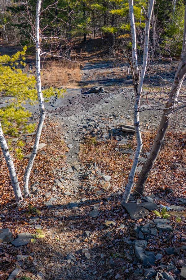
QUARRY TRAIL |
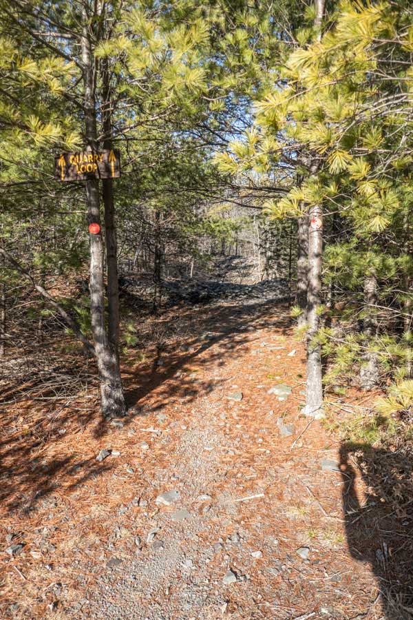 |
These images are part of the Quarry Trail. There are a few conifer sections, but most of the trail is in and around the quarry.
|
 |
|
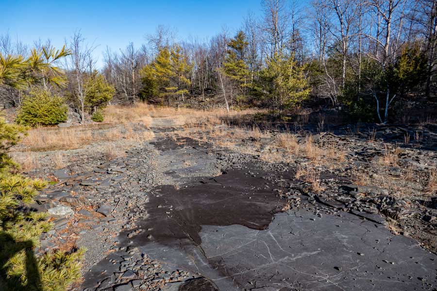 |
This image shows a small section of the huge bluestone slabs that can be seen on the Quarry Trail in the Lakes Region of Bluestone Wild Forest
There are some very large open sections of the bluestone slab that can be seen on the Quarry Trail. Some sections of the Quarry Trail are over small pieces of bluestone covering the trail. The trail can be windy and slow going for Mountain Bikers.
|
|
TURNPIKE TRAIL |
 |
These two images give you an example of the Turnpike Trail that runs from Onteora Lake to Morey Hill Road.
Some say that the Turnpike Trail starts from the Trail Head on the western side of Onteora Lake. Others say that it starts from the north side of Onteora Lake. It makes more sense for the Turnpike Trail to start from the Trail Head.
|
 |
|
MOREY HILL ROAD PARKING AREA |
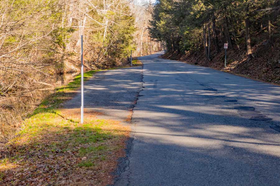 |
This is the Parking Area on Morey Hill Road. It is on the eastern side of the Lake Region. This is public parking on the side of the road. You may ONLY park between the two signs. You should park on a diagonal to allow more cars to park here. It will hold about 15 cars parked on a diagonal. Do NOT park on the side of the road outside of the two parking signs. If you do, expect your car to be towed. Additionally, pay attention to the 30 MPH speed limit while traveling down the road.
If you still have time and energy, the other side of Morey Hill Road is loaded with trails. The other side of the road is called the "Southern Region". ALL the trails in the Southern Region are marked with Yellow Trail Markers with numbers in the middle of the trail marker. It takes about a week to hike all the trails in the Bluestone Wild Forest. It is easy to get lost, so bring a map!
|
|
|
S E C T I O N S
|
W E A T H E R
|
O T H E R
|