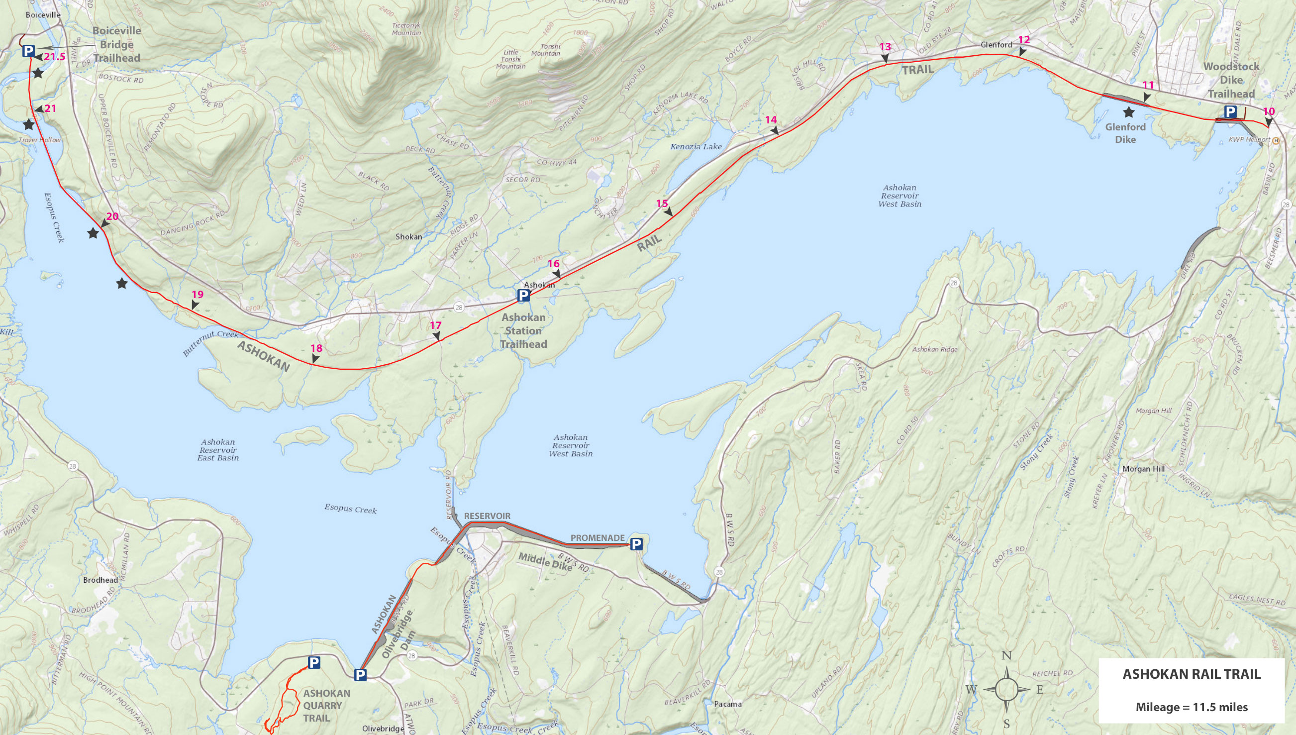
 Ashokan Rail Trail - Parking Areas
 |
 |
This is the WOODSTOCK DIKE Parking Area and Trailhead. It is 5.3 miles from Kingston (NYS Thruway - Exit 19). It holds about 75 cars. There are bathrooms at all Parking Areas. As of 2023, the access road and parking area was dirt.
The beginning of the Ashokan Rail Trail is about 1/3 of a mile west of the Woodstock Dike Parking Area. If in the future, Ulster County extends the Ashokan Rail Trail to the east, then this would change the mileage.
|
|
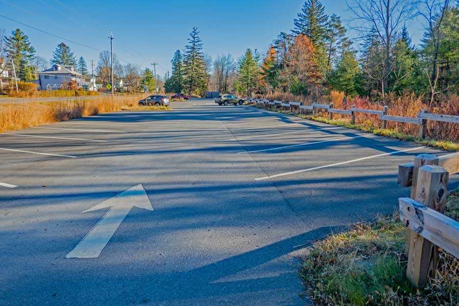 |
This is the ASHOKAN STATION Parking Area and Trailhead. It is 9.3 miles from Kingston (NYS Thruway - Exit 19). It holds about 60 cars. There are bathrooms at all Parking Areas. This Parking Area is completely paved.
The Woodstock Dike Parking Area is about 4 miles east of the Ashokan Station Parking Area. The Boiceville Bridge Parking Area is about 5.25 miles west of the Ashokan Station Parking Area.
|
|
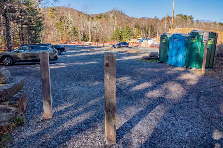 |
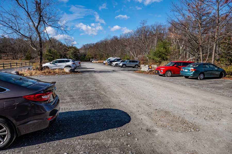
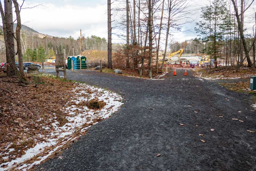
This is the BOICEVILLE BRIDGE Parking Area and Trailhead. It is 16.5 miles from Kingston (NYS Thruway - Exit 19). It holds about 40 cars. There are bathrooms at all Parking Areas. This Parking Area and access road are dirt (in 2023). Since they are rebuilding the bridge, this information will change in 2024, or thereafter.
The Ashokan Station Parking Area is about 5.25 miles east of the Boiceville Bridge Parking Area.
|
|
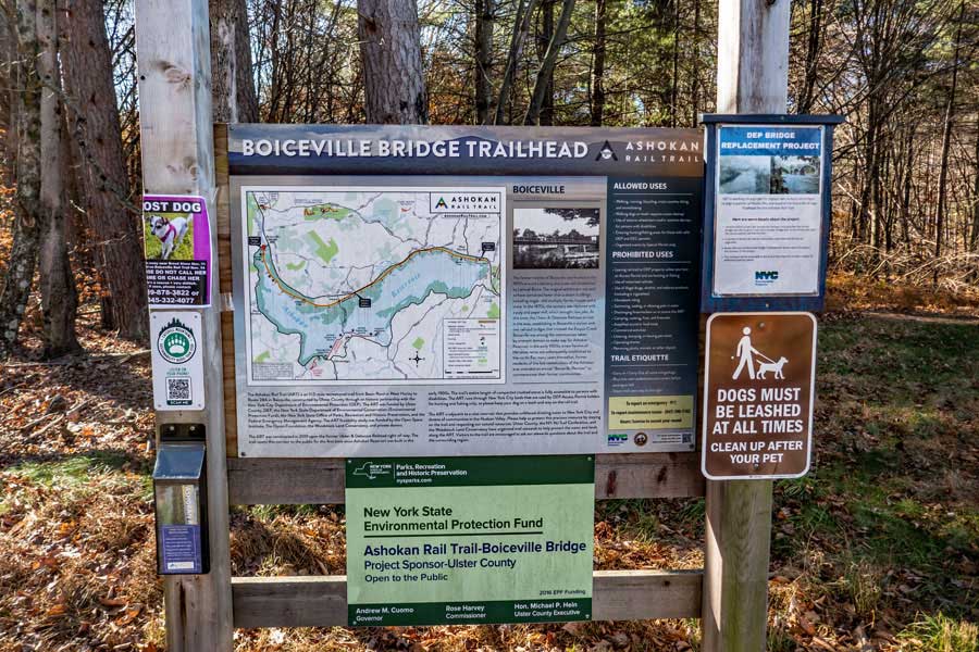 |
This is the Boiceville Bridge Parking Area Kiosk. There is a Kiosk at all three Parking Areas for the Ashokan Rail Trail.
There are printed maps at the kiosk at all three parking areas.
|
|
 Ashokan Rail Trail - Eastern Section
 |
 |
This is the beginning of the Ashokan Rail Trail. It starts at Mile Post 10 on the Ulster & Delaware Railroad. This is the most eastern point on the Ashokan Rail Trail.
|
|
 |
At Mile Post 11, you will reach the Glenford Dike. It provides an excellent view to the southwest. The mountain left of center of this image is Ashokan High Point.
|
|
 |
After the Glenford Dike, the Ashokan Rail Trail will move back inland. The trail trail is fairly straight in many areas.
|
|
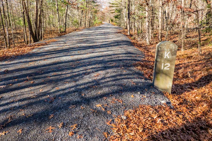 |
This is the Ashokan Rail Trail at Mile Post 12. After this point, the number of people you see will start to thin out.
|
|
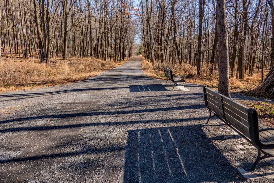 |
Along the Ashokan Rail Trail, you will see park benches in several places along the path for those who need a rest.
|
|
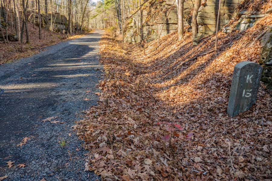 |
Mile Post 13 on the Ashokan Rail Trail
|
|
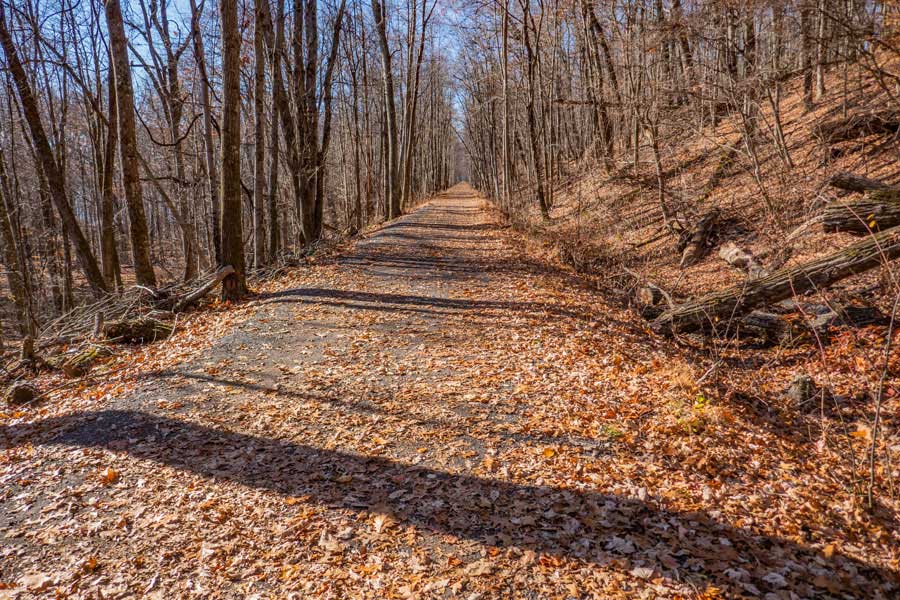 |
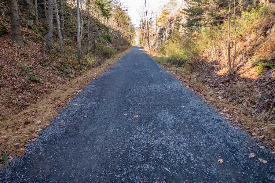
The Ashokan Rail Trail has many places where the path is completely straight for as far as you can see.
|
|
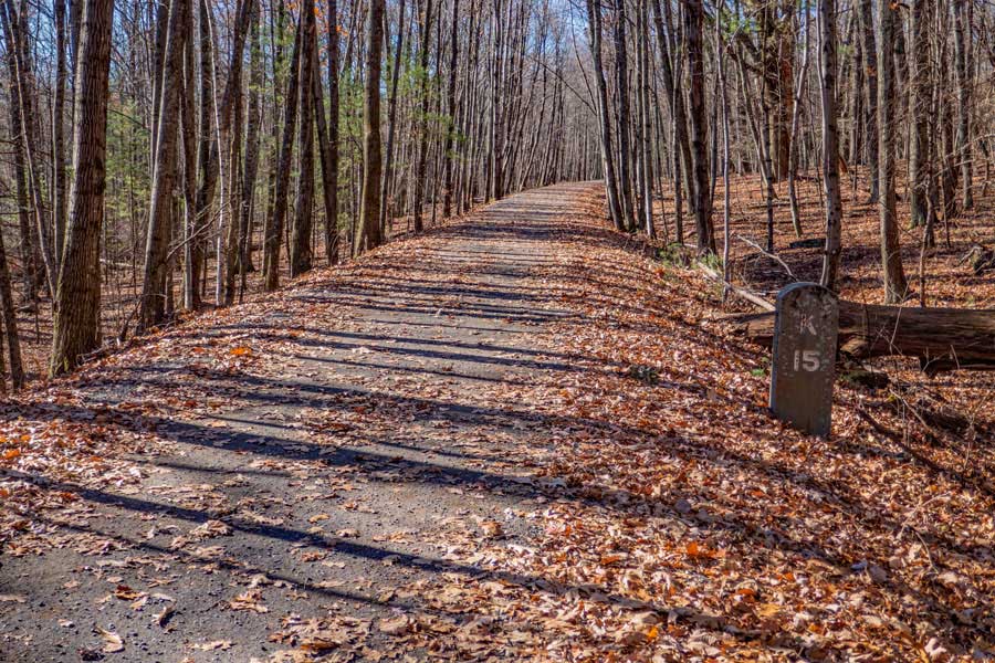 |
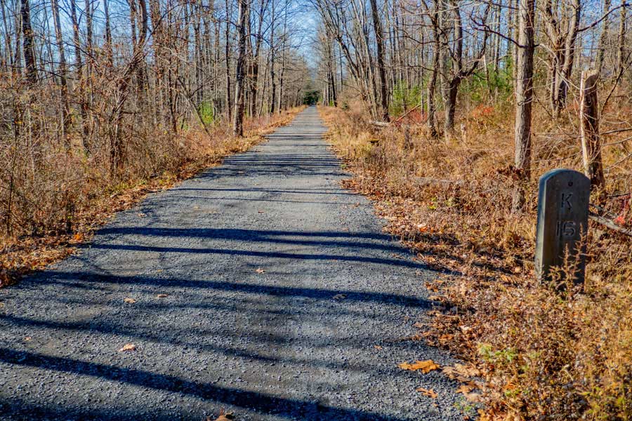
Mile Post 15 on the Ashokan Rail Trail
|
|
 |
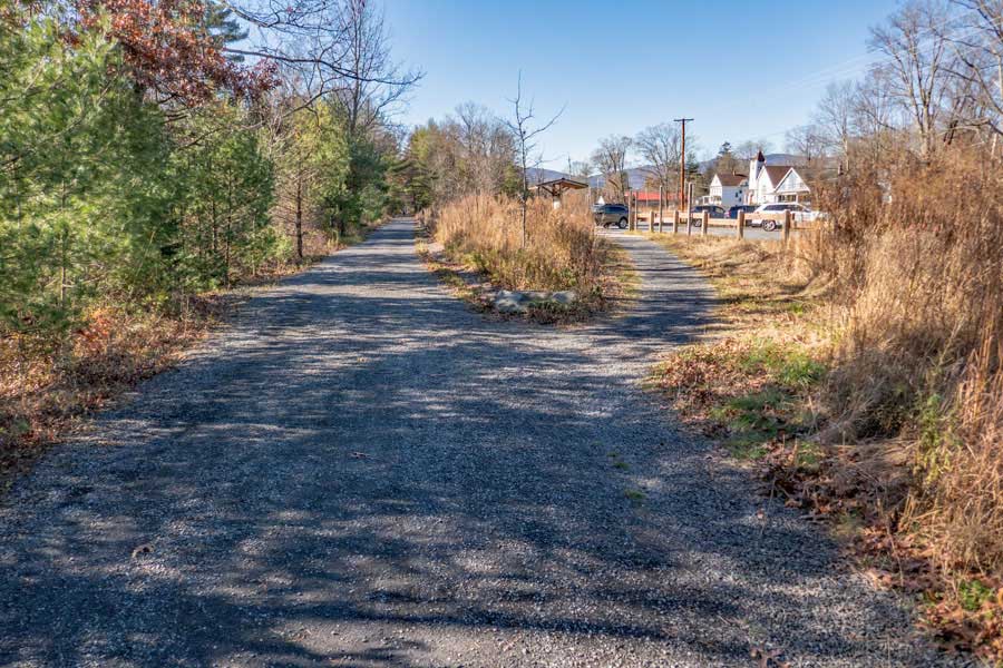
Mile Post 16 on the Ashokan Rail Trail. The Ashokan Station Parking Area and Trailhead are about 3/10 of a mile from Mile Post 16.
|
|
 |
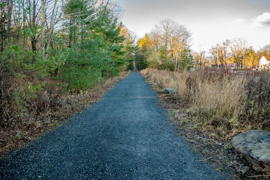
This is the Trailhead for the Ashokan Station Parking Area. There is a east and west trail that leads from the parking area to the Ashokan Rail Trail. They are about 150 feet apart.
|
|
Ashokan Rail Trail - Western Section |
 |
From the Ashokan Station Parking Area and Trailhead, the western section of the Ashokan Rail Trail runs close to some homes, so it is asked that you not make loud noises.
|
|
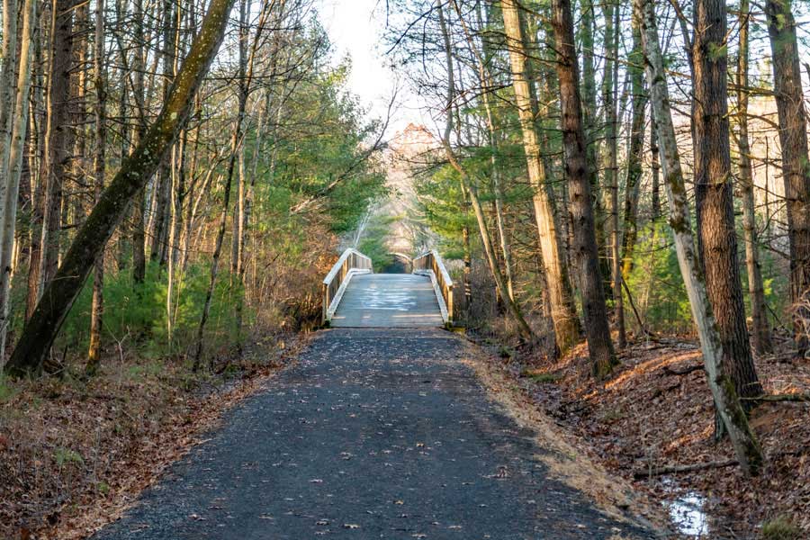 |
There is a fairly large wooden bridge not far from the Ashokan Station Parking Area. Easy to go up-and-over the bridge. It can get icy when the temperatures drop below freezing at some point during the night or day. So, beware.
|
|
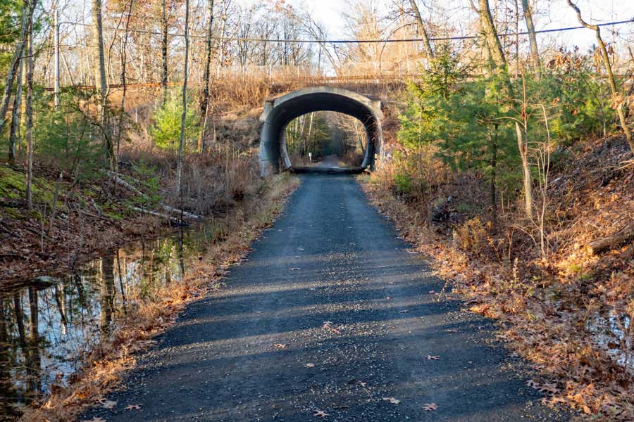 |
Just before Mile Post 17, you will go through this tunnel. The road going over the tunnel is the Reservoir Road. This is the road that goes over the bridge that separates the upper and lower basins of the Ashokan Reservoir.
|
|
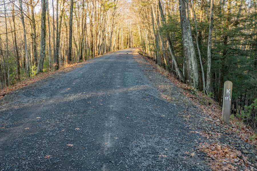 |
Not long after Mile Post 17-1/2, the Ashokan Rail Trail will go up hill in a "S" turn, and then drop in elevation. And, when the leaves are off the trees, you can start to see parts of the Ashokan Reservoir.
|
|
 |
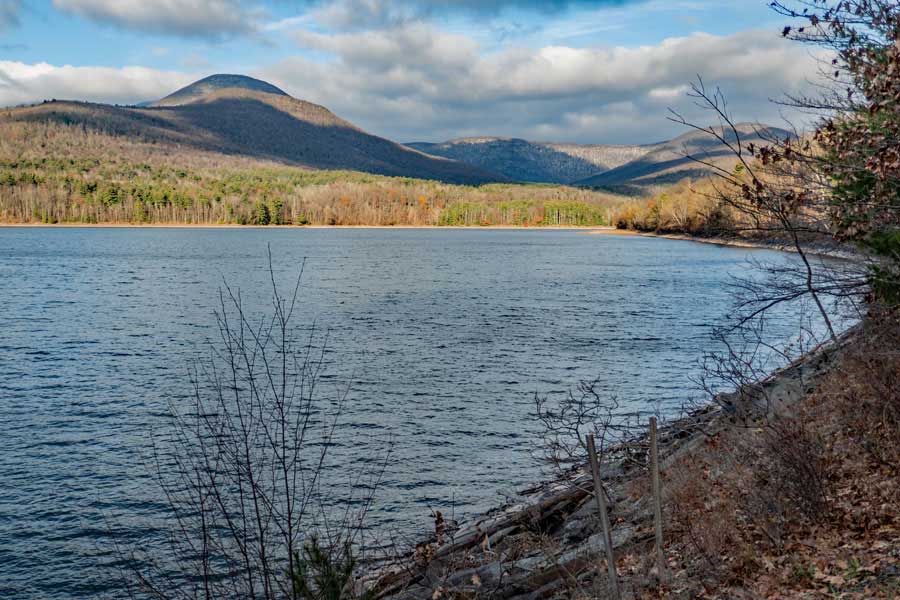
As you get up near Mile Post 19, the Ashokan Rail Trail will run right next to the reservoir. And, you will start to get some nice views. The mountain on the left is Ashokan High Point, and the smaller mountain across the ridge is South Mountain. Both on public land.
|
|
 |
The mountain on the left is Samuels Point, and the ridge in the back is Cross Mountain.
|
|
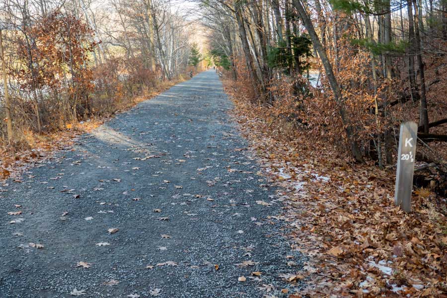 |
Shortly after the views, you will come to Mile Post 20-1/2 on the Ashokan Rail Trail. On the right you will see another small water body that appears to be part of the Ashokan Reservoir, and separated by the Ashokan Rail Trail.
|
|
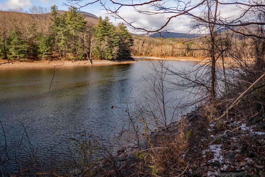 |
You will now be past the Ashokan Reservoir, and you will have the Esopus Creek on your left. It is the primary source of water for the Ashokan Reservoir, and it empties into the Ashokan Reservoir.
|
|
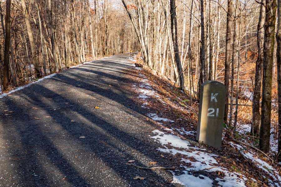 |
This is Mile Post 21 and will be arriving at the large metal bridge that goes over the Esopus Creek.
|
|
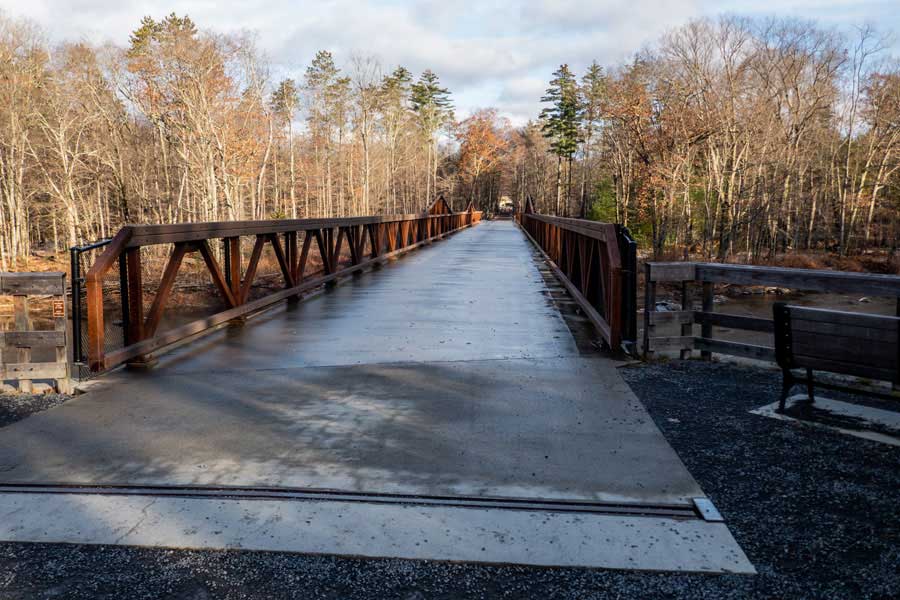 |
Not long after passing Mile Post 21, you will come the big metal bridge that crosses the Esopus Creek. There are nice views in both direction of the Esopus Creek.
|
|
 |
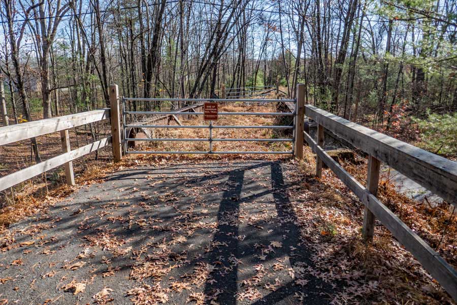
This is the end of the Ashokan Rail Trail at Mile Post 21-1/2. The parking area on the left is the Boiceville Bridge Parking Area and Trailhead. This Parking Area will change once they are done rebuilding the Boiceville Bridge. This picture was taken in 2023.
|
|
| |
|
S E C T I O N S
|
W E A T H E R
|
O T H E R
|