Maps of the Catskill Mountains
|
|
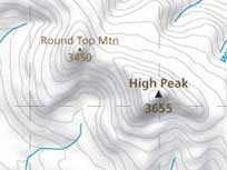
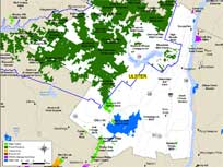
USGS Maps for the Entire Catskill Mountains. Quick high-resolution pull-up maps in your browser, and download high-resolution 7.5 min (1:24,000) pdf maps. Also included are historic USGS maps in 15 min (1:62,500) format. This section also has a map finder to help you select which USGS topo map to view or download.
|
|
|
|
|
|
|
|
|
|
|
|
|
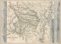
1880 Guyot Map of the Catskill Mountains - Made by the AJ Guyot Loan - Extensively detailed map of the Catskill Mountains. Guyot named and surveyed many of the higher Catskill Mountain peaks. Considered the main source of mountain names, locations, and shapes from the late 1800's. The map also shows the villages were they historically existed before the New York City reservoirs were created. Most notably the Ashokan Reservoir. (10.2 MB).
|
|
|
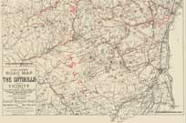
1892 Van Loan Map of Roads - Made by the Walton Van Loan - Shows roads and peaks of the Catskill Mountains. Considered a state-of-the-art map of the late 1800's. The map also shows the villages were they historically existed before the New York City reservoirs were created. Most notably the Ashokan Reservoir. (939k).
|
|
|
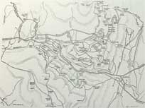
1949 Arrowhead Map - This map was made by Lambert Guenther. It was a hand-drawn map showing all the hiking trails in the Kaaterskill Mountains and North & South Lake. This map is valuable in finding some of the old hiking paths and locations. Some of these gems have been lost on some of the newer maps. Some of the gems are Hawkeye, Johnson's Point, west access to Kaaterskill High Peak, Fat Man's Delight, and many more hidden gems. (823k - 2943x2061)
|
|