Huffed up the hill to the DEC registration box, and signed in. Continued on up the hill. It leveled off after a short distance to an easy level hike. There was a new section of the trail, where everyone was getting lost. It is very poorly marked. The lost trails are more worn then the new trail. Then we crossed a number of nice small streams before coming to the Trail Junction to Wittenberg / Terrance.
Part of the purpose of this hike was to see if there was once a trail from this junction to Samual's Point. I do recall there being one, but I could be wrong. Very easy 3 mile hike to Samual's Point. Pretty much a flat hike to the base of Samual's Point. Then a small climb up the point. There are some nice ledges to overlook the Ashokan Reservoir. If I remember correctly, there is a small campground half way there. From the trail junction you can see Samual's Point very clearly. An easy bushwack for sure.
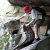
I then started my slog up the trail to Wittenberg Mtn. There some difficult climbs up the rocks in this section that rival the Devil's Path. The two hardest ones are encountered early. Then they just get interesting.
Once I reached the top, I was joined by about 25 other people, who sat there in the clouds with NO view. A real disappointment for everyone. We all waited a while hoping that the clouds would burn off. Didn't happen.
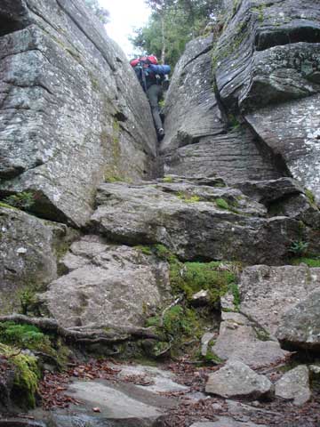
I decided to leave and head to Cornell. At first you have to go downhill to get onto Bruin's Causeway. It is a 10-50' wide narrow ridge that allows you go walk across it. When you get close to the peak of Cornell, you run into Cornell's Crack. Which is an unique scrabble/climb up a 25' rock wall with a wedge shaped crack in it. It is a hard as anything on the Devil's Path. Just very unique. Here is a picture:
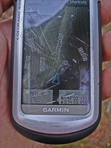
And, of course the summit of Cornell was also in the clouds. The view point is now almost grown over. I look down the west side of the trail . Headed back. Shimmed down the Cornell Crack. When I was most of the way across the Bruin's Causeway, I looked at my topo gps map to see Moonhaw Road turn into Tonisgah Road. Google maps has this really messed up. Now this mess is also on my GPS. Swell!
When I got back to Wittenberg summit, it was more clouded up then before. A lost cause for sure. Headed down. While on my way back down, I ran into a guy who needed a ride back to Rt 28. No problem. Gave him door-to-door service.
The trip down was uneventful. Just tired and sore.Hit the bottom around 4 pm.