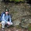
Ready to go at the trailhead. I was suprised that there was a giant 4 pronged parking area at the Adirondack Loj, and there were about 200 cars there. When I went to check myself out of the log book on the 2nd day, there were 5 full double sided pages in front of my name of hikers logging in. I have never seen anything like that.


This trail has horrible erosion problems. I encountered miles and miles of boardwalks, planks small wooden bridges and brigades of logs laid along the trail. This has to be the most worked on trail I've ever hiked.

Here is what used to be Marcy Lake. The tall mountain in the background is Colden Mountain. The Dam used to keep the water to a nice level where the mud flat you see used to be a lake. Irene took that out last year.

Marcy Dam

Around marcy lake there are several dozen camp sites. There are a few lean-to's and hundreds of people. I think I saw more people around here than anywhere else. I found a small site and hung the hammock. There are no fires allowed in this part of the adirondacks, so no firepits and I didn't have to bring my saw either. There are also really bad problems with black bears here, so you are required by law to bring a black bear canister and hide it away from your site. this meant the site was always very tidy and I never really sprawled everything about like I do other places.

There were some rainstorms forecast for 8/20 so I tied the rainfly down tight and it was only 11am so i decided to head off and see how far I could get along the Marcy trail and see what kind of condition it was in.

From the other side of Marcy Dam

A shot of fresh tracks in the mud. There was everything, bear, bobcat, raccoons, coyotoes.

Here is the Phelps brook that the Marcy trail travels along for the first 2 miles. The water here was crystal clear, unlike the brown sludge that was behind the Dam. I decided it wasn't too far of a hike and I would pump the water from here for drinking.

I had hiked for about 45 minutes and saw this sign. Only 1 mile to the top of another 46er, Phelps Mt. I was still about 3-4 miles away from the top of Marcy and decided to ditch that Idea for the day, and head to the top of Phelps.

The trails in the adirondacks have all the dirt worn from them, so every mile is like 2 miles in NJ, since you can't travel in a straight line and constantly have to climb over exposed roots and boulder size rocks.

Here's a nice steep pitch up a bare rock face. The pines were only 3 ft tall.

I got to the first viewspot on Phelps and saw Marcy. First I thought geeze that's still far away. Then I said looks like rain good thing I didn't try to go for it today.

Here is a shot of Colden and Algonquin.


It started to drizzle a bit so I put the camera away, snapped this shot from my cellphone and texted it to my wife. Surprisingly on the tops of these mountains I was getting 3-4 cell phone bars. I called her and wished her good night and headed back into the valley. I hunkered down in my hammock from about 2-5:30 while it was pouring on and off. I stayed completely dry but was bored and sort of napping sort of not. I got up and hiked over to the phelps brook so I could pump some water and cook some ramen. I had to have everything cleaned up before 7 since they tell you not to cook after then, and to have your sites clean and your bearcan hid away before dark, to decrease chances of running into a bear.

It was good I cooked when i did since I got back to my hammock and it started pouring again. I was completely dry and fell asleep by about 8 or 9 and was up by 5 am the next morning. I had a quick breakfast and headed out to tackle Marcy.
Here is a shot of Colden around sunrise.

From Marcy dam the trail is 5 miles to the summit of Marcy, so that's a 10 mile round trip. It is steep and worn in some places, other's it's muddy and has a lot of wood work on the trail. I didn't take many pictures since most of the scenery looked the same.


Here's a glimpse of Marcy summit from about 1.5 miles away.

I was debating in the morning packing my rain coat. It's only a couple pounds, but would probably be a couple pounds I didn't need since the forcast was great for the day. After seeing this sign I was happy I brought it.

A small clearing gives the view of the summit, less than 1 mile away, and you can see the ridge on the left that the trail takes.

Here is the last junction before the final .6 miles up to marcy summit

There were a few dozen people ahead and behind me. The popularity of this trail is very apparent.

In the alpine zone there are no trees, not allowed to walk on the grass, and the rocks are steep. Fortunately they are hard granite like in NJ and not slippery sandstone like in the Catskills. The pitches are steep but it's easier to make your way up them than it looks.

A view behind me you can see more people coming up the trail

Made the final climb and I can see a group of people on what seems to be the highest rock in the distance.

Plaque on the top of Mt. Marcy. "cloudsplitter" I like that name

Here is a shot to the west of Phelps mt. (it's small and under a cloud center shot) and the valley that I climbed up. The marcy lake and marcy dam is almost not visible.

A picture to the south

A shot east

A shot north. The tallest mountain in the back on the left is Whiteface Mountain. My parent's and wife and kids were driving up to the top of it with radios and were going to try to call me. I got to the summit of Marcy at only 10am, much earlier than I expected so I called them on the cellphone instead.

The highest puddle in New York State.

Some kids taking a break on the summit rock, while others are climbing up the final crest in the distance.

Here I zoomed in and whiteface mountain is on the right, and the town of lake Placid are the buildings visible on the left.

Me on summit of marcy

The trail back down was mud and logs.


I hurried along and passed about 100 people who were heading up. Good thing I got an early start. I made it back to the site, packed up my hammock and campsite, and hiked out the final 2 miles from Marcy Dam to the parking lot. I got there within 5 minutes of my family coming to pick me up.
