If you want to just look at post, you do NOT need an account.
But, if you want to post comments you need to open an account. Please:
Click Here to apply for an account.

Kaaterskill High Peak

Buttermilk Falls, Cortina, Devil's Kitchen, Haines Falls, Hawkeye, Huckleberry Point, Johnson's Point, Kaaterskill High Peak, Poet's Ledge, Round Top, Viola Falls, Wildcat Falls
Post Reply
User avatar
Jon
Posts: 324
Joined: Tue Dec 20, 2011 9:43 pm
Location: Bangor, PA

Kaaterskill High Peak

Unread post by Jon »

So we went up Kaaterskill High Peak yesterday. It started raining pretty good and we were in the middle of a cloud. We didn't get much of any views except from the north side of the mountain.

We stayed on the Long Path and then hiked around to the north side and took the snow mobile trail up to the summit trail. When we were at the summit there were two trails, one which was to the west and one which was to the south. We figured the viewpoint Ledge would be along the one which was to the south, but as we descended down it was veering off to the left and wound up being the trail that heads east toward the plane crash. We went down a few hundred feet then back up to the summit. Once we got back to the top we decided against going down the trail to the west which probably went to the ledge since we didn't even know if that was the right trail and it started raining pretty bad again. Also since we were basically in a cloud, there might not even be a view if we found the ledge. There was also a bunch of thunder, some which was really close to the mountain it shook your whole body.

Took about 5 hours, and was very very muddy. Next time I'll have to try taking that indian path which probably bypasses most of the mud, or looking for the airplanes. Also will try for the hurricane ledge next time. At least we got to the top and back alive, if a little soaked.

Image
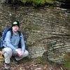
Taking a break by the Huckleberry point.

Image
Some of the wooden bridges over the mud

Image
Here the trail is basically a pond

Image
A shot of me in the evergreens.

Image
This is the Long Path on the northern side of the mountain. It's basically just one long stream with stretches of mud and sometimes rocks.

Image
Here we made it up to snowmobile loop.

Image
Summit trail

Image
Here is a bit of a view through the trees of Kaaterskill Clove. You can actually see 23a and some of the falls which are toward the road on the trail to Kaaterskill falls

Image
Zoomed in on the falls with 23a at the bottom.

Image
It rained pretty much the entire way up. Here I got the camera out cause the sun actually started shining.

Image
Some airplane parts on the summit

Image Summit of Kaaterskill High Peak

Image Didn't find the viewpoint, but I did take some more shots on the way down since my camera was away for most of the way up.

Image Shot down the trail

Image

Image
Back on the long path I just gave up trying to walk on rocks and just tore right through the mud.

Image This is pretty much what the trail is like for a mile.
Started to rain again so I put my camera away
User avatar
mike
Posts: 1444
Joined: Sun Aug 09, 2009 9:20 pm
Location: Ravena, NY

Re: Kaaterskill High Peak

Unread post by mike »

Sorry to hear that the weather didn't cooperate for your trip to KHP. One of the perks of KHP are the views. It was so nice in the morning, and then the clouds came in suddenly. Sometimes that is just the way things turn out. At least you reached the summit.

I see the 150 lb crank shaft is back on the summit. Thank you to whoever carried that thing back up. It actually belongs about 50-100' down the NE trail. Hopefully, I can return it to it's rightful spot next time I am there.

The viewpoint on the NE trail is about 100' past the location in your picture. But, with clouds it wouldn't matter. The view point is a little dangerous, so you have to be careful. The plane crash is about 50-100' to your left in the picture.

Yeah, the LP has a horrible mud/water trench that seems to go on forever. I usually use the old Mohawk Indian trail over to the SMT. So much easier, and a lot less mud.
rkugel
Posts: 143
Joined: Wed Nov 25, 2009 8:54 am

Re: Kaaterskill High Peak

Unread post by rkugel »

Good Morning Jon,

Sorry to hear you got rained out at KHP. And being at the summit with rumbles of thunder must have been absolutely frightening. At least you made it back OK.

I was actually hiking High Mountain Sunday morning (back in Jersey) and had trouble believing the forecast of afternoon showers and thunderstorms. The weather was "picture postcard" clear all morning. Regardless of the deceiving sky conditions, I was back at my car by 1:00 pm and headed home. Sure enough, within one hour, it clouded over and started raining. Amazing!

You mentioned taking the "south" trail at the summit towards the plane wreck. Did you guys actually get to see the plane wreck? It is not visible from the trail. After descending a short ledge, you have to turn left (north) and bushwhack about 50 - 75 feet.

I am also relieved to see the crankshaft was moved from Hurricane Ledge back to the summit. I would like to extend a sincere "thank you" to the individuals who cared enough to move it back. I was genuinely concerned some "jerk" would toss it over the side of Hurricane Ledge as a thrill, where it would be lost forever. As Mike said, the crankshaft really belongs closer to the wreck site. Perhaps someday we can finally move it to where it truly belongs.

As Mike mentioned, Hurricane Ledge is definitely worth seeing. From the summit, it would be the "west" trail (the one with the blue markers). From Hurricane Ledge, you can either retrace your steps to the summit or continue down the South Access Trail back to the Snowmobile Trail. Please be cautioned the South Access Trail is insanely steep, so please use appropriate caution.

Less obvious at the summit is another trail coming in from the north side of Round Top called the West Access Trail. This trail has not been regularly used in over 100 years and is quite difficult to find. Mike showed me this trail and we hiked it several times. The trail has quickly turned into one of my favorite hikes in the Catskills. The remoteness and wild beauty you experience are simply incredible.

If you wish, please check out the numerous trip reports Mike and I posted from KHP. There are so many sites of interest to see, both natural and man made.

Perhaps you can join Mike and me the next time we do KHP. Unfortunately, I've been enduring a long string of busy weekends between working and caring for my elderly parents. I'm really hoping I can get a full "play date" sometime soon.

Rich K
User avatar
Jon
Posts: 324
Joined: Tue Dec 20, 2011 9:43 pm
Location: Bangor, PA

Re: Kaaterskill High Peak

Unread post by Jon »

rkugel wrote: Perhaps you can join Mike and me the next time we do KHP.
sure. just let me know when. Can figure it out. I'd like to go back and see the plane crashes and stuff. I read your trail guides after we got back. We passed the cairn by the pines at the top of the hill and he asked "what is that" i said prob just a campsite cause that's usually what they are. I didn't want to follow some trail I didn't know where it ended up. I usually try to figure out getting in and out by myself, it's just the way I've always done it. I don't like spoilers. But seeing what I was looking at after the hike I always do. I can always go back and compare. Here's a shot of my GPS track(red) compared with the garmin track that is posted on catskillmountaineer(Yellow).

Image

The trail we took from the summit was on a compass bearing about south, but led to the east. We didn't go down the trail that was due West from the summit.

The track shows that we were much further down than the plane crash, if the yellow track is definitely going to the crash.
rkugel
Posts: 143
Joined: Wed Nov 25, 2009 8:54 am

Re: Kaaterskill High Peak

Unread post by rkugel »

Hi Jon,

From what I can see looking at your Garmin tracks, you were only a few feet away from the summit plane wreck. Like I mentioned, it is not visible from the trail. If you start at the summit (where the cairn and crankshaft are) and follow the trail heading south, the trail will turn to the east (as you noted) and skirt along the top of a ledge (the dropoff will be to your right - to the south). After a short distance, the trail will descend a short ledge (perhaps 15-20 feet). At the bottom of this ledge, turn left (north) and bushwhack along the base of the ledge for about 50 to 75 feet. You will come right to the plane wreck. If you stay on the trail and continue east, you will descend another short ledge and come out by a spectacular (but deceptively dangerous) overlook.

Once back at the summit, you should take the "west" blue marked trail to Hurricane Ledge. A short distance from the summit (perhaps 50 feet) and on your right, you may notice a vague trail heading into the thick conifer forest. That is the West Access Trail. As I described, the trail can be difficult to follow. I did the trail several times with Mike, but I'm still not confident enough to do it on my own - even with a GPS.

By the way, as you probably know, there are two plane wrecks on KHP. One is the "summit" wreck, which I just described. The other is along the Snowmobile Trail. As you ascend the Escarpment Trail from the Platte Clove parking area, you'll notice a cairn on the left side of the trail, with an unmarked trail heading off to the left (west). Follow this trail a couple of hundred feet and you'll come to the Mohawk Camp. The trail is easy to follow except for one tricky sharp left. If you miss it, you'll know immediately, because you'll come to a swamp! From the Mohawk Camp, continue west up a small ledge and then keep walking (a few hundred feet) until you come to the Snowmobile Trail.

Hope this helps!

Rich K
Post Reply