If you want to just look at post, you do NOT need an account.
But, if you want to post comments you need to open an account. Please:
Click Here to apply for an account.

Harding Road Trail (NSL -> Palenville)

Kaaterskill Falls, North/South Lake, North Point, North Mtn, Palenville Overlook, Rip's House, South Mtn, Stoppel Point
Post Reply
User avatar
mike
Posts: 1446
Joined: Sun Aug 09, 2009 9:20 pm
Location: Ravena, NY

Harding Road Trail (NSL -> Palenville)

Unread post by mike »

It was President's Day and it was beautiful out. We headed up to the parking lot at the South Lake dam. When we got there a couple of people were out on South Lake ice fishing. A really nice day to be out on the lake. We had other ideas of how to spend the day.

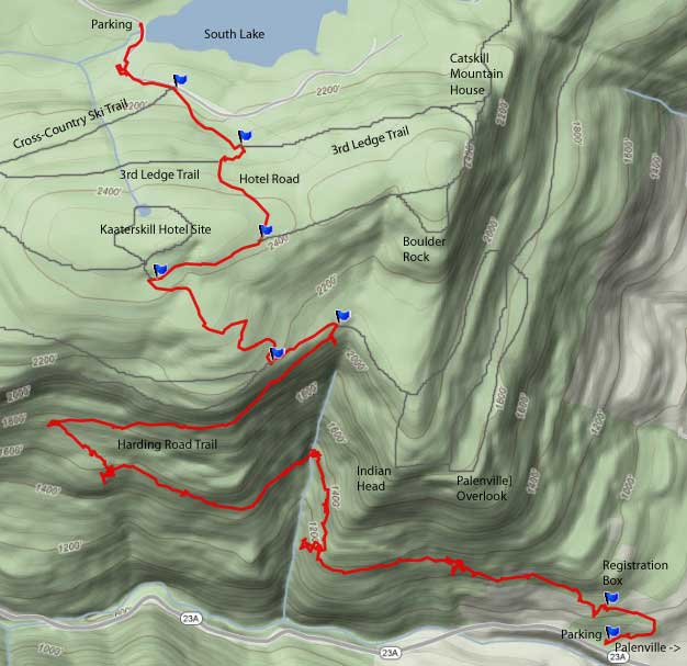
We headed up the road around the south side of South lake. Within 500' we put our Microspikes on. The road was pure ice with an inch of snow on top. Looks pretty, but dangerous. We passed the Cross-County ski Trail. We then took the old Kaaterskill Hotel Service Road. The road had snow on it, and a couple other people had been up it. When we got to the 3rd Ledge Trail, the Horseshoe turn was ice covered (as usual). Pretty soon, we reach the DEC trail. We then headed towards the old Kaaterskill Hotel Site. When we got there, it was all downhill. Easy hiking all the way to the car. We then headed downhill.

Once we got to the Trail Junction for Palenville Overlook. The trail then heads down the mountainside. The Harding Road was incredibly difficult to build. When you walk down the road, you can see why. On one side you have steep cliffs above you. On the other side is a ledge. Most of the way down you can see over the valley when the leaves are not on the trees. The trail is a nice steady incline, so walking is easy. During the trip down we saw Hillyer Falls and Lower Viola Falls. Both are quite tall, and you get to see these rarely seen Falls. You will also get to see Indian Head towering over the valley.

Near the top, most of the trees are Deciduous Trees. Part way down you start to see Pitch Pines, Red Pines, and a few Hemlocks. Enjoy the Pitch Pines. They only occur in a couple of places in the Catskills. When you get closer to the bottom you can hear the Waterfalls, but you can't see them. But, you can see them from Rt 23a when you drive up the road.

Along the way you will see some really nice sights. It is a very enjoyable hike.

When we got to the bottom we discovered that we had made a very bad mistake. We forgot the keys to our 2nd vehicle. It was one of those OMG moments. Luckily, another nice local couple gave me a ride up to North-South lake. The turned out very nice. It was good to have the day off. The hike is slightly longer the 5 miles. Took us about 3 hours and we took our time. Here are some pictures:
Image
Map of our hike

Image
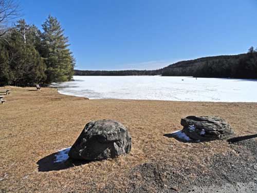
View of South Lake near the dam

Image
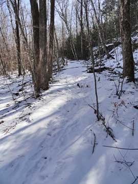
Kaaterskill Hotel Service Road

Image
Trail Junction near Kaaterskill Hotel

Image
Harding Road Trail

Image
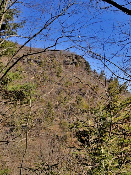
Indian Head from the Harding Road Trail
Image
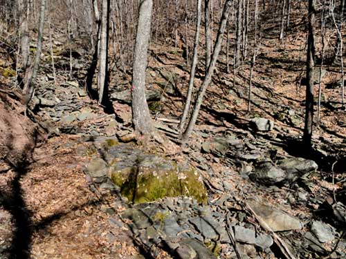
Stream

Image
Harding Road Trail

Image
Harding Road Trail
mtnclimber
Posts: 496
Joined: Sat Oct 10, 2009 10:46 pm

Re: Harding Road Trail (NSL -> Palenville)

Unread post by mtnclimber »

Ill have to try this hike sometime. Skies look real beautiful.
SNEAKers
Posts: 158
Joined: Wed Aug 03, 2011 3:30 pm

Re: Harding Road Trail (NSL -> Palenville)

Unread post by SNEAKers »

Everything looks beautiful about this hike, the weather, the trail, etc!

Mike, do you have any pics of the falls or are those the ones you referenced that you can't see other than from 23A?
User avatar
mike
Posts: 1446
Joined: Sun Aug 09, 2009 9:20 pm
Location: Ravena, NY

Re: Harding Road Trail (NSL -> Palenville)

Unread post by mike »

The hike is nicer then you would expect. Mainly because the leaves are not on the trees. It is an easy hike due to little elevation gain, and the gain is fairly easy.

The waterfalls can only be seen from Rt 23a. I think I have some pictures of the falls from Rt 23a somewhere, but they are slightly blurry due to the shooting thru the branches. Rich Kugel and I want to get a good photo from the base this year. You could probably climb down from the trail (where it passes over the stream). But, I would suspect that the view from the top is boring.
User avatar
mike
Posts: 1446
Joined: Sun Aug 09, 2009 9:20 pm
Location: Ravena, NY

Re: Harding Road Trail (NSL -> Palenville)

Unread post by mike »

Okay I found an image of the waterfalls:

Image

I don't know if it has a name, but I guess you could call it the Harding Waterfall.

Some have estimated it to be 80-120'. Not sure if that is correct or not.
Post Reply