If you want to just look at post, you do NOT need an account.
But, if you want to post comments you need to open an account. Please: Click Here to apply for an account.
Buttermilk Falls, Cortina, Devil's Kitchen, Haines Falls, Hawkeye, Huckleberry Point, Johnson's Point, Kaaterskill High Peak, Poet's Ledge, Round Top, Viola Falls, Wildcat Falls
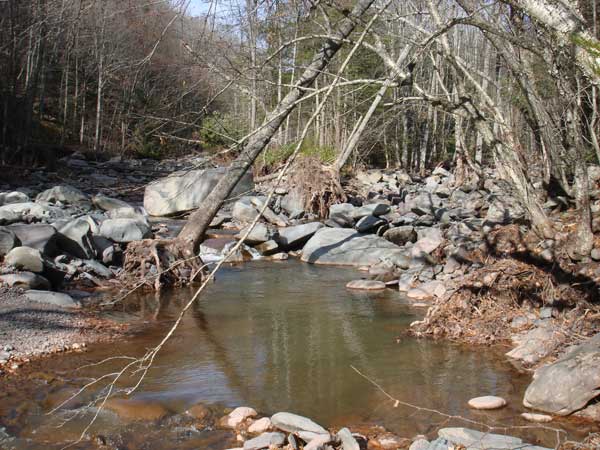
I arrived at the lower parking lot to Bastion Falls around 10 am. I then walked down to Lake Creek. I then walked down to the junction of Lake Creek and Kaaterskill Creek. There was some major reshifting of the stream. It was hard to tell I was in the same place about a year ago.
I then walked down to Lower Buttermilk Falls. Again the stream had reshifted a lot. The tannery sustained little damage from Hurricane Irene. I had a difficult time crossing Kaaterskill Creek. I finally found a route across the stream, but it was very difficult.
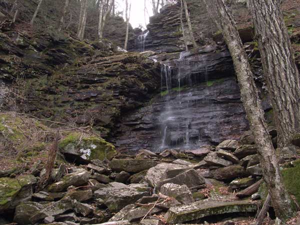
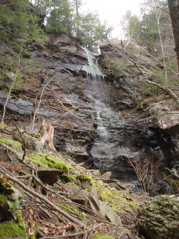
I then hiked up some of the old logging roads on the right side of Wildcat Ravine. When I got to 1400-1500' the road came to an end. Part way up the logging road, I found a section that was seriously washed out. But, I was able to get around it. Once above the old logging road, the incline got very steep. I came to the base of Lower Wildcat Falls. It is a pretty waterfall. But, difficult to get to the base or top. I then had to track out of the ravine, and then climbed above the Falls. There is an old path to get to the top of the falls. Probably used 100 years ago. I then hiked up the creek to the base of Wildcat Falls. This very difficult hiking. I then got on the left side of the ravine into the woods, and traveling is much better. The rocks in the ravine, had a lot of moss and were very slippery. But, going up the left side made it much easier. After I took a picture of Wildcat Falls, I then walked down to the road.
I was able to cross the creek down near Fawn's Leap. I then measured the height of Fawn's Leap, which is 24' high. I then walked up the road to my car. A nice day out in the woods.
The junction of Kaaterskill Creek and Lake Creek - 2011
The junction of Kaaterskill Creek and Lake Creek - 2010
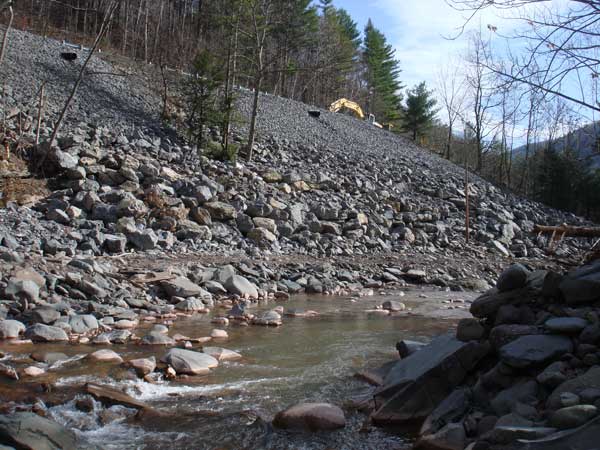
Part of old Rt 23a was washed away during Hurricane Irene
There are 3 waterfalls below the DEC trail around 2200', and two waterfalls above the trail.
The hike up from the valley is hard. Maybe harder the Buttermilk Ravine. Buttermilk has some level ledges between the waterfalls. Wildcat doesn't. The route is important. I think you can also get down below the big one on both sides. I know you can on the West side, but you have to hike down, and then back up quite a ways. I think you can below on the east side and walk right to the base. The guide books are woefully misinformed if they say it is easy.
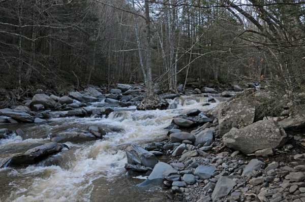
It is also hard to get across Kaaterskill Creek. Right now it is very easy to get across Lake Creek at the junction. Incredibly easy. But, after the next big rain, this will change. Upper Kaaterskill Creek (above Lake Creek) is littered with trees.
I walked down Rt 23a after the peak. At peak the water came up near the top of the bridge by Bastion Falls, and the water went over Moore's Bridge. The water actually went down pretty quick. But, it was still very scary. There were still 70 mph winds when I walked down the road. I actually considered walking down to the junction of Lake Creek, Kaaterskill Creek, and Santa Cruz. But, the thought of it scared me too much. When you got close to the water, the water spray was tremendous. It was hard to predict which areas were safe. If you look at the top picture, there is a large rock by the trees. That rock is 10' high. It probably weights 100 tons. That rock wasn't there before Hurricane Irene. But, the Kaaterskill Creek gets fed by some many other water sources.
Mike,
Two questions:
1- How do you find the old logging roads you mentioned? I've never seen them.
2- Is this shot of wildcat falls from the bottom of what you hike above if you were hiking the poets ledge, wildcat, buttermilk trail? is there a way to the top from there?
1- How do you find the old logging roads you mentioned? I've never seen them.
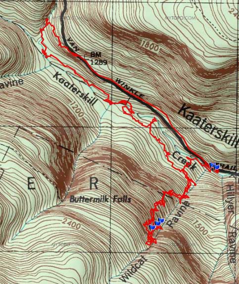
You can find the logging roads down by Kaaterskill Creek. Park at the lower parking area below Bastion Falls/KF. Then hike almost parallel to RT 23a (going back up the road), and drift downhill to Lake Creek. When you get to Lake Creek, you will find a trail. Take this trail down to Kaaterskill Creek. Then take the old Rt 23a (Rip Van Winkle Road). down to the old Tannery (across from Buttermilk Falls #10). Then try to find a way to get across Kaaterskill Creek. Can be difficult to find a spot to rock hop across. Once across, the old logging roads are on the south side of Kaaterskill Creek. Take the old roads down almost to Fawn's Leap. The old logging roads will then start to climb up the clove. Once you get to around 1500' they will stop at an old camp. Hope this helps.
2- Is this shot of wildcat falls from the bottom of what you hike above if you were hiking the poets ledge, wildcat, buttermilk trail? is there a way to the top from there?
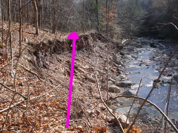
Yes, this shot was from the bottom of Wildcat Falls. There is an old trail that runs up to the trail. Please note: It is very steep and dangerous. Here is how you get to the old trail: Hike from Viola Falls to Wildcat Falls. Then hike back towards Viola Falls. When you take a left and hike down the hill, and just after you take a right on the trail, look for an old rusted square trail marker on the north side of the trail. This is where the old trail went. Walk in the woods, and you will find a ledge. This is where the old trail went. Look for a spot to get down below the ledge. Yes, it is steep and a little scary. I'll see if I can find an old picture and map for you. Rich K and I did hike this trail last year.
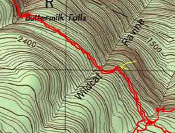
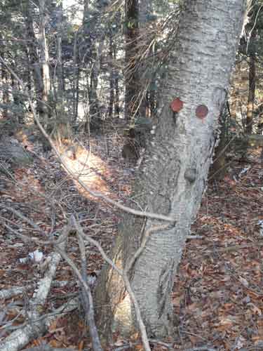
Okay, I'm back. The trail markers are round and not square. Here is a picture and a map:
The yellow arrow show approximately where the old rusted trail marker is
picture of the rusted trail marker
Remember: This route is dangerous and a little scary. Be VERY careful. Maybe Rich K might have a few words next week when he gets back to work on Tuesday.
I was able to join Mike last summer and explore the area from Buttermilk Falls to Viola Falls. The area is fascinating and breathtakingly beautiful. Some notes of caution and general observations.
1. I joined Mike at least two times exploring the area. In spite of our spending the entire day each time in this beautiful area, we never encountered another hiker. In other words, this area is more remote than you think. I strongly recommend you hike with a partner. If you suffer a fall or other injury preventing you from walking out on your own, you could literally be there for days, if not longer, before someone finds you.
2. The Escarpment Trail literally runs feet away from the dropoff of Buttermilk and Wildcat Falls. Please use EXTREME caution when crossing the streams. The water flow is stronger than you think and the rocks are VERY slippery.
3. If you choose to bushwhack down to the lower levels of the falls, once again, please use extreme caution and please go with someone. It is easier than you think to take a fatal fall. Before you descend a ledge or outcropping, be certain you have a way to get back up. The ledges are steep, high, and slippery. Getting down is one thing - getting back up is another.
4. Because of the many ledges and crevices, there are many critters inhabiting the area. As Mike and I worked our way down one of the rocky ledges, we heard "something" hiss. We never did find out what it was, but it was enough to "notch up" our level of caution.
5. The old trail that Mike mentioned is a beautiful walk and well worth trying to find. It runs just north of the Escarpment Trail (closer to the dropoff of Kaaterskill Clove) and roughly parallels the Escarpment Trail. In some places, the trail is plainly obvious; in other places, it all but disappears. From Viola Falls, it is literally a 10 minute walk (bushwhack, of course) from the old trail to Poet's Ledge. A GPS will make finding Poet's Ledge a breeze. And yes, Poet's Ledge is every bit as spectacular as everything you've read about it. Definitely check it out!
I did a Sprint Triathlon at North South Lake this weekend past, and got pretty trashed. Did a bunch of the tourist type stuff after, Sunset Ledge, walk around North South Lake and Kaaterskill Falls.
At the Parking Lot for the Falls, there was a TH and I went down it. Butt slid some of it. There was a car there before I lost the trail. Is there anything else interesting down there? I went down to the rapids but was still a little beat and knew getting back up would be tough so I bailed.
Unfortunately, there are lots of cars, tires, and other junk that has been pushed over the banks. But, there is a lot to see along the Kaaterskill Creek and Lake Creek. Rich and I usually enter from the lower parking lot to Kaaterskill Falls. It is an easier hike down.