Kaaterskill Amphitheater & Lucas Kill Falls
Posted: Fri Apr 22, 2011 10:16 pm
when we left the house this morning we had every intention of hiking Poet's Ledge. But with overcast skies we had second thoughts. Poet's Ledge is the kind of hike you want to do on a perfect day. Today was not perfect. It appeared that it was going to be overcast all day. So, we decided to do the other side of Kaaterskill Amphitheater and Lucas Kill Falls.
We arrived late at Devil's Kitchen around 11AM. Rather late to be starting a hike. But, we still had plenty of time to complete the hike. We headed up the Long Path to the top of the hill around 3,000'. Where the side trail to the Mohawk Indian Camp is where we headed to the Kaaterskill Amphitheater. Once there, we headed south down the old Indian Trail. The trail was spotty at time. Part way down we stopped by a rock and had lunch. Again, we were never able to get a clear picture of the Amphitheater without branches in the way. Sort of odd that there isn't a clear view somewhere on this path. It is several miles long. But, you can still see over the valley. Never-the-less it is a very nice walk.
We then headed down the slope to the valley floor. We did find a small blue stone quarry. But, they didn't get far. Apparently the stone was not good here. We then found the source of the Lucas Kill Creek. We then followed the creek down to the Eastern Escarpment.
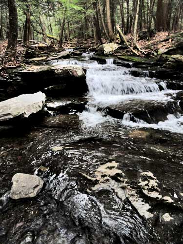
The closer we got to the Eastern Escarpment, the better the waterfalls got. When we got to the Eastern Escarpment there were a series of beautiful waterfalls. Not the biggest waterfalls, but very beautiful. As we moved down, we came to a large waterfalls. It was very dangerous to get to the top of it. But, we could see that it was about 200-250' high. We would return on another day to view all the waterfalls along the ravine. Today we were too tired and the day was getting late. From our calculates there are probably two waterfalls around 200-to-250' high and maybe two waterfalls around 100' high. Oddly, very few people know about these waterfalls. Very few people have ever visited it. Probably because it is difficult to get there.
Afterwards, we headed towards the Huckleberry Trail. Part way up, we ran into a road that lead us directly to the Huckleberry trail. Odd that no one even knew about the trail. We then followed Hell's Creek down until it ran next to the Steenberg Road. We then hiked down to the car.
Once at the car, we decided to hike down to the Arch bridge just before it enters into Hell's Hole (Devil's Kitchen). We then ran into some friends. We talked for a while, and then headed down to Hell's Hole.
Road up to KHP
Trail to KHP
Side trail to Mohawk Indian Trail and Kaaterskill Amphitheater
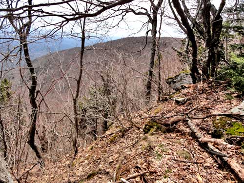
View of the Kaaterskill Amphitheater
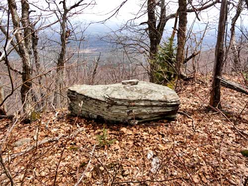
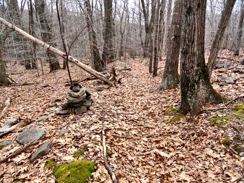
Rock were we had lunch by the edge of the Kaaterskill Amphitheater
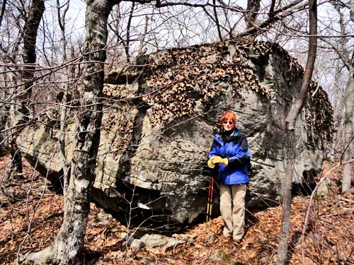
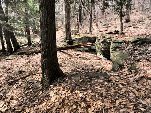
Large rock on Kaaterskill Amphitheater
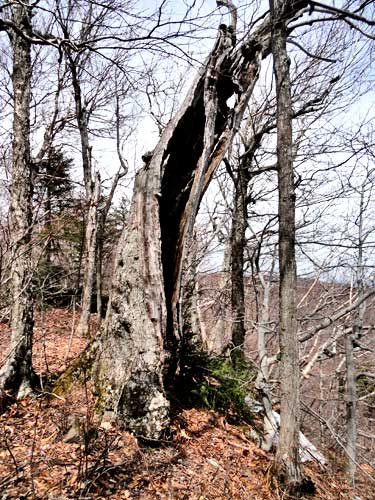
Hollow tree on the very edge of the Kaaterskill Amphitheater
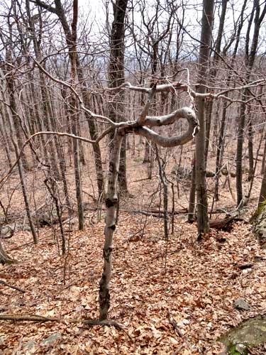
Oddly shaped maple tree
Small Blue stone quarry at the bottom of the Kaaterskill Amphitheater
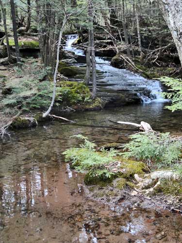
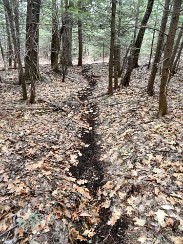
One of the sources of the Lucas Kill creek
A little way down the creek we encountered a 3' waterfall.
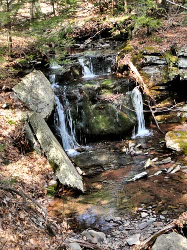
Around the corner was a 6-8' waterfall.
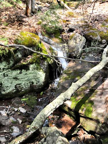
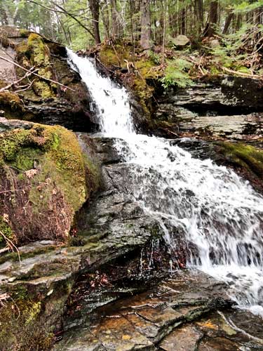
A 20' cascade by the eastern escarpment
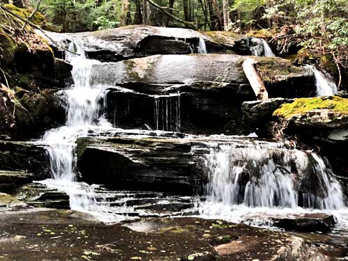
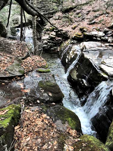
Just below the 20' cascade is this 4 step waterfall. Maybe 15' high
Below the 15' waterfalls was this 20' waterfall. Below this waterfall is a 200-250' waterfall.
Old Road to Huckleberry Point
Old Road to Huckleberry Point
Waterfalls along Hell's Creek
By the Arch bridge.
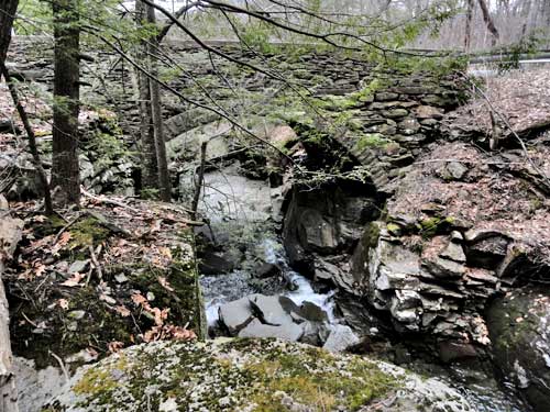
By the Arch bridge.
We arrived late at Devil's Kitchen around 11AM. Rather late to be starting a hike. But, we still had plenty of time to complete the hike. We headed up the Long Path to the top of the hill around 3,000'. Where the side trail to the Mohawk Indian Camp is where we headed to the Kaaterskill Amphitheater. Once there, we headed south down the old Indian Trail. The trail was spotty at time. Part way down we stopped by a rock and had lunch. Again, we were never able to get a clear picture of the Amphitheater without branches in the way. Sort of odd that there isn't a clear view somewhere on this path. It is several miles long. But, you can still see over the valley. Never-the-less it is a very nice walk.
We then headed down the slope to the valley floor. We did find a small blue stone quarry. But, they didn't get far. Apparently the stone was not good here. We then found the source of the Lucas Kill Creek. We then followed the creek down to the Eastern Escarpment.
The closer we got to the Eastern Escarpment, the better the waterfalls got. When we got to the Eastern Escarpment there were a series of beautiful waterfalls. Not the biggest waterfalls, but very beautiful. As we moved down, we came to a large waterfalls. It was very dangerous to get to the top of it. But, we could see that it was about 200-250' high. We would return on another day to view all the waterfalls along the ravine. Today we were too tired and the day was getting late. From our calculates there are probably two waterfalls around 200-to-250' high and maybe two waterfalls around 100' high. Oddly, very few people know about these waterfalls. Very few people have ever visited it. Probably because it is difficult to get there.
Afterwards, we headed towards the Huckleberry Trail. Part way up, we ran into a road that lead us directly to the Huckleberry trail. Odd that no one even knew about the trail. We then followed Hell's Creek down until it ran next to the Steenberg Road. We then hiked down to the car.
Once at the car, we decided to hike down to the Arch bridge just before it enters into Hell's Hole (Devil's Kitchen). We then ran into some friends. We talked for a while, and then headed down to Hell's Hole.
Road up to KHP
Trail to KHP
Side trail to Mohawk Indian Trail and Kaaterskill Amphitheater
View of the Kaaterskill Amphitheater
Rock were we had lunch by the edge of the Kaaterskill Amphitheater
Large rock on Kaaterskill Amphitheater
Hollow tree on the very edge of the Kaaterskill Amphitheater
Oddly shaped maple tree
Small Blue stone quarry at the bottom of the Kaaterskill Amphitheater
One of the sources of the Lucas Kill creek
A little way down the creek we encountered a 3' waterfall.
Around the corner was a 6-8' waterfall.
A 20' cascade by the eastern escarpment
Just below the 20' cascade is this 4 step waterfall. Maybe 15' high
Below the 15' waterfalls was this 20' waterfall. Below this waterfall is a 200-250' waterfall.
Old Road to Huckleberry Point
Old Road to Huckleberry Point
Waterfalls along Hell's Creek
By the Arch bridge.
By the Arch bridge.