
I have been planning on going back to Hawkeye for the past two years, but something was always in the way. Today, there was nothing in the way. It seemed like the right hike to do. I parked at the bridge on Rt 23a (just before Malden Ave). Walked down Malden Ave. After passing Fernwood Rest. I took the right up the driveway to the trailhead. The road had a lot of storm damage from Jan 25. Shortly up the road, there was an ice flow that covered the entire road. I had to put on my microspikes. Then I took off the microspikes and walked up the road.
After I left the road (Red Cliff Road?), I hiked up the trail in my boots. It was only after the flat section did I put on my snowshoes. Still had problems with rocks here-and-there. Many times I just left the trail. The storm damage washed away snow on the trail. Off the trail was fine.
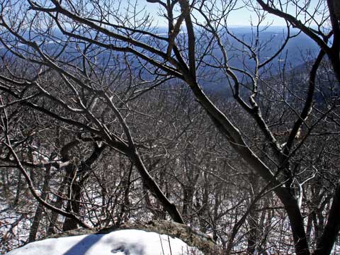
When I got to the top, I walked to Poet's Ledge trail, and then walked back slightly. I left the trail and walked into the conifer forest. The view was beautiful. The forest was nice and easy to walk thru. Very enjoyable. Before long, I was into a deciduous forest. Then it changed to Mountain Laurel. Then it changed to open areas. It seemed that every couple hundred feet the terrain would change. If you got close to the edge you could look over the Hudson valley. Then I came to a rock ledge to climb. It was about 15-20 feet high, and sloped. Not sure of what I would find, I climbed it. When I go to the top, it was very flat ledge rock with scrub pine sprinkled about. Very similar to what is on North Point-to-North Mtn. Very nice!. Shortly after, I pushed my way thru some Mountain Laurel, and I hit Hawkeye.
Hawkeye is a ledge about 50 feet high. There is now a tree growing up and blockin the view . Really too bad.

When I walked back, I walked down the old trail, which basically follows Viola Creek. Easy walk. Sometimes, you can see the trail. I want to return and walk the rim. About 7 miles all together.