So i didn't plan a hike this week with friends because my sisters car needed some work and needs and inspection so I was trying to save her a little money on repairs. I installed a new oil pan and some front brake rotors. Still has a bearing or CV issue but that is beyond my abilities so having gotten done what I could yesterday I went for a hike today.
I left from the parking lot on stoney clove rd (yes I paid for parking) at about 9am (seems to be about the earliest I can get myself to the trail heads). It started not too steep but that quickly changed after the register and was all business for the next mile. Not as many ledges as say Sugarloaf from the west but there were very few spots where it leveled off. I think that is the shortest distance I've ever done 1500 vertical feet in.
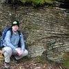
I made it up to Orchard Point for the first (and best) lookout of the day by about 10. I had switched to my sunglasses on the way up as the sun kept shining through the trees into my eyes on the way up and the polarization cut through a little of the haze for a better view. I ate a sandwich, took some pictures (I need to get a polarizing filter for the camera) and rested a bit before continuing on around 10:30 as a group I passed started to make their way up so I thought I'd leave the view for them (I'm finding I like the solitude when hiking alone). Shortly after I came upon another lookout where I decided I'd take another breather and soak in the views. This stop was maybe 10-15 minutes (didn't check the time when I left) and I continued on. The rather flat top of Plateau's ridge was more than welcome after the climb up from Notch Lake and much easier to set a nice pace. The path was somewhat overgrown in the parts along the ridge when the trees were thinner making me wish I had not opted for shorts on this hike (first time hiking in shorts, thankfully not too many prickers).
I reached the peak and then the lookout before the trail decends to farr into mink hollow just before Noon. I was turned around about 10 minuetes later. On the way back I was keeping a keen eye for the Warner Creek trail as I didn't notice it on the way in and came upon it at 10 after noon. It was not a wide trail (blends right into the hemlock woods) and the signs were facing SE which is part of why I didn't notice. I stopped again on the way back at Danny's Lookout for another sandwich and to let my feet air out and change socks.
I was back on the trail by a little after one I stopped to take some pics again at Orchard point at about quarter after 1. The descent was a bit faster paced than the way up. It was hard to keep from going fast and the loose gravely soil almost had me on a couple occasions. I found myself favoring awkwardly angled rocks over the dirt for fear of slipping as the dry clean rocks that were solidly in place had much better traction.
I made good time (thanks gravity!) and was back at the car by 2. I changed into a dry shirt, applied odor masking spray and had some gatorade by the lake and then drove off. I stopped at the Mountain Top Historical Society and bought the NYNJTC map set and the AMC Catskill Trails book. A fun day of hiking, great weather, practically no mud and the bugs started to get interested only when I was stopped and fresh deet kept them off.
Overall a nice day hike but a steep start. I almost believed the gentleman I passed close to the first outlook on the way down who told me he thought a little bit was added to it every year. I don't see it getting any easier as time goes on.
If you want to just look at post, you do NOT need an account.
But, if you want to post comments you need to open an account. Please: Click Here to apply for an account.
But, if you want to post comments you need to open an account. Please: Click Here to apply for an account.
Plateau 6/24/12
-
one2wonder
- Posts: 9
- Joined: Tue Jun 05, 2012 2:59 pm
Re: Plateau 6/24/12
Here is a panorama from the top - sorry about the obvious lines, I didn't retouch anything before stitching. https://dl.dropbox.com/u/70297255/Orchard_Point.jpg
-
mike

- Posts: 1444
- Joined: Sun Aug 09, 2009 9:20 pm
- Location: Ravena, NY
Re: Plateau 6/24/12
Nice trip report. Hiking up from Notch Lake has the most amount of vertical. An hour to the top is pretty good time. Climbing from Mink Hollow has about 1/2 the amount of vertical. Both routes are good. The hike across Plateau is always nice. Long beautiful hike through the woods.
I really enjoy hiking solo. Not safe when bushwhacking, but a nice way to hike marked trails. You can move at your own pace and soak up the beauty of the Catskills. Sounds like you had a great day in the woods.
Your panoramic pictures looked great.
I really enjoy hiking solo. Not safe when bushwhacking, but a nice way to hike marked trails. You can move at your own pace and soak up the beauty of the Catskills. Sounds like you had a great day in the woods.
Your panoramic pictures looked great.
-
Jon
- Posts: 324
- Joined: Tue Dec 20, 2011 9:43 pm
- Location: Bangor, PA
Re: Plateau 6/24/12
Nice panarama. I hated going down plateau to the Devil's tombstone. That is really rocky. Guess that's why it's called stony clove.
Solo hiking is fun, but always make sure you tell someone where you're going. don't be like the guy in that movie 127 hours.
Solo hiking is fun, but always make sure you tell someone where you're going. don't be like the guy in that movie 127 hours.
-
one2wonder
- Posts: 9
- Joined: Tue Jun 05, 2012 2:59 pm
Re: Plateau 6/24/12
I always make sure to leave an itinerary of where I'm going and what time I expect to be done when going solo, sign in at registers etc. What do others do when they find they have enough time on the trail to expand on a hike?
-
Jon
- Posts: 324
- Joined: Tue Dec 20, 2011 9:43 pm
- Location: Bangor, PA
Re: Plateau 6/24/12
Well I always will include the most outrageous amount that we could possibly go on. Like if I'm gonna climb friday I tell my wife Friday and maybe Balsam so she knows there's a probability we could be going to either. Most of the time I overshoot and only wind up doing 1/2 of what I say. When we do backpacking I will leave her with maps printed of several summits, routes, and camping spots we could be utilizing. She might not know where any of the stuff on that paper is or what it is, but if she has to call the Rangers she can tell them the stuff on the map and they would know.one2wonder wrote:I always make sure to leave an itinerary of where I'm going and what time I expect to be done when going solo, sign in at registers etc. What do others do when they find they have enough time on the trail to expand on a hike?
I never go further than I told someone I was going if it is solo, because I don't have cell service anywhere. Like when I climbed Giant Mountain in ADK, I could have gone further to Rocky Peak Ridge since I passed the turnoff for that early like 2 o'clock, but I said no, I was solo and my wife only knew I was going up Giant so I said 'oh well'. The mountain will still be there next year.