Zion National Park 6-8May2012 trip report
Posted: Wed May 30, 2012 11:17 pm
I finally have gotten around to going through some of the 1000+ pictures I took during my trip to Zion National Park earlier this May. Unfortunately, I typed up a detailed trip report last night, but was logged out and lost the whole thing. So here goes the reader's digest version….
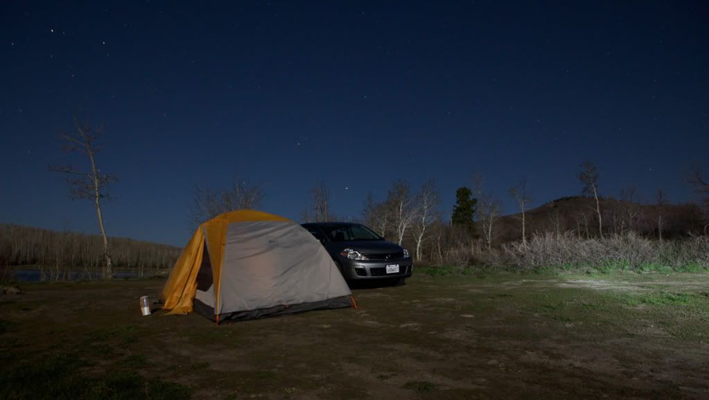
First night camped out at Kolob Reservoir, 8,500 ft elevation and was apparently the coldest place in Utah that night (right around freezing with 50-60mph gusts and no real shelter from the wind). Below is a picture of our campsite and we were the only ones camping at the reservoir that night.
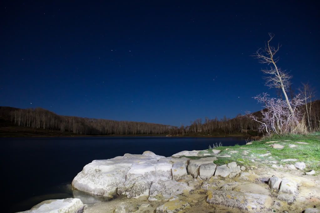
This is the water just to the left of the shot above.
The next morning we set out on the West Rim Trail (WRT) which starts at the northern end of the park and heads south to the main canyon of the Virgin River. The trail is about 16 miles and we camped at Campsite 4, which is nearly halfway down the trail.
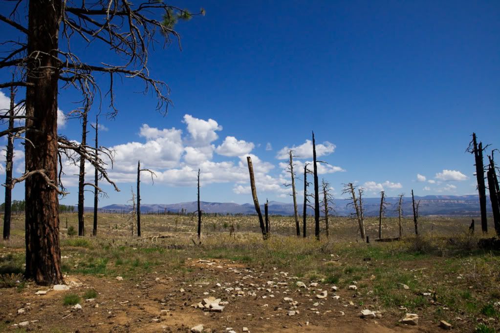
Much of the first few miles are this type of terrain with trees damaged by wildfire.
This was an approximately 4 inch long grasshopper with fire engine red legs.

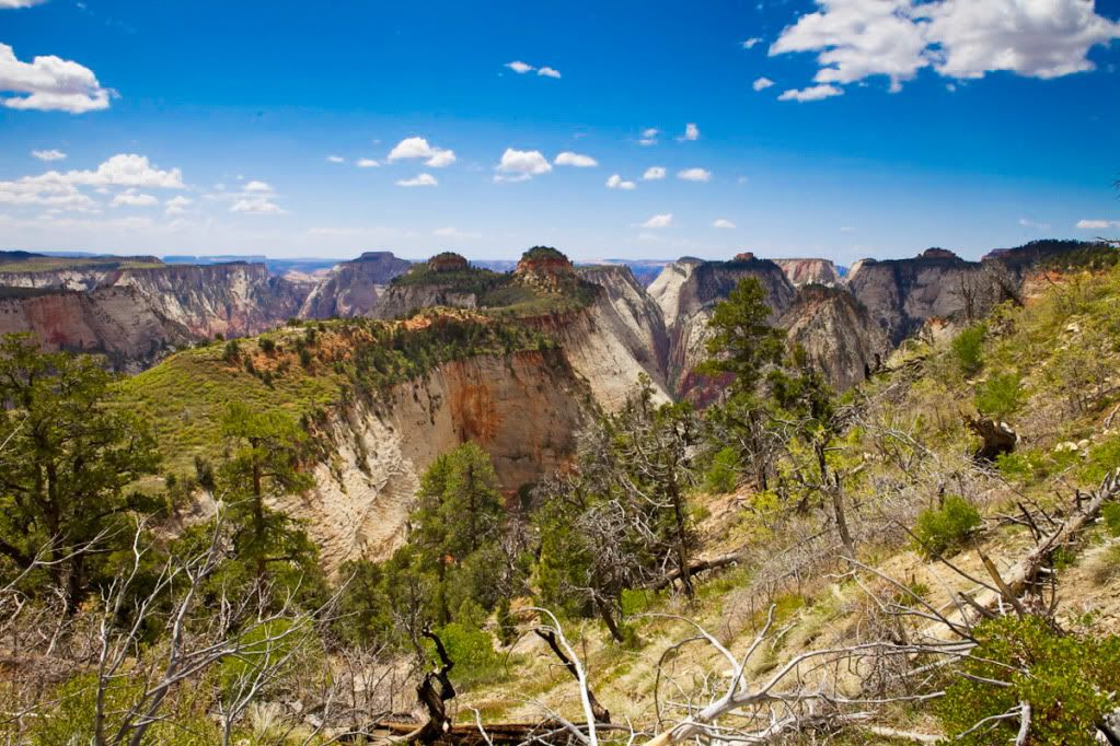
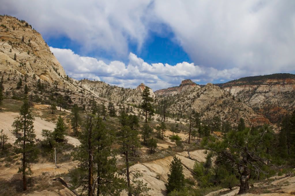
This was along the "west rim" where you begin to see into the hundreds of canyons that zig zag across the land.
The trail then seemingly ends at the edge of a cliff, but actually begins a descent down many switchbacks. This picture is approximately halfway down the switchbacks. You can see the trail in the bottom left of the picture.
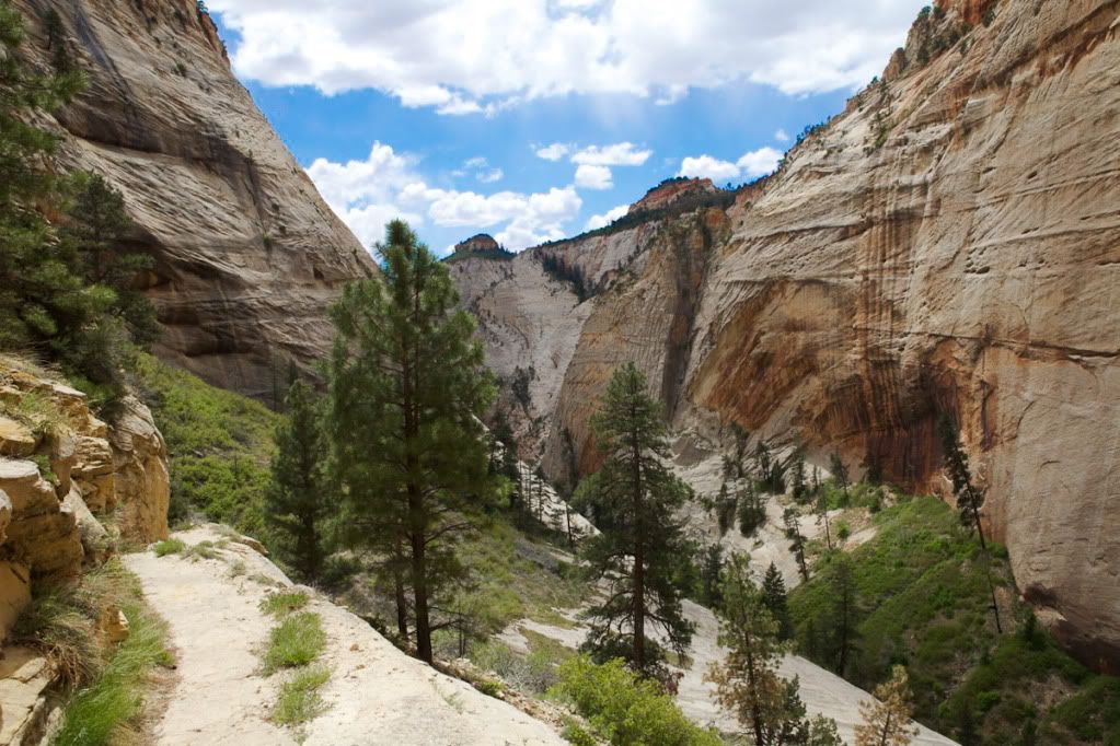
This is down towards the bottom. You can see how much the terrain has changed from the first picture of the WRT.
Another view from the bottom.
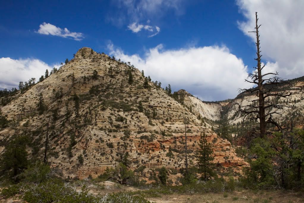
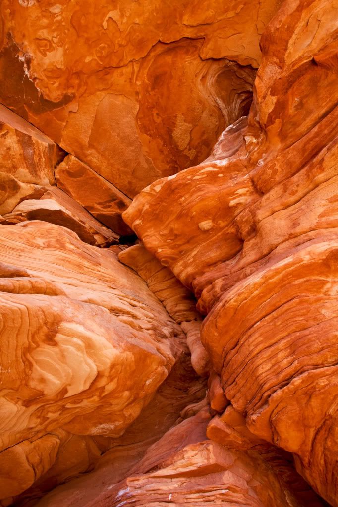
The trail then begins to climb slightly and changes again to even more dry and rocky terrain. I love the oranges and reds of the rock.

This was about 20 feet high and provided some much needed shade.
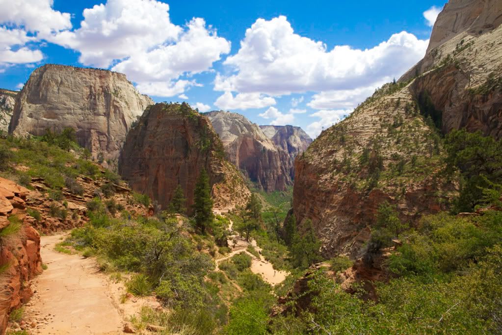
This is approaching the WRT junction with the Angel's Landing Trail and trail to the Grotto (which is at the bottom of the main canyon/Virgin River) This view is looking at the north side of Angel's Landing, which can be climbed by going up the narrow trail in this picture. Unfortunately, this was the second day and our friend was waiting at the end of the trail, so we did not climb to the top. It burns me so bad that we did not get to the top, that I modified a cross country road trip that I'm taking in July to go back!
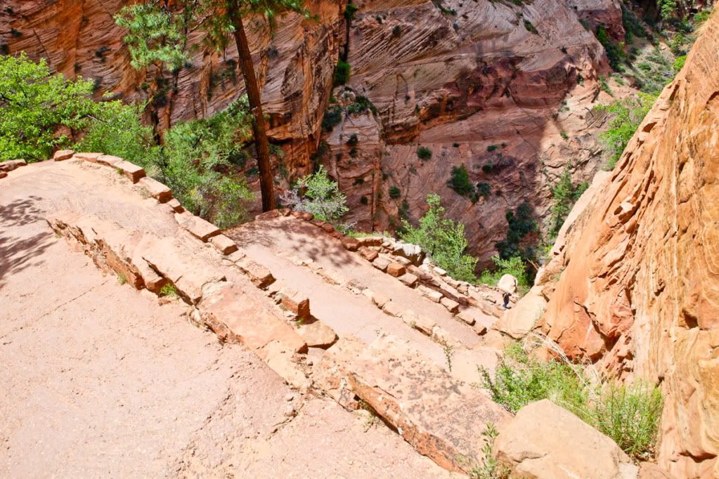
These are some of the switchbacks that goes from the trail junction down to the main canyon. To see the scale and steepness, there is a person down at the last switchback.
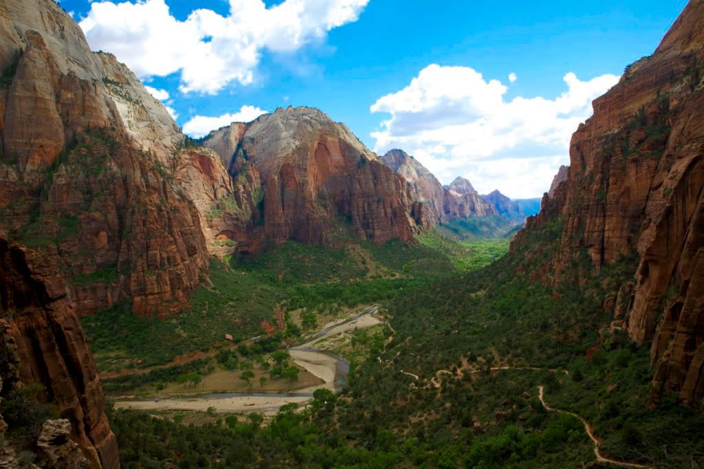
This is the view into the main canyon with the Virgin River and Zion's red canyon road to the left of the river. The trail is to the right in the picture. This is as close to the view from the top of Angel's Landing as I got, but really is no comparison to pictures I've seen.
If you are ever in Las Vegas and have time for a long day trip or can take a few days, I HIGHLY recommend heading to Zion! Hope you all enjoy the pictures!
First night camped out at Kolob Reservoir, 8,500 ft elevation and was apparently the coldest place in Utah that night (right around freezing with 50-60mph gusts and no real shelter from the wind). Below is a picture of our campsite and we were the only ones camping at the reservoir that night.
This is the water just to the left of the shot above.
The next morning we set out on the West Rim Trail (WRT) which starts at the northern end of the park and heads south to the main canyon of the Virgin River. The trail is about 16 miles and we camped at Campsite 4, which is nearly halfway down the trail.
Much of the first few miles are this type of terrain with trees damaged by wildfire.
This was an approximately 4 inch long grasshopper with fire engine red legs.
This was along the "west rim" where you begin to see into the hundreds of canyons that zig zag across the land.
The trail then seemingly ends at the edge of a cliff, but actually begins a descent down many switchbacks. This picture is approximately halfway down the switchbacks. You can see the trail in the bottom left of the picture.
This is down towards the bottom. You can see how much the terrain has changed from the first picture of the WRT.
Another view from the bottom.
The trail then begins to climb slightly and changes again to even more dry and rocky terrain. I love the oranges and reds of the rock.
This was about 20 feet high and provided some much needed shade.
This is approaching the WRT junction with the Angel's Landing Trail and trail to the Grotto (which is at the bottom of the main canyon/Virgin River) This view is looking at the north side of Angel's Landing, which can be climbed by going up the narrow trail in this picture. Unfortunately, this was the second day and our friend was waiting at the end of the trail, so we did not climb to the top. It burns me so bad that we did not get to the top, that I modified a cross country road trip that I'm taking in July to go back!
These are some of the switchbacks that goes from the trail junction down to the main canyon. To see the scale and steepness, there is a person down at the last switchback.
This is the view into the main canyon with the Virgin River and Zion's red canyon road to the left of the river. The trail is to the right in the picture. This is as close to the view from the top of Angel's Landing as I got, but really is no comparison to pictures I've seen.
If you are ever in Las Vegas and have time for a long day trip or can take a few days, I HIGHLY recommend heading to Zion! Hope you all enjoy the pictures!


