
The night before it showed about a 1/2 foot of wet heavy snow. As I headed to the Catskill Mountains, the snowstorm had just ended. There were still clouds hovering over the tops of the mountains. The clouds were 3,000' or higher. I assumed that as I hiked up, the clouds would clear off later in the day, and it would get sunny.
I reached the parking lot, and it was not plowed out. So, I parked on Shaft Road. I put on the snowshoes and pack and headed out. At the concrete post, I hiked another 100' down the trail. At an opening of the barbwire, I crossed the stream. Luckily for me the stream was iced over for the most part. I hiked about 30 feet up stream and found rocks in the stream to ensure I didn't get wet feet. After I crossed the stream, I walked thru the thick brush, and was met with the steepest part of the hike.
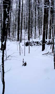
I walked up the hill, and finally got to my first flat section. The terrain was nice and peaceful. After walking about a 1/2 mile I came to a Whiskey Wall (rock wall). It was a very nicely built wall that was still in good shape. I walked thru an opening of the wall.
The hike had the usually terrain. Flat sections followed up by uphill sections. Sort of steps. This hike was no different. There were very few ledges are difficult sections.
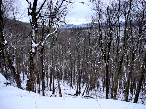
Around 2,800' we came to a section on the right that had a limited view. A very nice camping site. Flat, cleared, with good views to the east.
Around 3,000 feet there was thick brush, and a very nice cave that you could sleep in. Pretty cool.
Once we got around 3,400 feet we started to go up and down with multiple false summits. We had to keep going until we found the real summit. If you have a GPS, check it for the real summit. If you don't have one, just keep going. There are Balsam trees at the summit.
When we reached the summit we wrote our entry into the canister. The snow from around 3,000 increased to 9-12 inches of wet heavy snow. It had also rained at the beginning, so the crust below the snow was week. We had a significant problem with break-thru. We would often drop 18-24" down. This truly wore me out very quickly. Travel was tough and difficult. It took us 5 hours to get to the top due to the difficult snow depth. It took 1-1/2 hours to get down because we now had a broken trial.
We broke the trail all the way to the top. We did see some woodpeckers and blue jays. One lone Fisher made his rounds. Not that much wildlife. Signs of bears here and there.
