When I got out of my vehicle, I put on my snowshoes and prepared to head out. There were two boys playing with their sleds in the DEC parking lot. They were having a grand time sliding down the hill. When they saw me, they headed over to find out where I was headed. I told them that I was thinking about doing Sherrill. Both boys who lived next door, said that they had been to the top of Sherrill. The older boy proceeded to tell me how to get to the right location to climb the mountain. I thanked them and headed out.
When I got to the old Logging road, I decided to forgo climbing the Moraine, and take the logging path instead. My plan was to climb the moraine, which is on the right side of the stream. Instead, I took the old logging path on the LEFT side of the stream. I decided that I would switch over to the right side when I got much further up.
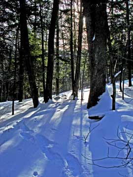
The trail was fresh with snow, and you could not see any previous trips from other hikers. I started up the trail, which was very easy to follow. When I got 0.44 miles up, the trail went around a large hill. No problem. I continued on the trail. When I got around the hill at 0.66 miles, the trail started to disappear. I decided to head back towards to the stream, so that I could keep the stream as a reliable reference point. About a mile up, I hit the trail again, so I followed the trail, which was easier traveling.
At 1.25 miles, I had a decision to make. I came to a steep hill that was going to block my path. Either I would have to cross the stream and head up the very steep hill to get on top of the moraine, or go left and go up the hill away from the stream. The steep moraine looked like a bad idea. Just before I got there, I could see Balsam Mtn on the left, and Sherrill Mountain on the right. I really didn't need to make a decision now. So, I choose to go left up the hill. I could cross later.
As I was climbing the steep hill on the left, my snowshoe came off. Difficult to get it back on. When I got to the top, I hit a summer pricker field. My reward for the steep climb! The grade then leveled off, and walking was nice and easy.
Then I came to the next steep hill. This was was the hardest hill to climb. It was the steepest, and the highest climb of the hike. There were some small ledges on top. I decided to zip-zag my way up. If I fell, I would slide quite a ways. I didn't have an ice axe, so I was careful to make sure I didn't fall. When I got to the top, I was met with a low of blowdown. My reward for the steep climb. This seems to be a theme on this hike. I worked my way thru the rocks, branches, and trees.
At this point, I decided that I would climb Balsam, and then cut over to Sherrill, and finally take the Moraine down. So, I continued to head towards the summit of Balsam. At this point I could have cut over to the col between the two mountains.
Then I finally came to the last steep climb. Another huff-and-puff climb. When I got to the top, I had a view of the mountains off in the distance. Nothing great, but still a view. Again, I was rewarded with more blowdown.
At this point I was on the top of the Balsam Mountain. I then set out to find the highest spot. But, my GPS kept coming up with the same elevation. Finally, I decided that the northeast corner probably was the tallest point. The top of the Balsam Mountain had a snow depth of around 2-1/2'. 50% of my steps resulted in breakthrus. This really wore me out.
I had calculated that it would take 2 hours to climb Balsam. In reality it took 3 hours. Since I started out at 11AM, it was now 2PM. I decided that it would be too dangerous to hike over to Sherrill. It was about 1 mile to the summit of Sherrill. I might have been able to make it to the bottom before I got dark. It was too dangerous of a risk. I decided that I would hike Sherrill another day.
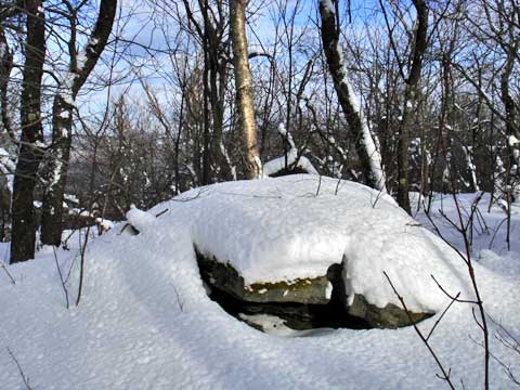
Summit of Balsam Mountain:
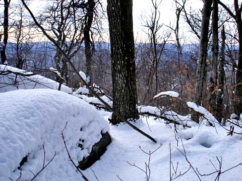
Top of third steep climb:
Picture on the way down: