Slide Mtn. Wilderness Loop 6.20-22.2014
Posted: Thu Jun 26, 2014 11:10 pm
A friend and I did a loop hike this past weekend through the Slide Mountain Wilderness. Our original goal was to hike all 9 peaks in the Southern Catskills, even after being warned about the spruce/fir forests between Cornell and Friday! I come from CT and my friend takes the train from NYC so we arrived at the Slide Mountain P.A. around 10:00 Friday night, got our stuff together and started hiking in about a mile or so to the primitive campsite along the trail on the western side of Slide.
Got on the trail about 8:00 saturday morning and headed directly to Slide, trail was actually pretty easy on the entire Western side. From there made the steep climb down to the col and then up Cornell, looking for a spot along the way where we could break off and head to Friday Mtn. Decided to cut Wittenberg off because of time, so we double back and found a spot to start our bushwhack.
Went right through the thick of it, over Dink, on our way to Friday. Took what seemed to be forever to get there, spent a few minutes trying to locate the canister but didn't have any luck. It was so thick up there that we didn't want to spend a ton of time trying to find it, so we started to move on to Balsam Cap. Made it in a little over an hour to BC, found the herd path(s) going up to the summit and found the canister pretty easily. As we were deciding where/how far to move on to next, a group of 4 dayhikers came by us on their way back from Lone/Rocky. We made it down into the col between BC and Rocky and set up camp. Filtered and treated water from a tiny stream, just to get us to morning, it was still a bit yellow and a little taste to it.
Got moving by 7:30 on Sunday and hiked right away to Rondout Creek to try and get us water for the day. Had to hike down the stream bed a ways but finally found where the water was coming out and filled up for the day's climbs. Hiked back up the creek bed for a while and then made a turn to Rocky. We approached Rocky from the South-East, not sure if people usually climb Rocky from this direction, but we came up on some really impressive ledges. This was definitely the toughest climbing of the weekend. Lots of downed trees, boulders, and difficult ledges to climb made getting to the summit a real challenge. Found the canister and moved right on to Lone. The hike between Rocky and Lone was a bit of a challenge.
Made it to the summit of Lone in about an hour, had lunch at the ledge south of the summit. The black flies were a bit much so we only stayed as long as needed. Started making our way to Table, once we made it to the col it was actually a pretty easy hike from there. Found good herd paths most of the way up Table, went through a couple hundred feet of thick conifers and popped out on the trail. What a great feeling after being off a trail for 24 hours! We had decided to cut off Peekamoose too because of time. All the bushwhacking and climbing took more time than we thought. Hiked all the way down Table, crossed the Neversink and took the Phoenicia-East Branch Trail back to the Slide Mountain P.A.
Great weekend hike! Had beautiful weather the entire weekend. Lots of incredible ledges and great climbing! The bushwhacking was incredibly difficult at parts, this hike was definitely a serious challenge. Got lots of quality compass & map time in which was fun.
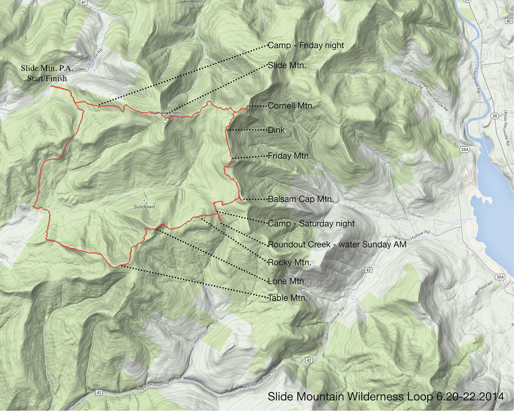
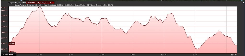
Here's our elevation profile and GPS track overlaid onto Google Terrain:
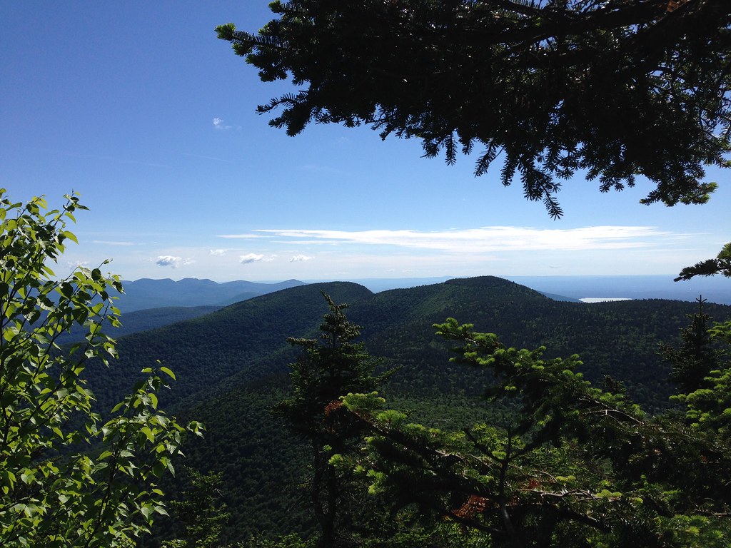
Looking at Cornell and Wittenberg, as we descended from Slide:
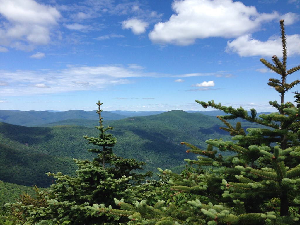
Looking at Panther/Giant Ledge from Cornell:
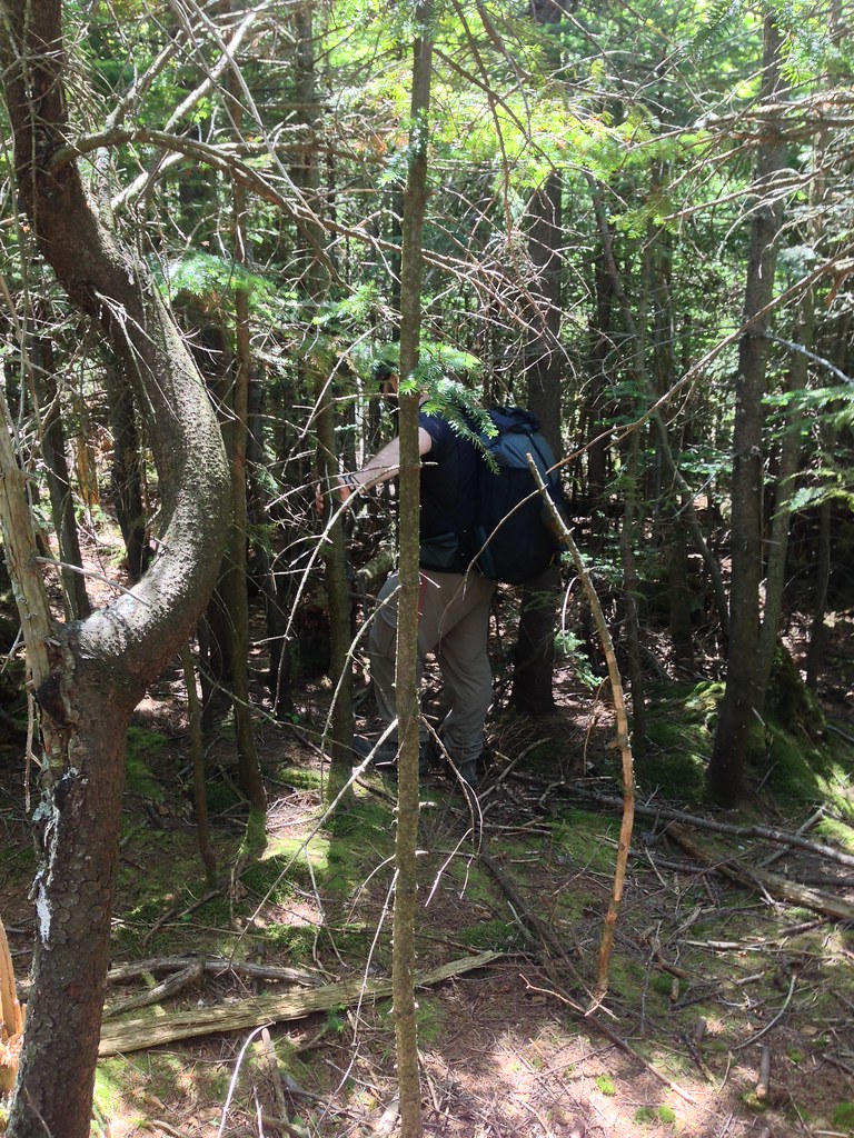
Our view for most of the bushwhack to Friday:

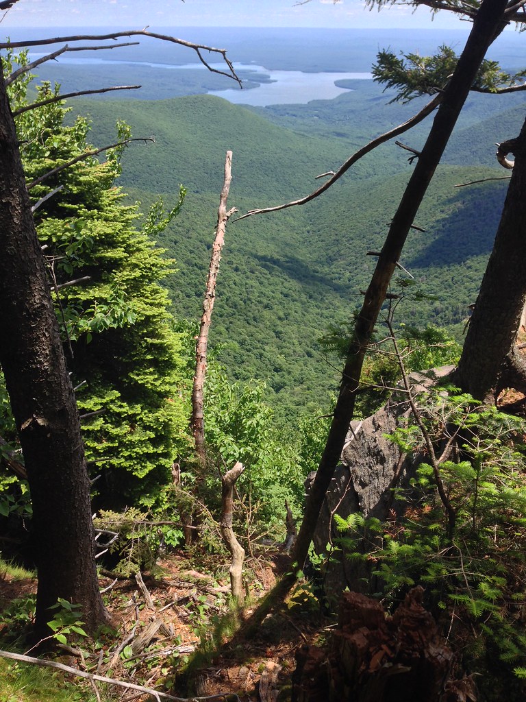
View between Friday and Balsam Cap:
Looking at Cornell/Wittenberg from Friday:
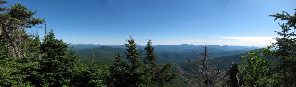
Panorama of Devil's Path from Cornell (photo by Rick Rock):
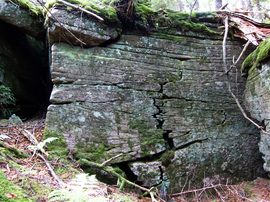
Came upon a lot of this on Rocky, toughest climb of the weekend (photo by Rick Rock):
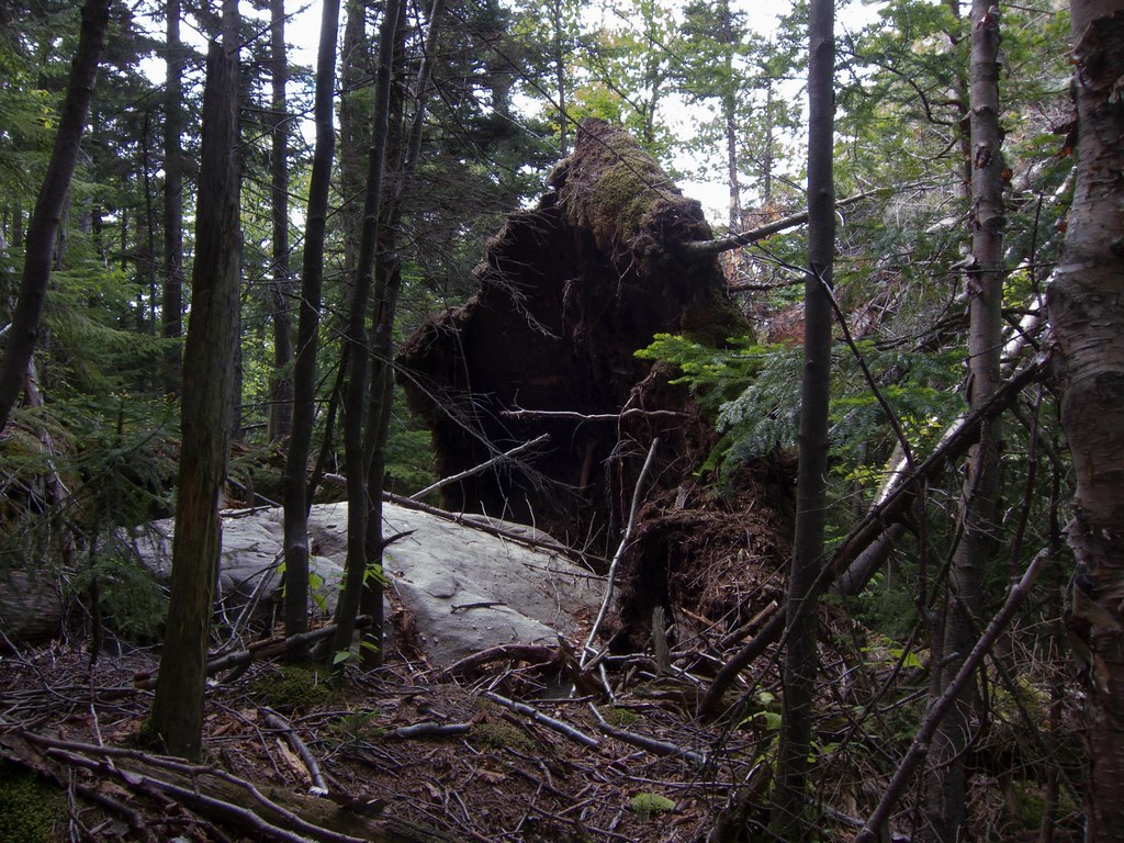
Cool looking ledge on Cornell (photo by Rick Rock):
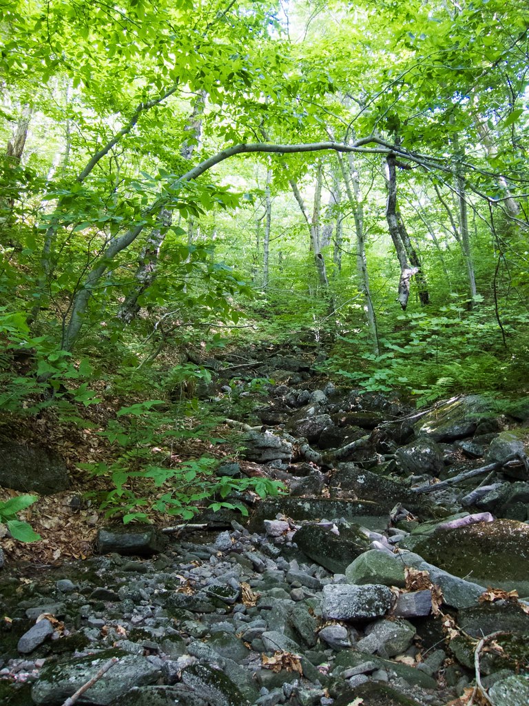
Looking back up Rondout Creek, hiked down a little ways on sunday morning to get water (photo by Rick Rock):
Looking at Peekamoose from ledge on Lone (photo by Rick Rock):
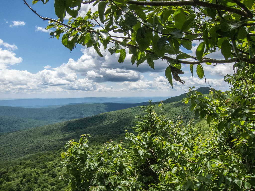
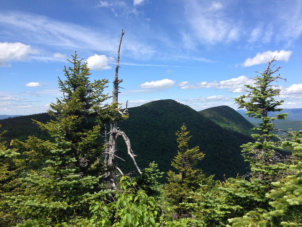
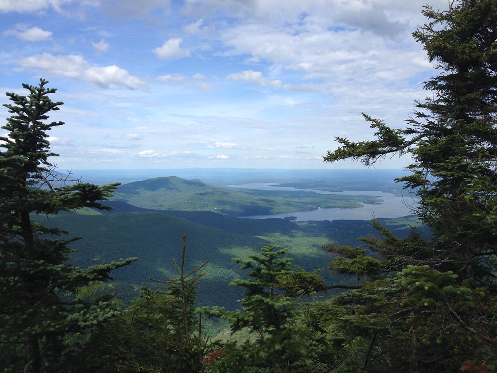
View from Balsam Cap:
Got on the trail about 8:00 saturday morning and headed directly to Slide, trail was actually pretty easy on the entire Western side. From there made the steep climb down to the col and then up Cornell, looking for a spot along the way where we could break off and head to Friday Mtn. Decided to cut Wittenberg off because of time, so we double back and found a spot to start our bushwhack.
Went right through the thick of it, over Dink, on our way to Friday. Took what seemed to be forever to get there, spent a few minutes trying to locate the canister but didn't have any luck. It was so thick up there that we didn't want to spend a ton of time trying to find it, so we started to move on to Balsam Cap. Made it in a little over an hour to BC, found the herd path(s) going up to the summit and found the canister pretty easily. As we were deciding where/how far to move on to next, a group of 4 dayhikers came by us on their way back from Lone/Rocky. We made it down into the col between BC and Rocky and set up camp. Filtered and treated water from a tiny stream, just to get us to morning, it was still a bit yellow and a little taste to it.
Got moving by 7:30 on Sunday and hiked right away to Rondout Creek to try and get us water for the day. Had to hike down the stream bed a ways but finally found where the water was coming out and filled up for the day's climbs. Hiked back up the creek bed for a while and then made a turn to Rocky. We approached Rocky from the South-East, not sure if people usually climb Rocky from this direction, but we came up on some really impressive ledges. This was definitely the toughest climbing of the weekend. Lots of downed trees, boulders, and difficult ledges to climb made getting to the summit a real challenge. Found the canister and moved right on to Lone. The hike between Rocky and Lone was a bit of a challenge.
Made it to the summit of Lone in about an hour, had lunch at the ledge south of the summit. The black flies were a bit much so we only stayed as long as needed. Started making our way to Table, once we made it to the col it was actually a pretty easy hike from there. Found good herd paths most of the way up Table, went through a couple hundred feet of thick conifers and popped out on the trail. What a great feeling after being off a trail for 24 hours! We had decided to cut off Peekamoose too because of time. All the bushwhacking and climbing took more time than we thought. Hiked all the way down Table, crossed the Neversink and took the Phoenicia-East Branch Trail back to the Slide Mountain P.A.
Great weekend hike! Had beautiful weather the entire weekend. Lots of incredible ledges and great climbing! The bushwhacking was incredibly difficult at parts, this hike was definitely a serious challenge. Got lots of quality compass & map time in which was fun.
Here's our elevation profile and GPS track overlaid onto Google Terrain:
Looking at Cornell and Wittenberg, as we descended from Slide:
Looking at Panther/Giant Ledge from Cornell:
Our view for most of the bushwhack to Friday:
View between Friday and Balsam Cap:
Looking at Cornell/Wittenberg from Friday:
Panorama of Devil's Path from Cornell (photo by Rick Rock):
Came upon a lot of this on Rocky, toughest climb of the weekend (photo by Rick Rock):
Cool looking ledge on Cornell (photo by Rick Rock):
Looking back up Rondout Creek, hiked down a little ways on sunday morning to get water (photo by Rick Rock):
Looking at Peekamoose from ledge on Lone (photo by Rick Rock):
View from Balsam Cap: