|
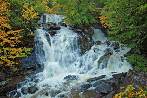
Information about Bastion Falls: |
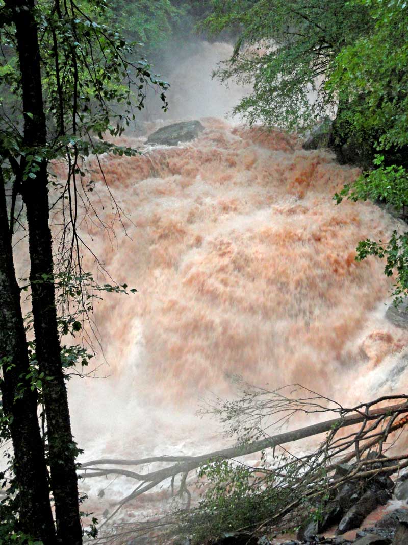
| Name: Bastion Falls |
| County: Greene |
| Region: North-South Lake |
| Location: Lake Creek Ravine |
| Order within ravine: 2nd of 2 drops (1=highest elevation) |
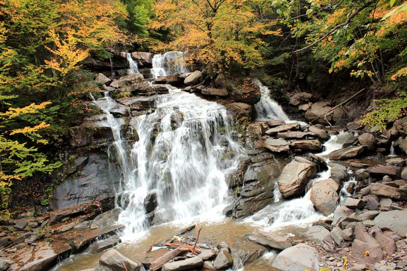
| Drops within waterfall: 3 |
| Total Height: 71' (measured by Dean Goss at Waterfalls of the NE ) |
| Top Elevation: 1,704' |
| Bottom Elevation: 1,633' |
| Type of Waterfall: plunge & cascade |
| Number of Drops: 3 |
| GPS location: N 42 11.487, W 74 04.233 |
| WGS84 location: 42.19145, -74.07055 |
| Deg, Min, Sec location: N42 11 29, W74 04 13 |
| UTM location: 18N 576744, 4671451 |
| Previous or Alternate Names: Sebation Falls, Horse shoe Falls, Rip Van Winkle Falls |
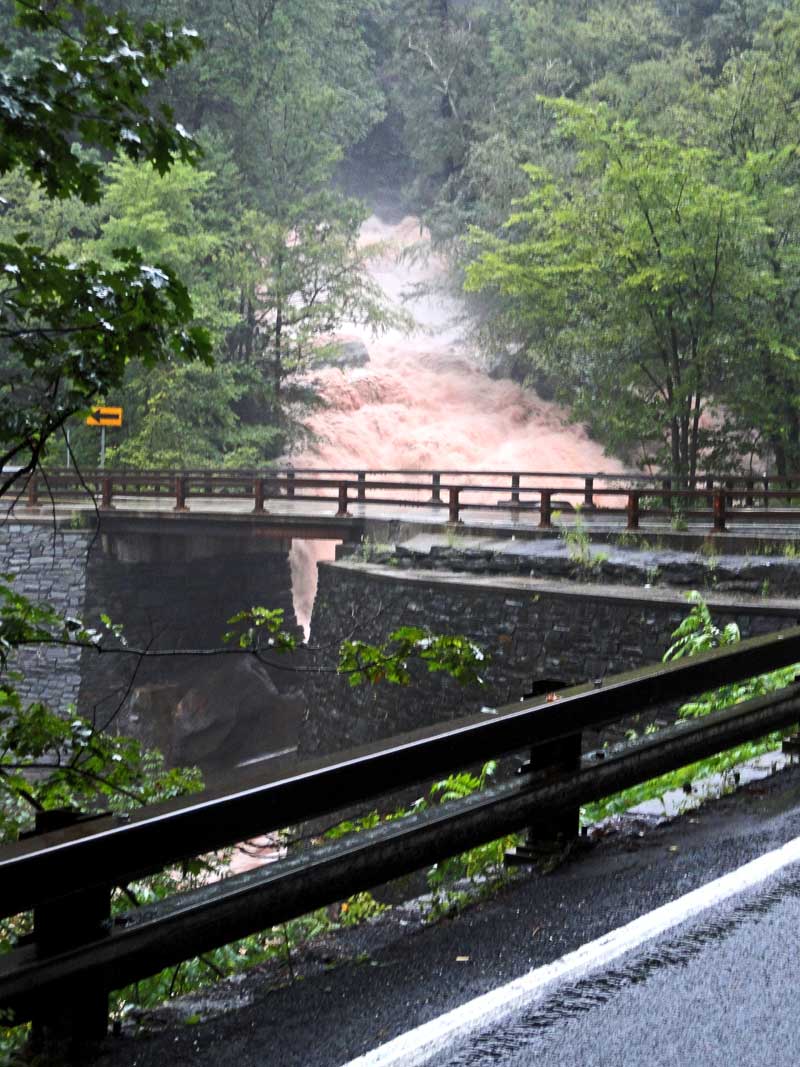
| Description: This waterfall consist of 3 drops. When hiked from the bottom of Lake Creek, it is very difficult to get above the falls. In the middle of the summer the flow of water is very poor. After a rain storm of 4-5" the falls looks the best. When there is 10"+, the falls look scary, and they are dangerous. |
| Hiking Distance: ~0.5 miles (round trip). |
| Best time to Visit: After a large rain storm (4-5" of rain) and in the late afternoon. The sun will shine up the clove late in the afternoon. |
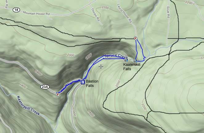
| Trail Information: Hiking Kaaterskill Falls |
| Time: Average 1/2 hours round trip |
| Elevation Loss: 55' from Molly Smith (Rip's Lookout) Parking Lot. |
| Difficulty: Easy |
| Access to top of waterfalls: Hike from Rt 23a |
| Access to bottom of waterfalls: Next to the bridge on Rt 23a (horseshoe turn) |
| Digital Mapper:
Topo
Terrain
Satellite |
| Known Access Safety: These waterfalls can be very dangerous after a rain storm. |
| Known Access Safety: The rocks near the water can be dangerous |
| Known Access Safety: Do NOT cross creek. |
| Known Access Safety: Do NOT hike hear the falls or the trail when creek is raging |
| Known Access Safety: Walking down the road is very dangerous - Walk on the other side of the guard rail on the west bound lane |
| Access Methods: Bastion Falls are right on Rt 23a. |
|
Directions to Trail Head to the Bottom of Kaaterskill Falls from the NYS Thruway |
| Take New York State Thruway to Exit 21 (Catskill). |
| Take a left out of the NYS Thruway entrance road. |
| Go approximately 1/4 mile |
| Take a right onto Route 23 West |
| Go approximately 6.6 miles to Cairo, NY |
| Take a LEFT onto Rt 32. McDonalds Rest. on corner. |
| Go approximately 7.7 miles on Rt 32 |
| Take a RIGHT onto Rt 23A |
| Go approximately 5.7 miles on Rt 23A . |
| After going around the Horseshoe turn (by Bastion Falls), park 1/4 mile past the Falls at Rip's Lookout. |