| |
Colgate Lake Trail |
 |
| |
|
|
|
Maps |
 |
|
 |
|
|
|
| | Notes About Hiking the Colgate Lake Trail |
|
| | TRAIL |
|
| |
The hike to Dutcher Notch from Colgate Lake is in Greene county. The hike is rarely hiked because it never reaches a peak. Many people discount it because it only goes up a couple hundred feet in elevation. This hike is great because of some many other things that you will never see on other hikes. It has five bogs that you can see from the trail. It has four bridges. Beauiful forest. Great trail. Nice apple orchard in a field in the middle of no where. Lots of streams. Good chance of seeing wildlife. You can take children on this hike, with the exception of the muddy section. You can go as far as you like before turning around. .
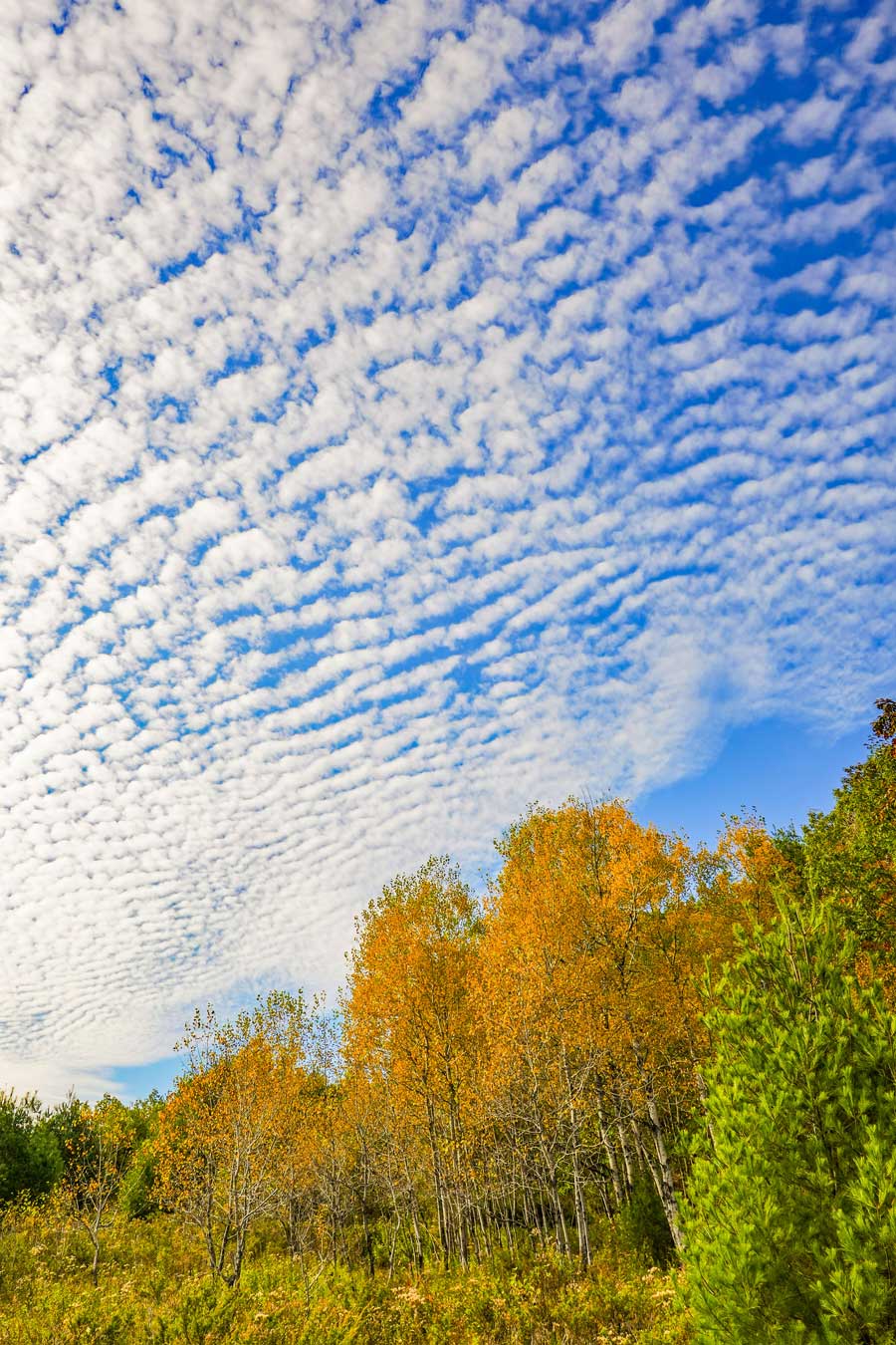
This hike is NOT recommended in the Spring or when there has been lots of rain. It then turns into a giant mud hole. But, in the dryness of the summer, it is a delight. It can also be cross-country skied in the Winter. The Fall season is exceptional. The field at the beginning of the trail is packed with butterflies. Also some rare Yellow butterflies. The forest has a large bird population. If you stop for 5-10 minutes the warblers will start their chatter again.
The field at the beginning of the hike takes you throught a beautiful field. Take some time to see some wildlife and enjoy the views of the surrounding mountains. I should also note that there are a lot of Black Bears in this region. Most of them come out at dusk and dawn. But, you can see them during the day.
The trail to Dutchers Notch is very flat. The trail does go up and down slightly. But, it is a nice cross-country ski trail.
There are five marshes along the trail, and many other marshes in the forest.
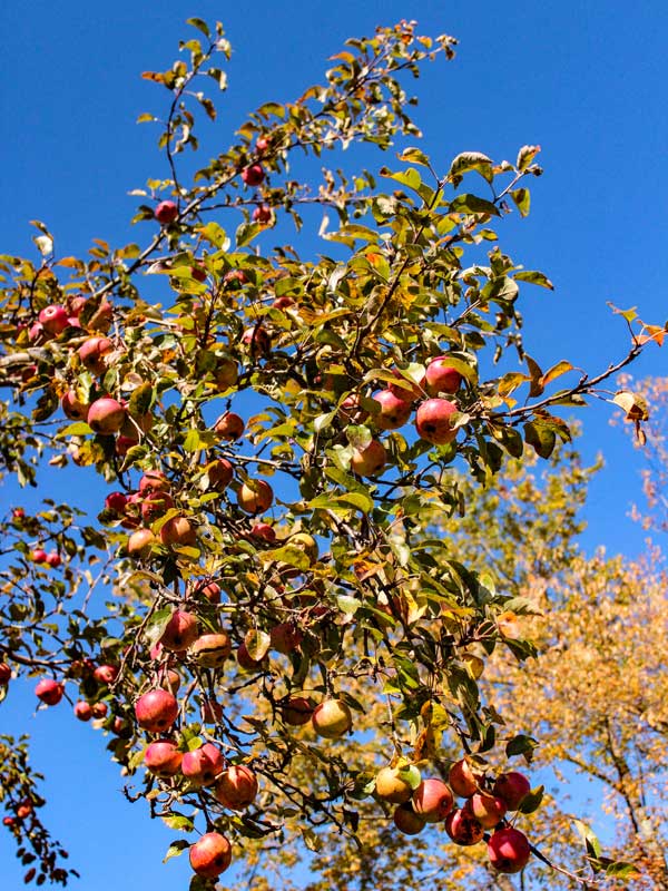
There is a field about 3 miles in where there was probably house at one time. You will find Apple Trees in the field. It is a very unusual place. There is a 15' Water Fall about 750-1000' from the field. There was a mill at the water falls at one time. There are always hikers camping there.
Over 100 years ago, there was a road from the Old Soul Church in Onteora Park that run down the mountain side and ran on the south side of Colgate Lake and Capra Lake. It then went to Dutcher Notch and finally to Round Top, New York. But, this path is rarely hiked. Few know that it even exist.
| |
| | WILDLIFE & PLANTS |
|
| |
The Colgate Lake Trail is a rich ecosystem that offers an experience that you cannot find anywhere else in the Catskill Mountains. You may have the opportunity to see large quantities of butterflies, owls, Mountain Lupines and Iris, large quantities of acorns, apple trees, marshes, large populations of warblers, bald eagles, hawks, turtles, fish, blue herons, and many more great finds.
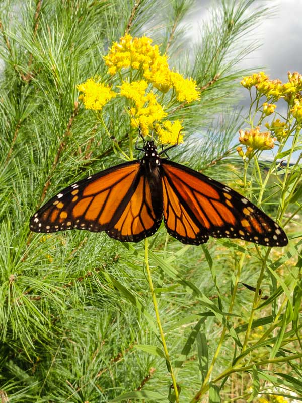
Butterflies, rare plants can be found in the fields by the parking areas. The field where Colgate Lake Trailhead Parking Area (#3) was a field 10-15 years ago, it is now becoming a forest. So, Monarch Butterflies have used this field for years. That will change as it becomes a forest.
There are numerous marshes, ponds, and lakes in this region.
There are a lot of warblers in this trail. If you stop for 5-10 minutes you will suddenly discover that there are many above you in the canopy of the forest. Even in the Winter months.
The East Kill valley (Colgate Lake region) has a good population of acorn trees, which draws other animals to this region.
| |
| | PARKING |
|
| |
The Colgate Trailhead Blackhead Parking Lot holds less then 10 cars. It is possible that this Parking Area can fill up on weekends. There are also two other parking areas before this one around Colgate Lake. The first one is large. There are also campsites on the north side of Colgate Lake. First-come-first serve
| |
| | OTHER INFORMATION |
|
| |
There is cell phone service on some parts of this trail.
|
|
|
| | Directions to COLGATE LAKE TRAILHEAD Parking Area |
| | Colgate Lake Trailhead Parking Area WGS84 (DEC): 42.238534, -74.1164 - Elevation is about 2,166 feet |
| | Colgate Lake Trailhead Parking Area Deg/Min/Sec: N42 14 18, W74 06 59 - Elevation is about 2,166 feet |
| | Colgate Lake Trailhead Parking Area GPS: N 42 14.312, W 74 06.984 - Elevation is about 2,166 feet |
| | Colgate Lake Trailhead Parking Area UTM: 18N 572904 4676639 - Elevation is about 2,166 feet
|
| |
|
| | Directions to Trail Head from New York State Thruway: |
| | Take New York State Thruway to Exit 21 (Catskill). |
| | Take a left out of the NYS Thruway entrance road. |
| | Go approximately 1/4 mile |
| | Take a right onto Route 23 West |
| | Go approximately 6.6 miles to Cairo, NY |
| | Take a LEFT onto Rt 32. McDonalds Rest. on corner. |
| | Go approximately 7.7 miles on Rt 32 |
| | Take a RIGHT onto Rt 23A |
| | Go approximately 9.0 miles to Tannersville NY (6.9 miles if you come from Saugerties from Palenville). |
| | Take a RIGHT at the Red Light in Tannersville onto Rt 23C. |
| | Follow Rt 23C approximately 3.0 miles to Jewett |
| | Take a RIGHT onto Rt 78 to Colgate Lake |
| | Go Approximately 1.7 miles on Rt 78 PAST Colgate Lake |
| | There are TWO DEC parking lots on the LEFT side of the road - You want the SECOND one off of the DIRT Road. |
| | The first parking lot is flat and hold about 25 cars - Second parking lot is on a slight incline and holds 10 cars. |
| | You want to continue past Colgate Lake where the road turns into a dirt road. |
| | GPS: |
|
|
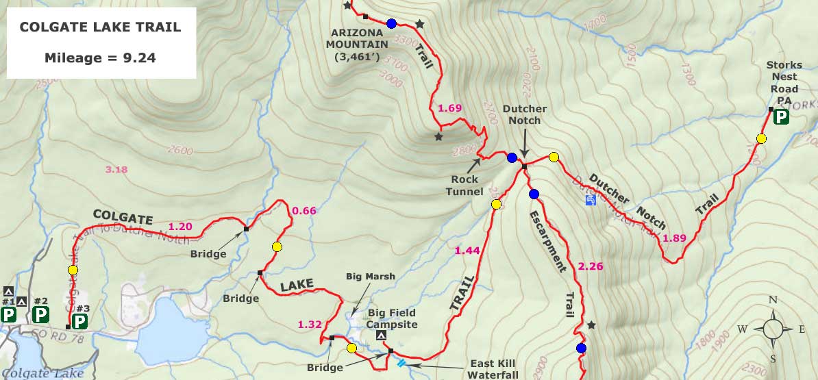
MILEAGE CHART for Colgate Lake Trail |
| | Mile Point | Altitude | Notes |
| | 0.00 | 2,166 | DEC Parking lot #2 on Rt 78. GPS: |
| | 0.18 | 2,204' | DEC registration box. |
| | 1.20 | 2,256' | Bridge #1. |
| | 1.50 | 2,301' | Marsh #1. |
| | 1.80 | 2,227' | Marsh #2 |
| | 1.86 | 2,224' | Bridge #2 |
| | 2.36 | 2,217 | Bridge #3 |
| | | 2.63 | 2,227 | Marsh #3 - Very Large! |
| | 2.75 | 2,227 | Marsh #4 & #5 |
| | 3.10 | 2,246' | Bridge #4 |
| | 3.18 | 2,238' | Field with Apple Orchard & Campsite - Just after Bridge #4. |
| | 3.35 | 2,277' | Waterfall about 150' off trail - listen for water splashing - NO trail to Falls - Easy to miss. |
| | 4.62 | 2,551 | Dutcher Notch |
| | 9.24 | 2,166 | Return to DEC Parking Lot #2 |
|
|
|
Hike of the Colgate Lake Trail |
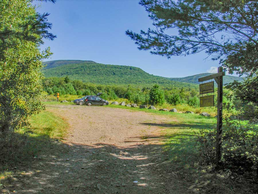 |
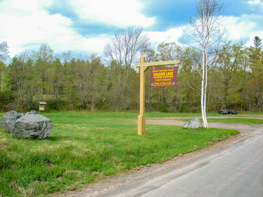
This this is Colgate Lake Trailhead Parking Area. Sometimes referred to as Colgate Lake Parking Lot #3. You will need to drive past Colgate lake to find this parking area. If this parking area is full, go back to the first parking area by Colgate Lake Dam |
|
 |
This is the Colgate Lower Parking Area. Sometimes referred to as Colgate Lake Parking Lot #1. It is located at the end of the Colgate Lake dam. There is a short walk further up the road to the Colgate Lake Trailhead. About 1/4 of a mile. All three parking areas are on the left side of the road. |
|
 |
 |
The picture on the LEFT shows you the trail marker at the road (rt 78) and the DEC Parking Lot #3 |
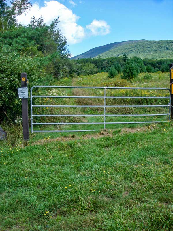
There is a metal fence at the beginning of the trail. This is the Trailhead for the Colgate Lake TrailThe DEC registration box is about 2/10 of a mile past this gate, and at the beginning of the forest. |
|
 |
 |
Monarch Butterflies can be seen in the field near the Colgate Lake Trailhead Parking Area in September. |
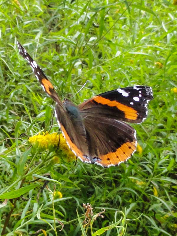
Red Admiral Butterflies can be seen in the field near the Colgate Lake Trailhead Parking Area in September. |
|
 |
 |
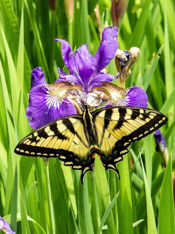
Eastern Swallowtail Butterflies can be seen near the second campsite in mid-June, which can be accessed at the Colgate Lake Parking Area #2. This butterfly is feeding at some Mountain Iris Flowers. |
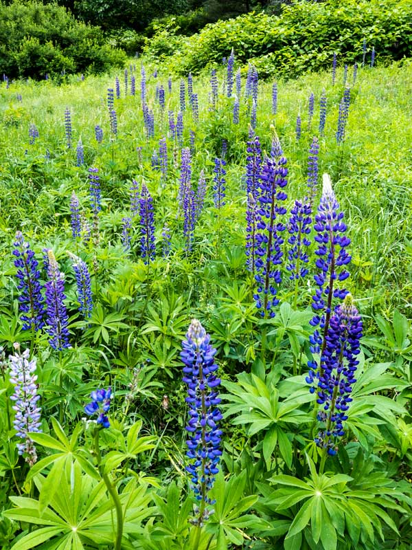
Mountain Lupines can be seen near the second campsite in mid-June, which can be accessed at the Colgate Lake Parking Area #2. It is illegal to pick or cut flowers on NYS land.. It took a hundred years for this patch of Lupines to grow. |
|
 |
 |
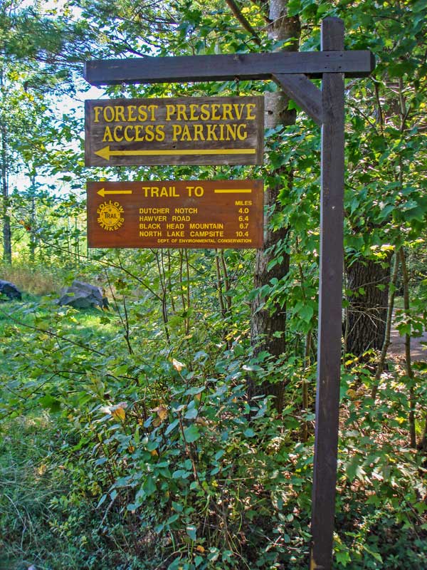
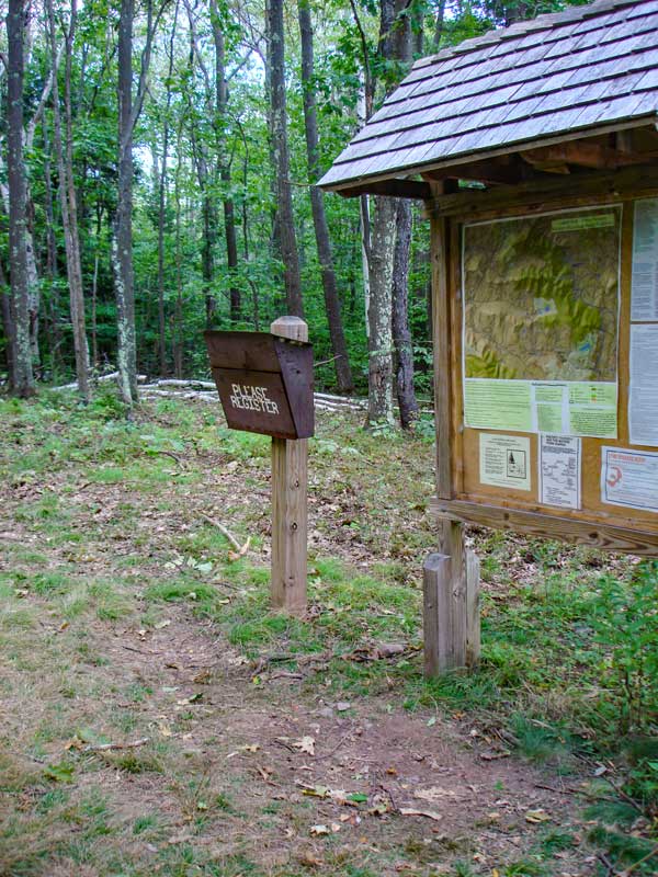
The DEC Registration Box is about 2/10 of a mile from the Colgate Lake Trailhead. The amount of funds dedicated to this trail depends upon how many people register for this hike. |
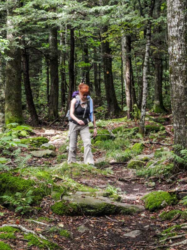
This trail is fairly flat for the entire trip. A real nice walk. But, in the Spring, it is quite muddy. |
|
 |
 |
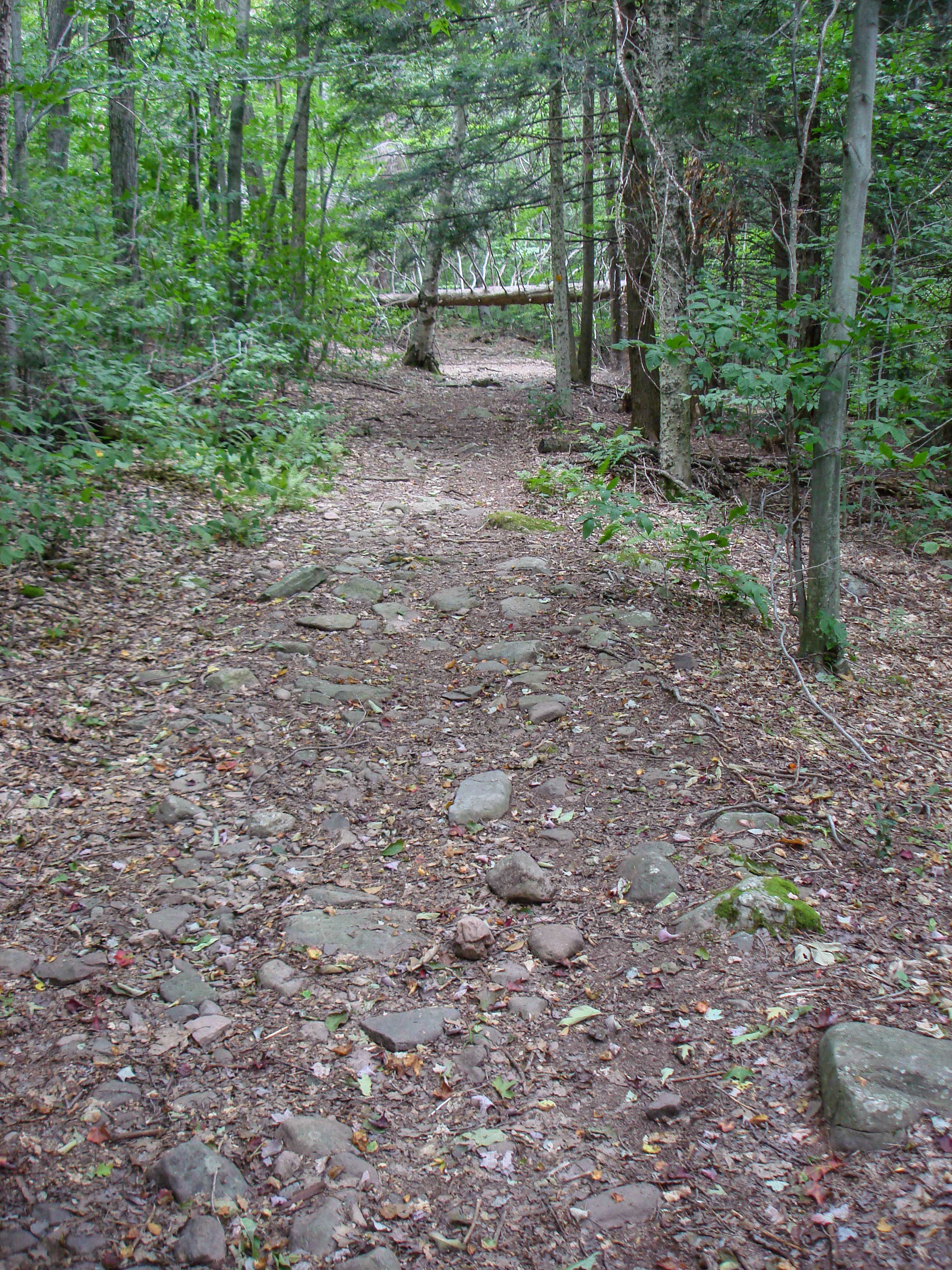
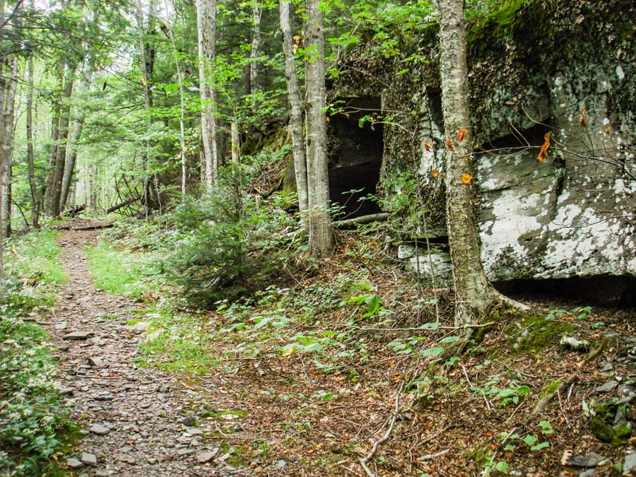
The beginning of the forest walk is rather rocky. But, it does not last long. |
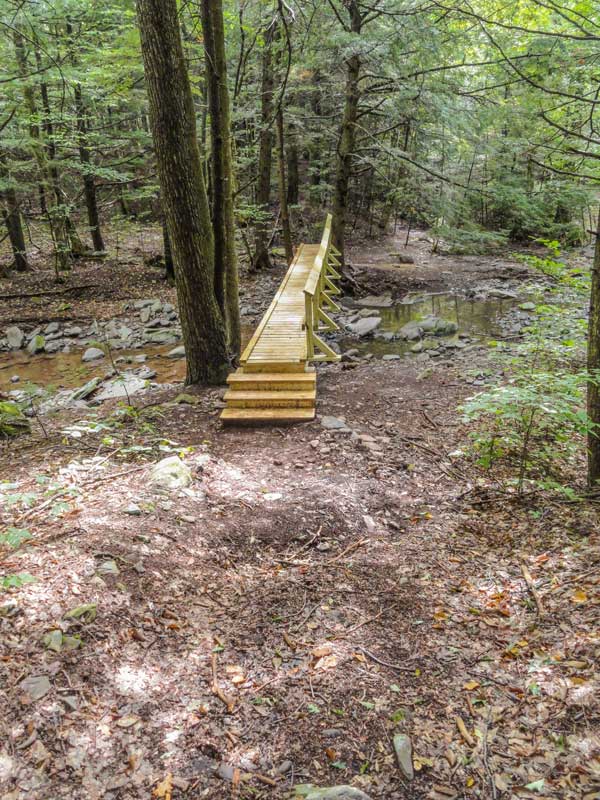
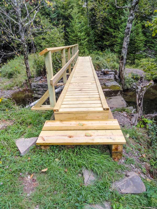
At 1.20 miles you will encounter Bridge #1. After the bridge, you will see a trail pointer. There are quite a few side logging roads. Some of these logging roads continue onto private land owned by Capra Lake. |
|
 |
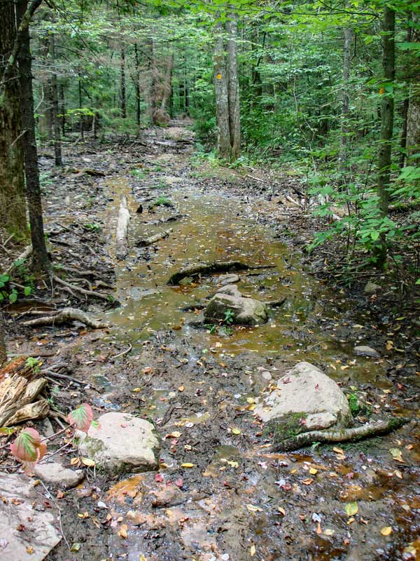 |
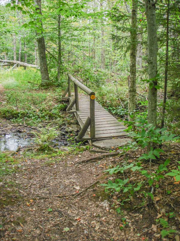
Bridge #2 just before the muddiest section of the Colgate Lake Trail. |
This small section of the trail is muddy almost year around. It only dries up when there is a drought in the summer months. Find the best route around the mud. |
|
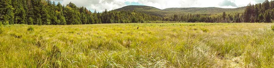 |
At mile post 2.36, you will encounter a very large marsh. It is about 1/4 mile wide. It is not a true peat bog because the water flows in-and-out. But, it is very impressive. If you walk out a ways, you will notice the spongy ground. In the background, you can see West Stoppel Mountain. Some people call West Stoppel and the two mountain to the right the "Three Sisters". |
|
 |
 |
After your visit at the Big Marsh, you will then walk around the marsh through some thick conifer forest. The Balsam trees smell great. |
AThis is the Bridge #3 on the Colgate Lake Trail. It goes over an old bridge that is now gone. |
|
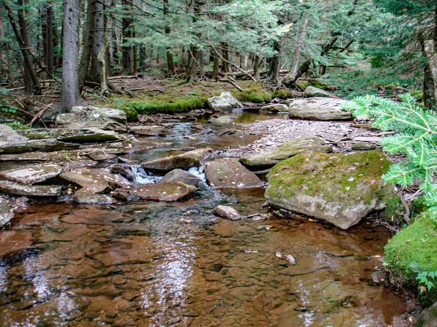 |
This is the steam by bridge #3. It is a very nice stream. Just beyond here are two more marshes near the Big Field. |
|
 |
 |
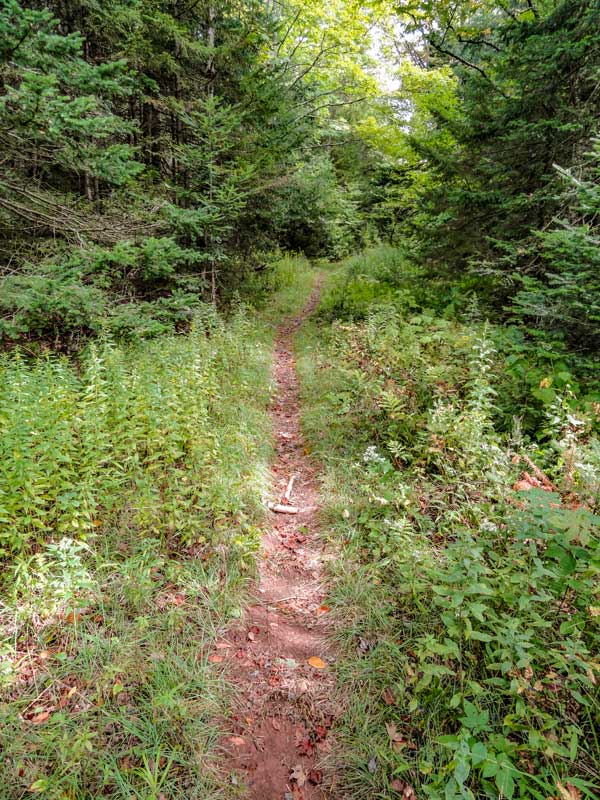
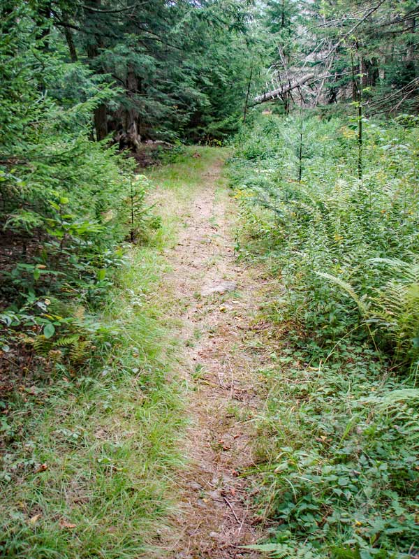
The trail / road continues along a flat course. |
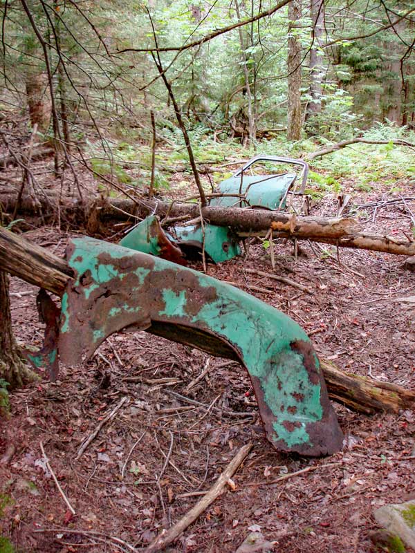
The picture on the RIGHT shows some old cars parts from the 1940's. |
|
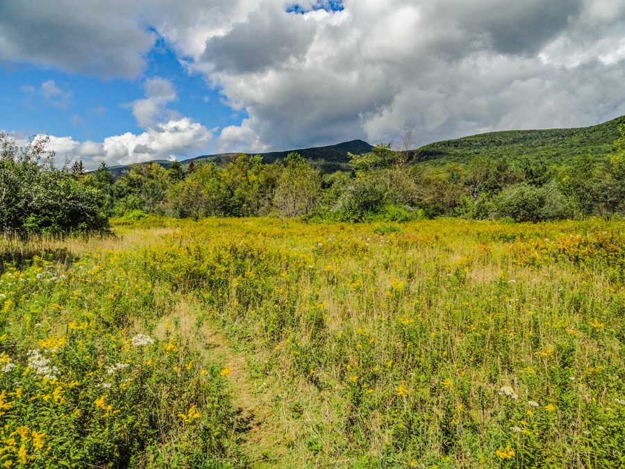 |
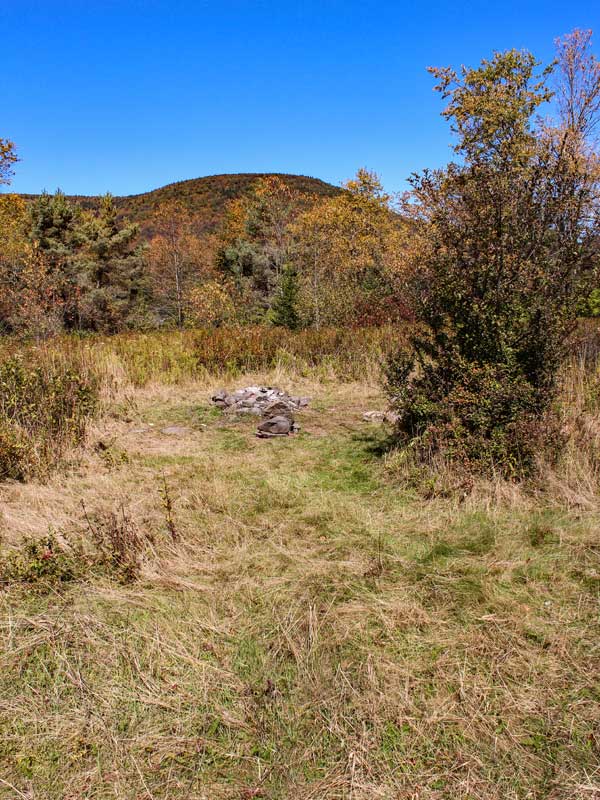
This is a picture of the Big Field. It has a number of old apple trees. There is also a place where people camp. This used to be an old homestead. |
|
 |
 |
This is a picture of the camping site and the fire ring. |
In September the apple trees have thousands of ripe apples for the picking. Since this orchard is about 100 years old, the apples are edible, but not as tasty as what you get at the store. |
|
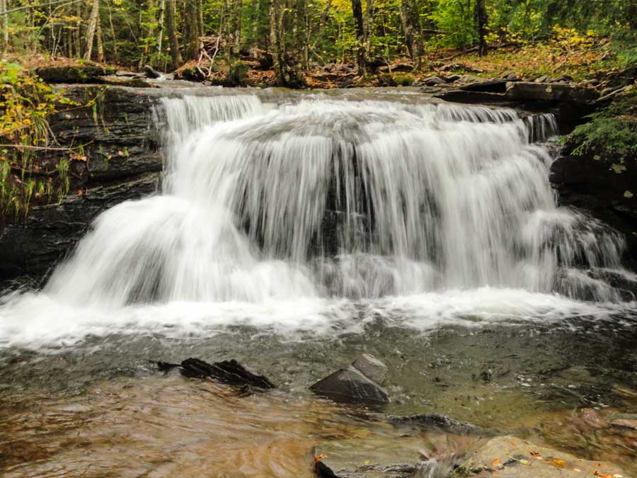 |
At mile post 3.35 (750-1000' from the field) is the East Kill WaterFall about 150' off the trail. Listen for the water falling. The water falls are about 15' high. The pool of water below the falls are about 5 feet deep. After a good rain storm, it flows like this. In the summer months the flow is much slower. |
|
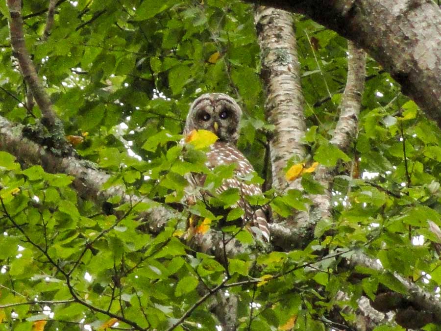 |
Barred Owls can be found near the Escarpment Trail and down near the Big Field in the summer and fall months. |
|
 |
As you approach Dutcher Notch the trail will increase in elevation slightly. You will also see rocks on the right, and the trail will sit on the edge of a steep bank. |
|
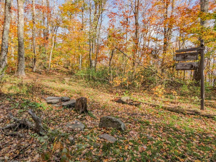 |
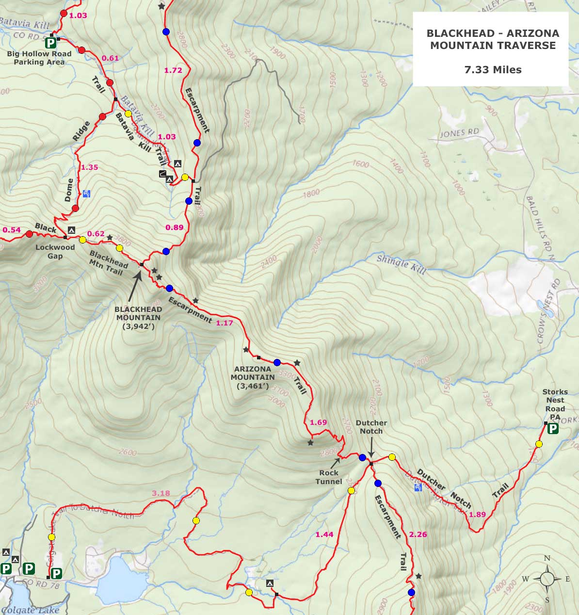
When you get to Dutcher Notch, you will come to a 4-way intersection of trails. Left till take you to Arizona Mountain and Blackhead Mountain. Right will take you to Stoppel Point and North Mountain. Straight will take you to Round Top via the Dutcher Notch Trail. This is the end of the hike, so turn around and head back to your car using the same trail. Hope you enjoyed this hike. |
|
|
S E C T I O N S
|
W E A T H E R
|
O T H E R
|