Windham High Peak
|

|
|
OVERVIEW |
| | Trail Name: |  Escarpment Trail (Rt 23 to Windham High Peak)
 |
| | | |
| | Parking Area : | Elm Ridge - Escarpment Parking Area off Rt 28) |
| | Winter Access: | Parking Area is Plowed in the Winter |
| | Camp sites: | 1 Camp Site location |
| | Lean-to sites: | 1 Lean-to |
| | | |
| | Trail Length: | 3.80 miles (one-way) or 7.60 (round-trip) |
| | Trail Type: | Single-track trail |
| | Hiking Time: | Average 5 hours round trip |
| | Highest Elevation: | 3,525' (A) |
| | Elevation Gain (Slide): | Gain of 1,750' |
| | Views : | 2 view spot |
| | Difficulty: | Easy |
| | Access Methods: | Foot and Snowshoeing. |
| | | |
| | USGS Map: | USGS Hensonville Quad Maps |
| | | | |
| | DEC Trail Map: | DEC Elm Ridge Wild Forest Map |
| | | | |
| | DEC Trail Map: | DEC Windham-Blackhead Wilderness Map (free) |
| | | | |
| | Digital Mapper: |
Topo
Terrain
Satellite |
|
|
Maps |
 |
|
|
| | Directions to Trail Head from New York State Thruway |
| | Elm Ridge Parking Area WGS84 (DEC): 42.3127, -74.19035 - Elevation is about 1,710 feet |
| | Elm Ridge Parking Area Deg/Min/Sec: N42 18 45, W74 11 25 - Elevation is about 1,710 feet |
| | Elm Ridge Parking Area GPS: N42 18.762, W74 11.421 - Elevation is about 1,710 feet |
| | Elm Ridge Parking Area UTM: 18N 566724 4684813 - Elevation is about 1,710 feet
|
| |
|
| | Get off New York State Thruway at Exit 21 (Catskill). |
| | Take a LEFT out of the NYS Thruway entrance road. |
| | Go approximately 1/4 mile |
| | Take a right onto Route 23 West |
| | Go approximately 20.2 miles on Route 23. |
| | Take a RIGHT onto Cross Road - DEC parking lot is on the corner - DEC parking lot - Holds 50 cars |
|
|
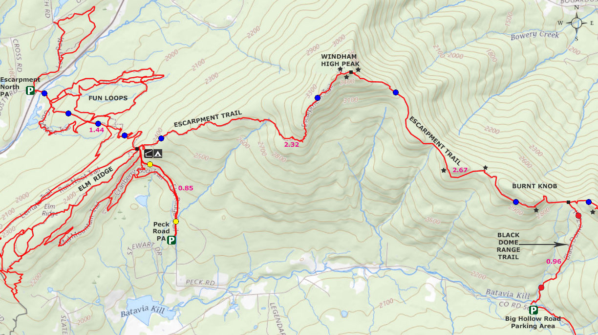
MILEAGE CHART for Windham High Peak |
| | Mile Point | Altitude | Notes |
| | 0.00 | 1,775' | DEC Parking lot on Rt 23 / Cross Road. |
| | 1.43 | 2,317' | Trail Junction for Elm Ridge Trails. Go STRAIGHT. |
| | 1.44 | 2,319' | Trail Junction. Go LEFT to Windham High Peak. |
| | 1.47 | 2,341' | Lean-To & Campsite on right. |
| | 1.61 | 3,487' | DEC 3500' sign. |
| | 3.66 | 3,516' | View Point #1 near Windham High Peak. |
| | 3.66 | 3,517' | View Point #2 near Windham High Peak. |
| | 3.76 | 3,525' | Windham High Peak & USGS Marker |
| | 3.80 | 3,507' | View Point #3 near Windham High Peak (slightly beyond summit) |
|
|
Hike of Windham High Peak from Rt 23 |
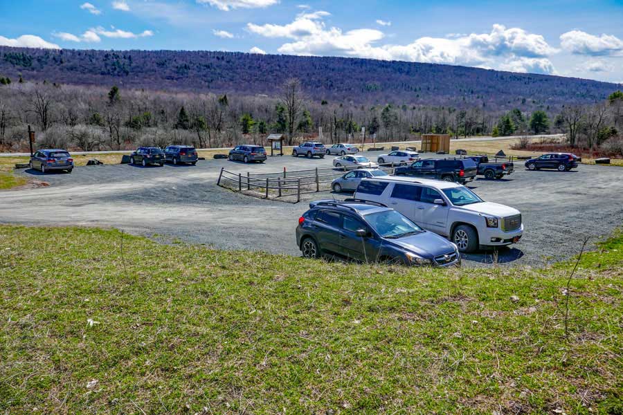 |
This the Escarpment North Parking Area. It holds about 40 cars
|
|
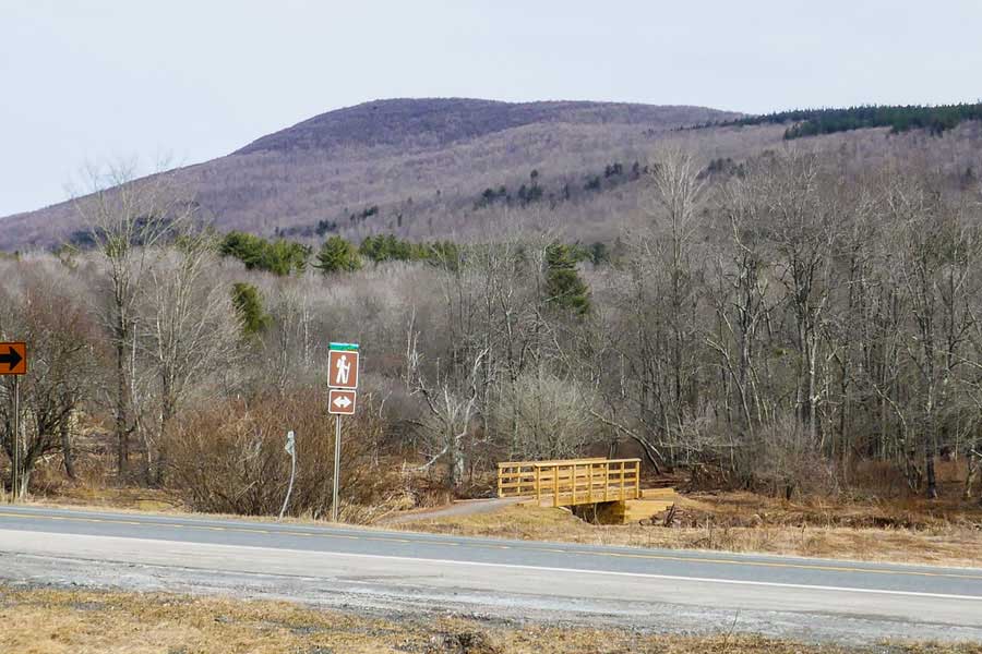 |
To get to the Trailhead, walk across Rt 23 and head towards the wooden bridge you see in the picture above. |
|
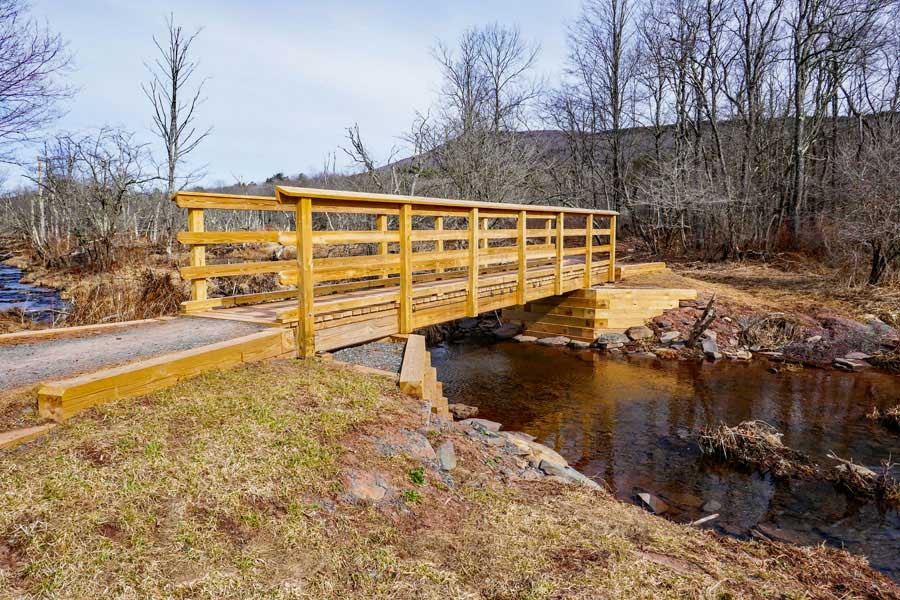 |
This is the bridge that goes across is creek. After a large rain storm, water can flow over the bridge. |
|
 |
 |
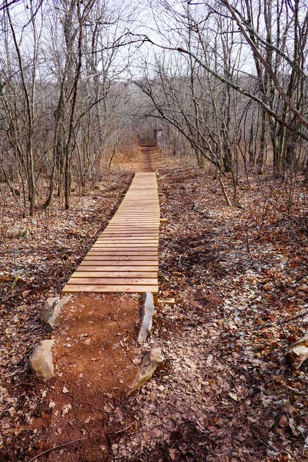
There is a muddy section, so walk on the wooden walkway. After a large rain storm, this section can be under water. |
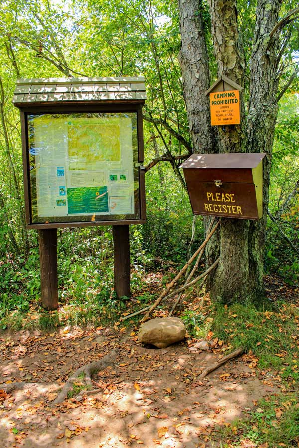
Register for your hike here. Registering allots money for trail maintenance and can be used by Rangers to find you if you go missing or are injured. |
|
 |
 |
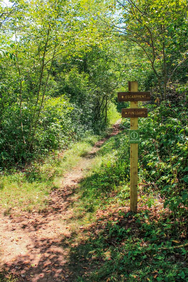
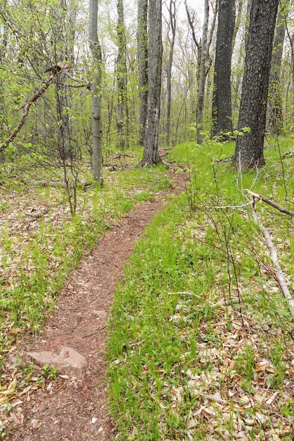
After registering for your hike head straight up the Escarpment Trail. Shortly, you will enter the forest from the grass land. |
As you hike up the Escarpment Trail, you will see several Mountain bike Trail for the Fun Loops and Elm Ridge. Keep going straight. |
|
 |
 |
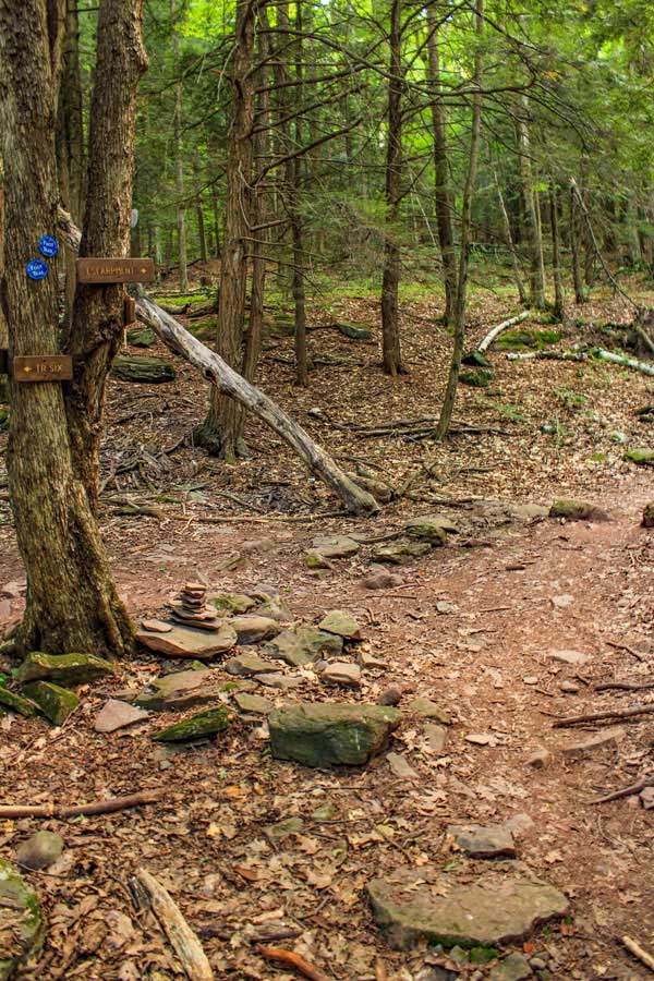
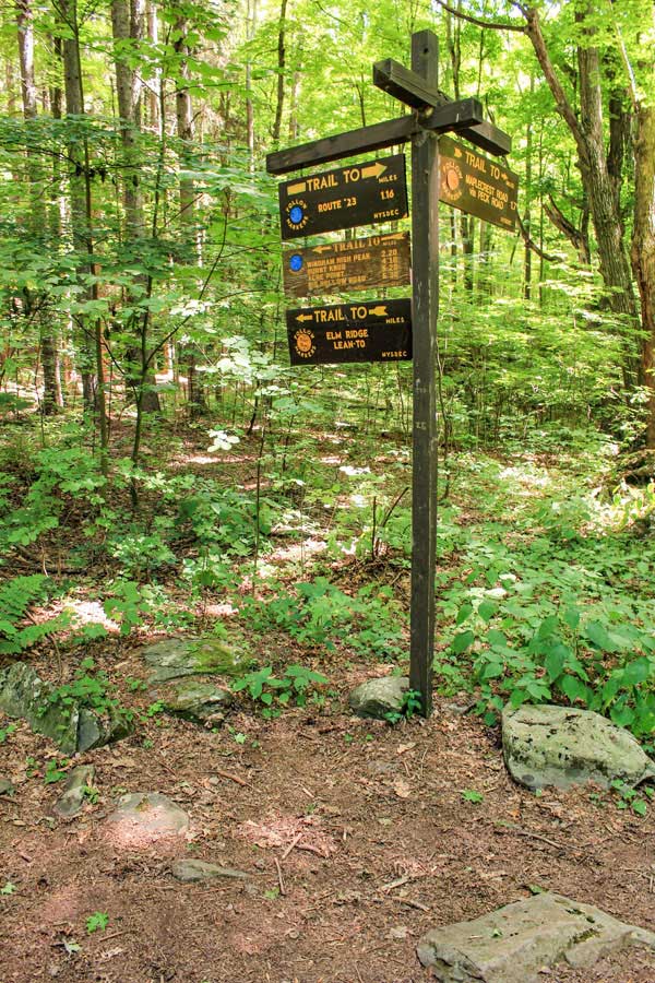
When you reach the top of Elm Ridge, you will come to a 4-way Trail Junction. You want to go LEFT up to Windham High Peak. Straight will take you to Peck Road Parking Area. Right will take you on the Mountain Bike Trails in Elm Ridge. |
This is the Escarpment Trail as it starts to climb up Windham High Peak Mountain. |
|
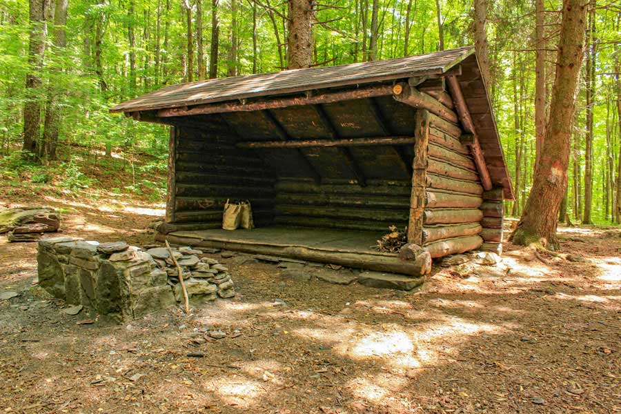 |
After a short distance you will see a trail on the right. The side trail will take you to the Elm Ridge Lean-to. Behind the Lean-to is a primitive campsite. If there is room in the Lean-to you MUST share it with other hikers that arrive after you. |
|
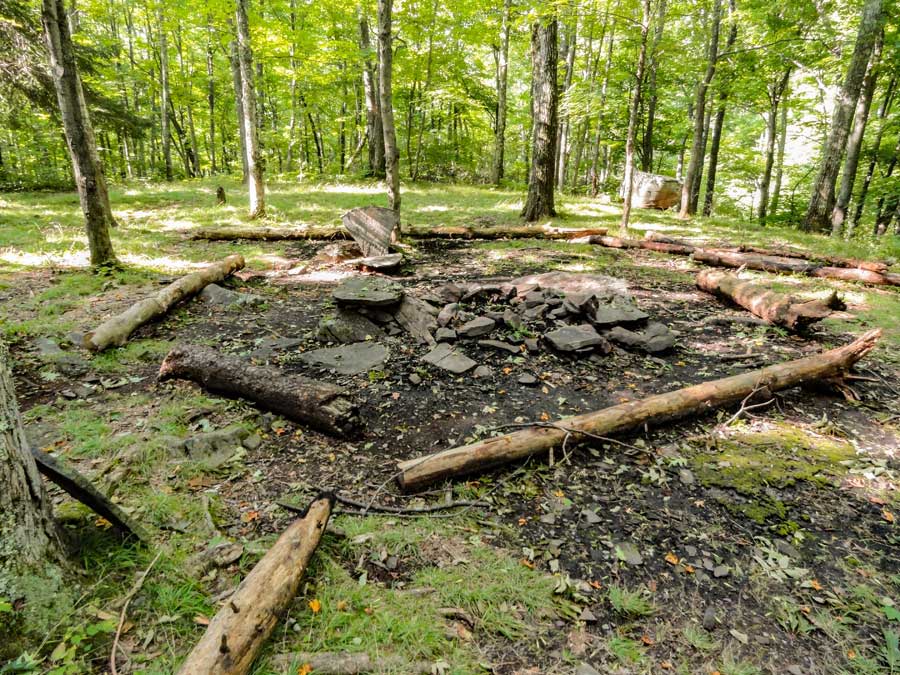 |
This is the DEC Primitive campsite behind the Lean-to. |
|
 |
 |
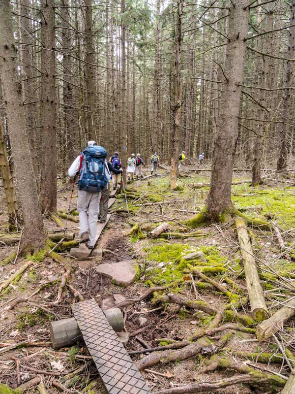
About half way to the summit of Windham High Peak, you will hike through a dense conifer forest. |
After the conifer forest, you will encounter a small steep section as you wind around the south side of Windham High Peak |
|
 |
 |
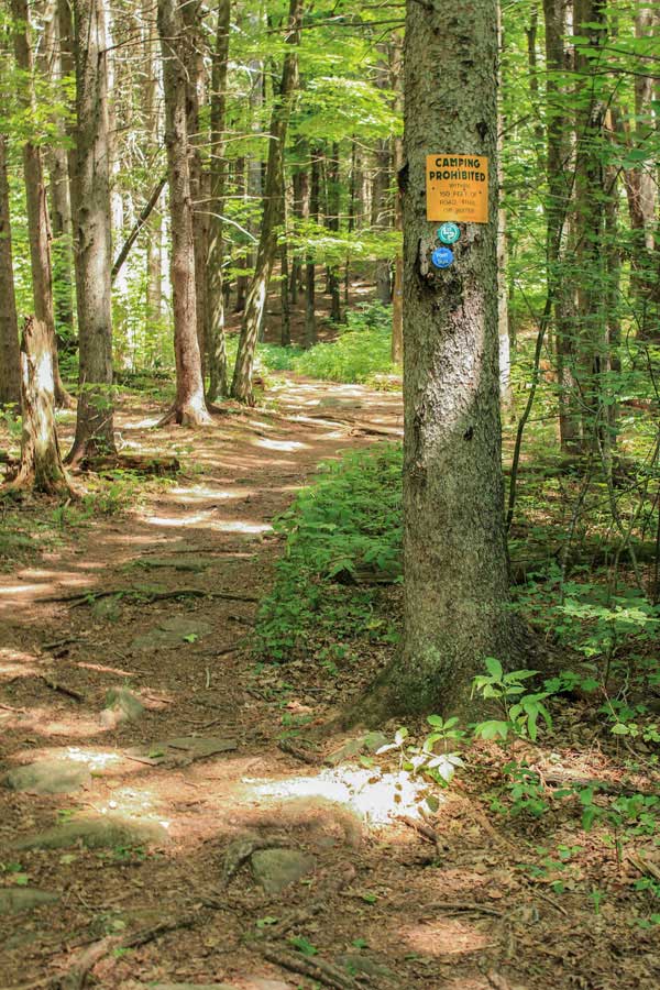
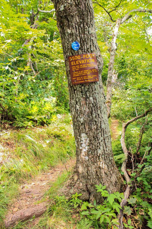
As you get close to the summit of Windham High Peak, you will see a 3500 foot elevation sign. You cannot camp above this point in the Spring, Summer or Fall. |
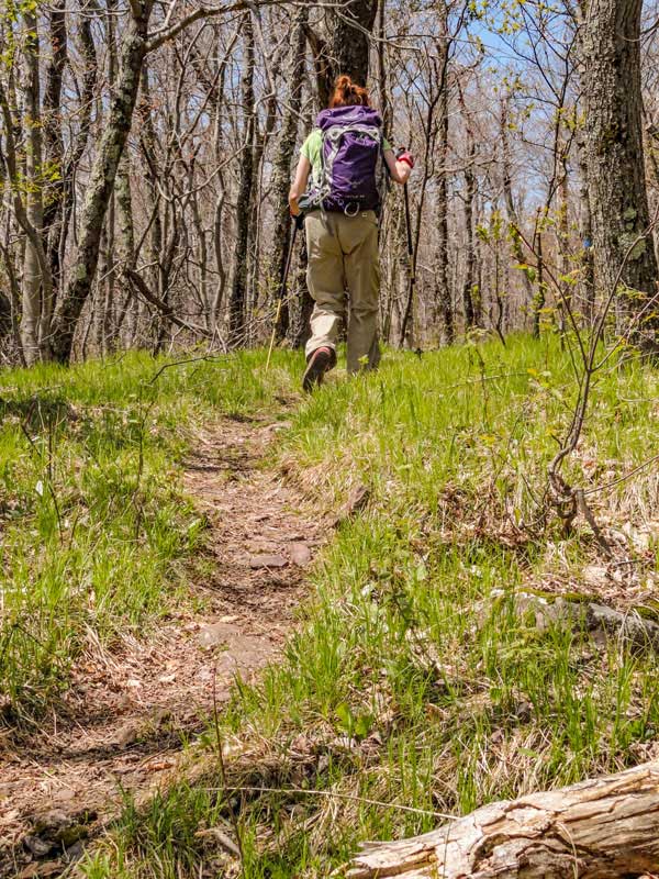
After the 3500 foot elevation sign, the trail will be fairly flat as you approach the summit of Windham High Peak. |
|
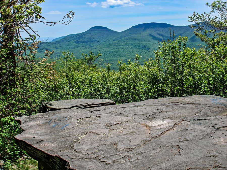 |
This is one of the three view points on the summit of Windham High Peak. The mountains in the distance are Blackhead Mountain (left), Black Dome Mountain (center), and Thomas Cole Mountain (right). On a clear day it is a very nice view. |
|
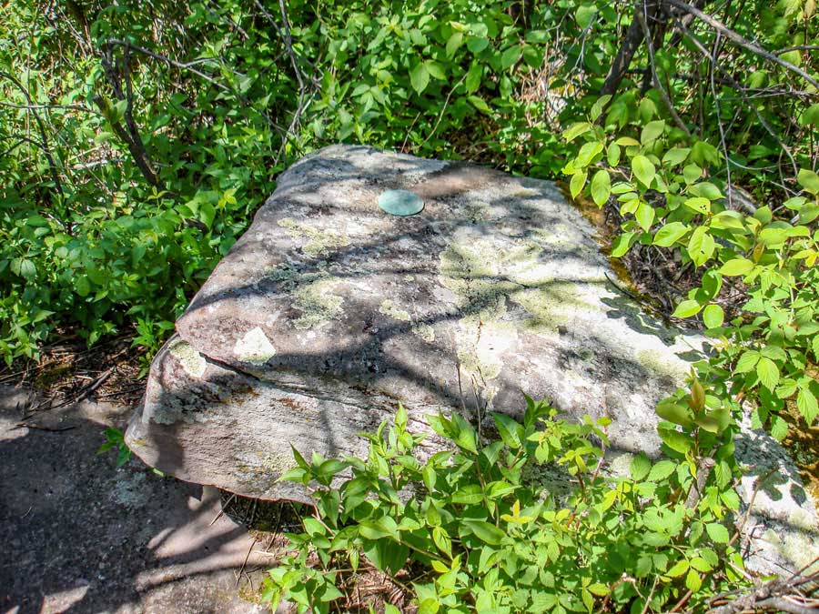 |
This is the summit of Windham High Peak with three USGS Markers. |
|
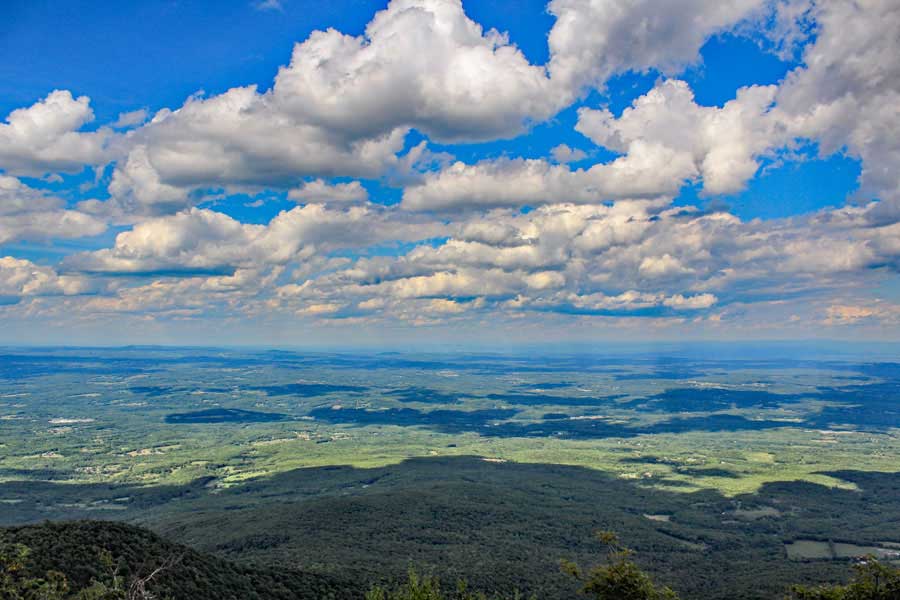 |
This is the view of the Hudson Valley looking northeast. It is the last view point near the summit of Windham High Peak |
|
|
S E C T I O N S
|
W E A T H E R
|
O T H E R
|