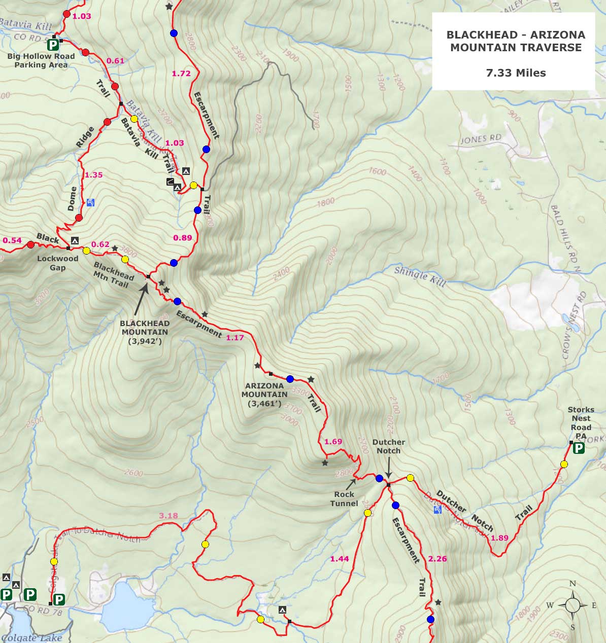
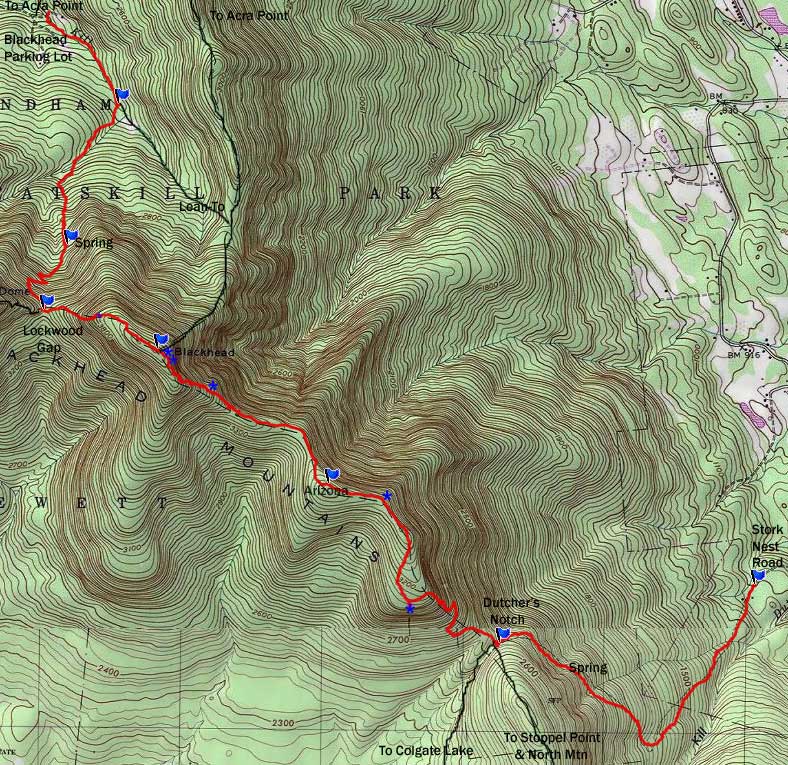
Blachead Mountain to Arizona Mtn to Dutcher's Notch
|
|
|
| |
OVERVIEW |
| | Trail Name: |  Black Dome Ridge Trail (Big Hollow PA to Batavia Kill Trail)
 |
| | Trail Name: |  Blackhead Mountain Trail (Blackhead Summit to Lockwood Gap)
 |
| | Trail Name: |  Escarpment Trail (Batavia Kill Trail to Blackhead Mtn Summit)
 |
| | Trail Name: |
Dutcher's Notch Trail (Dutcher's Notch to Stork Nest Road) |
| | | |
| | Parking Area : | Big Hollow Road Parking Area - Not plowed |
| | Parking Area : | Stork Nest Road Parking Area - Not plowed |
| | Winter Access: | Parking Areas are NOT plowed in the Winter |
| | Camp sites: | 1 Camp Site location near Lockwood Gap |
| | Lean-to sites: | NO Lean-to on this route |
| | | |
| | Trail Length: | 7.33 miles |
| | Hiking Time: | Average 4-5 hours round trip |
| | Trail Type: | 100% Single-track trail |
| | Elevation Gain: | 1,945' from parking lot to Blackhead (2,010' to 3,955') |
| | Elevation Loss: | 2,751' from Blackhead to parking lot (3,955' to 1,204') |
| | Blackhead Elevation: | 3,942' (A) |
| | Arizona Elevation: | 3,461' (A) |
| | Views : | Many view spot |
| | Difficulty: | Difficult |
| | Access Methods: | Foot and Snowshoeing. |
| | | |
| | USGS Map: | USGS Freehold Quad Maps |
| | | | |
| | USGS Map: | USGS Kaaterskill Quad Maps |
| | | | |
| | DEC Trail Map: | DEC Windham-Blackhead Wilderness Map (free) |
| | | | |
| | Digital Mapper: |
Topo
Terrain
Satellite |
|
|
Maps |
 |
|
 |
|
|
|
| | Notes About Hiking to Blackhead & Arizona Mountains |
|
| | TRAIL |
|
| |
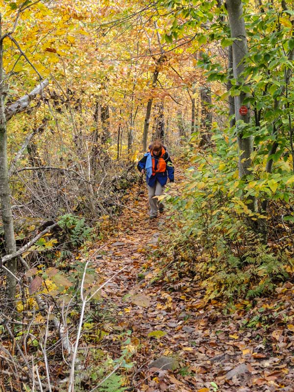
Parts of this route see very little traffic. The section between Blackhead Mountain Summit and Dutcher's Notch is rarely used. But, this section has some exceptional terrain. There is a nice 2 mile flat walk on a smooth trail around Arizona Mountain. It is a very nice walk. In the Fall season, the foliage is excellent.
The hike over Blackhead Mountain is difficult and there is quite a bit of elevation gain. But, some of the views from Blackhead are excellent. The hike over Arizona Mountain is excellent. The view over the East Kill Valley is one of the best in the Catskill Mountains.
At the end of this hike, you will be hiking 3/4 of a mile on private property and you will pass within 30' of some's private home. PLEASE respect the home owner.
| |
| | PARKING |
|
| |
The Blackhead Parking Lot and the beginning of the trail is on Private Property. PLEASE respect the home owners. Do NOT block the driveway entrance in the parking area. The Big Hollow Road Parking area is NOT plowed in the winter. Some hikers park on the side of Big Hollow Road. The Big Hollow Parking Area does fill up on weekends.
| |
| | OTHER INFORMATION |
|
| |
There is NO cell phone service at the Big Hollow Road Parking Area and at certain locations on the trail. At higher elevations there is cell service.
|
|
|
| | Directions to STORK NEST ROAD Parking Area |
| | Stork Nest Road Parking Area WGS84 (DEC): 42.25295, -74.053317 - Elevation is about 1,204 feet |
| | Stork Nest Road Parking Area Deg/Min/Sec: N42 15 10, W74 03 11 - Elevation is about 1,204 feet |
| | Stork Nest Road Parking Area GPS: N 42 15.177, W 74 03.199 - Elevation is about 1,204 feet |
| | Stork Nest Road Parking Area UTM: 18N 578091 4678295 - Elevation is about 1,204 feet
|
| |
|
| | Take New York State Thruway to Exit 21 (Catskill). |
| | Take a left out of the NYS Thruway entrance road. |
| | Go approximately 1/4 mile |
| | Take a right onto Route 23 West |
| | Go approximately 10.7 miles on Rt 23 (past Cairo, NY and up the hill towards Windham) |
| | Take a left onto Route 31 to Round Top, NY |
| | Go approximately 3.7 miles on Rt 31 |
| | Take a RIGHT onto Maple Lawn Road |
| | Go approximately 1.3 up Maple Lawn Road. |
| | At the top of the hill take a LEFT onto Floyd Hawver Road. |
| | Go approximately 200' |
| | Take a RIGHT onto Stork Nest Road |
| | Follow Stork Nest Road to the very end (0.6 miles) |
| | Park on the left side - Do NOT go up the driveway. |
| | Parking lot holds 5 cars. |
| | Drop your first car off here.
|
|
|
| | Directions to BIG HOLLOW ROAD Parking Area |
| | Big Hollow Road Parking Area WGS84 (DEC): 42.289297963, -74.116077991 - Elevation is about 2,194 feet |
| | Big Hollow Road Parking Area Deg/Min/Sec: N42 17 21, W74 06 57 - Elevation is about 2,194 feet |
| | Big Hollow Road Parking Area GPS: N 42 17.358, W 74 06.965 - Elevation is about 2,194 feet |
| | Big Hollow Road Parking Area UTM: 18N 572872 4682276 - Elevation is about 2,194 feet
|
| |
|
| | Go back down to the bottom of Stork Nest Road |
| | Take a LEFT onto Floyd Hawver Road - Go about 200'. |
| | Take a RIGHT onto Maple Lawn Road - Go 1.3 miles until the 4-way Intersection |
| | Take a LEFT onto Route 31 - Go approximately 3.7 miles |
| | Take a LEFT onto Route 23 at the 4-way intersection |
| | Go somewhere around 10.4 miles on Route 23. |
| | Take a left onto County Rt 65 (Main Care Gas Station on Right - Condos on left). |
| | Go approximately 0.7 miles on Route 65. |
| | Take left onto Rt 65A. |
| | Go approximately 0.3 miles on Rt 65A . |
| | Continue Straight onto Rt 40 after stop sign. |
| | Go approximately 1.8 miles on Rt 40. |
| | Take a left onto Rt 56 (3-way intersection in Maplecrest). |
| | Follow Rt 56 approximately 4.2 miles |
| | Continue off the asphalt road to the gravel road until you reach the DEC parking lot. |
| | In the Winter you can park at the end of the road - BUT do NOT prevent snow plows from turning around at the end of the road!!! |
| | Do NOT block driveway in the DEC parking lot. This goes to someones house. |
| | Do NOT drive beyond the DEC parking lot. This is someones driveway. |
| | Land around the DEC parking lot and the beginning of the trail is PRIVATE land. Please respect private landowners. |
|
|
MILEAGE CHART for Blackhead-Black Dome-Thomas Cole Mtns |
| | Mile Point | Altitude | Notes |
| | 0.00 | 2,010' | Blackhead Parking lot. |
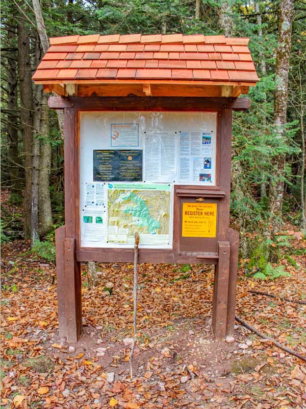
| | 0.00 | 2,010' | DEC registration box is located at the Blackhead Parking Lot Kiosk. |
| | 0.70 | 2,225' | Trail Junction - Take a RIGHT. |
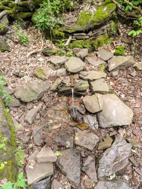
| | 1.50 | 2,955' | Good Water Source! Very reliable and ONLY water source for the next 3 miles. |
| | 2.04 | 3,184' | Lockwood Gap Trail Junction - Take a LEFT. |
| | 2.69 | 3,955' | Summit of Blackhead Mountain - No view from the summit |
| | 3.86 | 3,461' | Summit of Arizona Mtn |
| | 4.96 | 3,155' | Great views over the East Kill Valley - view is 100' off the trail |
| | 5.55 | 2,557' | Trail Junction - Dutcher's Notch - Take a LEFT |
| | 7.44 | 1,204' | End of hike - Parking Lot at the end of Stork Nest Road |
|
|
|
Hike to Blackhead & Arizona Mtns to Dutcher's Notch |
 |
 |
In the summer months you will park in the DEC designated Parking Lot. In the Winter months, the DEC PA is not plowed and you need to park near the snow plow turnaround. Do NOT block the ability of the snow plows to turnaround. They will tow your car if you do block their ability to turn around at the end of the road. Do not block the road above the DEC PA or the driveway entrance in the DEC PA. These are private driveways.
You SHOULD register in the DEC Register. It is located in the Kiosk in DEC PA. The registration book is vital for Search-and-Rescue in case you are injured or lost. A hiker died in 2010 because he didn't tell them where he was going. |
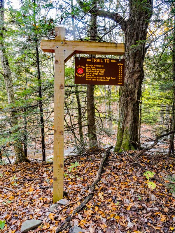
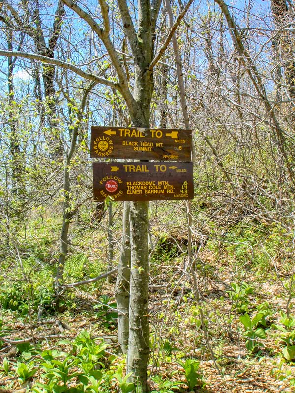
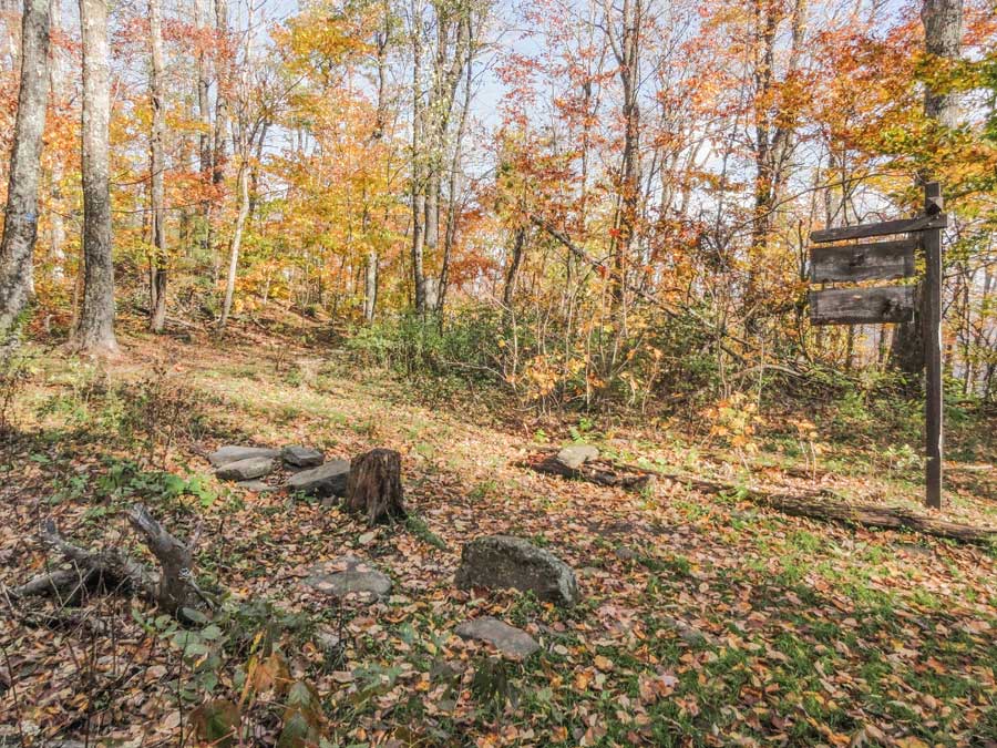
Walk UP the road. You will see the sign on the LEFT side of the trail. The trail will continue past this sign. The trail to Blackhead starts on the RIGHT side of the creek. There is another trailhead to ACRA POINT. The Acra Point trailhead starts DOWN the road. |
|
 |
 |
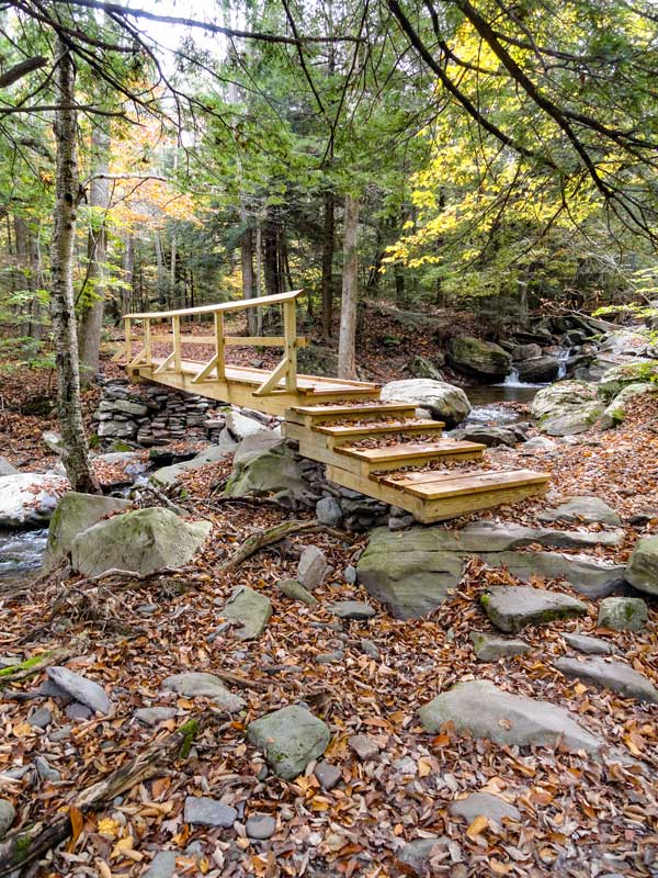
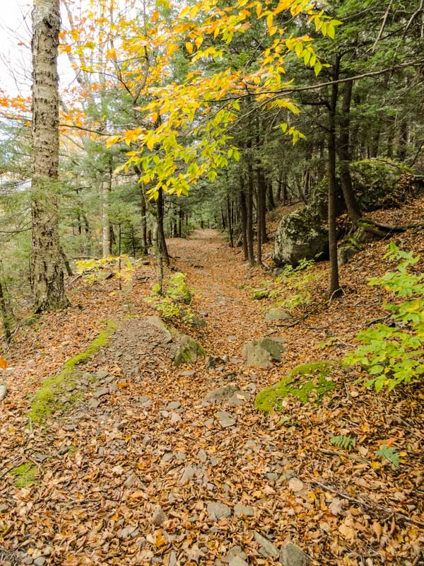
After you walk past the DEC sign the trail will change from a 10' wide road to a 4' wide rocky path. As you walk up the trail, the trail will move to the left side of the creek. This is the first bridge you will cross. Please stay on the trail. Parts of this trail are on private land. |
After walking up the left side the creek for a while, you will encounter another bridge. You will then move back to the right side of the creek until you reach the Trail Junction to Blackhead and Black Dome Mountains. |
|
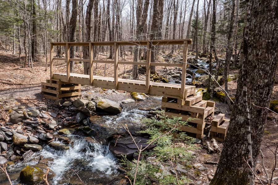 |
This is the third wooden bridge on this trail. Do NOT take the bridge. You want to go right and stay on the right side of the creek.
|
|
 |
 |
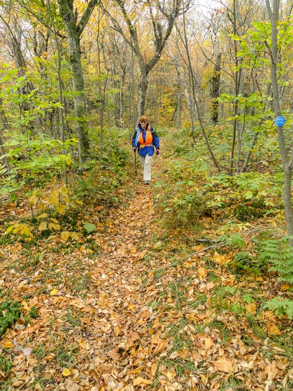
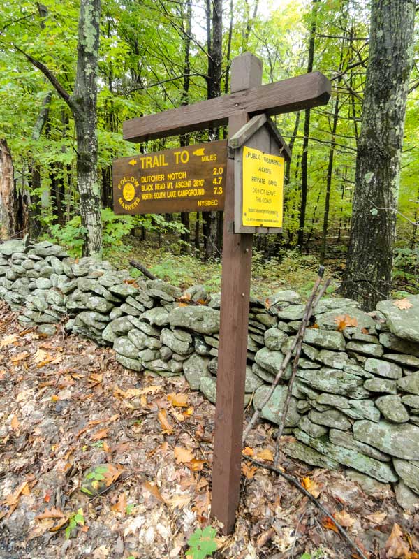
About 6/10 of a mile from the very end of Big Hollow Road and the Trailhead, you will come to a Trail Junction. Or, 7/10 of a mile from Big Hollow Road Parking Area. You want to go RIGHT at the Trail Junction. Left over the bridge will take to the Lean-To, campsites, and the Northeast route to the summit of Blackhead Mountain. The Northeast Route is very steep. For this hike we will be taking the NORTHWEST Route, which is easier. So you want to take a RIGHT at the Trail Junction. |
This is the Black Dome Ridge trail beyond the third bridge. In the beginning it is pretty easy hiking. But, the further you hike, the steeper the trail becomes. It is not as steep as the northeast side, but a steady uphill incline that seems to go on forever. As you approach Lockwood Gap, you will go through some switchbacks that make the hiking easier. |
|
 |
 |
About 1.5 miles from the Blackhead parking lot there is a Water Spring. This is an excellent water source that never seems to dry up. If you need water for your trip, you need to collect it here. |
At about 2 miles, you will arrive at Lockwood Gap. At Lockwood Gap there is a second Trail Junction. Right will take you to Black Dome Mountain. Left will take you to the summit of Blackhead Mountain. You want to take a LEFT. |
|
 |
 |
As you ascend up Blackhead Mountain, the view backwards is quite nice. About half way up the view of Black Dome Mountain will come into view if you take the time to turn around. |
After you go up a small switchback, you will come to an excellent view point of Black Dome Mountain. At this point you are entering the summit region of Blackhead Mountain. |
|
 |
This is another picture of the excellent view point on the Blackhead Mountain Trail. The mountain in the distance is Black Dome Mountain. While you are done with most of the elevation gain to the summit of Blackhead Mountain, you still have about another 1/4 mile walk across the long summit to reach the official summit of Blackhead Mountain. |
|
 |
 |
After about 2.7 miles you will reach the summit of Blackhead Mountain. There is no view from the official summit. Years ago, the summit was bare, and the views were spectacular. There is also a Trail Junction at the summit. Left will take you down the Northeast side of Blackhead Mountain. You want to continue to go STRAIGHT down the southeast side of Blackhead Mountain. |
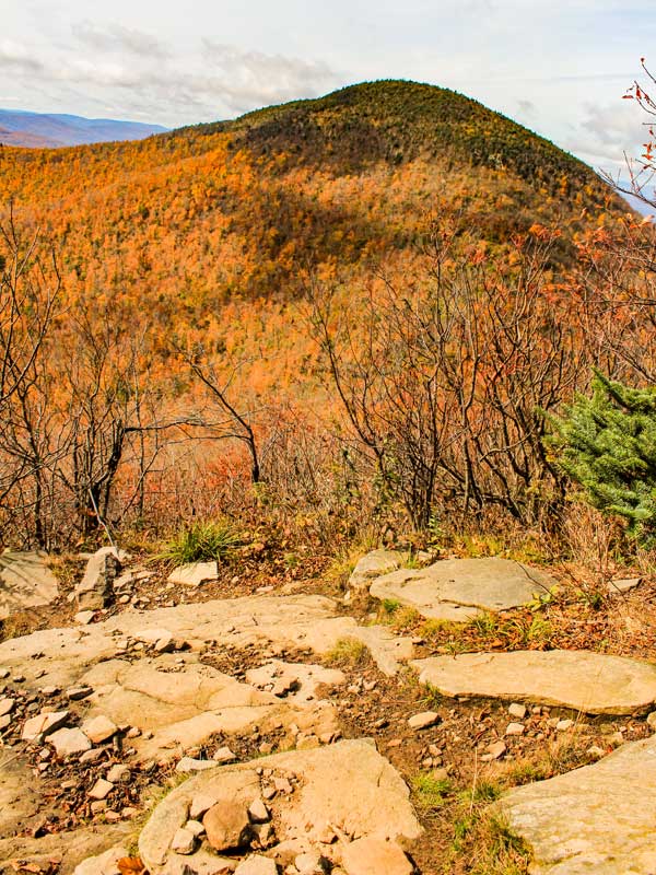
After you continue straight, you will start to descend down the mountain. After a short distance you will encounter TWO view points. The first one is called Camp Steel. It is marked on the rock. The second view point is the best view point. In the picture on the right is the long ridge walk from Blackhead to Dutcher's Notch. It is a beautiful 2 mile flat walk across the ridge of the Eastern Escarpment. Many consider it magical. |
|
 |
This is the view from the second view point looking North. In the distance you can see Acra Point and the nice ridge walk of the Eastern Escarpment from Blackhead to Acra Point to Burnt Knob. |
|
 |
 |
After you get done soaking up the beautiful views from the 2nd view point on the southeastern side the Blackhead Mountain, you will then start to descend the southeastern face of Blackhead Mountain. The descent is quite rapid, so you need to exercise a little caution on your trip down. Some people might be a little intimidated by the steep descent. But, if you take your time, you will find a doable path down the trail. |
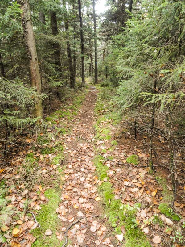
As you approach the bottom, the rate of descent will decrease. When you get near the very bottom you will see this beautiful rock hallway. Once you pass through the Rock Hallway, the trail will become flat for the next two miles. There will be several slight inclines or declines, but the trail is pretty much flat. It is a beautiful walk across this part of the Eastern Escarpment. Especially, in the Fall when the leaves are changing. |
|
 |
Shortly after you start the flat section of this hike, you will encounter a view point. The picture on the left shows the view. The mountain in the background is Acra Point. You have to walk a little bit off the trail to see this view. |
|
 |
 |
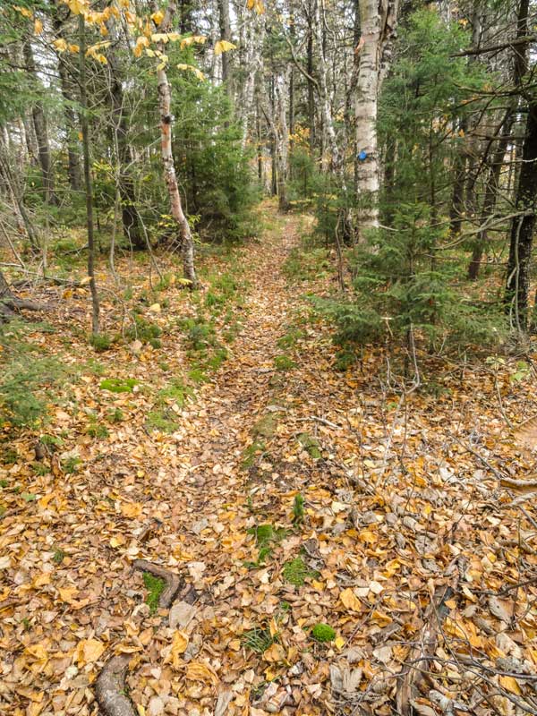
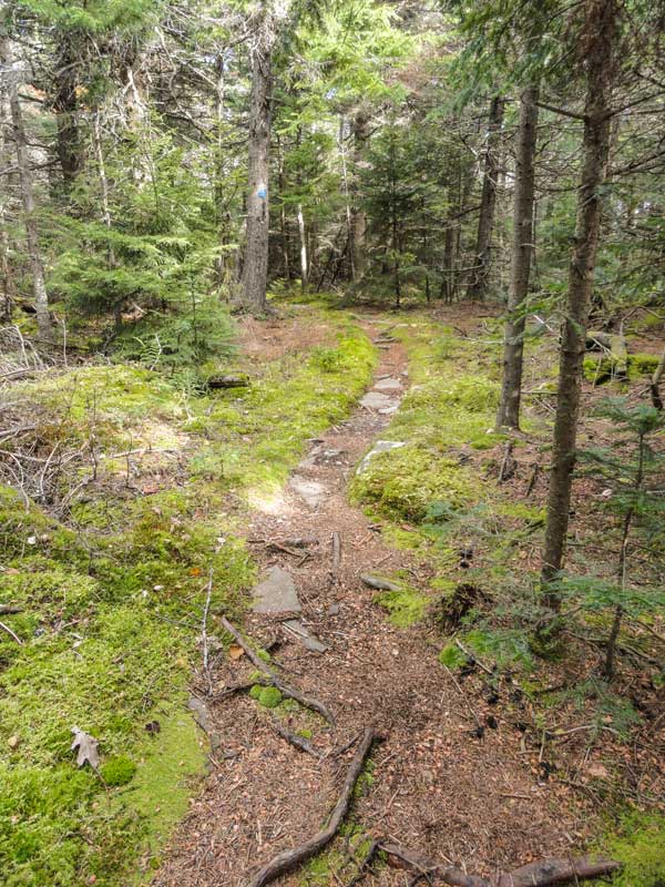
There are a few short sections of conifer forest. But, they don't last long. |
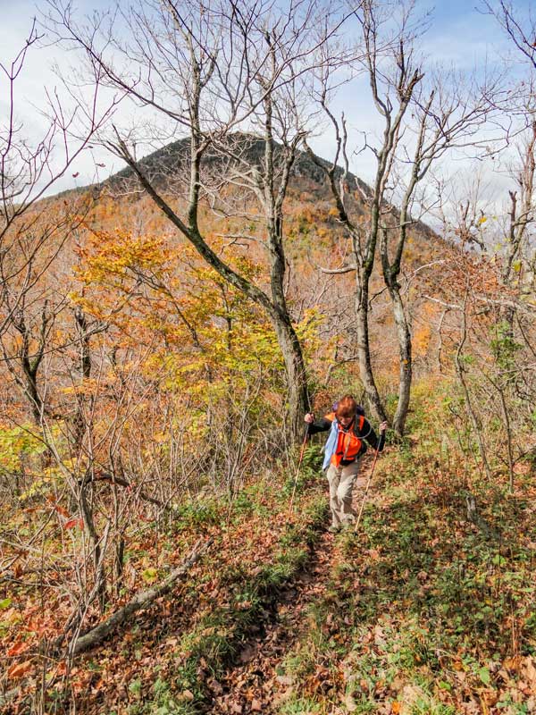
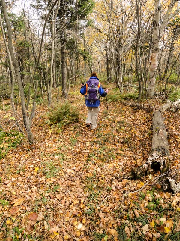
This is what the long hike across the Arizona Mountain ridge looks like. It is mainly a deciduous forest. Arizona Mountain at one time burned leaving a stark landscape. Hence the name of the mountain. |
|
 |
 |
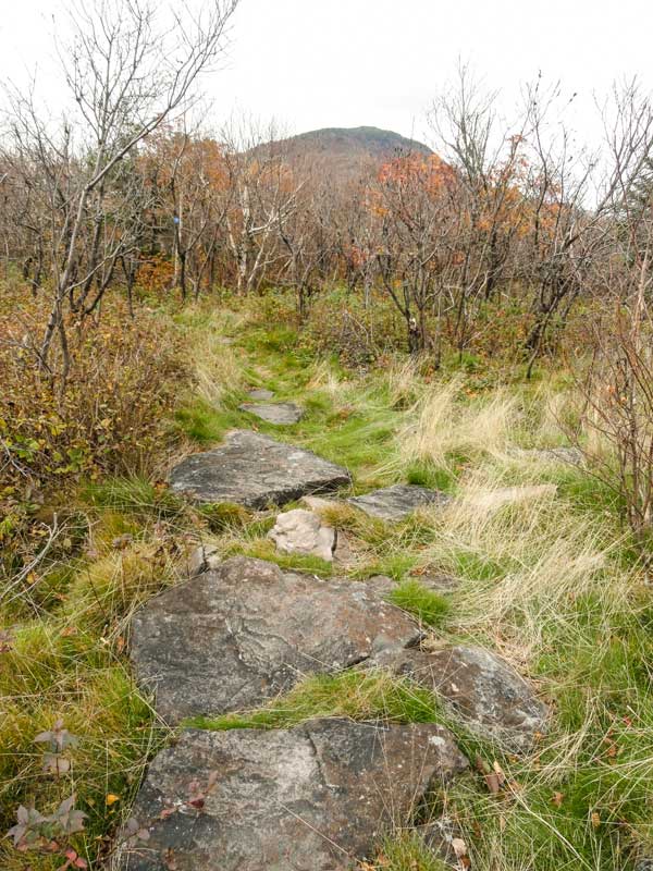
It is hard to realize when you have reached the summit of Arizona Mountain. There is a small grass section with stones defining the trail. When you find the stone pathway you have reach the summit of Arizona Mtn. If you turn around, you will see Blackhead Mountain in the distance. There are no spectacular view points from the summit of Arizona Mountain. |
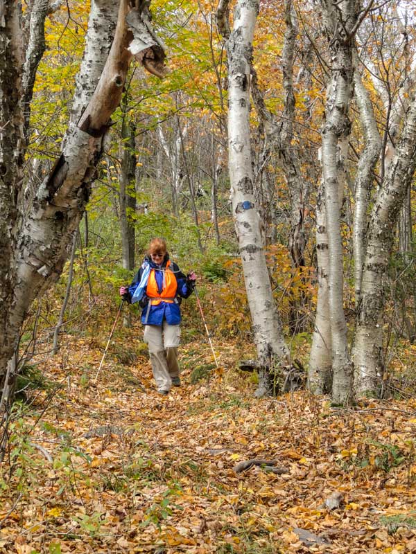
As you move further south of Arizona Mountain summit, the forest will stay the same. While this flat section goes for miles, do not be fooled, this ridge has steep walls. The east and west walls of this path are incredibly steep. Enjoy the easy hike across this beautiful ridge of the Eastern Escarpment. |
|
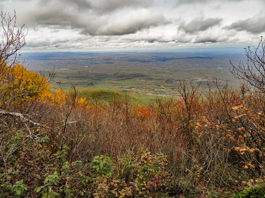 |
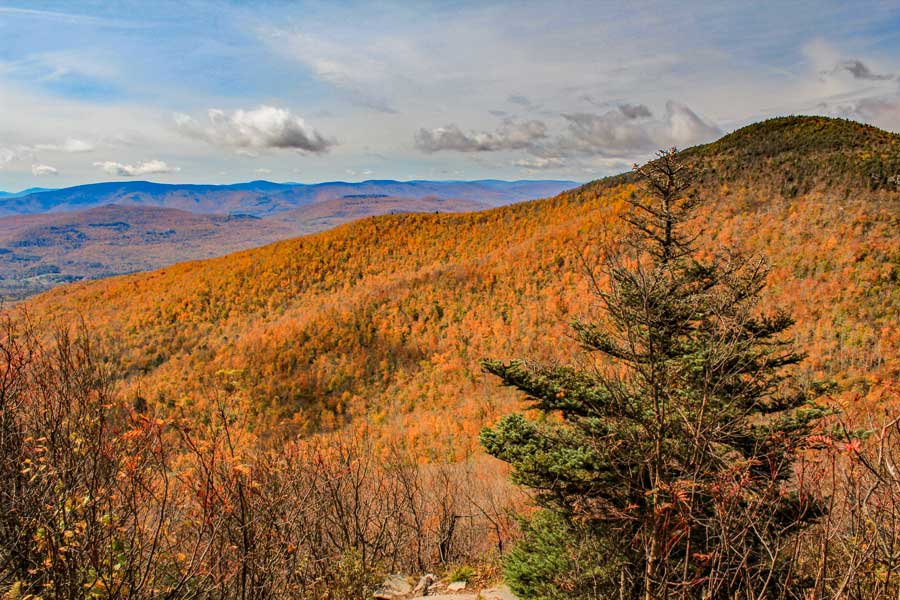
After hiking a distance down the trail between Arizona Mountain and Dutcher's Notch, you will come to another view point. This view point is mainly overlook the Hudson River Valley. After this view point, the trail will move slightly southwest. |
|
 |
 |
The forest will change from a deciduous forest to a conifer forest for a period of time. |
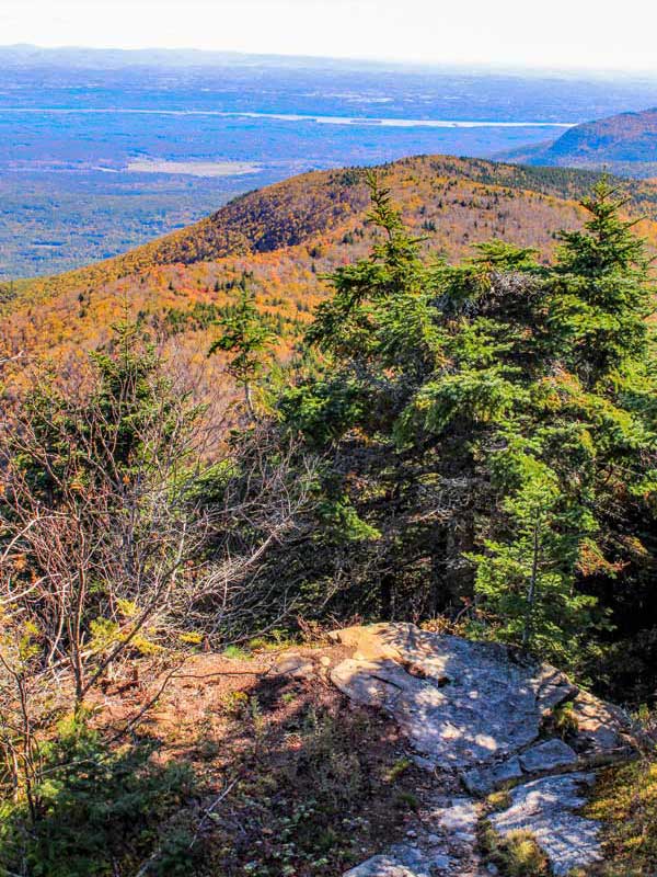
Near the end of the conifer forest section, you will go down a slight decline in elevation. Nothing significant, but it marks where the forest will change back to deciduous forest, and you will encounter a spectacular view point of the East Kill Valley. |
|
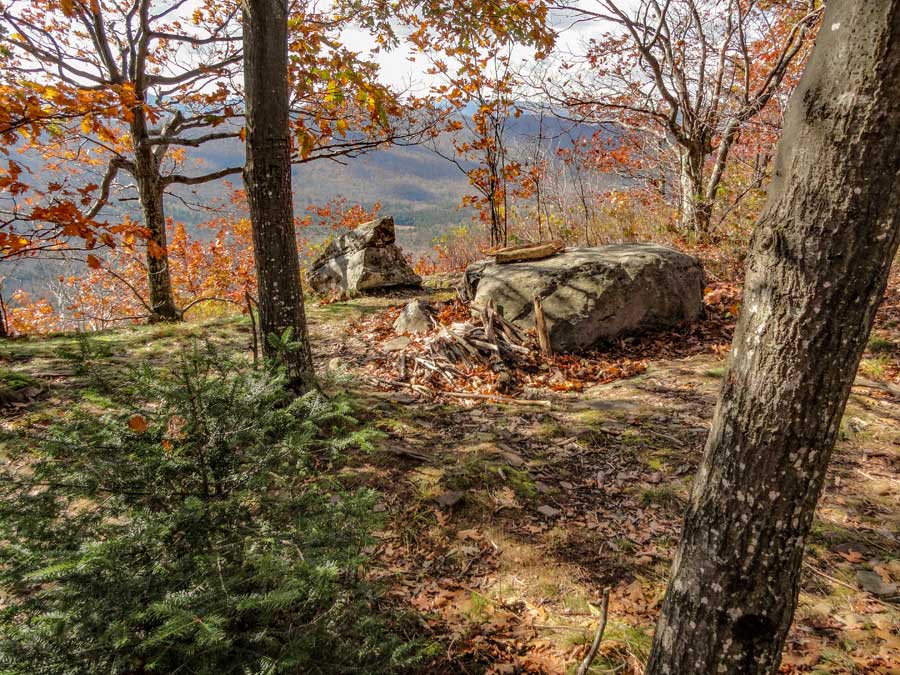 |
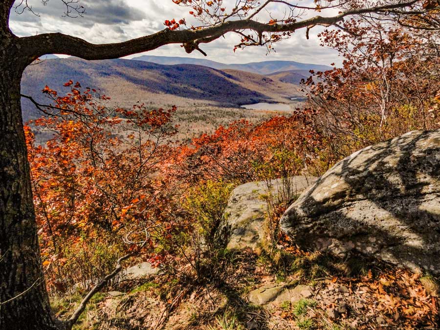
This excellent view point is about 100-150' off the trail. Worth every step on a beautiful clear day. Make sure you stop and catch the views. The rock in the picture is a good place to stop and rest, or eat lunch. |
|
|
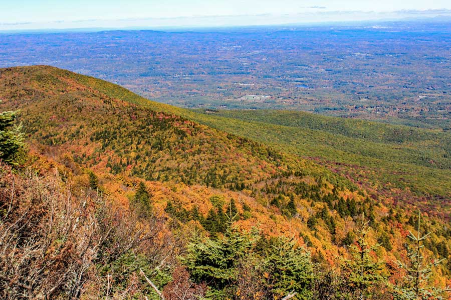
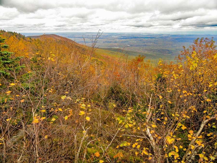
This is one of the views from this particular view point. The view is over the East Kill Valley. In the distance you can see Capra Lake and get a glimpse of Colgate Lake. You probably cannot camp at this rock. It is probably not 150' off the trail, as required by the NYS DEC. But, you can move along the rim to find a good spot to camp. But, remember there is NO water here. |
|
 |
 |
After you leave the great view point over the East Kill Valley, you will come to a point where the trail will descend steeply in elevation into Dutcher's Notch. |
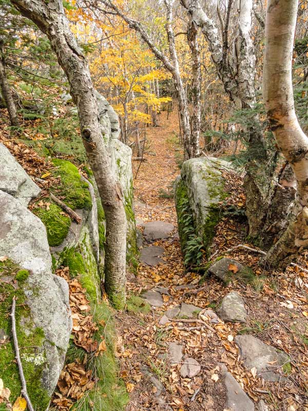
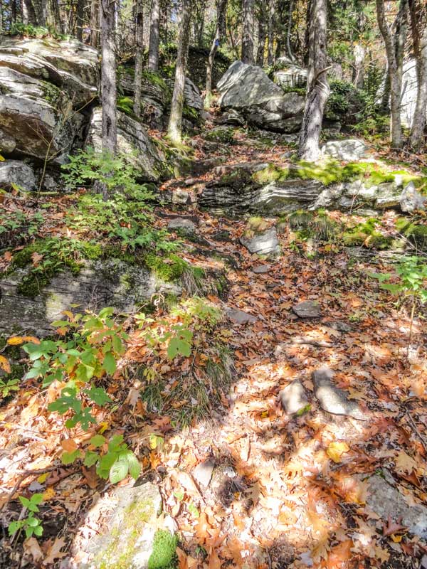
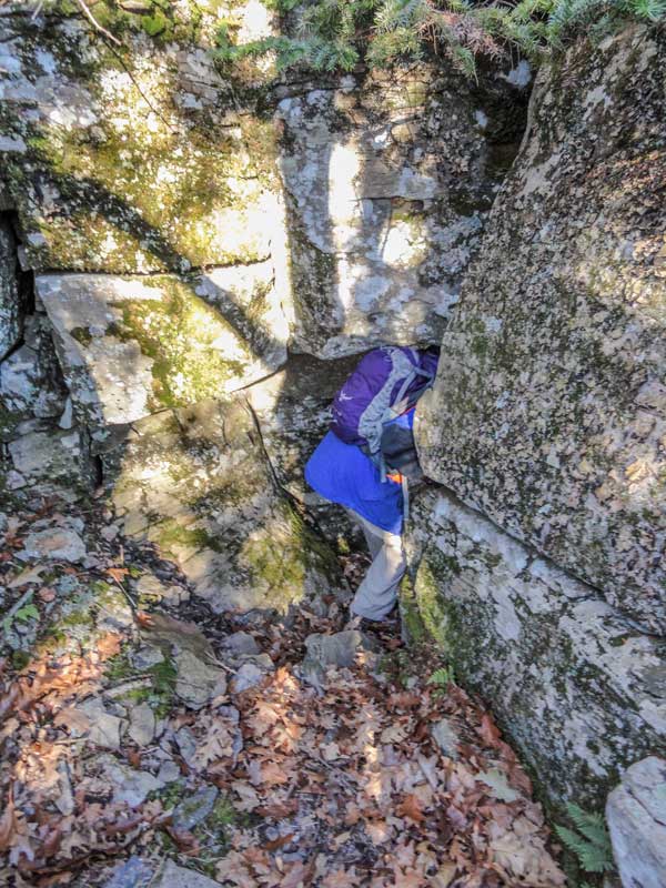
After you get past the steepest part of descent towards Dutcher's Notch, there is a place called the Stone Tunnel (pictured on the right). It is located in a difficult rock section. There are two ways through this section. So, it is possible that you can miss the Stone Tunnel. After the Stone Tunnel the trail becomes easy hiking. |
|
 |
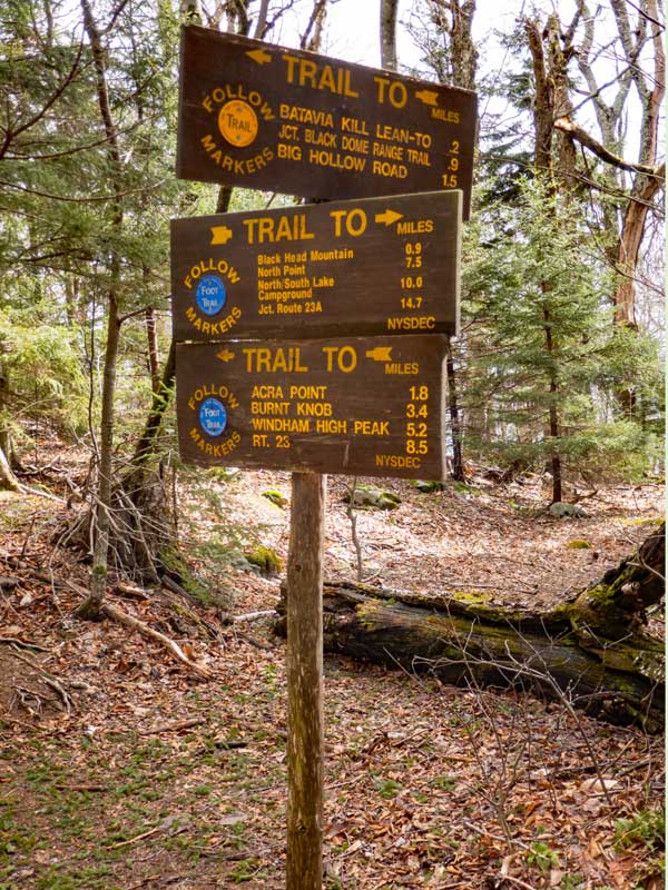
When you get to the bottom of the notch in the Eastern Escarpment, you will be at Dutcher's Notch. There is a 4-way Trail Junction. Straight will take you to Stoppel Point and North-South Lake and the Southern part of the Escarpment Trail. Right will take you to Colgate Lake. About 3/4 of a mile down this trail to Colgate Lake is a camp site and a small waterfall. Left will take you to Stork Nest Road where your car is parked. You want to take a LEFT down the hill. |
|
 |
 |
The beginning of the trail from Dutcher's Notch down to Stork Nest Road. This trail is the old Cairo and East Kill Turnpike built around 1836. The DEC turned it into a hiking trail in the early 1970's. The old turnpike is quite rocky and has severe erosion. Parts of the trail have been diverts slightly. |
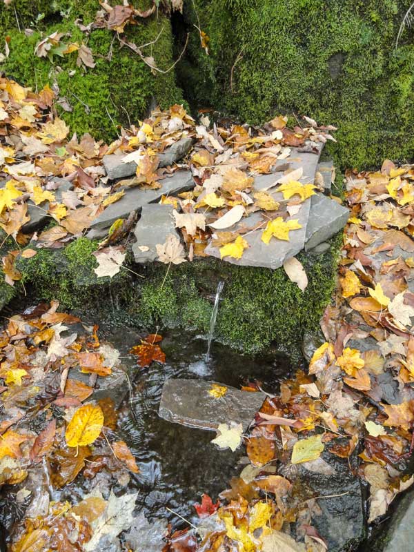
About 1/4 mile down the trail is a water spring. During some summers it will dry up. It is easy to miss, so pay attention if you need water. |
|
 |
 |
You leave NYS public land around 1.15 miles from Dutcher's Notch, and 3/4 of a mile before the parking lot at the end of Stork Nest Road. From this point forward the land you are walking on is private property. Stay on the Trail. |
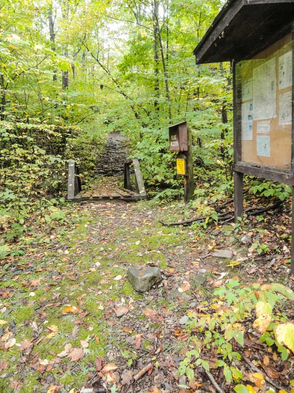
When you cross this little bridge you will see the DEC registration box. Since you signed in at the Blackhead Parking lot, you do not need to sign out here. At this point you are about 2/10 of a mile from the parking lot at the end of Stork Nest Road |
|
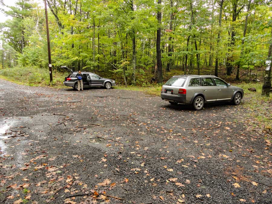 |
This is the DEC Parking Lot where your second car is parked. The hike is over. |
|
|
S E C T I O N S
|
W E A T H E R
|
O T H E R
|