Mt. Pisgah Loop
|
|
|
|
Overview of this Hike: |
| Distance: 3.40 miles round trip from the end of the DEC Pisgah Road. |
| Time: Average 1.75 hours round trip. |
| Elevation Gain: 87' feet from the Parking Area on DEC Pisgah Road to the summit of Pisgah Mountain. |
| Best Time to Hike: Anytime. |
| Difficulty: Easy |
| Peak Elevation: 2,912' |
| Access Methods: Foot and snowshoe |
| |
| Digital Mapper:
Topo
Terrain
Satellite |
|
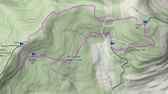
Maps |
 |
|
|
Directions to Trail Head from New York State Thruway (Easist, not the shortest): |
| GPS Coordinates for the Parking Lot on the DEC Pisgah Road: N42 22.411 W74 15.792 - Elevation 2,811 feet |
| Take New York State Thruway to Exit 20 (Catskill). |
| Take a LEFT out of the NYS Thruway toll booths. |
| Take a RIGHT onto Rt 23 westbound |
| Go 22.2 miles on Rt 23 (just before Windham) |
| Take RIGHT on to Mitchell Hollow Road (Rt 21) |
| Go 4.2 miles to Rt 10 |
| Take a sharp LEFT onto Rt 10 |
| Go approximately 1/2 mile on Rt 10 |
| Take RIGHT onto Mt Pisgah Road |
| Go approximately 0.3 mile on Pisgah Road |
| Take RIGHT onto the DEC Pisgah Road (look for DEC sign - road looks like a private driveway). |
| Go approximately 1.6 miles to the end of the dirt road. Park at the turnaround. |
| This road is NOT plowed in the Winter. |
|
Notes about this Hike |
This hike is located on the northeaster part of the Catskill Mountains. Pisgah Mountain is located in Greene County. The mountain can be hiked from several different directions. On this hike we will hike it from the west side on the Long Path. You can also hike it from the east side on the Long Path from Mitchell Hollow Road. You can also hike it from the DEC Pisgah Road on the Handicap trail. This mountain is rarely hiked, so it is unlikely you will see anyone during this hike. This hike does not offer a view. But, it does have an excellent conifer forest on the southwest side that goes all the way to the top of the mountain.
The nice part of this hike is that it is very remote, and you are unlikely to see anyone. Of the dozen times I have hiked this trail, I have never seen a person hiking it.
There is NO DEC registration box on this hike. The hike is not well marked, and some parts are not marked at all. It is not a bushwack hike, but not that far from one either.
The trails on this mountain are very poorly maintained. They can be difficult to follow year around.
|
|
| Mile Point | Altitude | Notes |
| 0.00 | 2,817 | Parking area at the end of the DEC Pisgah Road (GPS: N42 22.411 W74 15.792) |
| 0.36 | 2,903 | Trail Junction - Pass / Long Path to Mt Pisgah (GPS: N42 22.486 W74 15.913) |
| 1.85 | 2,904 | Summit of Mt Pisgah (GPS: N42 22.647 W74 14.681) |
| 2.50 | 2,500 | Trail Junction - Trail and DEC Pisgah Road (GPS: N42 22.486 W74 15.009) |
| 3.40 | 2,817 | Parking area at the end of the DEC Pisgah Road (GPS: N42 22.411 W74 15.792) |
|
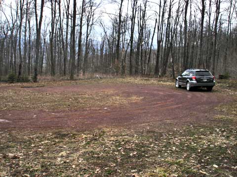 |
This is where you will park at the end of the DEC Pisgah Road. Years ago, this road continued up over the pass and down into the South Mountain Access area. But today, we will hike from the turnaround area. |
|
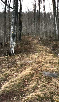 |
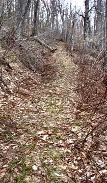
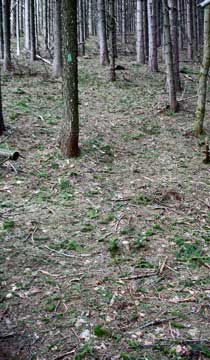
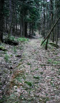
In the turnaround area there are several roads. You want the one that has the yellow DEC trail marker on the tree. You can see the trail from this picture. The trail is the one that goes straight at the end of the road.
The picture on the right shows what the trail looks like. You will travel about 1,000' feet before you will come to a switchback. Follow the switchback. Keep following the yellow trail markers. |
 |
|
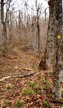 |
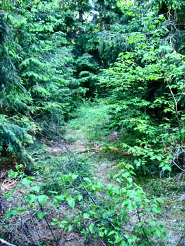
This is a picture of the trail further uproad further up.
At mile post 0.36, you will come to the pass. If you look on the right side of the trail, you will see another trail. You want to take this trail. This trail will have blue DEC trail markers and green Long Path painted trees. There is also a trail on the left side of the trail that will take you to Richmond Mountain. This trail is heavily overgrown, but the markers are still there. |
 |
|
 |
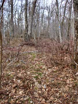
This trail is poorly maintained, and hard to follow at time. You need to pay attention, so that you do not walk off the trail. The trail will be marked with Blue DEC trail markers and Long Path Green paint. For the most part, it follows the old trail from 100 years ago. The trail follows the ridge from Richmond Mountain to Pisgah Mountain. When you start to get close to Pisgah Mountain, the trail will move off the ridge. This seems strange, but the trail is going around private property.
When you get to Pisgah Mountain, you will enter a nice conifer forest. At this point look out for black bears. They like to dig in this forest for bugs.. |
 |
|
 |
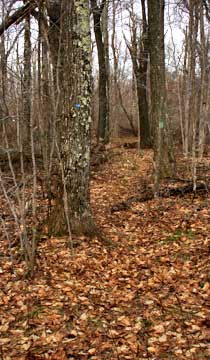
Here is where you will need to climb the mountain in one of the steeper sections..
This is the top of the mountain. There is a USGS marker in this section. At the top of the mountain, there is a 3-way intersection. You want to go right. Left will take you down the other side of the mountain to Hayden Mountain. |
 |
|
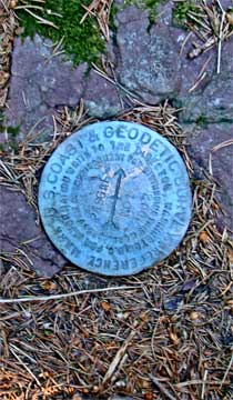 |
Here is the USGS marker on the peak of Pisgah Mountain.
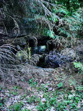
Just after you walk past the summit, you may see a water hole on the left. This is an old well dug many years ago. The water is not very sanitary. |
 |
|
 |
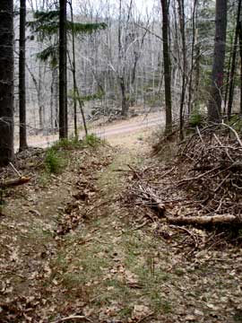
After you walk past the water hole, the trail turns into an old jeep trail. The first problem you will encounter is a large number of trees blocking the road. It has been my experience to bushwack my way down the mountain, instead of following the road. There are more trees down on the road then off the road. The jeep trail starts from the DEC Pisgah Road and runs east bound until it starts to wrap around the mountain. Once you hit this road, you can follow it down the mountain.
The picture on the right shows the jeep trail coming out to the DEC Pisgah Road. |
 |
|
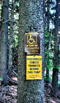 |
When you get to the bottom, you can see that this is a handicap trail. Not sure how a handicap person can get up the trail and past all the trees down on the trail. Once you get to the road, take a right and hike up the road.
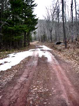
This is a picture of the road back to your car. |
 |
|
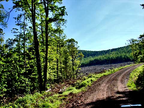 |
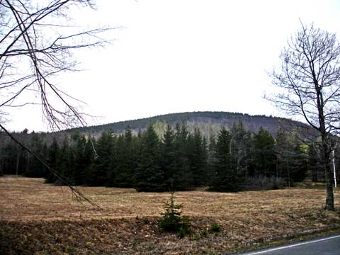
As you travel up the road you will see a large opening on the left. This section of forest was cleared out. It is our understanding that it was cleared out because of the Pine Shoot Beetle. |
|
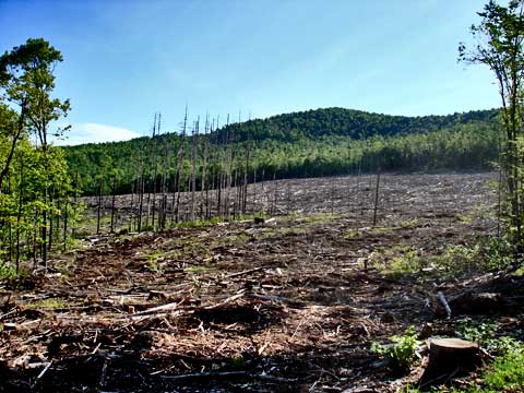 |
Here is another picture of the cleared section. It is our understanding that it will be reforested at some point. |
|
|
A little further up the road, you will come to your car. The hike is now over. |
|
S E C T I O N S
|
W E A T H E R
|
O T H E R
|