Ashland Pinnacle & Huntersfield Mountain |
 |
|
|
Overview of this Hike: |
| Distance: 6.31 miles round trip from the DEC service road in Ashland Pinnacle Wild Forest on the north side. |
| Time: Average 4.00 hours round trip. |
| Elevation Gain: 687' feet from the north access to Ashland Wild Forest DEC Service Road to the summit of Huntersfield Mountain. |
| Best Time to Hike: Anytime. |
| Difficulty: Easy |
| Peak Elevation: 3,423' |
| |
| Digital Mapper:
Topo
Terrain
Satellite |
| |
| Access Methods: Foot, ski, mountain bike (road), snowmobile (road), and snowshoe |
|
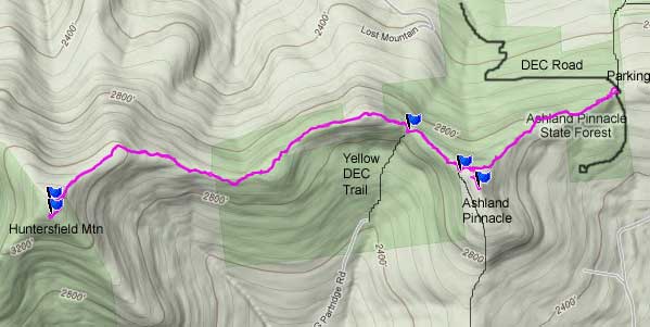
Maps, Profile, and GPS files |
 |
|
|
Directions to Trail Head from New York State Thruway (Easist, not the shortest): |
| North Entrance to Ashland State Forest (GPS: N42 21.734 W74 18.080) - Elevation 2,721 feet |
| Take New York State Thruway to Exit 20 (Catskill). |
| Take a LEFT out of the NYS Thruway toll booths. |
| Take a RIGHT onto Rt 23 westbound |
| Go approximately 22.2 miles on Rt 23 (just before main street Windham) |
| Take RIGHT on to Rt 10 |
| To 6.0 miles on Rt 10 |
| Take very sharp LEFT onto Durham Road (no road sign) |
| Go 2.5 miles on Durham Road |
| Take LEFT on to Toles Hollow Road |
| Go 2.2 miles on Toles Hollow Road |
| Take LEFT on to an unmarked dirt Road (Cook Road is on the right - Silver travel trailer on left side of the dirt road). |
| Go 1.4 miles on the DEC dirt service road into the Ashland State Forest. |
| The road inside Ashland State Forest is NOT plowed in the Winter. |
|
Notes about this Hike |
This hike is located on the northern part of the Catskill Mountains. Most of Huntersfield Mountain is located in Greene County. About 25% of the northern side of Huntersfield is located in Schoharie County. The mountain can be hiked from several different directions. The hike from DEC service road in the Ashland Pinnacle State Forest is the old Historic Trail that has been hiked for over 100 years. This path and Huntersfield Mountain is sometimes referred to as the Butterfly Path. There are often lots of butterflies on this hike.
This historic trail is rarely used. It is very rare to see anyone on the path. You can often find people at Huntersfield Mountain, but very few people use this path. Most people like to use the path when the leaves are not on the trees. It is much easier to follow, and you will not have to contend with the significant numbers of prickers at the base of Huntersfield Mountain. It can be used in the summer, but following the path is harder.
The DEC registration box is in the Huntersfield Lean-to, which is about 200 feet from the summit.
If you want a very remote hike without other people, you will enjoy this hike. It is not a bushwack, but sometimes it will feel like one.
|
|
| Mile Point | Altitude | Notes |
| 0.00 | 2,721 | North Entrance to Ashland State Forest (GPS: N42 21.734 W74 18.080) |
| 0.09 | 2,752 | Start to find trail |
| 0.15 | 2,762 | Run into ATV Trail |
| 0.86 | 3,070 | Ashland Pinnacle Summit (GPS: N42 21.393 W74 18.737) |
| 1.02 | 3,028 | Side trail on the southwest side of Ashland Pinnacle Mountain (GPS: N42 21.304 W74 20.759) |
| 1.28 | 2,830 | DEC Yellow Trail (GPS: N42 21.595 W74 19.068) |
| 3.11 | 3,423 | Summit of huntersfield mountain (GPS: N42 21.352 W74 20.768). |
| 3.22 | 3,380 | Lean-to & Registration Box (GPS: N42 21.304 W74 20.759) |
| 6.31 | 2,721 | North Entrance to Ashland State Forest (GPS: N42 21.734 W74 18.080) |
|
|
Hike to Ashland Mountain and Huntersfield Mountain |
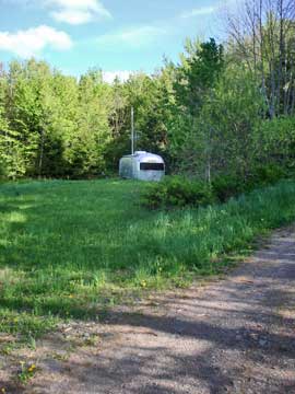 |
Finding the DEC service road into Ashland Pinnacle State Forest can be difficult find. The road looks like a driveway. On the left you will see a silver travel trailer. Continue past the trailer. The entrance of the DEC service road is directly across the street from Cook Road.
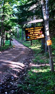
About 500' in, you will then see the DEC sign shown on the right side. |
 |
|
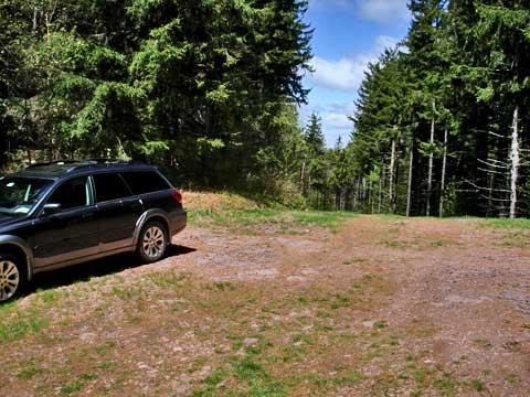 |
After traveling up the road about 1.2 miles, you wil come to a pass. Park at the top of the pass. The picture on the right shows the pass.
To start the hike, you will need to bushwack into the forest right where the car is parked. The forest blowdown is fairly thick here, but you will start to find a trail about 500' into the forest. At 750' you will find an ATV trail. Follow the ATV trail towards Huntersfield. When you return, you have to remember to leave the ATV trail and bushwack back to the car. |
|
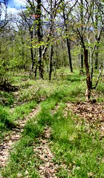 |
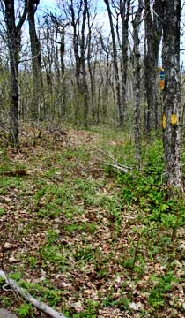
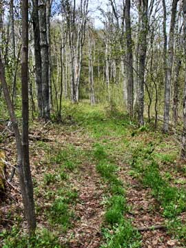
The pictures on the left and right snow what parts of the trail looks like. |
 |
|
 |
The picture on the left is the summit of Ashland Pinnacle. You have to leave the trail to get to the top. It is a short trail through some prickers. The summit is on private land.
After you walk around Ashland Pinnacle, you will see a trail on the left. This trail is VERY wet and muddy. It is also on private land. |
 |
|
 |
After Ashland Pinnacle Mountain, you will see some Yellow DEC trail markers on the left. This trail will take you down to the parking area on the south side of the mountain range.
Later in the hike, you will come to some clearings. The picture on the right shows those clearings. You want to hike uphill to the right. Most paths will take you there anyway. |
 |
|
 |
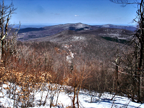
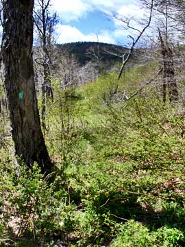
This is the view to the south of the ridge and below huntersfield mountain |
|
 |
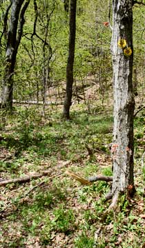
As you approach the base of Huntersfield Mountain, the trail has a lot of prickers. You will also notice that the green LP markers stop here. The old LP actually runs thru the woods in some very terrible sections. I strongly suggest that you avoid this section of the LP. |
|
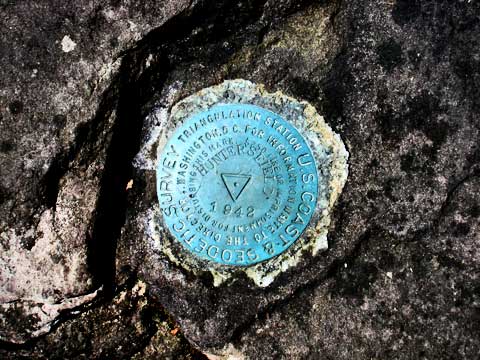 |
When you get to the top, you will see a Lean-To sign. You want to continue up the hill for another 100' feet. This is the summit of Huntersfield Mountain. You will find a USGS marker at the summit. After the USGS marker on Huntersfield Mountain, go back down the trail 100' and take the trail to the Lean-To. |
|
|
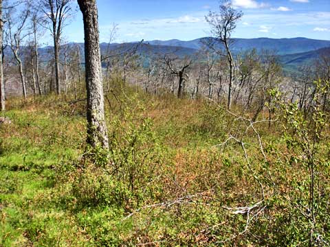
As you walk towards the Huntersfield Lean-To, you will encounter a clearning with a nice view of Ashland Pinnacle and Richmond Mountain. |
|
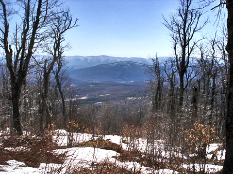 |
This is the view from the entrance of the Lean-to. From this view, you can see both Windham Mountain Ski Area, and the west side of Hunter Mountain Ski Bowl. |
|
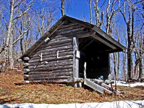 |
This is the Huntersfield Lean-To. The DEC registration box is inside the Lean-To. Make sure that you register your hike. |
|
S E C T I O N S
|
W E A T H E R
|
O T H E R
|