Huntersfield Mountain Loop
|
|
|
|
Overview of this Hike: |
| Distance: 5.05 miles round trip from the Forest Entrance on the north side. 4.13 miles round trip from inside the park |
| Time: Average 3.50 hours round trip. |
| Elevation Gain: 1,219' feet from Huntersfield Road (Forest entrance) to the summit of Huntersfield Mountain. |
| Best Time to Hike: Anytime. |
| Difficulty: Easy |
| Peak Elevation: 3,423' |
| Digital Mapper:
Topo
Terrain
Satellite |
| Access Methods: Foot, ski, mountain bike (road), snowmobile (road), and snowshoe |
|
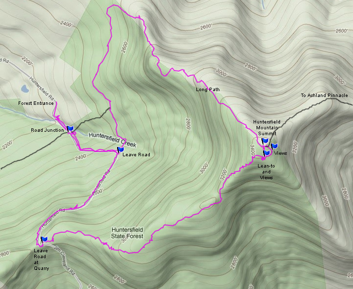
Maps, Profile, and GPS files |
 |
|
|
Directions to Trail Head from New York State Thruway (Easist, not the shortest): |
| GPS Coordinates to entrance to Huntersfield State Forest: N42 21.521 W74 21.854 - Elevation 2,238 feet |
| Take New York State Thruway to Exit 20 (Catskill). |
| Take a LEFT out of the NYS Thruway toll booths. |
| Take a RIGHT onto Rt 23 westbound |
| Go approximately 29 miles on Rt 23 (just past Ashland) |
| Take RIGHT on to West Settlement Road |
| To 1.8 miles to the end of West Settlement Road |
| Take LEFT onto Rt 10 |
| Go 3.1 miles on Rt 10 |
| Take Right Rt 11 (Sharp Right Turn) |
| Go 2.6 miles to the end of the road (road will turn into Marv Rion Road) |
| Take RIGHT onto Huntersfield Road. |
| Go 0.8 miles to the entrance of Huntersfield State Forest. |
| The road inside Huntersfield State Forest is NOT plowed in the Winter. |
|
Notes about this Hike |
This hike is located on the northern part of the Catskill Mountains. Most of Huntersfield Mountain is located in Greene County. About 25% of the northern side of Huntersfield is located in Schoharie County. The mountain can be hiked from several different directions. The most common way is to hike it from the pass on the south side of the mountain. The historic way is to hike it from the east side and exit on the west side. Presently there are two areas where trees have been cut to create views. Over the last hundred years there has always been a view. This hike is also one of the easier hikes in the Catskill Mountains. In the Winter snowmobilers use the road thru the forest. They also go up to the summit. They don't use the Long Path.
The shortest and easy way to the top of huntersfield mountain is from the pass of Huntersfield Road / Jim Cleveland Road. This way is a little over a mile one-way. Another way is from the two trail entrances from Huntersfield Road. This hike is moderate in difficulty. It is a little over two miles long. This trail follows the Long Path. You can also follow the Long Path from Ashland Pinnacle. This hike is about 4 miles to the summit.
The DEC registration box is in the Lean-to, which is about 200 feet from the summit. Since there are numerous ways to hike to the summit, this is where they keep the registration box.
The trails on this mountain are very poorly maintained. In the summer, they can be difficult to follow. One of the nice things about Huntersfield, is the variety of terrain, and nice views. It is very different from some of the other mountains in the Catskill Mountains.
|
|
| Mile Point | Altitude | Notes |
| 0.00 | 2,204 | North Entrance to Huntersfield State Forest - Huntersfield Road (GPS: N42 21.521 W74 21.854) |
| 0.11 | 2,248 | Road Junction - Long Path (GPS: N42 21.399 W74 21.793) |
| 0.46 | 2,467 | Trail / Road Junction - Long Path (GPS: N42 21.317 W74 21.526) |
| 1.19 | 2,803 | Trail / Road Junction - Leave Road (GPS: N42 20.968 W74 21.927) |
| 2.57 | 3,380 | Lean-to & Registration Box (GPS: N42 21.304 W74 20.759) |
| 2.65 | 3,421 | Summit of huntersfield mountain (GPS: N42 21.352 W74 20.768). |
| 4.69 | 2,467 | Trail / Road Junction. (GPS: N42 21.317 W74 21.526) |
| 5.05 | 2,204 | North Entrance to Huntersfield State Forest - Huntersfield Road (GPS: N42 21.521 W74 21.854) |
|
|
Hike to huntersfield mountain and North huntersfield mountain |
 |
This picture shows parking about 250' inside the park. It is just before Huntersfield Creek. In the middle of the Winter, you cannot get 250' in, and you will need to park in the snow plow turnaround.
In the Summer, you can park at a number of locations. You can park up the hill by the Huntersfield State Forest sign. Or, you can go further up and park at the metal gate. Lastly, you can go all the way up to the pass, and park in the quarry or the side of the road. For the purpose of this hike, the mileage is from the entrance of the north side of the park. Adjust accordingly. |
|
 |
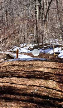
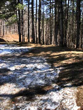
About 1,000' inside the park, you will come to a road junction. Right will take you to the edge of a conifer forest. Straight will take you further up Huntersfields Road. To the left is a hidden entrance to the Long Path. It is hard to see the entrance, but it is there. This sign is about 100' inside the woods. Very hard to see in the summer.
This sign is on the intersection of the road (1,000' inside the park). |
 |
|
 |
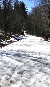
This is a picture of the road further up.
At mile post 0.46, you will come to a sharp turn. On the left is an old jeep trail. About 100' in is a steel gate. This jeep trail is also part of the Long Path. It will also take you to the summit of Huntersfield. But, it is a steeper way up to Huntersfield. The preferred route is up the road. We will return by this gate on the way back from the summit. It completes the hiking loop. |
 |
|
 |
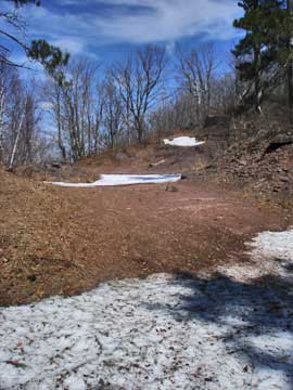
This is the road just before the pass.
This is the pass. This is where we want to leave the road for the trail to Huntersfield Mountain summit. You can park on the side of the road or inside the quarry. |
 |
|
 |
This is the quarry at the pass.
When you walk into the quarry, you want to head to the right side of the quarry. This is where the trail begins. |
 |
|
 |
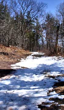
This is the beginning of the trail. Most of the trail is fairly flat. Please keep in mind that the trail is NOT marked, nor is it maintained.
Here is another picture of the trail to Huntersfield Mountain summit. |
 |
|
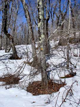 |
Just before you get to the summit, you will come to the final climb of the hike. It is actually the steepest part of the hike, which really isn't that steep. Just before you start the final climb up, you will see yellow DEC trail markers. This is the old trail that ran across the ridge of Huntersfield, Ashland Pinnacle, Richmond, and Pisgah Mountains. This trail is over 100 years old. But, it is no longer maintained. You can still follow it. |
|
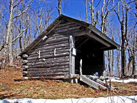 |
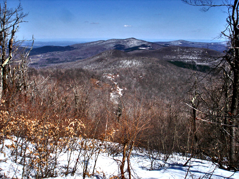
At mile post 2.57 (elevation 3,380') you will come to the Huntersfield Lean-to. This lean-to has a bench and table. The lean-to has a beautiful view of the mountains of Spruceton Road. You can also see Windham Mountain Ski Area and Hunter Mountain Ski Bowl.
This is the registration box is located for the hike. It seems strange place for a registration box, but since there are so many entrance points, this is the only place where it works for everyone. So, please register here. |
|
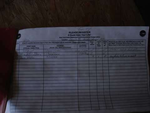 |
This is the registration sheets inside the lean-to. |
|
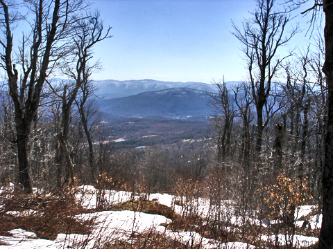 |
This is the view from the entrance of the Lean-to. |
|
 |
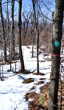
As soon as you pass the lean-to, you will start to see Long Path and DEC markers. |
|
 |
Just past the lean-to, you will see a trail junction for the Long Path. If you take the path down the hill, it will take you to Ashland Pinnacle, Richmond Mountain, and Pisgah Mountain. |
|
 |
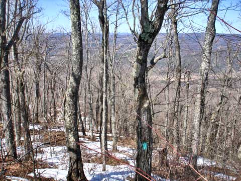
This is the summit of Huntersfield Mountain. There is also USGS markers on the summit.
After visiting the summit, continue down the path on the Long Path. It will take you down the Northwest side of the mountain. |
|
 |
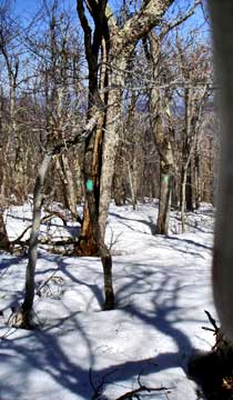
The long path follows the ridge line down the mountain. You have to be careful here. The trail is very poorly marked, and poorly maintained. It is very easy to get lost. But, it is a nice hike down the mountain. You just have to pay attention to where the real trail is. |
|
|
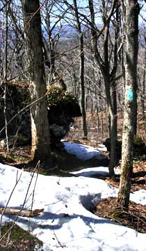
Here is another view of the trail. This is one of the areas that provides a view in the winter months. |
|
 |
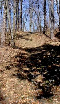
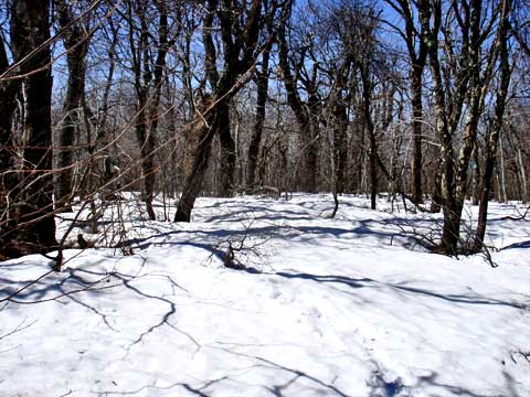
Here is another area of the Long Path. Not too long after this picture, the trail will turn left. If you miss the turn (which you might), you will come to a house on private property.
You will then enter a large conifer forest. This trail will lead to the jeep trail that will lead back to Huntersfield Road. |
 |
|
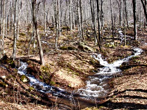 |
When you get near the end of the jeep trail, you might see part of the Huntersfield Creek. In the Spring there are a lot of converging streams. The road can get a little wet. |
|
|
When you get to the end of the Jeep trail, you will walk past the metal gate. This will put you back on the Huntersfield Road. |
|
S E C T I O N S
|
W E A T H E R
|
O T H E R
|