North Point, North Mtn Ledge, and Stoppel Point
|
|
|
|
Overview of this Hike: |
| Distance: 9.16 round trip from parking lot by Scutt Road. Deduct 0.50 miles for skipping plane crash. Deduct 0.34 miles for skipping Ashley Falls Trail. Minimum distance is 8.32 miles. |
| Time: 6 hours round trip (hiking time) |
| Elevation Gain: 1,252' gain from parking lot (2,165' to 3,417') |
| Best Time to Hike: Arrive at Stoppel Point between 11 and 2 PM for best views |
| Difficulty: Moderate |
| Highest Elevation: 3,420' |
| Digital Mapper:
Topo
Terrain
Satellite |
| Access Methods: Foot and snowshoeing. |
|
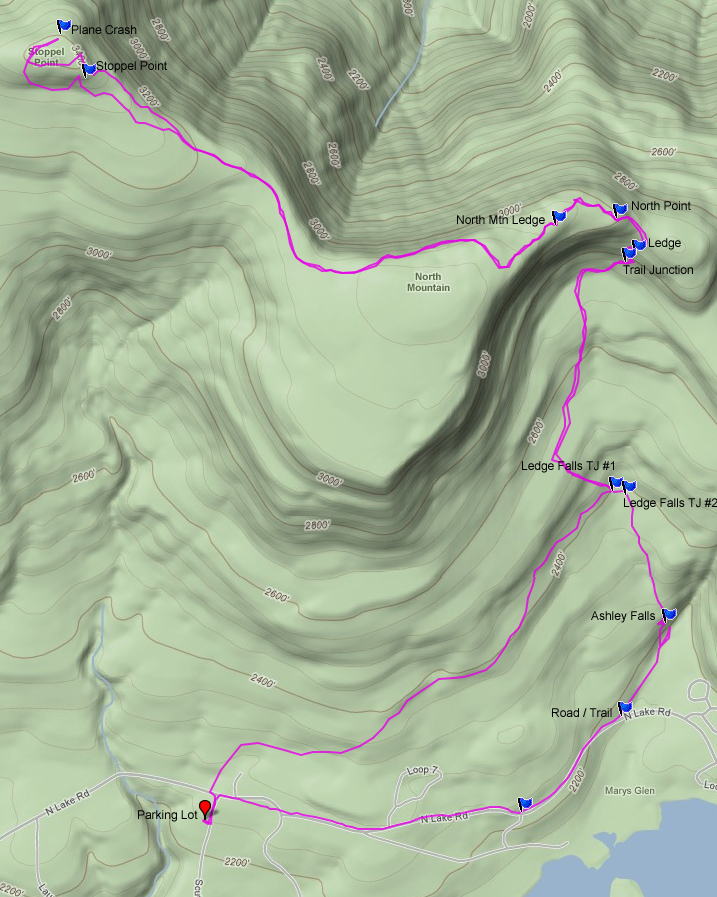
Maps |
 |
|
|
Directions to Trail Head from New York State Thruway (Easist, not the shortest): |
| Take New York State Thruway to Exit 21 (Catskill). |
| Take a left out of the NYS Thruway entrance road. |
| Go approximately 1/4 mile |
| Take a right onto Route 23 West |
| Go approximately 6.6 miles to Cairo, NY |
| Take a LEFT onto Rt 32. McDonalds Rest. on corner. |
| Go approximately 7.7 miles on Rt 32 |
| Take a RIGHT onto Rt 23A |
| Go appoximately 7-8 miles to the intersection of Rt 23a and North-South Lake Road. |
| Climb up the windy mountain road (Rt 23A). When you reach the top, you will then be in Haines Falls. |
| Take a RIGHT onto North Lake Road (DEC sign on corner of road). |
| Follow North Lake Road until you almost reach the DEC booths. |
| Take a RIGHT onto Scutt Road. |
| Take a RIGHT into the DEC parking lot. The parking lot fills up quickly. If the parking lot is full, you can park on the side of the road. Do NOT park down by the two houses. |
| Mile Post | Altitude | Notes |
| 0.00 | 2,224 | DEC Parking lot on Scutt Road. Take a LEFT out of the parking lot and walk back up Scutt Road to North Lake Road. |
| 0.09 | 2,250' | Scutt Road to North Lake Road. |
| 0.10 | 2,254' | North Lake Road to Trail. |
| 1.37 | 2,444' | Trail Junction #1 at Ledge Falls. |
| 2.12 | 2,785' | Trail Junction to North Point, North Mtn, and Stoppel Point. |
| 2.25 | 2,869' | First Ledge overlooking North/South Lake |
| 2.39 | 3,017 | North Point |
| 2.54 | 3,068 | Pocket Holes Ledge |
| 2.64 | 3,074 | North Mountain Ledge overlooking North/South lake |
| 4.10 | 3,418' | Stoppel Point. |
| 4.40 | 3,400' | Plane Crash - Just before the plane crash is a lovely ledge overlooking the Blackhead Mtn Range. |
| 4.64 | 3,418 | Stoppel Point |
| 6.52 | 2,752 | Trail Junction to North Point, North Mtn, and Stoppel Pt. |
| 7.29 | 2,443 | Trail Junction #1 at Ledge Falls. |
| 7.33 | 2,425 | Trail Junction #2 at Ledge Falls. |
| 7.70 | 2,305 | Top of Ashley Falls. |
| 7.79 | 2,230 | Trail Junction to Ashley Falls. |
| 7.82 | 2,244 | Bottom of Ashley Falls |
| 8.07 | 2,244 | Trail & North Lake Road. |
| 9.08 | 2,315 | North Road & Scutt Road. |
| 9.16 | 2,315 | Parking Lot. |
|
|
Hike to North Point, North Mountain, Stoppel Point, Plane Crash, and Ashley Falls |
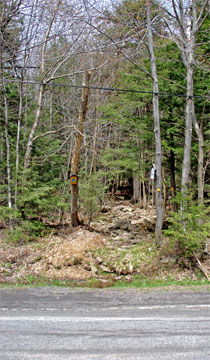 |
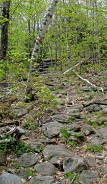
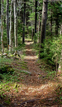
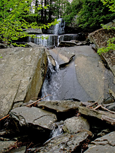
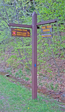
After walking out of the DEC parking lot, take a LEFT and walk UP Scutt Road back to North Lake Road. At mile post 0.08 you will reach North Lake Road. Take a LEFT and head west away from North/South Lake.At mile post 0.09 you will come to the DEC trail sign. Directly across the street is the beginning of the trail (see picture on the LEFT).
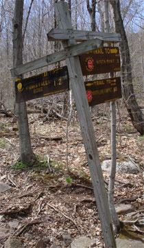
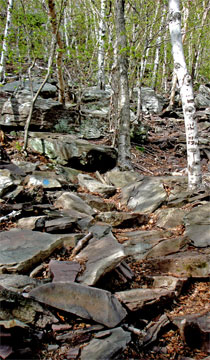
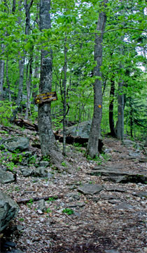
The beginning of this trail has a lot of rocks and water. The trail get better as you continue up the trail. At mile post 1.37 you will encounter Trail Junction #1 at Ledge Falls. You want to take a LEFT, and continue climbing in elevation.
|
 |
|
 |
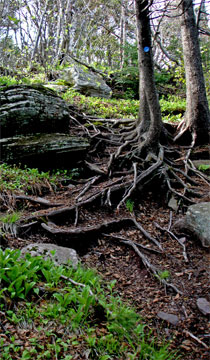
The picture on the LEFT is what the trail looks like after you leave Trail Junction #1 at Ledge Falls. The trail will continue to climb in elevation. You will encounter a Conifer forest below North Point and North Mtn.
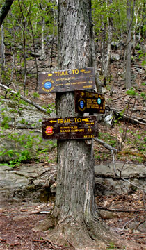
At mile post 2.12, you will encounter the Trail Junction to North Point, North Mountain, and Stoppel Point. Take a LEFT up the steep trail. |
 |
|
 |
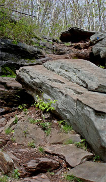
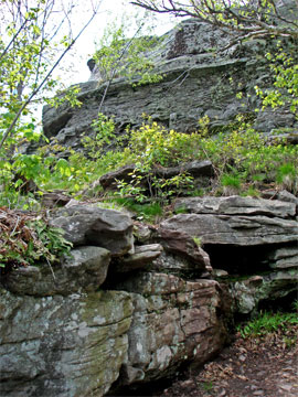
Shortly after you start climbing, the trail will zig to the left. If you look at the middle left side of the picture on the left, you will see blue painted dot on the rock. This is the first zig in the trial. The picture on the RIGHT is what awaits you at the top of the zig. Some people are intimidated by the climbing the rock. To avoid the rock, you can continue to climb up the steep rock trail on the picture on the LEFT, and take a LEFT once you get on top.
The best way to climb this rock ledge, is to climb it backwards (sitting on the ledge).
After you climb this section, you will come to the first overlook of North/South Lake. It looks good, but the best views are from North Point and North Mtn Ledge. |
 |
|
 |
The picture on the left is a difficult ledge to climb. It is just below North Point. It is a 2 section ledge. You can skip the first ledge by walking around the left side of the picture. This is the way the trail used to go many years ago.
The second ledge is more difficult. Again, you need to climb this ledge backwards (sitting on the ledge, and then turning around). As soon as you climb up this last section, you will be on North Point. It is important to know that this is North Point, and NOT North Mountain Ledge. Some people stop here believing that this is the end of the hike. It isn't. |
|
 |
The picture on the LEFT is the view from North Point. It is at mile post 2.39. The picture only shows some of the view. You actually get a spectacular view of the Hudson Valley, including the Hudson River. From this point, you can see five states on a clear day.
This ledge can get quite crowded on a nice summer weekend. |
|
 |
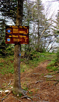
The picture on the LEFT shows the trail marker where the trail continues along the Escarpment. It is on top of North Point. The path can be difficult to follow. The section between North Point and North Mtn Ledge the trail is marked with blue paint spots and plastic DEC trail markers. You have to observe the trail carefully. It is easy to walk off the trail in this section.
|
|
 |
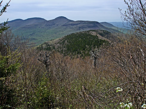
The picture on the LEFT is Pocket Hole Ledge. It is at mile post 2.54. There is a large rock on the ledge. We stood on top of this rock to get this picture. It is half way between North Point and North Mtn Ledge. The mountains in the background of the picture are (from right-to-left) is Acra Point, Dutcher Notch, Blackhead Mtn, Blackdome Mtn, and Thomas Cole. On the very left you can see Stoppel Point. This is where we are headed.
|
|
 |
The picture on the LEFT is North Mountain Ledge. It is at mile post 2.64. It has spectacular views of North/South Lake, Kaaterskill High Peak, and the Hudson Valley. From North Point to Stoppel Point there are a lot of coyotes. If you hike early in the morning or late in the afternoon, you might encounter one. |
|
 |
The picture on the LEFT is one of the nice conifer forest you will walk thru on your way to Stoppel Point. The trail from North Mtn Ledge and Stoppel Point is fairly flat. It actually travels in a very long dip.
The picture on the RIGHT is the trail just below Stoppel Point. There is a small climb up to Stoppel Point. This picture shows the climb up to Stoppel Point. Once you climb to the top, you will be at Stoppel Point. |
 |
|
 |
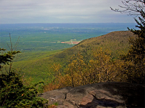
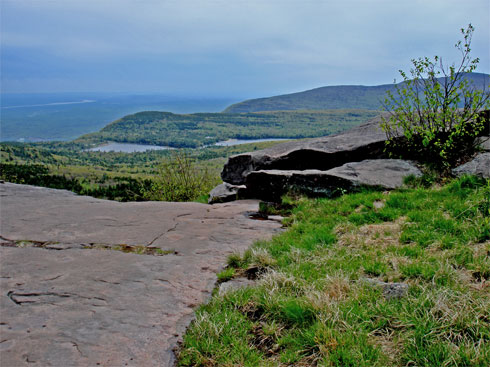
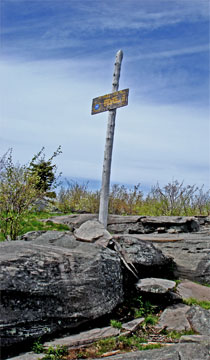
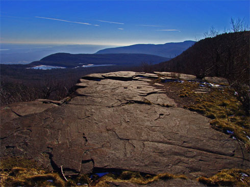
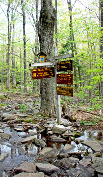
The picture on the LEFT is the DEC trail marker at Stoppel Point. This is at mile post 4.10. The picture on the top of this page is the view from Stoppel Point. It overlooks Cairo, NY.
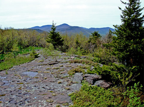
The picture on the RIGHT is the view just before the Plane Crash. In this picture you can see Acra Point, Dutcher Notch, Blackhead Mtn, Blackdome Mtn, and Thomas Cole. |
 |
|
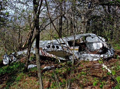 |
The picture on the LEFT is the plane crash that is right next to the trail. You are at Mile Post 4.40 (end of hike). You can't miss it. If the pilot has been 25 higher, he would have not crashed. If you have a GPS, you can track it with "Air Crash 2" on geocaching.com. The pilot was John T Grace flying the pictured Piper PA-28 (#N1316T). He crashed on May 25th 1983 at 9:40 AM. He was killed in the crash. He left Poughkeepsie at 9:12 AM and was flying to Watertown, NY. He had a revoked student pilot's licence. He didn't file a flight plan.
There is a second plane crash that is Northeast of Stoppel Point at elevation of 2,800 feet. It is located in a VERY difficult and steep section of the mountain. It is accessible from the valley by following up the stream. From the top, it can only be accessed with climbing gear and ropes. This crash was piloted Timothy Burns, who was a very good pilot. The crash occured on December 15, 1989 and killed 6 people. The plane was a Piper Navajo with registration #N45CH. He was flying in a snowstorm, and was flying NVR. |
|
 |
After the plane crash reverse course. When you get the Trail Junction #1 at mile post 7.29 continue STRAIGHT instead of returning RIGHT. Go down below the Ledge Falls, and walk below the falls until you reach Trail Junction #2.
The picture on the RIGHT is Trail Junction #2 at Mile Post 7.33 (200' away from Trail Junction #1). Go RIGHT down the trail. After a lot of rain this section below the falls can be under water. |
 |
|
 |
Part way down, you will cross the stream. If the water is high, don't cross the stream. Follow it down until you reach Ashley Falls. Just before you reach Ashley Falls, you will cross the stream again. But, now the stream will be even harder to cross after large rain storms.
NOTE: Bears walk across the top of Ashley Falls, so keep your eyes open for them when approaching the top of Ashely Falls.
The picture on the LEFT is Trail Junction at the bottom of the Ashley Falls. After a very short walk you will be at the bottom of Ashley Falls. Picture is on the RIGHT. |
 |
|
 |
At the end of trail you will come to North Lake Road. The picture on the LEFT is the trail marker. This is mile post 8.07. Take a RIGHT and walk up the road (westward).
When you come to the DEC booths, follow the grass path under the power lines. Then you will come to Scutt Road at mile post 9.08. Then take a LEFT down Scutt Road to end the hike at the DEC parking lot at 9.16 miles. |
|
|
S E C T I O N S
|
W E A T H E R
|
O T H E R
|