Kaaterskill Rail Trail |
 |
|
|
Overview of this Hike: |
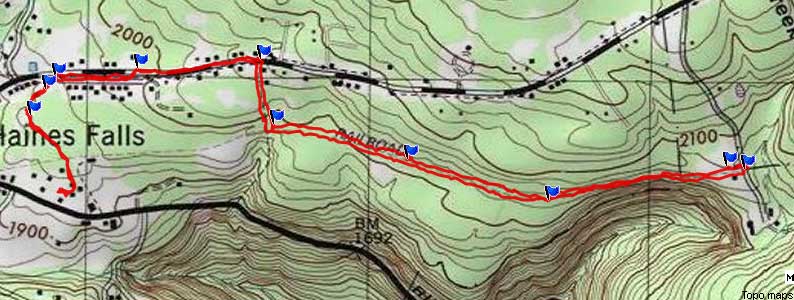
| Distance: 4.16 round trip from either Laural House Road and MTHS parking lot in Haines Falls, NY. |
| Time: 2.5 hours round trip (hiking time) |
| Elevation Gain: ~100' |
| Best Time to Hike: Anytime. |
| Difficulty: Easy |
| Highest Elevation: 2,069' |
| Digital Mapper:
Topo
Terrain
Satellite |
| Access Methods: Foot, ski, and snowshoeing. |
|
| Take New York State Thruway to Exit 21 (Catskill). |
| Take a left out of the NYS Thruway entrance road. |
| Go approximately 1/4 mile |
| Take a right onto Route 23 West |
| Go approximately 6.6 miles to Cairo, NY |
| Take a LEFT onto Rt 32. McDonalds Rest. on corner. |
| Go approximately 7.7 miles on Rt 32 |
| Take a RIGHT onto Rt 23A |
| Go approximately 7-8 miles on Rt 23A . |
| Climb up the windy mountain road (Rt 23A). When you reach the top, you will then be in Haines Falls. |
| Take a RIGHT onto North Lake Road. |
| Follow North Lake Road until you reach Laurel House Road on the RIGHT side of the road. |
| Take a RIGHT onto Laurel House Road. |
| Go to the end of Laurel House Road and park at the turn-around. |
| GPS:N42 11.743, W74 03.827 WGS84: 42.195717, -74.063783 UTM: 577298, 4671931 for Parking Lot at end of Laurel House Road |
| Mile Post | Altitude | Notes |
| 0.00 | 1,975 | Parking lot at the end of Laurel House Road (GPS: N42 11.743, W74 03.827) |
| 0.44 | 1,974' | Walk across small wooden bridge. |
| 1.11 | 1,991' | Turn RIGHT and go up hill. |
| 1.30 | 2,067' | Take a LEFT onto North Lake Road and walk down road. |
| 1.58 | 2,020' | Take a LEFT onto Osborne Road and walk down road.. |
| 1.78 | 1,990' | Take a LEFT onto dirt trail just before Osborne Road come back to North Lake Road. |
| 1.81 | 1,984 | Take a RIGHT at the Y in the trail - walk across small field (stay on left side of field) |
| 1.89 | 1,983 | Take LEFT at next Y in the trail - Head towards RED building - Walk down road to MTHS building. |
| 2.08 | 1,976 | Arrive at MTHS building (not the trail station. |
| 4.16 | 1,975' | Reverse course back to Laurel House Road. |
|
Notes about this Hike |
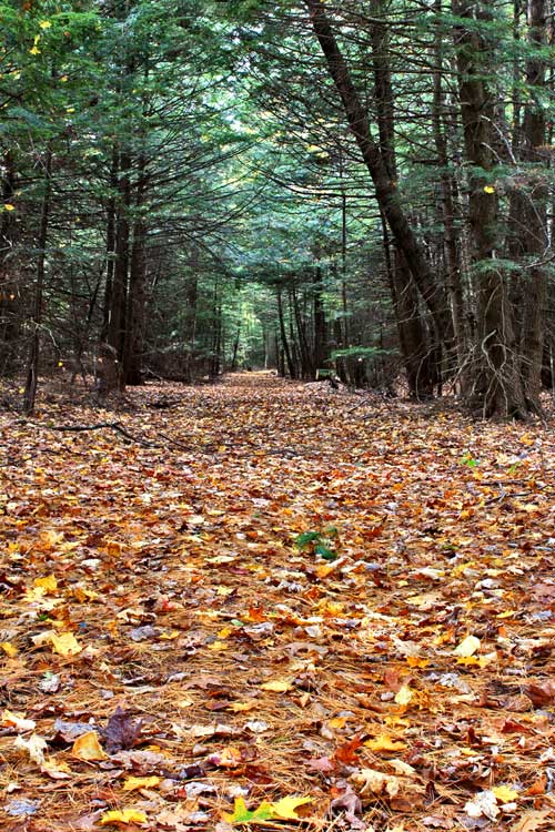
The first half of this hike will take you down the old rail road track bed. One land owner will not allow people to hike across his land, so you must detour around the land. The first half of the hike is almost flat, so it would be a good cross-country ski trail. The first part of the hike on the rail road tracks is very nice an beautiful. On a cloudy afternoon or near dusk you can often hear Barred Owls. Remember that the land off of the Rail Road tracks is private property.
.
The second half of the hike is more hilly, and parts of it are a road hike. But, the walk from Osborne Road to MTHS is nice. While at the Mountain Top Historical Society, stop in and say hi.
|
|
Hike the Kaaterskill Rail Trail |
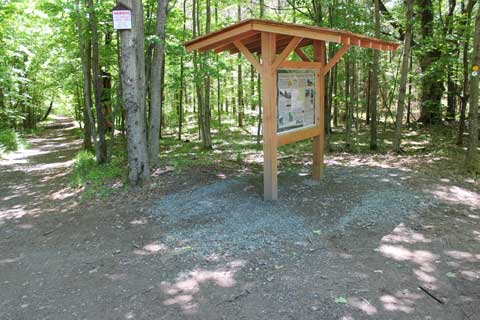 |
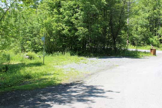
When you come to the end of Laurel House Road, there will be a turn around. You can park anywhere. Walk towards to the gate. By the gate is a Kiosk. This is the trail head for the Kaaterskill Rail Trail. Going straight will take you to the top of Kaaterskill Falls. You want to take a RIGHT and walk down the flat trail. This is the beginning of the Kaaterskill Rail Trail.
|
|
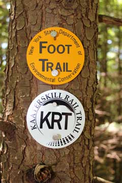 |
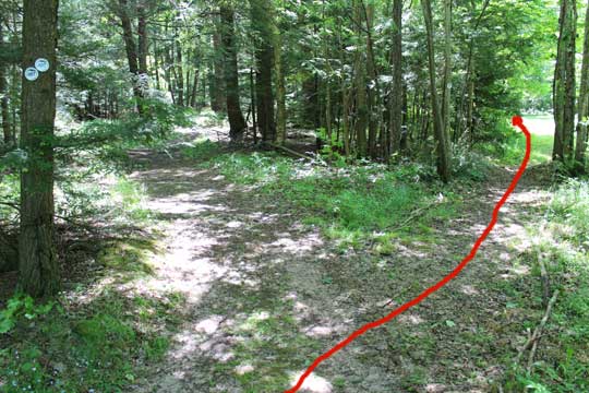
If look at the trees as you walk down the trail you will see two trail markers. The Yellow DEC markers will only take you part way down the trail. The other trail marker will take you further.
After about a 1/2 mile you will cross this small little bridge.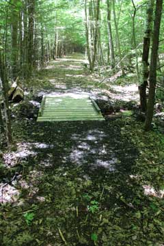 | |
|
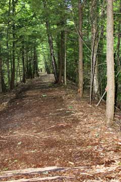 |
Most of the Kaaterskill Rail Trail is absolutely flat. It has some beautiful spots for a slow paced hike. |
|
 |
After walking about 1.1 miles, you will come to the end of the DEC trail. You cannot continue straight because it is private property and the landowner does not want people hiking on his land. You want to take a RIGHT and hike up the hill. |
|
 |
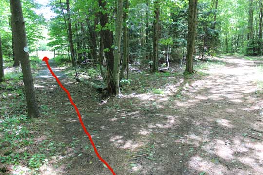
After walking up the hill you will come to North Lake Road. You will also see new Kaaterskill Rail Trail signs. When you come to North Lake Road, you want to take a LEFT and walk down the road. |
|
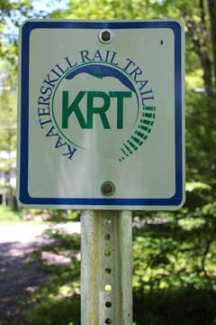 |
Kaaterskill Rail Trail signs on the road sections of the hike. The first one will be on the right side of the trail
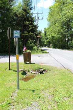
After walking down the road, you will come to a side road. You want to take a LEFT when you get to the road. Notcie the Kaaterskill Rail Trail sign.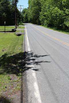 | |
|
 |
Take a LEFT onto Osborne Road.
When you get near the end of Osborne Road, you will see another Kaaterskill Rail Trail sign. You want to take a LEFT off Osborne Road and onto the dirt trail.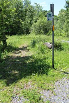 | |
|
 |
Just before you loop back to North Lake Road, you want to take a LEFT by the Kaaterskill Rail Trail sign. You will be about 50' before coming back out onto North lake Road. |
|
 |
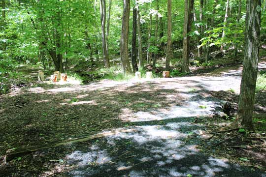
After walking a short distance you will come to an intersection. You want to take a RIGHT towards a small field. Stay on the left side of the field. When you get to the other side of the field go LEFT. |
|
 |
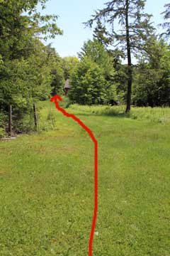
After walking a short distance you will come to an intersection. You want to take a LEFT and head towards another field. When you enter the field you will see a horse corral. Stay to the left and walk down towards the red barn. |
|
 |
Walk down the narrow lawn strip towards the red barn.
Walk past the red barn on the jeep trail.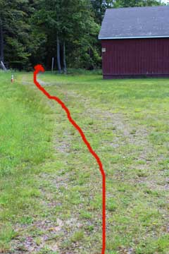 | |
|
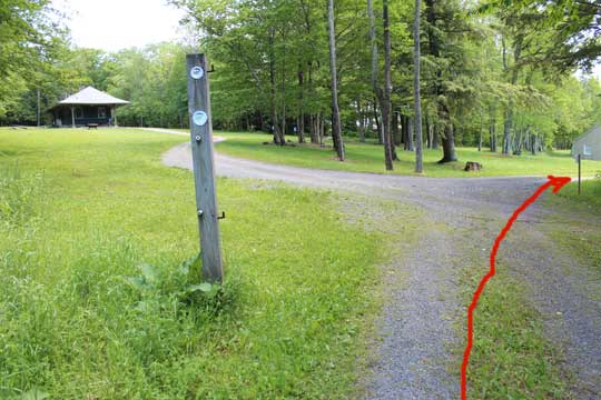 |
After a short distance you will see the old Rail Road Station on the left. You want to continue straight. |
|
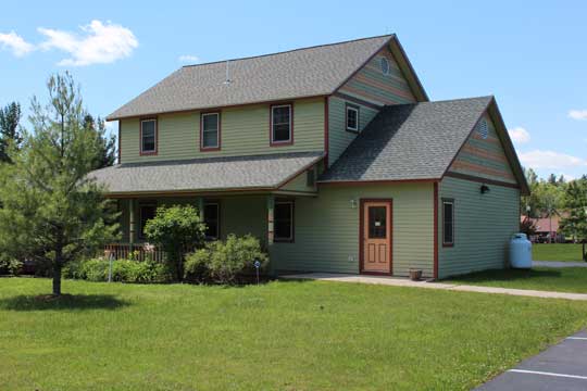 |
After a short distance you will reach the Mountain Top Historical Society Building ("MTHS" for short). This is the end of the hike. You can go inside and visit. Then reverse your course back to your car. |
|
|
S E C T I O N S
|
W E A T H E R
|
O T H E R
|