North Point & North Mountain from Winter Clove |
 |
|
|
Overview of this Hike: |
| Distance: 6.01 round trip from the Winter Clove Inn in Round Top. Add 1.32 miles if you visit Winter Clove Falls. |
| Time: 5 hours round trip (hiking time) - Add 1 hour if you visit Winter Clove Falls |
| Elevation Gain: 2,062' gain from parking lot to Lookout #2 at North Mountain(938' to 3,000') |
| Best Time to Hike: Any time of day |
| Catskill Highest: 66 |
| Highest Elevation: 3,000' |
| Digital Mapper:
Topo
Terrain
Satellite |
| Access Methods: Foot and snowshoeing. |
|
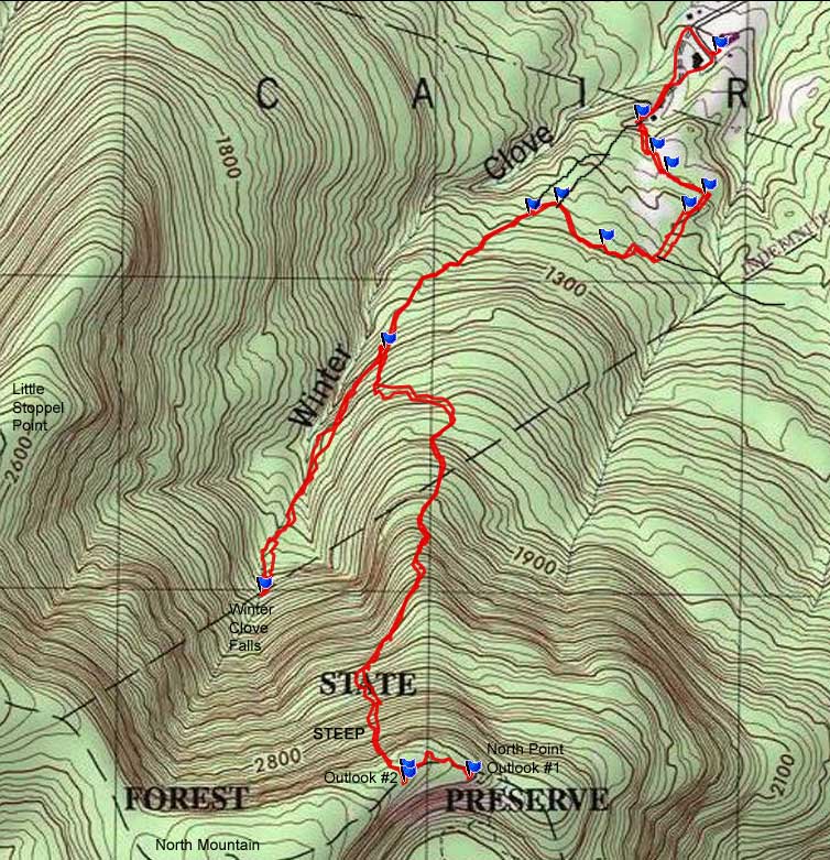
Maps, Profile, and GPS files |
 |
|
|
Directions to Trail Head from New York State Thruway (Easist, not the shortest): |
| Take New York State Thruway to Exit 21 (Catskill). |
| Take a left out of the NYS Thruway entrance road. |
| Go approximately 1/4 mile |
| Take a right onto Route 23 West |
| Go approximately 10.7 miles on Rt 23 (past Cairo, NY and up the hill towards Windham) |
| Take a LEFT onto Rt 31 to Round Top, NY. |
| Go approximately 3.7 miles on Rt 31 |
| Take a RIGHT onto Maple Lawn Road (Fire House is on the corner) |
| Go approximately 1.3 up Maple Lawn Road. |
| At the top of the hill take a LEFT onto Floyd Hawver Road. |
| Go approximately 1.0 mile |
| At the Stop sign continue STRAIGHT. |
| At the Y in the road - go RIGHT. |
| At the end of the road you will come to Winter Clove Inn. |
| Go into the Hotel and ask for permission at the front desk. If they want you to park your car in a special spot, they will let you know. |
| GPS: N42 14.445 W74 01.868 WGS84: 42.24075, -74.031133 UTM: 579936, 4676961 for Parking Lot of Winter Clove Inn |
| Mile Post | Altitude | Notes |
| 0.00 | 938 | Parking lot at Winter Clove Inn - Take dirt service road on the the left side of the hotel. |
| 0.13 | 977' | Take LEFT onto another dirt road. |
| 0.24 | 1,024' | Take LEFT by Winter Clove Apiaries Building. Go up the hill on the dirt road. GPS: N42 14.326 W74 02.053 |
| 0.37 | 1,067' | At the top of the hill and take Center Road onto Golf Course by the 3 road junction. Stay to the RIGHT side of the fairway next to the woods. GPS: N42 14.269 W74 02.017 |
| 0.44 | 1,078' | At the green take the small trail that goes over two small wooden bridges to the next fairway. Then walk down the right side of the fairway. GPS: N42 14.237 W74 01.983 |
| 0.54 | 1,072' | When you almost get to the next green, you will see a dirt road on the Right side. Take a RIGHT up the dirt road. GPS: N42 14.199 W74 01.895 |
| 0.61 | 1,113 | Look carefully for a small trail on the left side of the road - top of hill - Take LEFT onto small trail. There is a wooden sign. GPS: N42 14.169 W74 01.941 |
| 0.67 | 1,112 | Take a LEFT when you come to the end of the trail. GPS: N42 14.111 W74 02.136 |
| 0.67 | 1,112 | Walk 30' and take a RIGHT - trail leads right at top of hill. |
| 0.77 | 1,167 | Trail leads left at the end of conifer forest.. |
| 0.86 | 1,204 | Turn LEFT onto side trail. GPS: N42 14.111 W74 02.136 |
| 1.00 | 1,156 | Turn LEFT at trail junction (steel pipe runs parallel to trail - remember this spot). GPS: N42 14.184 W74 02.240 |
| 1.06 | 1,175 | Turn LEFT onto dirt road (remember this spot). GPS: N42 14.165 W74 02.307 |
| 1.51 | 1,512' | Turn LEFT to go up hill to North Point - straight goes to Winter Clove Falls. GPS: N42 13.932 W74 02.643 |
| 2.75 | 3,000 | Lookout #2 near North Mountain - Take LEFT and hike DOWN trail. GPS: N42 13.194 W74 02.602 |
| 3.03 | 2,958 | Lookout #1 (North Point) - Reverse Course. GPS: N42 13.190 W74 02.447 |
| 3.25 | 3,000 | Return to Lookout #2 - turn RIGHT and go back down trail |
| 4.50 | 1,571 | Trail Junction to Winter Clove Falls - Turn LEFT to hike up to Winter Clove Falls (optional). |
| 5.19 | 1,894 | Top of Winter Clove Falls (be careful around this waterfall). - Reverse course back down trail. GPS: N42 13.509 W74 02.935 |
| 5.82 | 2,315 | Trail Junction to North Point. |
| 6.26 | 1,262 | Take RIGHT off dirt road onto parallel trail (one with steel pipe). |
| 6.33 | 1,244 | Take RIGHT off smaller dirt road onto side trail. |
| 7.33 | 981 | Parking Lot of Winter Clove Inn. |
|
|
Hike to North Point & North Mountain from Winter Clove Inn |
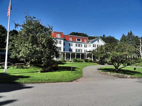 |
The picture above is Winter Clove Inn. Make sure you get permission from the front desk. If they ask you to park in a certain spot, please do so. If you are coming in from out-of-town, this is a great place to stay. If you forgot to bring this page with you, ask the front desk for a map. There are many turns, and it is almost impossible to figure out on your own.
|
|
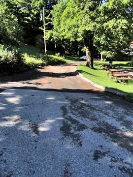 |
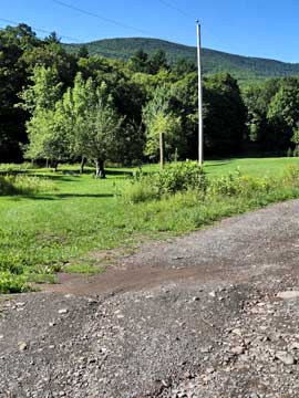
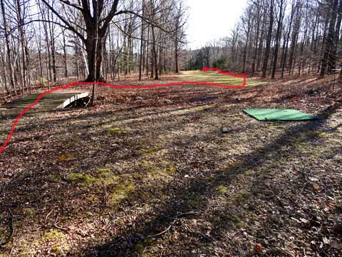
I start the hike by going up the service road on the LEFT side of the hotel. This will lead you to the back of the hotel. It is possible to take the service road on the right side of the hotel too. The service road on the LEFT side of the hotel will lead into the other service road. See the map. We show both ways.
As you walk up the LEFT side service road in back of the hotel, you will see North Mountain in the distance. You will also see one of the golf fairways on the left. |
 |
|
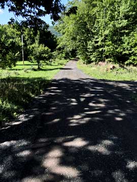 |
At 0.13 miles, you will come to the RIGHT service road. Continue onto the right service road. .
The left service road is shorter hike then taking the right service road. Remember that the right service road is a private driveway to someone's home. So, stay on the road. |
|
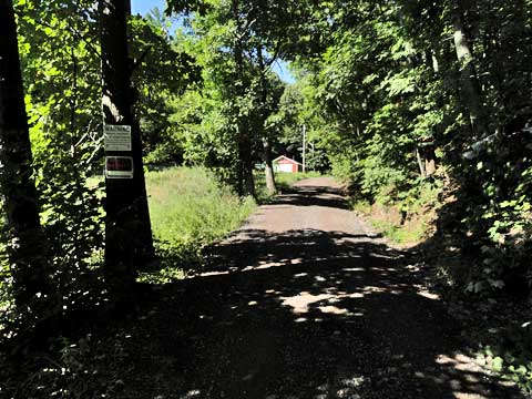 |
As you walk up the road, you will see "No Trespassing" signs on both sides of the road. It is okay to continue hiking up the road.
If you look off into the distance, you will see a red building. This red building is call the Winter Clove Aspiaries. There is a sign above the door with the name on it. When you get to this building you will be leaving the road and hiking up another Private Road. |
|
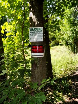 |
The picture shows one of many "No Trespassing" signs you will see at the beginning of the hike. |
|
 |
When you get to the Winter Clove Asparies little red building, you want to take a LEFT onto a smaller Private Road. This new Private Road will go up a hill. The Winter Clove Aspiaries is on the left side of the road. If you continued past the Winter Clove Asparies building, you would come to a private residence. So, make sure you take this left.
|
|
 |
As you walk up the private road, you will see a side road off to one of the gold greens. Stay on the private road and continue up the hill. Again, you may see "No Trespassing" signs. Continue past the signs.
|
|
 |
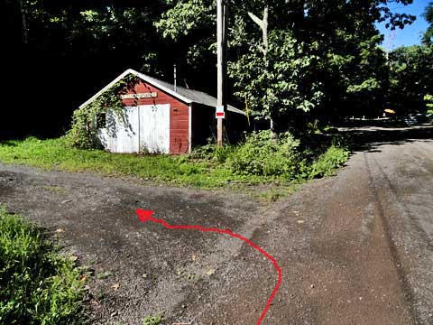
When you get towards to the top of the hill, there will be 3 roads. On the left of the picture is the left-most road. You don't want this road. In the center of the picture is the 2n'd road. You want to take this road. This will immediately lead you onto the golf course. This picture was taken from the 3rd road, which you just walked up. |
|
 |
When you walk onto the golf course, you want to continue walking next the woods. In this distance is another golf green. When you get to the green, you will see a small trail that will cross two very small streams. There are two arched bridges without side rails that you mist cross to the next golf fairway.
NOTE: Remember this is a golf course. Watch for golfers and flying golf balls. Golfers have the right-of-way over hikers. Wait for them to tee off before walking down the fairway. |
|
 |
This is the small trail that leads from the green to the next green. It is right next to the golf green. |
|
 |
This is the next fairway. You want to walk down the right side of the fairway. Just before you get to the next golf green, you will see a road on the RIGHT side of the fairway. You want to take this road. There is also a smaller trail about 2/3 of the way down the fairway. This small trail will lead into the next road you want to take. It is a small short cut.
On the left of the picture is the 2nd arched bridge that you will walk over. |
|
 |
This is the road near the 2nd golf green. It is wide enough to drive a truck on. You want to take a RIGHT off the golf fairway onto this dirt road. The road will go up a hill.
As you walk up up the hill, you need to start looking for a small side trail on the left. It is easy to miss, so look carefully. It is about 350' from the golf fairway. There is also a wodden sign on a tree on the left side of the road.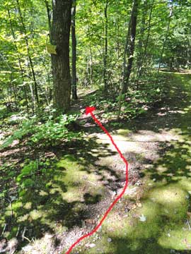 | |
|
 |
This side trail off the dirt road will have a sign like you see in the picture. You want to take a LEFT onto this side trail.
This side trail is short, and it will come to an end very shortly. When it does you want to take a LEFT.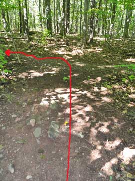 | |
|
 |
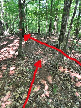
After you come to an end of the side trail and take a LEFT, you want to walk about 30 feet. Then look for a trail on the RIGHT. You want to take a RIGHT and head up the hill. If you continue straight, it will take you out towards Rip's Ledge.
There is a sign that exist about 30' down the trail. Look for it on the RIGHT.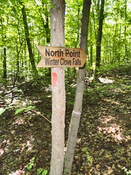 | |
|
 |
You want to walk up this small incline. When you get to the top of the small hill, the trail will turn 90 degrees to the right. It is easy to miss this turn of the trail. This will lead you into a nice Pitch Pine forest.
As you walk through the conifer forest, you will come to the sign, and the trail will turn towards the LEFT. After the trail turns left it will go up a small incline.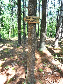 | |
|
 |
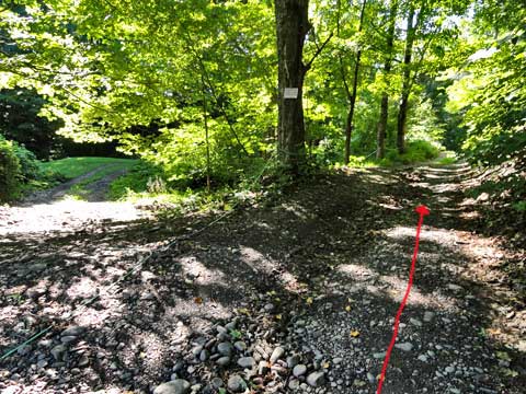
As you walk down the trail, there is a smaller side trail off to the LEFT. You want to take this small side trail. This side trail is very easy to miss, so you need to look for it. |
|
 |
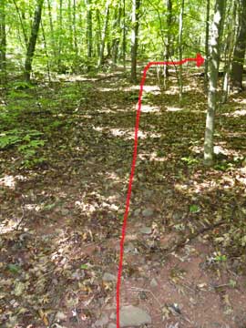
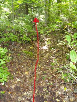
After you walk down this side trail, it will come to a Y intersection. Look for a small steel pipe running down the trail. You want to take a LEFT here. When hikers return, they often miss the side trail, so turn around and try to remember what it looks like. It is very easy to miss when returning from North Mountain. |
|
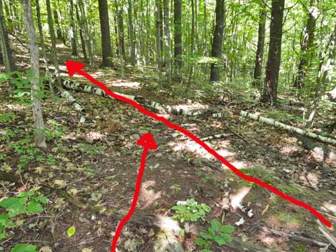 |
After walking a short distance you will come to another Y intersection. Same situation for this Y intersection. You want to take a LEFT here. When hikers return, they often miss the side trail, so turn around and try to remember what it looks like. It is very easy to miss when returning from North Mountain.. |
|
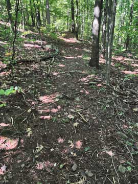 |
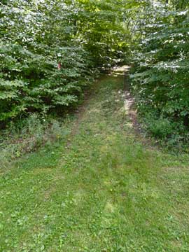
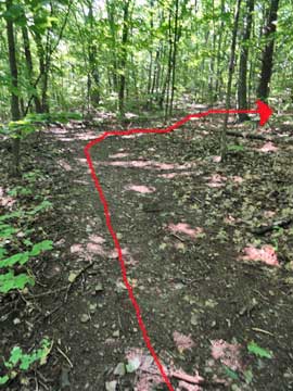
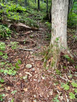
This trail is a former road. You will follow this dirt road for quite a while. You will also cross a stream that might be difficult to cross at high water. It has a nice and easy incline.
When you get within a 1/2 mile of Winter Clove Falls, you will come to a trail intersection. You want to take a LEFT and hike up the hill. This trail will take you to North Mountain and come out at Lookout #2. If you continued straight, you will reach Winter Clove Falls in about a 1/2 mile. In the summer Winter Clove Falls doesn't run very fast. During a drought, it may be a trickle of water. During moderate or high water, it flows well. It is a two drop waterfall with a small cascade at the end. It is about 129' high. I generally visit the waterfalls on the way back.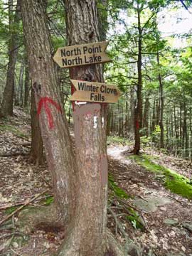 | |
|
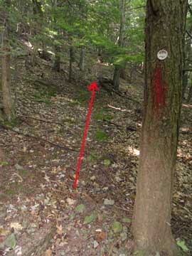 |
The trail heads up the hill. After a short time, it will turn towards the left. This trail can get overgrown, so you need to looke for trail markers. If you get lost, backtrack until you find trail markers, and then move forward again. You need to pay attention.
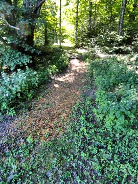
This shows part of the trail that is overgrown. You just need to pay attention to the trail markers.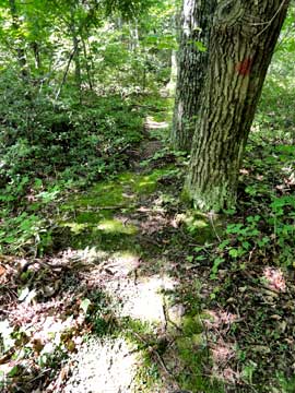 | |
|
 |
This shows part of the trail that is overgrown. You just need to pay attention to the trail markers.
Once you climb up a steeper portion of the trail, the trail will move towards the right and you will walk through some nice conifer forest.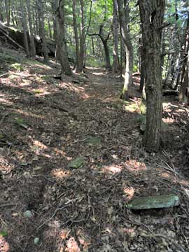 | |
|
 |
Near the end of the conifer section, there is an opening of the forest which overlooks the ridge line where Little Stoppel Point is located. |
|
 |
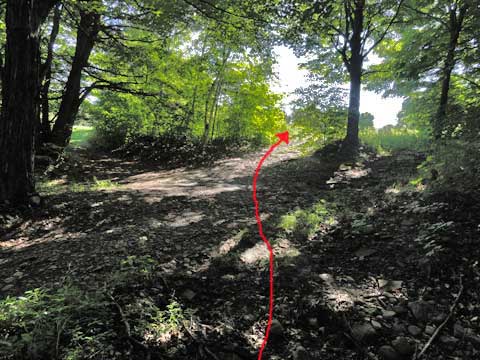
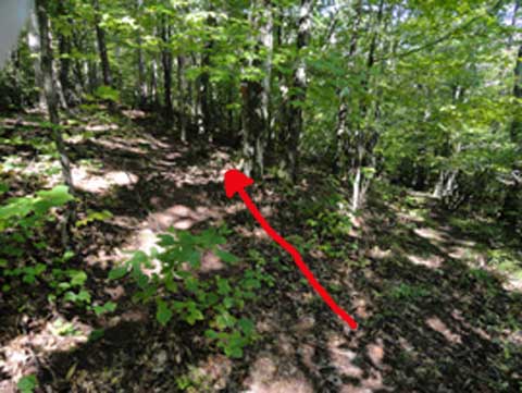
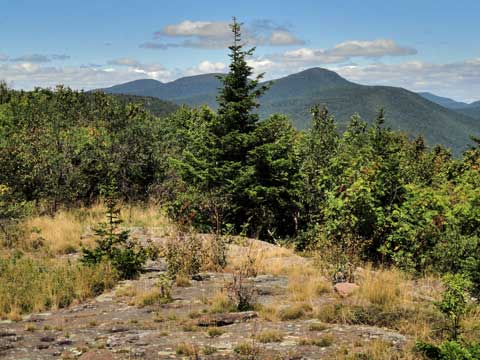
After walking towards the north slightly, the trail will then move to the left slightly. At this point the traill become very steep for about 300 vertical feet. Towards the top, it gets quite steep. There are no ledges or rocks to climb, but it is very steep. Near the top, the trail will level off and wind through the trees. It will then come out directly across from North Mountain Lookout #2.
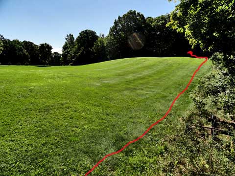
When you come out of the forest, you will cross a small section of grass, as you see in the picture. When you hit the Escarpment Trail, Lookout #2 will be right in front of you.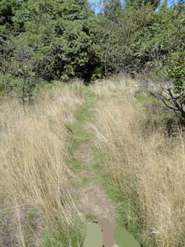 | |
|
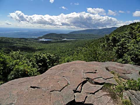 |
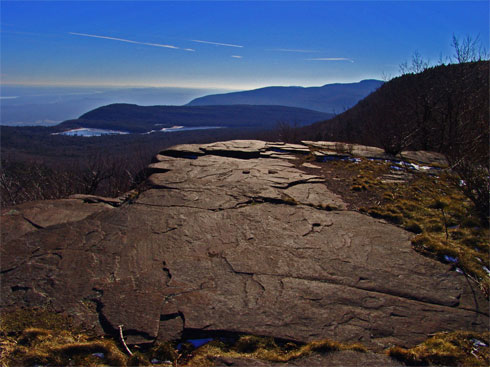
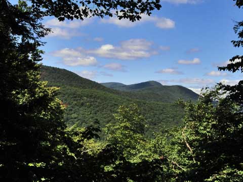
This is the view from North Mountain's Lookout #2. It often produced some great photos. It has some of the best views in the Catskill Mountains. |
|
 |
As you hike DOWN the trail towards North Point, you will encounter a ledge called Pocket Ledge. It gets it's name from the dish shaped holes in the ledge. If you climb up on the rock, you can see the Blackhead Mountain Range. |
|
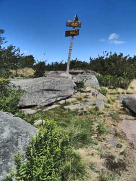 |
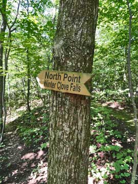
Just before North Point, you will see this sign. This means that you have arrived at North Point.
The picture on the right was taken from North Point overlooking North and South Lake. North Point is also called Lookout #1.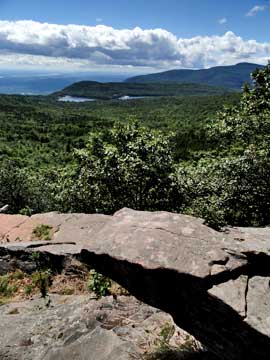 | |
|
S E C T I O N S
|
W E A T H E R
|
O T H E R
|