Poet's Ledge, Viola Falls, Wildcat Falls, and Buttermilk Falls |
 |
| |
| |
|
|
|
|
| | DIRECTIONS TO TRAIL HEAD |
| | Take New York State Thruway to Exit 21 (Catskill). |
| | Take a left out of the NYS Thruway entrance road. |
| | Go approximately 1/4 mile |
| | Take a right onto Route 23 West |
| | Go approximately 6.6 miles on Route 23. |
| | Take a LEFT onto Rt 32 (McDonalds on corner). |
| | Go approximately 7.7 miles on Route 32. |
| | Take RIGHT onto Rt 23A. |
| | Go approximately 2.6 miles on Rt 23A . |
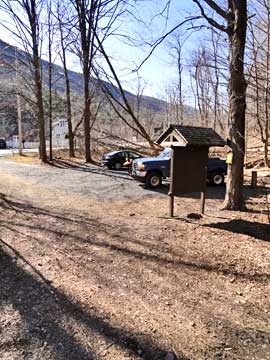
| | Take a Right into the DEC Palenville Parking Area |
| | Some people have parked at the Fernwood Resturant (with permission - they eat there once they are done with the hike). |
| | You cannot park at the trail head! |
| | Do NOT park by the red building next to the bridge. |
| | Do NOT park on Malden Ave or in someones driveway on Malden Ave. |
| | Do NOT drive up the dirt entrance road to the trail head - this is PRIVATE property - AND there is NO place to park or turn around once you get to the trail head. |
|
|
SPECIAL CIRCUMSTANCES ABOUT THIS HIKE |
| | You should park at the DEC Parking Area about 1/4 mile before the bridge that passes of the Kaaterskill Creek. This parking area fills up quickly on weekends, so get there early. There are several places NOT to park. You should NOT park by the red building. Yes, this is part of Malden Ave, and it is a public road. Expect to have the owner of the Red Building to have your car towed. The owner of the building will go nuts! You cannot park anywhere on Malden Ave. You can park at Fernwood Resturant with permission. Make sure you eat there when you return. The people along Malden ave really do not like hikers, and some make it very difficult for hikers.
The driveway to the trail head, is the one just around the corner from the Fernwood Resturant. It is the one with No Parking signs on the driveway. The trail head is about 150 feet from the road. The road part way up the mountain is Privately Owned! Please be respectful! If you look up the road, you should see a Blue DEC trail marker or a green LP marker. Some local owners will rip down the markers. Stay on the road! After the gate the path will be on the right. It will still be a ways after the gate.
PLEASE NOTE: The private dirt road from Malden Ave up to State land is closed to the public during hunting season.
The side trip to Poet's Ledge is quite nice. We believe that Poet's Ledge has one of the best views in the Catskill Mountains. Some people don't like the noise from the road, but the view is great.
For the trip to Hawkeye Ledge, continue on the trail after the trail junction to Poet's Ledge. After a short distance, you will see a very small stream (might be dry in the summer months). This is the eastern branch of Hillyer Creek. This is where you will leave the trail and bushwhack up to Hawkeye Ledge. Follow the stream bed. The stream bed stops before Hawkeye Ledge. People to camp up there.
For the side trip to Johnson's Point, leave the trail when you get to the intersection that takes you to KHP or Twilight Park. Travel down until you find a small ledge that looks towards Bastion Falls.
You should always try to visit Poet's Ledge first. It has the best view in the morning, as the sun shines in from east and fills up the Kaaterskill Clove with sunlight. Later in the day, the view is very disappointing. The path to Poet's Ledge is well marked DEC trail. You can also access it from Viola Falls by following northern escarpment into the woods. This is where the old trail existed. They have recently changed it so that people could access Poet's Ledge from Palenville with less mileage.
There is a Timber Rattlesnake den below Hawkeye Ledge on the Eastern Escarpment. Once in a while one of the Rattlesnakes does pass over this trail into the Kaaterskill Clove. It is extremely rare to see one.
|
|
|
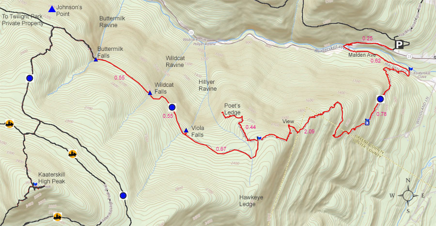
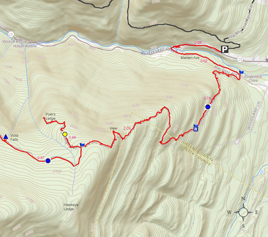
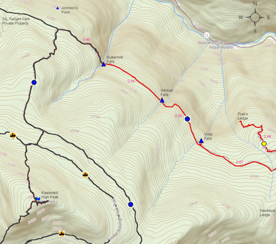
MILEAGE CHART |
| | Mile Point | Altitude | Notes |
| | 0.00 | 680 | Parking - From Route 23A turn onto Malden Ave - Walk past double guard rails (watch out for poison ivy on left side of road). |
| | 0.62 | 680 | Walk up wide dirt driveway about 250 ( look for green Long Path trail marker on tree - hard to see from Malden Ave) - Turn right and walk up narrow dirt driveway past metal gate (If gate is closed, walk around gate). |
| | 1.01 | | Road branch - Go straight |
| | 1.27 | | Road branch - Go Right |
| | 1.33 | 1,255 | Road Branch - Go Right - leave dirt road and continue onto the foot path |
| | 1.40 | | Leave private land onto public land |
| | 2.13 | 1,955 | Level off for a while |
| | 2.31 | 2,067 | Giant steps |
| | 2.34 | 2,102 | Ledge #1 (views) |
| | 2.44 | 2,264 | Rock-in-the-Path |
| | 2.52 | 2,325 | Reach top of moderate ascent - Levels off after this for several miles. Total ascent of 1,661. |
| | 2.57 | 2,317 | Start of Boreal Forest - Take a LEFT and walk south along ridge line |
| | 2.63 | 2,341 | Trail Branch - go right to Poets Ledge (0.44 miles) - Yellow trail markers |
| | 2.98 | 2,187 | Mossy Notch |
| | 3.07 | 2,145 | POETS LEDGE . |
| | 3.74 | 2,183 | Viola Falls |
| | 4.29 | 2,212 | Wildcat Falls |
| | 4.84 | 2,186 | Buttermilk Falls |
| | 9.68 | 680 | Return to Parking Lot |
|
 |
There are 3 places you can park to do this hike.
(1) You can park in this very small DEC parking area (fills up very quickly on weekends)
(2) You can continue 1/4 mile past the Kaaterskill Creek and park on the right side of the road (fills very quickly)
(3) Some people have parked at the Fernwood Restaurant (with permission). Make sure you eat there when you return.
For the purpose of this hike listing, we will assume that you are going to park in the small DEC Parking Area about 3/10 of a mile before the bridge that goes over the Kaaterskill Creek.
You cannot park anywhere along Rt 23a between Palenville and Haines Falls.
|
|
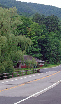 |
You will need to walk down the road until you come to this red building. The red building is on Malden Ave. Turn left onto Malden Ave.
The mileage for this hike starts where this picture is taken. It is the closest place to the trail head.
Walk over bridge and take a left onto Malden Ave (In front of the red building).
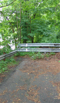
Walk around the barrier. You will have to wade thru the brush at the beginning of this barrier. Then you can continue walking on the road until you reach the barrier on the other side of Malden Ave. Continue down Malden Ave. The distance to the dirt road that is the beginning of the trail is 0.62 miles. |
 |
|
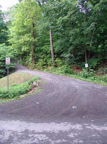 |
This is the entrance to the Long Path/trails from Malden Ave. Walk up this driveway.
Absolutely do NOT park here, or drive up this road. This road is private property, and you only have the rights to walk up the road to access the trail head. I can assure you that if you park here, your car will be towed.
If you look very carefully from Malden Ave, you might see the green Long Path trail marker on the tree. You have to look very carefully.
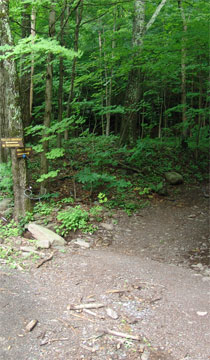
After walking 150 feet up this driveway, turn RIGHT onto a smaller driveway. You will see a DEC sign denoting that this is the way to the trail. 30 feet after turning right you will see a steel gate. You can walk around the gate and continue up the road.
There is another metal gate further up the road. Walk around that one too, if it is closed.
The picture on the right shows the sign denoting the direction to the trail. The first metal gate blocking the road is just past the sign denoting the trail. |
 |
|
 |
At mile marker 1.01 (from where you parked your car), you will come to a 3-way intersection. GO STRAIGHT.
You will see trail markers, so follow them if you get confused.
There is another road on the right of the picture (which you cannot see in the photo). |
|
 |
At mile post 1.27, you will encounter the second trail branch. You want to GO RIGHT. Again follow the trail markers. |
|
 |
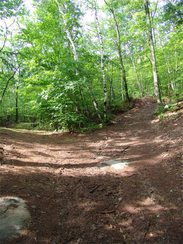
At Mile post 1.33 (elevation 1,250) the road will branch again. This time the branch will move off the road on to a foot path. If you were to continue further, you will run into the property owners house. So try not to disturb them.
At Mile post 1.40, you will leave private land and will enter public land. At this point you can leave the path if you so choose.
The path will continue on a steady moderate uphill ascent.
|
|
 |
At Mile post 2.31 (Elevation 2,067) you will encounter The Giant Steps. These rocks are often slippery to dont be deceived by their appearance.
|
|
 |
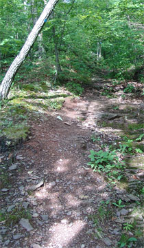
At Mile post 2.34 (elevation 2,102) you will encounter the first ledge with a view. From this ledge you can clearly see Indian Head, Palenville Overlook, and Boulder Rock. You will also be able to see down into Palenville and the Hudson Valley. Nice view on a clear day.
At Mile post 2.44 (elevation 2,264) you will encounter Rock-in-the-Path.
At Mile post 2.52 (elevation 2,325) you will come to the end of the long ascent. (At this point you have completed the 1,645 vertical ascent. At this point, the trail will continue on a level path all the way to Twilight Park.
At Mile post 2.57 (elevation 2,317) you will enter the beautiful Boreal Forest that has many magnificent old growth trees. Some are 3+ feet in diameter. The forest has a nice thick canopy, and is exceedingly enjoyable to walk through.
|
|
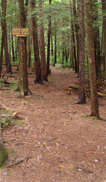 |
At Mile post 2.63 (elevation 2,341) you will encounter a Trail branch. If you go right it will lead to Poets Ledge. The trail is marked with Yellow Trail Markers. The detour to Poets Ledge is 0.44 miles one way or 0.88 miles round trip.
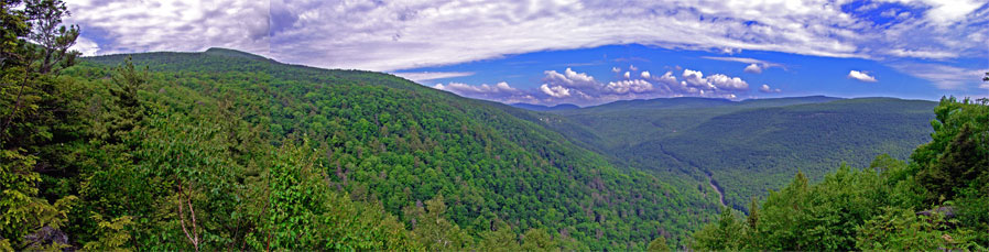
Poets Ledge is the shining star of this hike, and should not be skipped. It has one of the most magnificent views in the Catskill Mountains.
If this is the end of your hike, your round trip mileage will be 6.14 miles. The trail will be a 196 drop in elevation from the trail junction down to Poets Ledge.
|
 |
|
 |
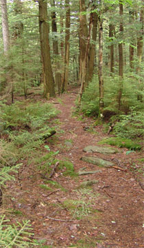
About 2/3 of the way down to Poets Ledge, you will encounter two ledges (pictures on the right and left). These are NOT Poets Ledge. There are blueberry bushes around both of these ledges.
Continue on the path until the path comes to an ends. Then you will be at Poets Ledge. |
 |
|
 |
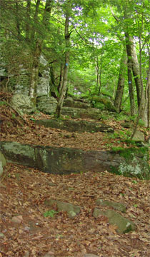
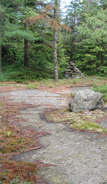
After the two ledges, you will come to a beautiful mossy notch. Continue down and around the notch.
Shortly after exiting the notch, you will enter a beautiful conifer forest. At the end of the short forest is Poets Ledge. |
 |
|
|
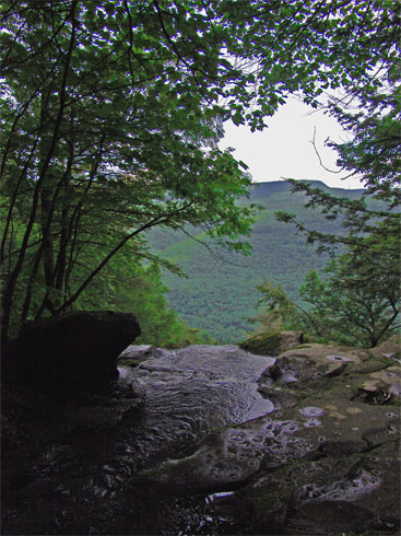
This is the view of Poets Ledge. While the photo is beautiful, it really does not do it justice to the view you will get. On a clear crisp day, the vistas are awe inspiring. Hillyer Falls is just below Poet's Ledge. If the waters is flowing well, you can easily hear the water flowing over the waterfalls.
There is a benign looking hole in the ledge.
The best time to arrive at Poets Ledge is around noon time to 2 PM in the afternoon. Late in the afternoon is the worst time. The photo above was taken at 10 AM. It takes 2 hours and 15 minutes to get there.
The mileage from the Long Path to Poets ledge is 0.44 miles, and the elevation at Poets Ledge is 2,145. There is a 197 drop in elevation.
Reverse course to return back to the Long Path. |
|
 |
At mile 3.74 you will encounter Viola Falls. Elevation 2,183. There are several waterfalls below this one, and several above Viola Falls. Below here are links to more information about Viola Falls and West Hillyer Ravine.
Viola Falls
West Hillyer Ravine (Viola Falls)
|
|
 |
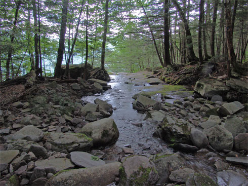
At mile 4.29 you will encounter Wildcat Falls. Elevation 2,212. There are several waterfalls below this one, and several above Wildcat Falls. Below here are links to more information about Wildcat Falls and Wildcat Ravine.
Wildcat Falls
Wildcat Ravine (Wildcat Falls)
|
|
 |
At mile 4.84 you will encounter Buttermilk Falls. Elevation 2,186. There are several waterfalls below this one, and several above Wildcat Falls. Below here are links to more information about Buttermilk Falls and Buttermilk Ravine.
Buttermilk Falls
Buttermilk Ravine (Buttermilk Falls)
OPTIONAL Side Trip: About 750-1,000' past Buttermilk Falls is a faint trail (on the RIGHT) that will take you to Johnson's Point. It is hard to follow the trail, so expect to bushwhack some of the way. You will go downhill a little ways, and come to a flat ledge. From this ledge you can see Bastion Falls. |
|
|
S E C T I O N S
|
W E A T H E R
|
O T H E R
|