OVERVIEW |
| | Distance: | Distance: 5.20 miles round trip from Platte Clove Road. |
| | Time: | Average 3-4 hours round trip |
| | Elevation Gain: | 1,018 feet from parking to Quarry on Plattekill Mountain. |
| | Best Time to Hike: | Anytime. |
| | Difficulty: | Easy |
| | Catskill Highest: | #74 |
| | Peak Elevation: | 3,100' |
| | | |
| | | USGS Official Names: | Plattekill Mountain (ID: 960694) |
| | USGS Summit-Elevation: | 3,091' (USGS) |
| | USGS Plattekill-Summit-WGS84: | 42.107312, -74.086528 (DEC-WGS84) |
| | USGS Plattekill-Summit-GPS: | N 42 06.439, W 74 05.192 (GPS) |
| | USGS Plattekill-Summit-UTM: | 18N 575525, 4662095 (UTM) |
| | USGS Plattekill-Summit-Deg, Min, Sec: | N42 06 26, W74 05 11 (Degree, Min, Sec) |
| | |
| | | USGS Official Map: | Woodstock Topographical Map (free) |
| | |
| | | Acme Digital Mapper: |
Topo
Terrain
Satellite |
| | |
| | | Notices: | Timber Rattlesnakes (Low) |
| | Access Methods: | Foot and snowshoe. Very good snowshoe trail. Good cross-country ski trail. |
|
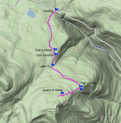
Maps |
 |
|
|
| | DIRECTIONS TO TRAIL HEAD |
| | Platte Clove Road Parking WGS84 (DEC): 42.133267, -74.085983 - Elevation is approximately 1,844 feet |
| | Platte Clove Road Parking Deg/Min/Sec: N42 07 59, W74 05 09 - Elevation is approximately 1,844 feet |
| | Platte Clove Road Parking GPS: N 42 07.996, W 74 05.159 - Elevation is approximately 1,844 feet |
| | Platte Clove Road Parking UTM: 18N 574020, 4665046 - Elevation is approximately 1,844 feet |
| | Take New York State Thruway to Exit 21 (Catskill). |
| | Take a left out of the NYS Thruway entrance road. |
| | Go approximately 1/2 mile |
| | Take a right onto Route 23 West |
| | Go approximately 5 miles on Route 23. |
| | Take a left onto Rt 32 (McDonalds on corner). |
| | Go approximately 7-8 miles on Route 32. |
| | Take right onto Rt 23A. |
| | Go approximately 7-8 miles on Rt 23A . |
| | When you come into Tannersville, take LEFT at the red light onto RailRoad Ave (Rt 16), which will turn into Spruce Street, which will turn into Platt Clove Road. Follow this road approximately 7-8 miles |
| | The parking lot is on the RIGHT side of the road. You will actually be parking on the side of the road |
| | It is approximately 1/4 mile past Josh Road (on right side of the road). |
| | Alternate Parking: Kaaterskill High Peak Parking (1/4 miles further). |
| | Alternate Parking: Prediger Road Parking (Turn around and go ~1/2 miles back up Rt 16). |
|
|
SPECIAL CIRCUMSTANCES ABOUT THIS HIKE |
| | There is a view and quarry by the Trail Junction up to the top of Plattekill Mountain. Timber Rattlesnakes have been seen here. There may be Timber Rattlesnakes at the quarry on Plattekill Mountain and on the peak of Plattekill Mountain. We have never seen them there, but logically, they should be there. There are Black Bears on this hike.
|
|
|
MILEAGE CHART |
| | Mile Point | Altitude | Notes |
| | 0.00 | 1,844 | Parking by side of road (Platte Clove Road). GPS: N42 07.996 W74 05.159 Elevation 1,844' |
| | 0.82 | 2,153' | Trail Junction to Prediger Road (DEC authorized Bicycle Trail). |
| | 0.94 | 2,187 | "Chairs" in Quarry |
| | 1.02 | 2,211' | Trail Junction to Indian Head Mountain. |
| | 1.22 | 2,255' | DEC Lean-To |
| | 1.86 | 2,518 | Dual Trail Junction. LEFT goes to ledges/quarry 200' from trail. RIGHT goes to Plattekill Mtn. |
| | 1.93 | 2,506 | Quary & Ledges - Timber Rattlesnakes seen here from time-to-time. |
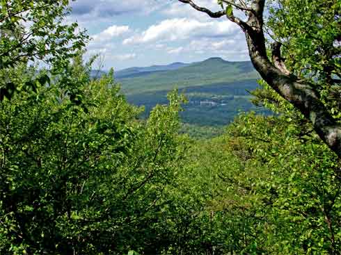
| | 2.44 | 2,860 | Views of Platte Clove from Quarry |
| | 2.60 | 2,862 | End of wagon trail & hike. You can continue the hike by take a 90 degree left turn and follow faint trail up to Plattelkill Mtn Peak - Ledges exist just beyond peak. Ledges have a great view of Echo Lake. |
| | 5.20 | 1,844 | Return back to parking on Platte Clove Road. |
|
|
Hike to Plattekill Mountain |
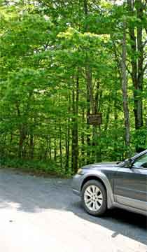 |
The picture on the LEFT is the parking on the side of Platte Clove Road. If the spaces are full, you can park at the DEC parking lot further down the road (less then 1/4 mile). This parking lot can probably hold 6 cars. The spaces are filled up most of the year.
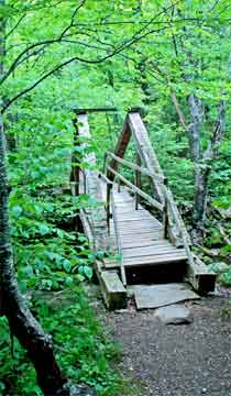
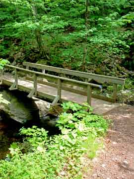
The image on the RIGHT shows the walking bridge over the Plattekill Creek. Just below the bridge is Old Mill Falls, which are two ledges that drop a total of 10 feet. About 2/10 of a mile below Old Mill Falls is Plattekill Falls, which is 70 feet high. There are 14 falls over 20 feet high down the Clove. Very dangerous place to hike. This bridge is called Overlook Bridge. The construction of the bridge is called "King Post" bridge construction. This was the beginning of Overlook Road. The old bridge (1880-1920) was larger then the existing bridge. The old bridge was used for wagons traffic from Woodstock to Platte Clove. Some of the wagons hauled blue stones from many of the quarries higher up on the mountain. The existing walking bridge in the picture was created to look like the old Overlook Bridge from 100 years agao. |
 |
|
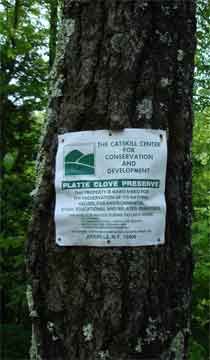 |
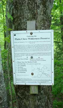
The land by Platte Clove Road is not New York State Land. It is called the Platte Clove Wilderness Preserve. The 208 acres is owned by the The Catskill Center for Conservation and Devlopment, Inc. The land was granted to the foundation by the Griswold Family. The land has rules that are different then New York State land. Their rules are fairly simple for hikers. You cannot ride your mountain bike, camp, or swim on this land. |
 |
|
 |
The Platte Clove Wilderness Preserve has recently cut a new path to New York State Land. The old path was severely rutted by over 100 years of traffic. It should be noted that after a significant rain storm, this trail may not be passable.
At mile post 0.82 you will come to a Trail Junction. This trail on the right side of the trail is the DEC Bicycle Trail. It will take you to either Indian Head Mountain and/or Prediger Road Parking Lot. You want to continue STRAIGHT. |
 |
|
 |
At mile post 0.94 you will see a quarry on the left side of the trail. There is a small path that leads to the quarry. In the middle of the quarry, you will see the "Chairs". We have never seen or heard of Timber Rattlesnakes nor Copperheads here, but it is possible that they might exist here.
At mile post 1.02 you will come to another Trail Junction. This trail junction will take you to the top of Indian Head Mountain. This Trail is part of the Devil's Path. It is rough and difficult, but has great views. There is a reason they call it the Devil's Path. You want to continue STRAIGHT. |
 |
|
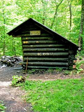 |
At mile post 1.22 (Elevation 2255'), you will come to this DEC Lean-To.
There are Black Bears around this Lean-To, so you want to make sure that your food is tied up according to DEC regulations. If you have a bear resistant container please use it. In 2009, bear resistant containers are only required in the Adirondack Mountains. You can use a "Food Hang. You can hang your food a MINIMUM of 15 feet off the ground and a MINIMUM of 10 feet away from the tree. You should use a dark colored cord that is at least 75 feet long.
There is an outhouse behind the Lean-To. |
|
 |
About 50-100 feet past the DEC Lean-To you will encounter this wooden bridge over the creek. Some people hang their food on the other side of the creek to keep the bears away from the Lean-To.
|
|
 |
At mile post 1.86, you will encounter a dual Trail Junction. LEFT will take you to a quarry which as some nice views of the Hudson River and Hudson Valley.
NOTE: Timber Rattlesnakes have been seen in this quarry, so keep an eye out for them.
Going STRAIGHT will take you to Overlook Mountain and Echo Lake.
Going RIGHT will take you to Plattekill Mountain
Almost everyone likes to visit this viewing area. It is only 350' off the trail. After enjoying the views return back to this spot. The Trail to Plattekill Mountain is about 10 feet past the rock cairns on the RIGHT. Take a RIGHT. This is a non-DEC trail.
|
|
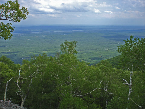 |
The picture on the LEFT is the views from the Quarry.
|
|
 |
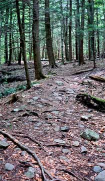
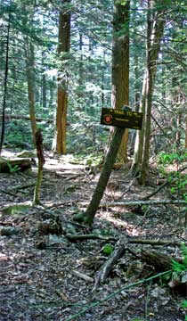
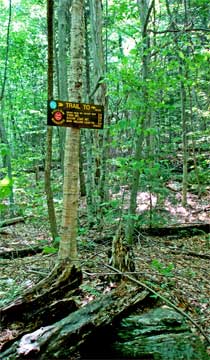
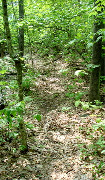
The picture on the LEFT is the entrance to the trail to Plattekill Mountain. This is a non-DEC trail, and is not travelled as much as other trails in the Catskills. This is a common trail for locals in the winter.
The picture on the RIGHT is another picture of the Plattekill Mountain Trail. |
 |
|
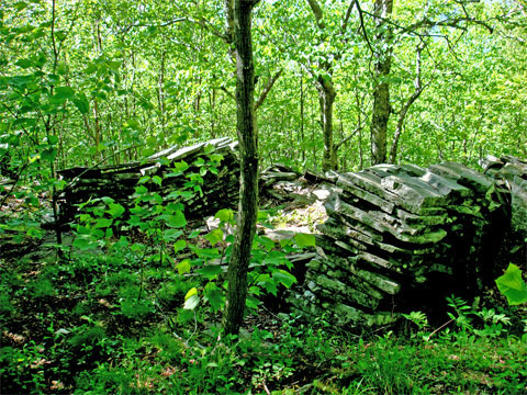 |
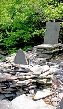
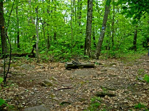
At mile post 2.44, you will come to a quarry. There is also a view of Platte Clove from the quarry. The picture on the LEFT is part of an old foundation of the building for the quarry. You will also see some finished inventory of blue stone next to the trail.
We have never seen or heard of Rattlesnakes at this quarry, but logic tells us that they may exist here.
|
|
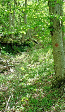 |
At mile post 2.60, you will come to the end of the Wagon Trail. You can see a red spot on the tree marking the trail. About 50-to-100 feet past this tree the trail takes a 90 degree turn and head up the mountain. The trail to the top is faint and difficult to follow in the summer. When the leaves are not on the tree, it is much easier to follow.
Just past the peak are some ledges that overlook Echo Lake. Some hikers may then hike down the south face and go to Echo Lake. Make sure that you consult your maps prior to leaving this point. A GPS with a topo map is recommended.
Reverse course back to the parking lot.
|
|
|
S E C T I O N S
|
W E A T H E R
|
O T H E R
|
|