Hike to West Kill Mountain from end of Spruceton Road |
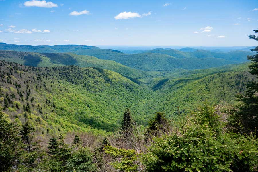 |
| View from Buck Ridge Lookout near the summit of West Kill Mountain |
| |
| |
|
OVERVIEW |
| | Trail Name: | Diamond Notch Trail
 (Spruceton Road to Devil's Path)
 |
| | Trail Name: | Devil's Path
 (Diamond Notch Trail to West Kill Mountain)
 |
| | |
| | | Parking Area : | 3 area near the end of Spruceton Road (Hunter Mtn PA) |
| | Winter Access: | Parking Area is Plowed in the Winter |
| | Camp sites: | No Camp Site locations |
| | | |
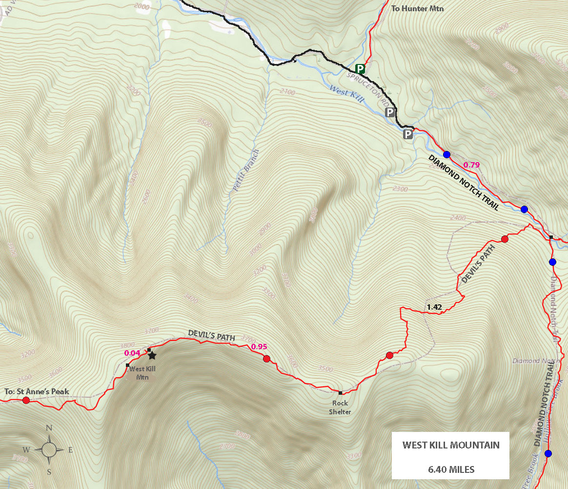
| | | Distance: | 6.40 miles from Spruceton Road & back. |
| | Trail Type: | Single-track trail |
| | Time: | Average 4.50 hours round trip |
| | Elevation Gain: | 1,786 feet from the DEC Parking Lot and the summit. |
| | Best Time to Hike: | Morning. |
| | Difficulty: | Very Difficult |
| | Peak Elevation: | 3,891' |
| | Views : | Buck's Ridge |
| | Access Methods: | Foot |
| | |
| | | USGS Official Map: | Lexington Topographical Map (free) |
| | |
| | | DEC Trail Map: | DEC Hunter-West Kill Wilderness Map (free) |
| | |
| | | Digital Mapper: |
Topo
Terrain
Satellite |
|
|
Maps |
 |
|
|
|
| | DIRECTIONS TO TRAIL HEAD |
| | Hunter Parking Lot #1 (WGS84): 42.184717, -74.27175 - Elevation is approximately 2,117 feet |
| | Hunter Parking Lot #1 (GPS) : N42 11.083 W74 16.305 - Elevation is approximately 2,117 feet |
| | Hunter Parking Lot #1 (UTM) : 18N 560137, 4670542 - Elevation is approximately 2,117 feet |
| | Hunter Parking Lot #1 (Deg, Min, Sec): N42 11 04 W74 16 18 - Elevation is approximately 2,117 feet |
| | |
| | Take New York State Thruway to Exit 21 (Catskill). |
| | Take a left out of the NYS Thruway entrance road. |
| | Go approximately 3/4 mile |
| | Take a right onto Route 23 West |
| | Go approximately 6.6 miles to Cairo, NY |
| | Take a LEFT onto Rt 32. McDonalds Rest. on corner. |
| | Go approximately 7.7 miles on Rt 32 |
| | Take a RIGHT onto Rt 23A |
| | Go appoximately 22.2 miles to the intersection of Rt 23a and Rt 42 . |
| | Go approximately 0.3 miles - Take LEFT and go over bridge (over Schoharie Creek) |
| | Go approximately 4.1 miles on Rt 42 (from Rt 23a) to Rt 6 (Spruceton Road) |
| | Go approximately 7 miles on Rt 6 (Spruceton Road). |
| | About 4 miles down Rt 6 the road will go from a 2-lane road into a 1-lane road. The 1-lane road looks like a private driveway. Continue down the 1-lane road. |
| | There are a number of parking lots along this road. The parking lot you are looking is at the very end of the road or the parking lot just before the end of the road. The GPS coordinates listed here are for the first parking area. There are two more parking areas beyond this one. Which are preferable, but not always available. |
| |
|
| | PARKING NOTICE: THE THREE PARKING LOTS FOR THIS HIKE ARE WOEFULLY TOO SMALL. THEY FILL UP VERY QUICKLY ON WEEKENDS. |
|
|
|
| | NOTES |
|
| | PARKING: |
|
| |
Parking is an issue for this hike. During the busy summer months it is important to arrive at one of the parking areas early.
| |
| | WATER: |
|
| |
Water can be a significant issue on this hike. So, if you need to obtain water for this hike, you should get it by West Kill Falls. West Kill Falls is located about 3/4 mile from the trailhead.
| |
| | THE HIKE: |
|
| |
This is the shortest way up West Kill Mountain. But, also the hardest way. Many hikers state that it goes steeply uphill for further then expected. Hiking it from the West Hunter Mountain Parking Area (St Anne) is easier because the elevation gain is spread across more miles. Others like to have two cars parked at both parking areas and do it as a thru-hike.
| |
| | VIEWS: |
|
| |
The view from West Kill Mountain is one of the best views in the Catskill Mountains. If you decided to hike West Kill Mountain, make sure you pick a day where it will be clear. The view is exceptional on a clear day.
|
|
|
MILEAGE CHART |
| | Mile Point | Altitude | Notes |
| | 0.00 | 2,105' | DEC Parking Lot #3 - End of Spruceton Road |
| | 0.13 | 2,135' | DEC Registraion Box is just past the road barrier. |
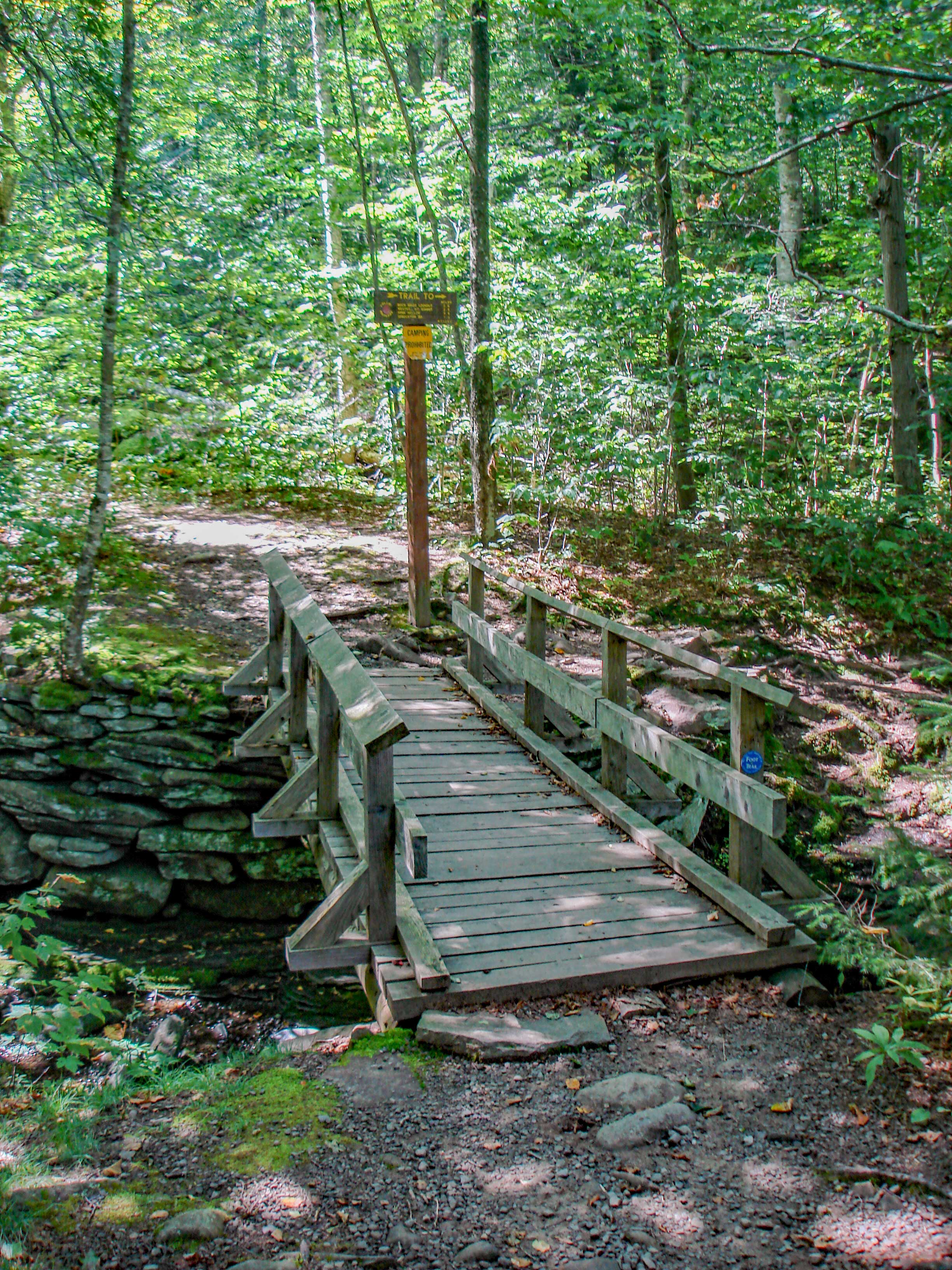
| | 0.79 | 2,323' | Trail Junction - Take right over wooden bridge just above West Kill Falls. |
| | 0.82 | 2,318' | Trail Junction - Take right after walking over wooden bridge. |
| | 2.21 | 3,551' | Rock Shelter |
| | 2.22 | 3,565' | 3,500' DEC sign. |
| | 3.16 | 3,821' | Buck Ridge Lookout Ledges. |
| | 3.20 | 3,891' | Summit of West Kill Mountain |
| | 5.58 | 2,318' | Trail Junction - Take left over wooden bridge |
| | 5.61 | 2,323' | Trail Junction - Take left after wooden bridge |
| | 6.40 | 2,105' | DEC Parking lot where your car is parked. |
|
 |
 |
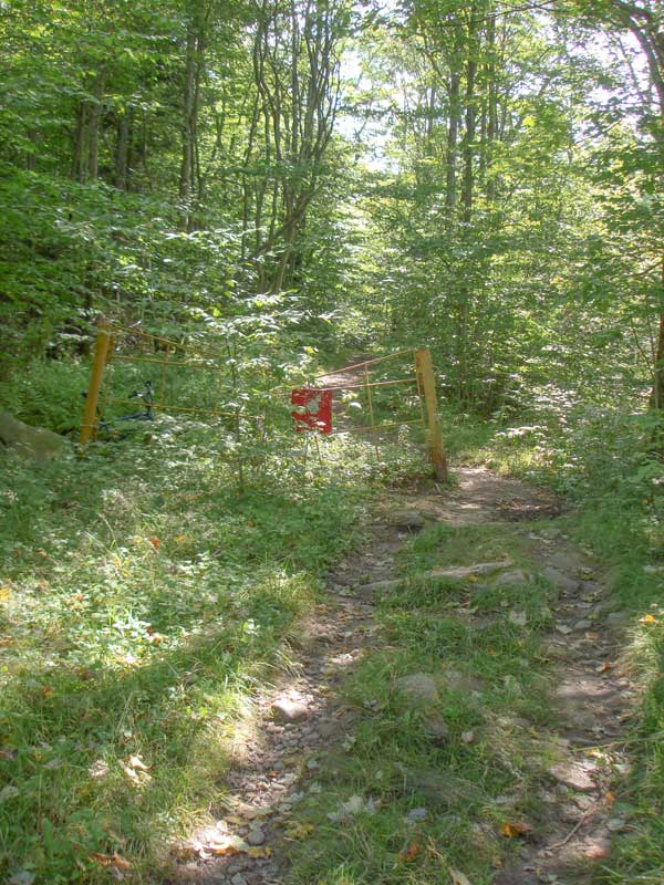
The Trailhead starts at the end of the public section of Spruceton Road.The gate at the trailhead is part of the old Spruceton Road that goes all the way to Lanesville (Rt 214). This part of the road has been changed. The road used to cross the creek about 100 feet past the sign. When you sign in, look down at the creek and you can find the old bridge pillars. Make sure you sign in at the registration box. Registration helps bring dollars to the trail you are hiking on.
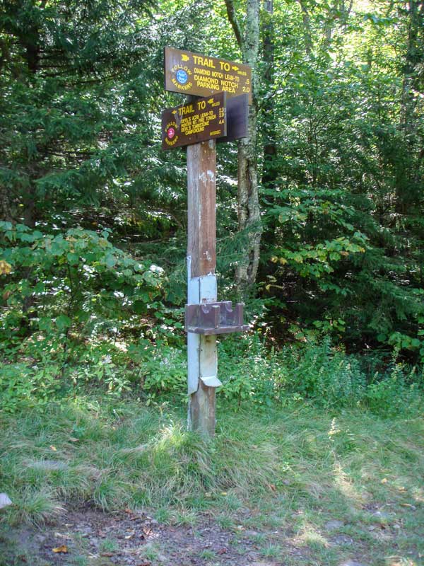
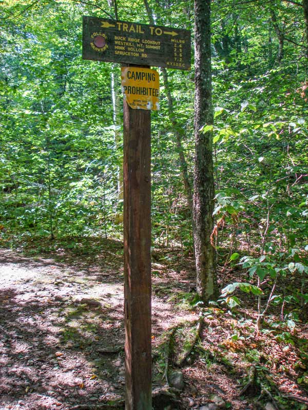
At mile post 0.72 miles, you will come to a Trail Junction. Right will take you to two trails: (1) will take you to the summit of West Kill Mtn; (2) Will take you down the old Carriage Road to Lanesville, NY (Rt 214). Years ago this was one of the major roads thru the Catskill Mountain. It will take you thru Diamond Notch. Going straight will take you up to Hunter Mtn and Leavitt's Peak. Go RIGHT.
|
|
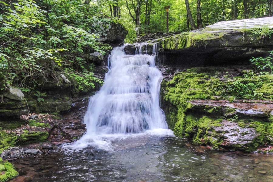 |
After about 3/4 of a mile, you will come to West Kill Waterfalls. Above waterfall is the bridge you will take to the summit of West Kill Mountain.
|
|
 |
 |
After walking across the wooden bridge you will come to another Trail Junction. Which is 150 feet from the other Trail Junction.
After the bridge the next Trail Junction will take you in two different directions. Straight will take you to Diamond Notch and Lanesville, New York. The Diamond Notch Trail is actually an old carriage road. Right will take you to West Kill Mountain. Go RIGHT down the small trail.
|
|
 |
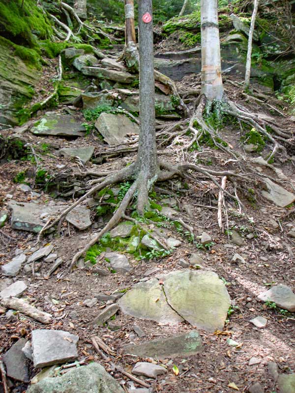 |
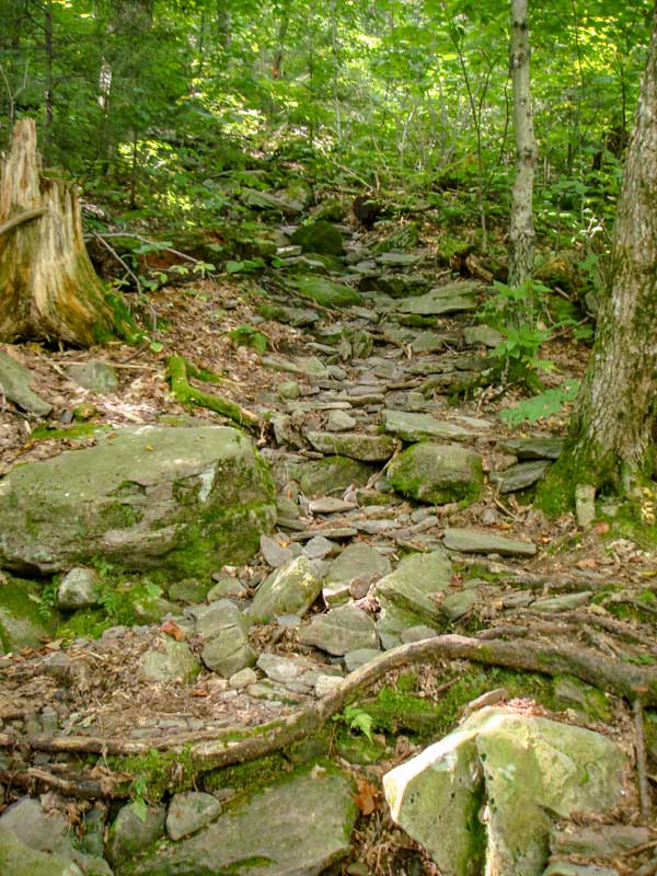
From these two pictures you can see that the climb up West Kill Mountain is steep and relentless. You will climb up this steep pitch for the next 1200 vertical feet.
|
|
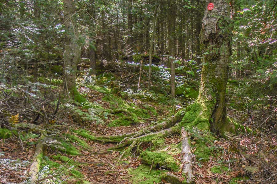 |
At about an elevation of 3,500 feet the trail finally starts to level off to a more moderate climb. The forest starts to change to a conifer forest. You will also find a lot of moss covered rocks.
|
|
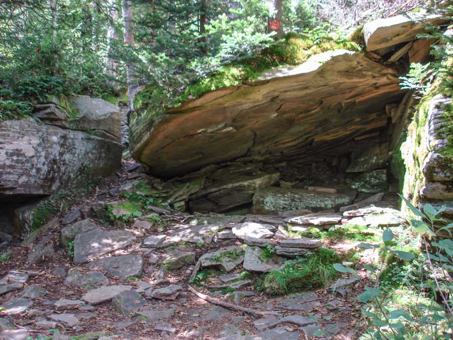 |
At mile post 2.21 and elevation 3,551 feet you will encounter Rock Shelter. New York DEC regulations prevent you from camping here. You cannot camp above 3500' (except in the Winter), and you cannot camp within 150' of the trail. |
|
 |
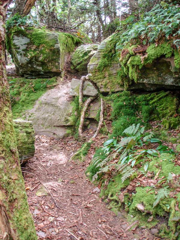 |
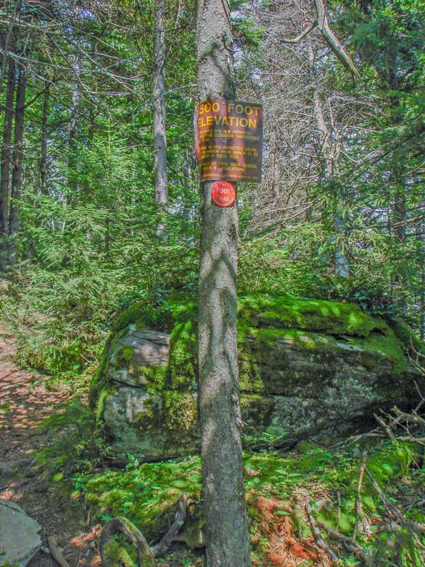
Just above Rock Shelter at mile post 2.22 and elevation 3,565' you will encounter the 3,500' sign preventing camping above this point except during the winter.
The picture on the right shows another example of the trail to the summit. It is a moderate climb with conifers and moss covered forest floor.
|
|
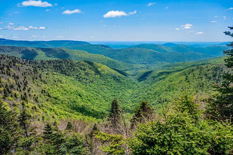 |
This is the view from Buck Ridge Lookout. It is right off the trail, so you can't miss it. It has one of the best views in the Catskill Mountains. It has a huge amphitheater and a huge drop below the ledge. This gives it a spectacular view. The town off in the distance is Lanesville, New York on Rt 214.
|
|
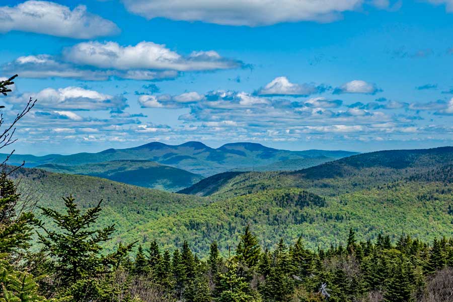 |
This is another view from Buck Ridge Lookout towards the north. |
|
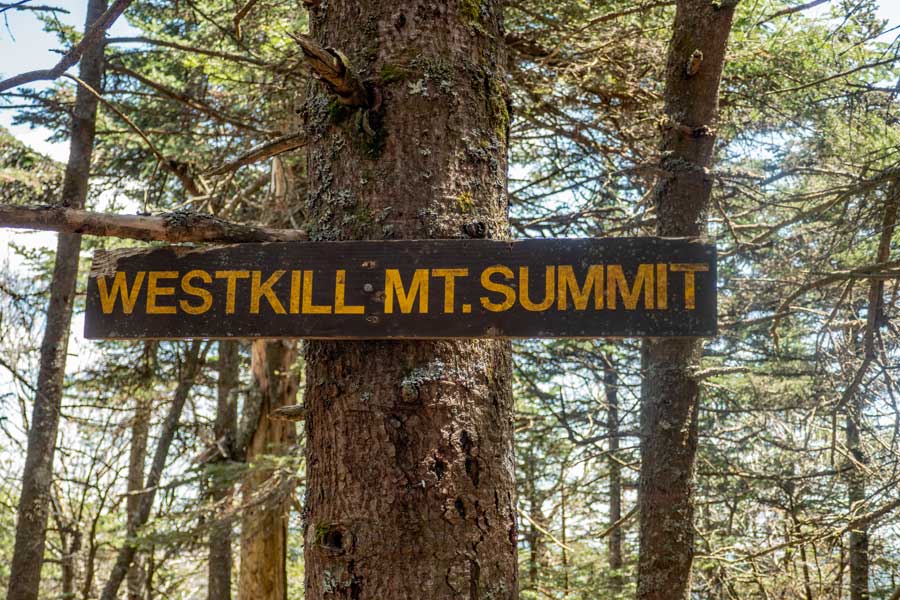 |
Another 200 feet past Buck Ridge Lookout is the actual summit of West Kill Mountain. The sign denotes the summit. Once done you can return back to your car. |
|
|
S E C T I O N S
|
W E A T H E R
|
O T H E R
|