|
Maps |
 |
|
|
| | DIRECTIONS TO TRAIL HEAD AT THE END OF SPRUCETON ROAD |
| | DEC Parking lot for the FIRST parking area on SPRUCETON ROAD - Elevation is 2,117' |
| | DEC Parking Lot - Spruceton - GPS: N42 11.083 W74 16.305 |
| | DEC Parking Lot - Spruceton - WGS84 (DEC): 42.184717, -74.27175 |
| | DEC Parking Lot - Spruceton - Deg Min Sec: N42 11 04 W74 16 18 |
| | DEC Parking Lot - Spruceton - UTM: 18N 560137 4670542 |
| | |
| | DEC Parking lot on the LANESVILLE side - Elvation is 1,826'. |
| | DEC Parking Lot - Lanesville - GPS: N 42 08.998, W 74 15.877 |
| | DEC Parking Lot - Lanesville - WGS84 (DEC): 42.149967 -74.264617 |
| | DEC Parking Lot - Lanesville - Deg Min Sec: N42 08 59, W74 15 52 |
| | DEC Parking Lot - Lanesville - UTM: 18N 560760 4666689 |
| | |
| | Directions to the DEC Parking areas near the end of SPRUCETON ROAD |
| | Take New York State Thruway to Exit 21 (Catskill). |
| | Take a left out of the NYS Thruway entrance road. |
| | Go approximately 3/4 mile |
| | Take a right onto Route 23 West |
| | Go approximately 6.6 miles to Cairo, NY |
| | Take a LEFT onto Rt 32. McDonalds Rest. on corner. |
| | Go approximately 7.7 miles on Rt 32 |
| | Take a RIGHT onto Rt 23A |
| | Go appoximately 22.2 miles to the intersection of Rt 23a and Rt 42 . |
| | Go approximately 0.3 miles - Take LEFT and go over bridge (over Schoharie Creek) |
| | Go approximately 4.1 miles on Rt 42 (from Rt 23a) to Rt 6 (Spruceton Road) |
| | Go approximately 7 miles on Rt 6 (Spruceton Road). |
| | About 4 miles down Rt 6 the road will go from a 2-lane road into a 1-lane road. The 1-lane road looks like a private driveway. Continue down the 1-lane road. |
| | There are a three (3) parking areas near the end of Spruceton Road. The road to the parking area on the Lanesville side is very ROUGH! |
| |
|
| | PARKING NOTICE: THE THREE PARKING LOTS FOR THIS HIKE ARE WOEFULLY TOO SMALL. THEY FILL UP VERY QUICKLY ON WEEKENDS. PEOPLE HAVE RESORTED TO PARKING ON THE SIDE OF RT 6 (WHICH IS A ONE-LANE ROAD). PRESENTLY THE TOWN OF HUNTER ALLOWS HIKERS TO PARK ON THE SIDE OF THE ROAD. IF YOU DO PARK ON THE SIDE OF THE ROAD YOU MUST GET YOUR CAR ALL THE WAY OFF THE ROAD! IF YOU DO NOT LEAVE ENOUGH ROOM FOR EMERGENCY VEHICLES (LIKE LARGE FIRE TRUCKS), YOUR CAR WILL BE TICKETED OR TOWED. ALSO, THERE ARE HOMES IN THIS AREA. DO NOT BLOCK THEIR DRIVEWAY, OR PARK ON THEIR LAND, OR PARK IN FRONT OF THEIR HOUSE. IF HIKERS CONTINUE TO CAUSE PROBLEMS, THE TOWN OF HUNTER WILL BAN HIKERS FROM PARKING ON THE SIDE OF THE ROAD. |
|
|
SPECIAL CIRCUMSTANCES ABOUT THIS HIKE |
| | This trail is very old. The trail first existed for the Mohawk Indians who used it to travel from valley-to-valley. They probably used the actual jagged Diamond Notch to travel over the pass. The Europeans then built the first road over the pass. The first road followed the notch down the east side much closer to the notch. Later on a new road was built on the east side that was higher up on the mountain side. This is the road that the trail is now on. In 1937, the NYS DEC then created the second carriage road as a hiking trail. It remains this way today.
The west side of the trail can be used for horse back riding. The east side is too dangerous for horses.
|
|
|
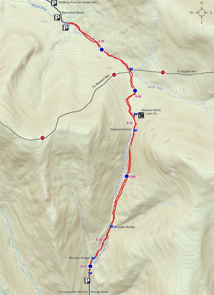
MILEAGE CHART |
| | Mile Point | Altitude | Notes |
| | 0.00 | 2,105 | DEC Parking Lot - Spruceton - GPS: N42 11.083 W74 16.305 |
| | 0.00 | 2,105 | DEC Parking Lot - Spruceton - WGS84 (DEC): 42.184717, -74.27175 |
| | 0.00 | 2,105 | DEC Parking Lot - Spruceton - Deg Min Sec: N42 11 04 W74 16 18 |
| | 0.00 | 2,105 | DEC Parking Lot - Spruceton - UTM: 18N 560137 4670542 |
| | | |
| | 0.02 | 2,115 | DEC Registraion Box is just past the road barrier. |
| | 0.70 | 2,345' | Trail Junction - Take right over wooden bridge just above West Kill Falls. |
| | 1.18 | 2,639' | Diamond Notch Lean-to near pass. |
| | 1.24 | 3,668 | West side of Diamond Notch Pass. |
| | 1.33 | 3,687 | East side of Diamond Notch Pass. |
| | 1.38 | 3,673 | Old trail Junction for old carriage road and new carriage road. |
| | 2.13 | 2,126 | Old trail junction to bypass hill to wooden bridge |
| | 2.21 | 2,092 | Wooden Bridge#1 |
| | 2.53 | 1,888 | Wooden Bridge #2 |
| | 2.70 | 1,826 | DEC Parking lot on the Lanesville side. |
| | 2.70 | 1,826 | DEC Parking Lot - Lanesville - GPS: N 42 08.998, W 74 15.877 |
| | 2.70 | 1,826 | DEC Parking Lot - Lanesville - WGS84 (DEC): 42.149967, -74.264617 |
| | 2.70 | 1,826 | DEC Parking Lot - Lanesville - Deg Min Sec: N42 08 59, W74 15 52 |
| | 2.70 | 1,826 | DEC Parking Lot - Lanesville - UTM: 18N 560760 4666689 |
| | | |
| | 4.10 | 3,687 | East side of Diamond Notch Pass. |
| | 4.69 | 2,345 | trail Junction - West Kill Falls (Buttermilk Falls or Diamond Notch Falls). |
| | 5.37 | 2,105 | DEC Parking lot where your car is parked. |
|
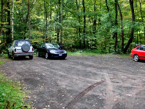 |
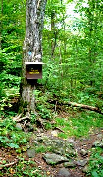
If space is available you can park right by the trail head in this picture. If space is not available, then you can park down in the parking lot 1/4 mile back down the road. The gate at the trail head is part of the old Spruceton Road that goes all the way to Lanesville (Rt 214). This part of the road has be changed. The road used to cross the creek about 100 feet past the sign. When you sign in look down at the creek and you can find the old bridge pillars. Make sure you sign in at the registration box. Registration helps bring dollars to the trail you are hiking. |
|
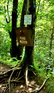 |
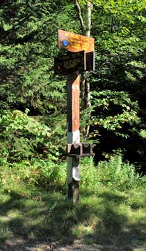
The picture on the left is a DEC registration box. It is about 100 feet from the parking lot.
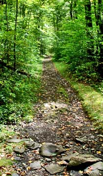
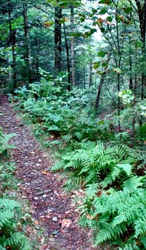
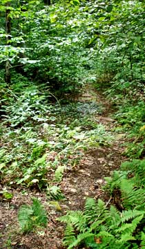
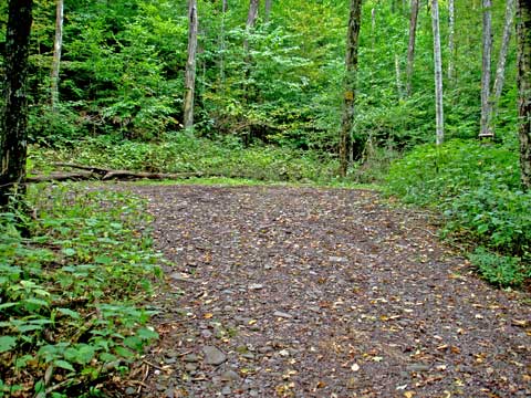
The trail from the DEC parking lot to the first trail junction looks like the picture on the right. There is a slight incline. You can easily cross-country ski this part of the trail. |
 |
|
 |
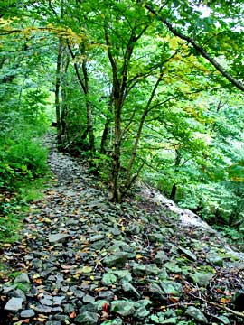
At mile post 0.72 miles, you will come to a Trail Junction. Right will take you to two trails: (1) will take you to the summit of West Kill Mtn; (2) Will take you down the old Carriage Road to Lanesville, NY (Rt 214). Years ago this was one of the major roads thru the Catskill Mountain. It will take you thru Diamond Notch. Going straight will take you up to Hunter Mtn and Diamond Notch. Go RIGHT.
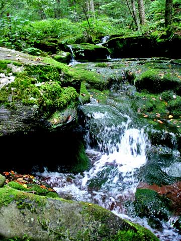
Just below the bridge is West Kill Falls. It is sometimes called Buttermilk Falls or Diamond Notch Falls.
The picture on the right is another example of the trail up to Diamond Notch. |
 |
|
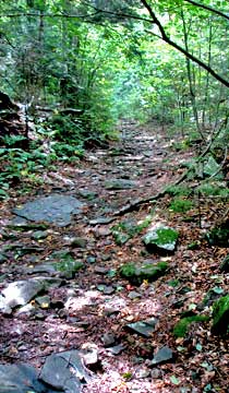 |
As you climb further up the trail, the rockiness will decline, as you can see in the picture on the left.
At mile post 1.81 (elev 2,639') you will the Diamond Notch Lean-to from the Trail. It is about 50 feet from the trail. |
 |
|
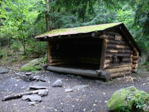 |
The picture on the left shows the Diamond Notch Lean-to. The opening of the lean-to faces away from the trail. Off about 30 feet beyond lean-to is the actual Diamond Notch. This is where you can stand on West Kill Mountain with one foot and Leavitt's Peak with the other foot. The only other place this could have been done 100 years ago was Stony Notch. It is a remarkable geological location. The trail doesn't follow the notch. It moves from one side to the other.
The Diamond Notch Lean-to is in poor shape. It is leaning towards the west and will collapse in due time. While it is still safe, this condition will deteriorate. I suppose that the Lean-to could be straighten and strengthen. You will also notice the chew marks on the Lean-to. This is from porcupines. They are chewing on the Lean-to is their never-ending quest for salt. The salt is from the hands of the builders of the Lean-to. If you camp here beware of porcupines. |
|
 |
Just beyond the Diamond Notch Lean-to will lead you to the Diamond Notch pass. The picture on the left shows what the trail looks like. This pass has two sides to it. The West side of the Diamond Notch Pass is at mile post 1.24 (elevation 2,668'). The East side of the Diamond Notch Pass is at mile post 1.33 (elevation 2,687'). The east side is slightly higher then the west side. .
You should keep alert in this spot. If you encounter a bear here, neither of you will be able to escape. Back in November 5, 1888 a man did encounter a black bear and was attacked. Days later the bear was trapped and killed.
The picture on the right shows the road junction between the old carriage road and the new carriage road. You want to stay to the left on the new carriage road. You do not want to take the old carriage road. It is dangerous. You could cause a rock slide and be sweep over the high rock wall.
|
 |
|
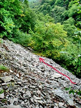 |
As you walk down the trail another 100 feet you can see the old carriage road move down and away from you. From this vantage view, you can see the danger of walking down there.
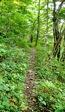
The picture on the right shows the trail on the East side the pass. We do NOT recommend that you ski here. While this is an old wagon trail, the trail is quite narrow in places. Dirt and rocks have filled in the high side of the trail.
|
 |
|
 |
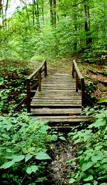
At mile post 2.13 you will see a faint trail to the right. This faint trail to the right will allow you to bypass the hill down to the wooden bridge. This is actually the old carriage road section. We don't recommend that you take it, except in the winter when it is icy or snowy. the steep hill is too hard to climb in the Winter, and the rocky road is too difficult to travel in the Summer.
The picture on the right shows the first wooden bridge you will encounter. It crosses the Diamond Tree Hollow Creek.
|
 |
|
 |
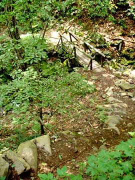
At mile post 2.53 (elev 1,888') Is the second wooden bridge you will cross. This bridge is about 750' away from the DEC parking area near Lanesville.
At mile post 2.70 (elev 1,826') you will encounter the DEC registration box.
|
 |
|
 |
A.t mile post 2.70 (elev 1,826') you will encounter the DEC registration box and the DEC parking lot on the Lanesville, NY side. |
|
|
S E C T I O N S
|
W E A T H E R
|
O T H E R
|
|
Copyright 1994-2024 www.catskillmountaineer.com
ALL RIGHTS RESERVED
|