Balsam Mountain in Greene County |
 |
| |
| |
|
OVERVIEW |
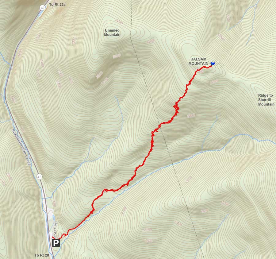
| | Distance: | ~5.00 miles from the DEC parking lot on Rt 42. |
| | Time: | Average 4.5 hours round trip in the Winter - 3 hours in the summer |
| | Elevation Gain: | 1,792 feet from the DEC Parking Lot and the summit. |
| | Best Time to Hike: | Anytime. |
| | Difficulty: | Moderate |
| | Catskill Highest: | #51 |
| | Peak Elevation: | 3,353' |
| | | |
| | USGS Official Name: | Balsam Mountain (declared on Feb 4, 1903) |
| | USGS Past Names: | Sherrill Mountain, Sherril Mountain |
| | USGS Peak-Elevation: | 3,353' (USGS) |
| | USGS Balsam-GPS: | 42.1836992, -74.3873710 (DEC-WGS84) |
| | USGS Balsam-GPS: | N 42 11.022, W 74 23.242 (GPS) |
| | USGS Balsam-GPS: | 18N 550590 4670354 (UTM) |
| | USGS Balsam-GPS: | N42 11 01, W74 23 14 (Degree, Min, Sec) |
| | | |
| | USGS Official Map: | Westkill Topographical Map (free) |
| | | |
| | DEC Trail Map: | DEC Hunter-Westkill Wilderness Map (free) |
| | | |
| | Digital Mapper: |
Topo
Terrain
Satellite |
| | | |
| | Access Methods: | Foot and snowshoe |
|
|
Maps |
 |
|
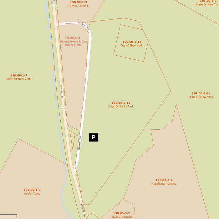
Public & Private Land Ownership for NYS Parking Area around Shaft Road.
Red=Private Land
Green=Public Land (DEC, DEP, NYS Parks, etc) |
|
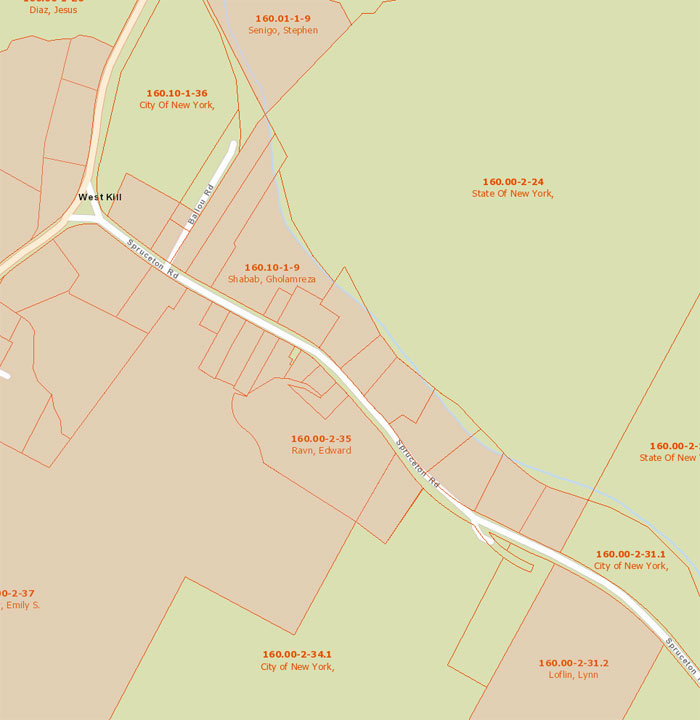
Public & Private Land Ownership around Westkill (Spruceton Road) - Hiking from the NORTH side
Red=Private Land
Green=Public Land (DEC, DEP, NYS Parks, etc) |
|
|
| | DIRECTIONS TO TRAIL HEAD |
| | DEC Parking lot on the right after getting onto Shaft Road - Elevation is 1,551' |
| | DEC Parking Lot - Shaft Road - GPS: N 42 09.956, W 74 24.532 |
| | DEC Parking Lot - Shaft Road - WGS84 (DEC): 42.165933, -74.408867 |
| | DEC Parking Lot - Shaft Road - Deg Min Sec: N42 09 57, W74 24 31 |
| | DEC Parking Lot - Shaft Road - UTM: 18N 548829 4668369 |
| | |
| | Elevation is approximately 1,551 feet |
| | Take New York State Thruway to Exit 21 (Catskill). |
| | Take a left out of the NYS Thruway entrance road. |
| | Go approximately 3/4 mile |
| | Take a right onto Route 23 West |
| | Go approximately 6.6 miles to Cairo, NY |
| | Take a LEFT onto Rt 32. McDonalds Rest. on corner. |
| | Go approximately 7.7 miles on Rt 32 |
| | Take a RIGHT onto Rt 23A |
| | Go approximately 22.2 miles to the intersection of Rt 23a and Rt 42 . |
| | Go approximately 0.3 miles - Take LEFT and go over bridge (over Schoharie Creek) |
| | Go approximately 7-8 miles on Rt 42 (from Rt 23a) |
| | Take a LEFT onto Shaft Road. |
| | Continue STRAIGHT up into the DEC parking lot (cannot see from Rt 42 or Shaft Road). |
| | There are 25 parking spaces. |
| | |
| | | Note #1 - If traveling from south of the Catskill Mountains, get off Exit 19 (Kingston). Take Rt 28 West for 28.5 miles. Turn Right onto Rt 42. Go north on Rt 42 for approximately 3 miles and turn right onto Shaft Road (PA on right side of road off Shaft Road). |
| | | |
| | IMPORTANT NOTICE: In the Winter Months sometimes the PA is not plowed out. For road side parking, see map above where the road adjoins public land. Parking on the side of the road would be unwise if the plows need to clear the snow from the road. One of the local land owners has given hikers a hard time about parking on the side of the road. |
|
|
SPECIAL CIRCUMSTANCES ABOUT THIS HIKE |
| | The hike up to Balsam Mountain does not have a view from the summit. There is a limited view from the top of the steep climb #3 during the winter. The the view is poor and limited. It is considered a bushwacking hike. One of the strange things about this hike is there are very few conifer trees. More strange is the fact that it is named Balsam Mountain when there are NO balsam trees on or near the summit. It got it's official name in 1903 for the USGS. It is possible that there were many balsam trees in 1903. While this hike is located in Greene County, there is another Balsam Mountain in Ulster county. Additionally, there is also Balsam Lake Mountain in Ulster County. Easy to get them mixed up.
While the hike starts out on an old logging path, the path disappears within a mile. The DEC parking lot for the hike up to Balsam mountain is quite large, so parking should not be a problem. This parking lot is also used for hiking up to Mt Sherrill.
From the summit of Balsam Mountain, you can also walk over to Sherrill Mountain. If time permits, you could also walk over to North Dome Mountain. You could then descend back to your car from the moraine from Sherrill Mountain.
From the DEC parking lot, finding the start of the hike is a little difficult. The key to this hike is to find the left side of the stream. You want the path that starts out running parallel to the stream. The path quickly rises well above the stream. Don't follow the stream bed because the going will be tough. The stream divides the Balsam Mountain and Sherrill Mountain. It is a good guide and reference for your ascent.
After approximately a 1/2 mile the path will lead away from the stream. It basically skirts around a hill. After you walk around the hill, the path will become harder to follow. Just keep hiking parallel to the stream, but inland slightly. During the winter you can see the summits of both Balsam Mountain and Sherrill Mountain thru the trees. At this point you will see a lot of Ash trees. Most Ash trees suffer for disease. Pilated Woodpeckers like this area. If you hear a bird screaming, it is most likely a pilated woodpecker.
After 1-1/4 miles, you will come to your first steep hill. If you look carefully, you will see the path up the hill. At this point you will start to drift away from the stream. You will actually climb more westerly up the steep hill #1. When you get to the top of the steep hill #1, you will be greeted by a nice patch of prickers. A bad reward for your steep ascent. At the top, you want to continue in a parallel path to the stream (as a reference). At this point, you will not find an evidence of the path. The grade will level off.
After a while you will encounter Steep climb #2 on Balsam Mountain. This is the most difficult climb of the hike. There are some very small ledges on the top in sections. During the winter the climb is steep and difficult. If you fall, you could slide quite a ways down. In the winter you will probably have to zip-zag up the hill. Do so carefully. Once you get to the top of the steep hill, you will be rewarded with a lot of downed branches and trees. It will make traveling difficult. The trail will level off again, but this time you have to navigate the ground clutter.
Finally, you will encounter Steep climb #3 on Balsam Mountain. Not quite as steep or as high as Steep climb #2, but still difficult in the winter. Once you get to the top you will be rewarded with ground clutter and a significant amount of brush and small trees. The summit is very flat on the east side, and is the highest point. It is hard to determine which point is the highest point. Our GPS, came up with the same reading from many points. We regarded the north east point as the highest point.
If you want to visit Mount Sherrill, just head east.
Balsam Mountain can also be hiked from the north side of the mountain range. The DEP now owns land that ajoins Spruceton Road and NYS DEC land. This access route is located in the village of West Kill (see map above).
|
|
|
MILEAGE CHART |
| | Mile Point | Altitude | Notes |
| | 0.00 | 1,555 | DEC Parking Lot off Shaft Road |
| | 0.02 | 1,551 | Walk past the green road barrier. |
| | 0.05 | 1,560' | Take right onto small trail after walking up hill. |
| | 0.06 | 1,558' | Take a right onto old dirt road. |
| | 0.07 | 1,558 | Take a LEFT at concrete post in road. |
| | 0.09 | 1,566 | Take a RIGHT at trail junction - take old logging road. |
| | 0.44 | 1,744 | After following stream - follow trail around hill |
| | 0.64 | 1,869 | Trail starts to fade away |
| | 1.25 | 2,275 | Hit steep hill #1 (prickers on top to greet you) |
| | 2.53 | 3,353' | Summit of Balsam Mountain |
| | 5.06 | 1,555' | DEC Parking Lot |
|
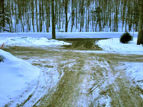 |
This DEC parking lot can be easily missed. If you are heading from Rt 23, and heading south on Rt 42, the access to Shaft Road is on the LEFT side of the road. If you are heading north from Rt 28, Shaft Road is on the RIGHT side of the road. Shaft road just loops back to Rt 42. The picture shows Rt 42, and Shaft Road. Once you come in from Shaft road, continue until you come to the DEC parking lot. It is not obvious. Continue until you see the green steel gate in the next section. Then continue into the DEC parking lot. |
|
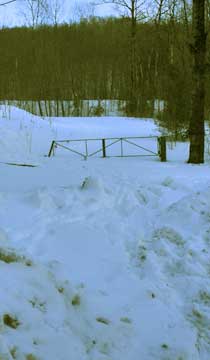 |
The picture on the left show you the green steel gate at the start of the trailhead.
The picture on the RIGHT shows the DEC parking (unplowed). They usually do plow it in the Winter. |
 |
|
 |
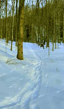
After walking up the hill from the green gate, look for a small trail on the right. The picture on the left showes what the trail looks like. Take a RIGHT onto the very short trail. After about 50 feet, you will come to another logging road. Take a RIGHT onto the logging road.
The picture on the right shows the next intersection. If you look carefully, you will see two concrete post on each side of the road. At this point you want to take a LEFT onto the small logging path. |
 |
|
 |
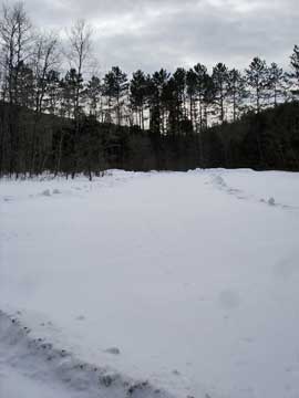
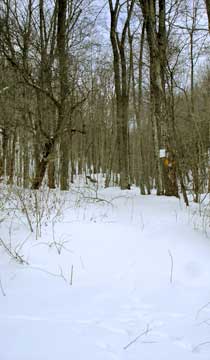
The picture on the left shows the logging path.
After a short distance, you will come to a sign showing that this is the main section of the State Land. Take the path that goes parallel to the stream. |
 |
|
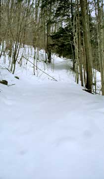 |
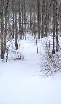
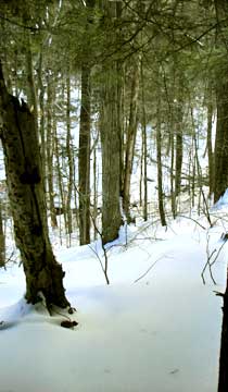
The picture on the left show you what the trail looks as it starts to climb next to the stream. As you climb it will rise well above the stream. The trail is very well defined for the first 1/2 mile. From 1/2 mile to 1 mile the trail becomes harder to follow. You will start to fall off the trail, and then pick it up later on. After 1.25 miles, the trail is completely gone.
The picture on the right shows the stream below the trail.
|
 |
|
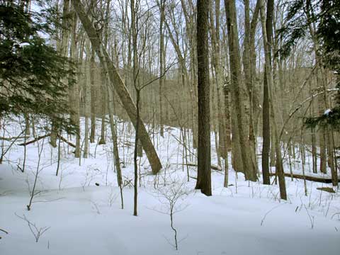 |
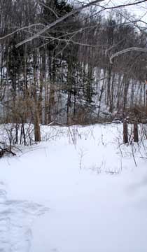
This picture is a good reference point. The mountain on the LEFT is Balsam Mountain. The mountain on the RIGHT is Sherrill Mountain. In the Summer, the leaves will obscure this view, and you will not have this reference point.
When you get about 1-1/4 miles in, you will come to a steep hill that will block your path. This is Steep Hill #1. At this point, you want to move left up the hill. There is a faint path up the hill.
|
|
 |
The picture on the left is the reward you will get once you climb Steep Hill #1. A Pricker field! In the summer, this would be a painful experience. Once you get to the top of the Steep Hill #1, turn slightly to the right and continue the trek uphill. The forest at this point have trees that are widely spaced, and it is a fairly easy walk.
After some walking, you will come to Steep Hill #2. This is the steepest and highest hill to climb. In the Winter it is quite a challenge. Your snowshoes want to slip out as you climb uphill. When you get to the top, and look backwards, you will see the same view as the picture on the right. This climb has some small ledges near the top of the climb, but you can easily get around them. Good cramp-ons would make this hill easier to climb.
|
 |
|
 |
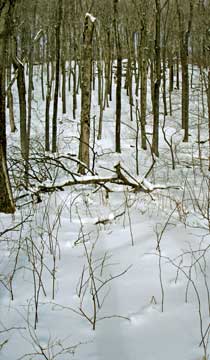
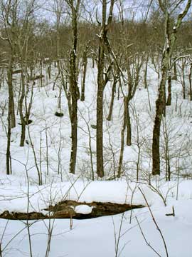
Again, once you get to the top of hill you get your next reward. You are met with a significant amount of blowdown and downed trees. Mixed in there are a number of large rocks. This makes it more difficult to navigate.
After walking thru a maze of tree branches, rocks, and dead trees, you will come to Steep Hill #3. It is steep, but not nearly as high as Steep Hill #2. Once you climb this hill, you will be on the top of the mountain.
|
 |
|
 |
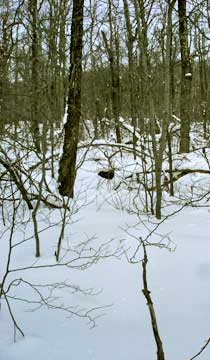
Once you get to the top of Steep Hill #3, you are again rewarded with blowdown and bushes. |
|
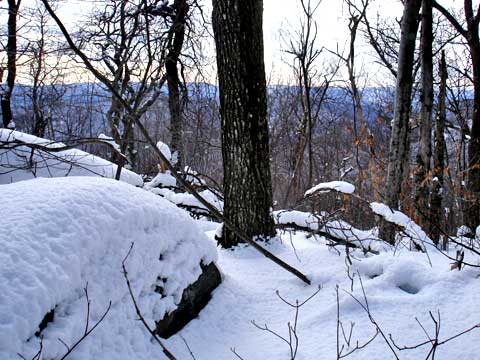 |
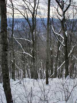
If you turn around after climbing Steep Hill #3, you will get a limited view of the valley. You will only get a view in the Winter when the leaves are not on the trees. |
|
|
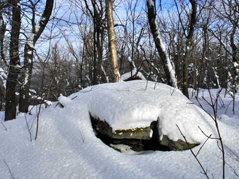
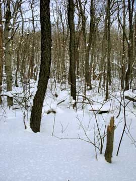
The top of Balsam Mountain is very flat. Using a GPS, the elevation didn't seem to change very much. But, we believe that the northeast corner is the highest point on Balsam Mountain. You can see this point in the picture. |
|
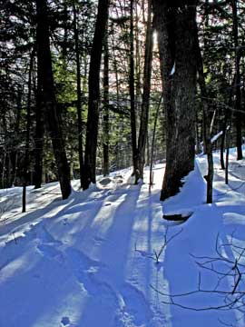 |
On the way back down from the summit of Balsam Mountain, we got this picture of the sun shining thru the trees. |
|
|
S E C T I O N S
|
W E A T H E R
|
O T H E R
|
|
Copyright 1994-2024 www.catskillmountaineer.com
ALL RIGHTS RESERVED
|