North Dome and Mount Sherrill |
 |
| |
| |
|
OVERVIEW |
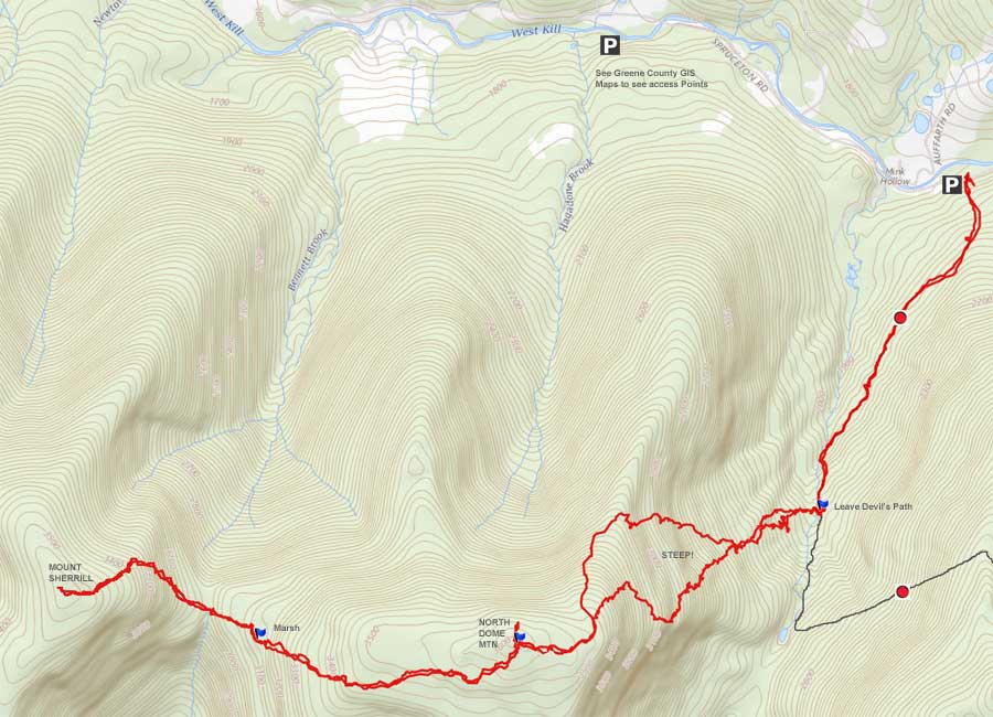
| | Distance: | ~9.50 miles from the DEC parking lot directly on Spruceton Valley Road Rt 6. |
| | Time: | Average 8 hours round trip |
| | Elevation Gain: | 1,811 feet from the Parking Lot to the summit. |
| | Best Time to Hike: | Early morning in the Late Fall to Early Spring when the leaves are not on the trees. |
| | Difficulty: | Very Difficult |
| | Catskill Highest: | #26 |
| | North Dome Peak Elevation: | 3,615' |
| | Mount Sherrill Elevation: | 3,549' |
| | |
| | | USGS Official Name: | North Dome Mountain (ID: 958771) |
| | USGS Summit-Elevation: | 3,610' (from USGS map) |
| | USGS North Dome-Summit-WGS84: | 42.173422, -74.349037 (DEC-WGS84) |
| | USGS North Dome-Summit-GPS: | N 42 10.405, W 74 20.942 (GPS) |
| | USGS North Dome-Summit-UTM: | 18N 553765, 4669236 (UTM) |
| | USGS North Dome-Summit-Deg, Min, Sec: | N42 10 24, W74 20 56 (Degree, Min, Sec) |
| | |
| | | USGS Official Name: | Mount Sherrill (ID: 1829070) |
| | USGS Summit-Elevation: | 3,550' |
| | USGS Naming History: | Named for Eliakim Sherrill (tanner in the Shandaken area in the mid-1800's). |
| | USGS Sherrill-Summit-WGS84: | 42.175644, -74.372926 |
| | USGS Sherrill-Summit-GPS: | N 42 10.539, W 74 22.376 |
| | USGS Sherrill-Summit-UTM: | 18N 551790, 4669468 |
| | USGS Sherrill-Summit-Deg, Min, Sec: | N42 10 32, W74 22 22 |
| | |
| | | USGS Official Map: | Lexington Topographical Map (free) |
| | |
| | | DEC Trail Map: | DEC Hunter-Westkill Wilderness Map (free) |
| | |
| | | Digital Mapper for North Dome: |
Topo
Terrain
Satellite |
| | |
| | | Digital Mapper for Sherrill Mountain: |
Topo
Terrain
Satellite |
| | |
| | | Access Methods: | Foot and snowshoe |
|
|
Maps |
 |
|
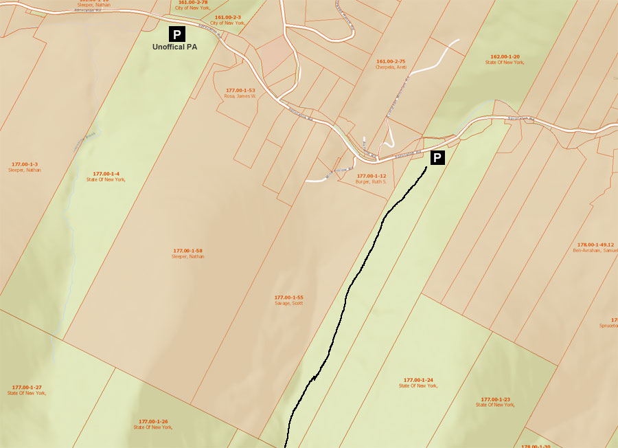 Public & Private Land Ownership on Spruceton Road by North Dome Parking Area
Red=Private Land
Green=Public Land (DEC, DEP, NYS Parks, etc) |
|
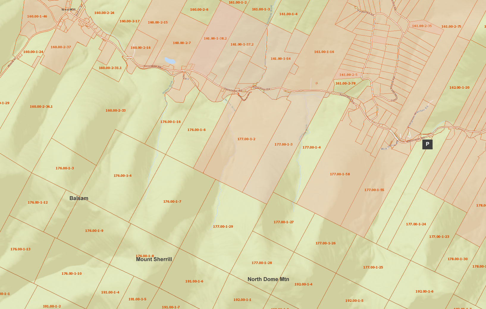
Public & Private Land Ownership on Spruceton Road from Westkill to North Dome Parking Area
Red=Private Land
Green=Public Land (DEC, DEP, NYS Parks, etc) |
|
|
|
|
| | DIRECTIONS TO TRAIL HEAD |
| | DEC Parking Lot WGS84 (DEC): 42.175644, -74.372926 - Elevation is approximately 1,799 feet |
| | DEC Parking Lot GPS: N 42 10.539, W 74 22.376 - Elevation is approximately 1,799 feet |
| | DEC Parking Lot UTM: 18N 551790, 4669468 - Elevation is approximately 1,799 feet |
| | DEC Parking Lot Deg, Min, Sec: N42 10 32, W74 22 22 - Elevation is approximately 1,799 feet |
| | |
| | Take New York State Thruway to Exit 21 (Catskill). |
| | Take a left out of the NYS Thruway entrance road. |
| | Go approximately 3/4 mile |
| | Take a right onto Route 23 West |
| | Go approximately 6.6 miles to Cairo, NY |
| | Take a LEFT onto Rt 32 (McDonalds Rest. on corner) |
| | Go approximately 7.7 miles on Rt 32 |
| | Take a RIGHT onto Rt 23A (Red Light) |
| | Go appoximately 22.2 miles to the intersection of Rt 23a and Rt 42 . |
| | Go approximately 0.3 miles - Take LEFT and go over bridge (over Schoharie Creek) |
| | Go approximately 4.1 miles on Rt 42 (from Rt 23a) to Rt 6 (Spruceton Road) |
| | Go approximately 3-4 miles on Rt 6 (Spruceton Road). |
| | There are a number of parking lots along this road. The parking lot you are looking for is on the RIGHT side of the road. It is a small parking lot with only a couple of spaces. Maybe half way down Spruceton Road.
|
|
|
SPECIAL CIRCUMSTANCES ABOUT THIS HIKE |
| |
| |
The hike up to North Dome and Sherrill Mountain does not have a view from the summit. There is a limited view part way up the mountain in the winter. There are also views from the south eastern side of the summit of Sherrill Mountain, which is NOT marked on our map. This hike is considered a bushwacking hike. There are multiple ways of getting to the summit, and this hike just represents one possible way.
There is no easy way to get to the summit of North Dome Mountain on public land. There is a hard way to the top of North Dome Mountain, and harder ways to get to the top of North Dome Mountain. The most difficult part of hiking to the summit of North Dome Mountain is the band of ledges you have to negotiate. This may create anxiety for some hikers. But, the trick is to walk horizontal to the ledge until you find an acceptable way to get above the ledge. There is always a way. Try to be patient, and don't take un-necessary risk. Years ago, a hiker disappeared on North Dome, and was never found.
Sherrill Mountain is different. There are a couple easy ways to the top of Sherrill Mountain. This hike does show a harder way to get to the top. The advantage to this route is that you can bag both peaks in one day. Another way is to hike from Rt 42, and spot a car on Rt 6.
From the DEC parking lot, the trail immediately heads uphill at a moderate rate. Once on top of the hill the trail levels out and is a nice walk. As you walk along the trail, you will go through a variety of terrain. As you approach the first mile, the trail will come very close to a stream. You want to continue along the trail until you come close to the trail again. On the second approach to the stream, you can leave the trail and head up North Dome Mountain without crossing over private land.
Once you leave the trail, you will have to cross a number of fractionalized streams. During low water, they are easy to cross. During high water, they may be impossible to cross. If this is the case, you may have to go further up the trail to find a safe place to cross.
Once across the streams, you will then head uphill. It doesn't take long before you encounter your first band of ledges. It is important to scope out the ledge and look for the best way to get above the ledge. If you can't find one, walk horizontal to the ledge until you find one. As you move up the mountain the incline will become steeper, and the ledges become more difficult. There about 5-6 bands of ledges you must negotiate. Once the incline slopes off, you will be close to the summit region. The important point is to not panic and take un-necessary risk.
Once it slopes off, you will have another set of ledges. But, they are fairly easy to get up. Start looking for one of the herd paths to the summit. Once you find one, follow it to the very summit. The summit is fairly easy to find. If you are a member of the 3500 club, the canister may not be located at the highest point. But, is not that far away. And, the canisters are moved from time-to-time.
Once you leave North Dome Mountain for Sherrill Mountain, I headed down the southwest side. The reason I picked this route is because the west side of North Dome has thick conifer trees in places. The southwest side has many open areas and the travel is very easy. Once below the summit region of North Dome we moved to the west side of North Dome Mountain. Our goal was to hit the top of the pass between North Dome Mountain and Sherrill Mountain. This particular pass is lined with a small ledge on both side. Not hard to get across, but that is our particular crossing point. On the way down North Dome Mountain, we hit two sizable ledges. One wasn't that hard to get down. The other ledge was steeper, and we had to scout out the best route down the ledge. We just headed horizontal across the top of the ledge until we found the best spot. You will also see a marsh near the col between the two mountains. A significant amount of water moves through the marsh. But, you can cross the marsh in many places.
Once across the col between North Dome Mountain and Sherrill Mountain we headed to the northeast side of the mountain. We believed that this is the best way up the steep slope. Like North Dome there are some bands of ledges that need to be negotiated.
When you get close to the summit, you will start to see trails. Most of which lead to the summit. The summit is fairly flat, with a lot of trails. There is a mixture of Balsam trees and deciduous trees. The 3500 Club canister is not on the summit. You may have to wonder around a bit to find it.
There are also some views from the south eastern side of the summit. You may have to wonder around a bit to find it. It is not mark it on the map.
You can camp on top only in the Winter Months.
|
|
|
MILEAGE CHART |
| | Mile Point | Altitude | Notes |
| | 0.00 | 1,716' | DEC Parking Lot |
| | 0.08 | 1,758' | DEC registration box. |
| | 1.05 | 2,125' | Leave trail and cross a number of streams and walking up hill. |
| | 2.48 | 3,615' | Summit of North Dome Mountain. |
| | 3.52 | 3,052 | Col in between North Dome and Sherrill Mountain. |
| | 4.23 | 3,549' | Summit of Sherrill Mountain - Canister on top |
| | 9.46 | 1,716' | Return to parking lot |
|
|
Hike to North Dome Mountain |
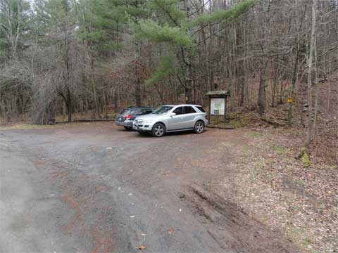 |
This DEC parking lot is right off Rt 6 on the right side of the road. It is big enough to hold 6-10 cars. There is another DEC parking lot before this one. This parking area is most commonly used to climb North Dome Mountain. |
|
 |
The trail starts on the RIGHT side of the parking lot. The trail starts where the sign is
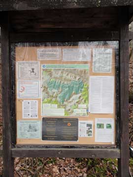
The picture on the RIGHT shows the DEC Kiosk. Check it for any special considerations that you might need to know about this hike. |
 |
|
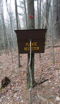 |
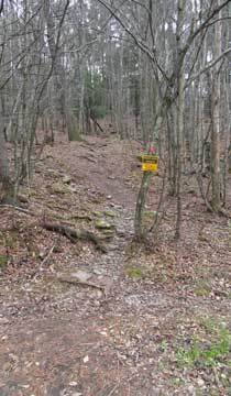
About 300 feet up the trail you will encounter the DEC registration box. Make sure you register. If you get lost or injured the Search-n-Rescue needs an rough idea of where you went. Your life could depend upon this registration.
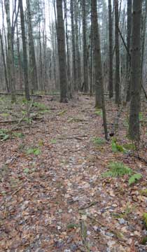
The picture on the right shows what the trail looks like. In the beginning it will be deciduous forest. Then it will change to a conifer forest. And, then will turn back to a deciduous forest. |
 |
|
 |
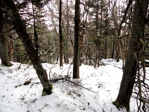
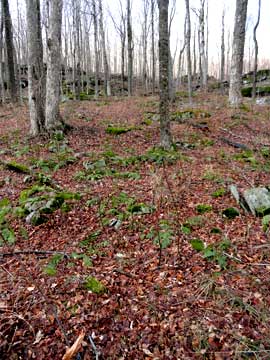
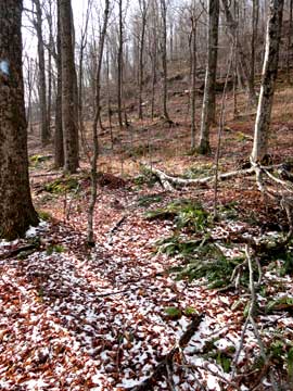
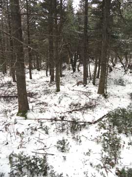
Once you get up the hill, the trail remains fairly flat. This shows what the trail looks like in the conifer section to North Dome.
The trail will come very close to the stream. Continue until the trail comes very close to the stream a SECOND time. That way you avoid trespassing on private land. |
 |
|
 |
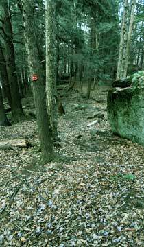
After encountering the stream a SECOND time, this is where NYS land is consistent to the top of the mountain. That way you will avoid going over private land. This second stream encounter is at mile post 1.05. The stream will be fictionalize and you will have to cross 4-5 streams to get to the edge of North Dome Mountain. If you continue to follow the DEC trail, it will take you to St Anne's Peak and Westkill Mountain. The pictures shows the trail spliting. Leave the DEC trail and head to the right.
The picture on the right shows one of the streams you will have to cross. At high water, it may be impossible to cross here. In that case go further down the trail until you can cross the stream. But, do NOT head up to St Anne's Peak.
|
 |
|
 |
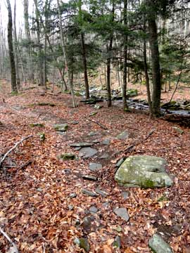
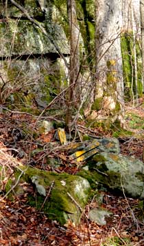
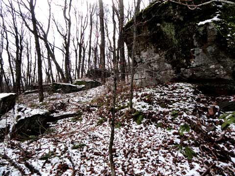
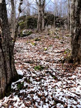
As soon as you start up the hill you will see the first band of ledges you will have to get past. North Dome mountain is known for having numerous bands of ledges. The trick is to find the easy path up throught them. If you don't see an acceptable path, walk horizontal to the ledges until you find a good path. Most of the ledges are 25-50' high. Some dwindle off to nothing, while others can go as high as 100' high. The higher up you go, the more difficult the ledges.
Around the first band of ledges, you may see the corner of private land and NY State land. After this point, the land is NY State land exclusively. The property is marked in yellow paint on trees or rocks.
|
 |
|
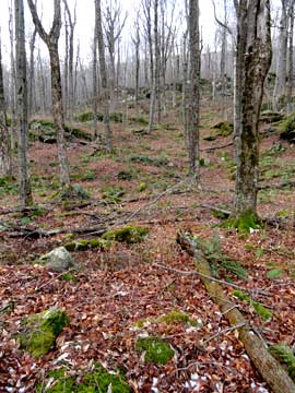 |
As soon as you get above the first band of ledges, you will see the second band of ledges.
As soon as you get above the second band of ledges, you will see the third band of ledges. |
 |
|
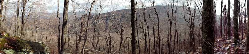 |
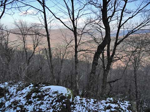
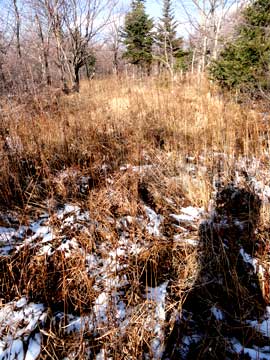
The picture on the left shows the views above the third band of ledges. You will only get a view when the leaves are not on the trees.
|
|
 |
On my trip up North Dome mountain, I kept moving LEFT. This moved me closer to steeper section of north dome mountain. Above the third ledge, there is a field of boulders the size of cars. |
|
 |
Once you look up you see the next band of ledges. The slope is steeper, and the band of ledges are more difficult. |
|
 |
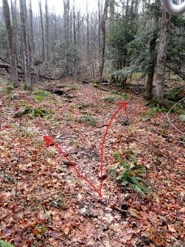
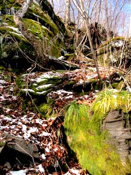
As you climb up the steep slope, you will see how difficult this band of ledges is. We had to find the best route up.
In our case, this was the best route up. If we continued to move to the right we might have found a better route. But, this one got us over the band of ledges. Your trip might be different from ours depending upon the route you choose. I can't say that one route is better then another. All are steep and have bands of ledges.
|
 |
|
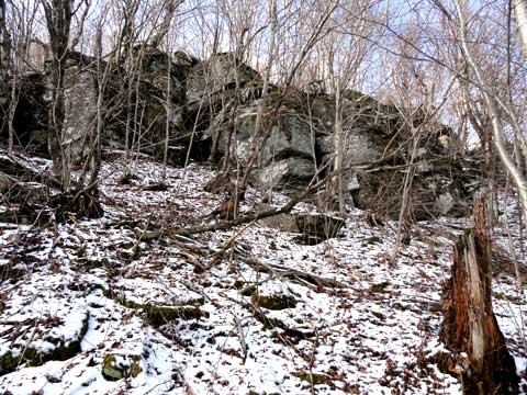 |
Once you get above the band of ledges, the next band of ledges comes into view. Swell! This band of ledges looks more difficult, but we walk along the ledge until we found an easy route over the band of ledges. This one was not as bad as the previous band of ledges on north dome mountain.
|
|
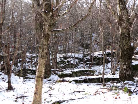 |
Once you get over the previous band of ledges on north dome mountain, you will see the next band of ledges. This one is actually very easy to get past. The steepness of the land also levels off. It now gets much easier to get to the top of north dome mountain.
|
|
 |
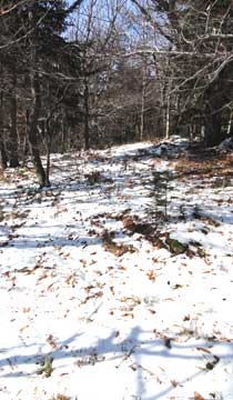
Once above the last band of ledges, you might see a herd path. Follow this path. It will turn into a conifer forest. |
|
 |
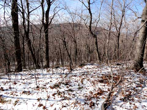
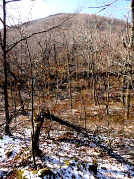
When the leaves are not on the trees, you can look back and get a limited view. This picture was taken after the last band of ledges. |
|
|
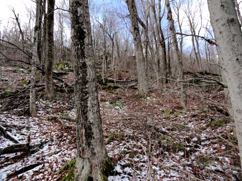
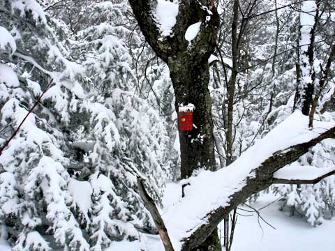
Finding the summit is fairly easy. It is easy to find the highest spot. This is a picture of the highest point. For 3500 club members, the canister is NOT directly at the highest point on the mountain. |
|
 |
After you leave the summit of North Dome Mountain, I headed southwest. If you stay on the summit and head directly west, you will have to push through some thick conifer trees. If you move slightly south of the summit cap, you will encounter some open areas and easy walking. Once you get past the summit cap, move slightly north so that you come to the col of Mount Sherrill and North Dome Mountain. |
|
 |
As you start to move downhill, you will come to a couple ledges. Nothing as difficult as the east side of North Dome. One ledge is more difficult, but if you walk along the ledge you will find an acceptable place to descend. |
|
 |
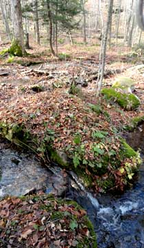
Part way down the the west side of North Dome mountain, you may encounter a marsh.
When you get down to the col there is a small ledge on both sides of the col. The col is actually pretty small. From there we moved northwest to avoid some of the more difficult bands of ledges. Once on the ridge, we moved up the ridge to the summit
|
 |
|
 |
The top of Sherrill Mountain is fairly large. The canister on the summit is not on the true summit. Once you are done backtrack back over North Dome and back to your car. |
|
|
S E C T I O N S
|
W E A T H E R
|
O T H E R
|
|
Copyright 1994-2024 www.catskillmountaineer.com
ALL RIGHTS RESERVED
|