Halcott Mountain |
 |
| |
| |
|
OVERVIEW |
| | Distance: | ~3.25-to-4.00 miles from the parking lot directly Rt 42. |
| | Time: | Average 3.25 hours round trip in the Winter |
| | Elevation Gain: | 1,726 feet from the Parking Lot and the summit. |
| | Best Time to Hike: | Anytime, but most prefer to hike it in the Winter. |
| | Difficulty: | Moderate |
| | Catskill Highest: | #34 |
| | Peak Elevation: | 3,520' |
| | |
| | | USGS Official Names: | Halcott Mountain(ID: 952008) |
| | USGS Official Elevation: | 3,524' |
| | USGS Halcott Peak-GPS: | 42.1800882, -74.4379281 (DEC-WGS84) |
| | USGS Halcott Peak-GPS: | N 42 10.805, W 74 26.276 (GPS) |
| | USGS Halcott Peak-GPS: | 18N 546418, 4669924 (UTM) |
| | USGS Halcott Peak-GPS: | N42 10 48, W74 26 16 (Degree, Min, Sec) |
| | |
| | | USGS Official Map: | Westkill Topographical Map (free) |
| | |
| | | DEC Information: | Big Indian Wilderness Information |
| | |
| | | DEC Trail Map: | Big Indian Wilderness Trail Map |
| | |
| | | DEC Interactive Map: | DEC Interactive Map |
| | |
| | | Digital Mapper for Halcott: |
Topo
Terrain
Satellite |
| | |
| | | Access Methods: | Foot and snowshoe |
|
|
Maps |
 |
|
|
| | DIRECTIONS TO TRAIL HEAD |
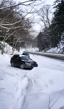
| | Parking Lot (DEC-WGS84: 42.185153°N, 74.414912°W) - Parking Lot Elevation is approximately 1,794 feet |
| | Parking Lot (GPS: N 42 11.109, E 74 24.895) - Parking Lot Elevation is approximately 1,794 feet< |
| | Parking Lot (Lat-Long: N42 11 06 E74 24 53) - Parking Lot Elevation is approximately 1,794 feet< |
| | Parking Lot (UTM: 43N 451685 4670500) - Parking Lot Elevation is approximately 1,794 feet |
| | |
| | | Take New York State Thruway to Exit 21 (Catskill) See NOTE #1. |
| | Take a left out of the NYS Thruway entrance road. |
| | Go approximately 3/4 mile |
| | Take a right onto Route 23 West |
| | Go approximately 6.6 miles to Cairo, NY |
| | Take a LEFT onto Rt 32. McDonalds Rest. on corner. |
| | Go approximately 7.7 miles on Rt 32 |
| | Take a RIGHT onto Rt 23A |
| | Go appoximately 22.2 miles to the intersection of Rt 23a and Rt 42 . |
| | Go approximately 0.3 miles - Take LEFT and go over bridge (over Schoharie Creek) |
| | Go approximately 6-7 miles on Rt 42 (from Rt 23a) |
| | Small parking lot directly on Rt 42 on the right side of the road (west side of road). |
| | There are 8 parking spaces. |
| | |
| | | Note #1 - If traveling from south of the Catskill Mountains, get off Exit 19 (Kingston). Take Rt 28 West for 28.5 miles. Turn Right onto Rt 42. Go north on Rt 42 for 4.5 miles (PA on left side of road). |
|
|
|
SPECIAL CIRCUMSTANCES ABOUT THIS HIKE |
| | The hike up to Halcott Mountain doesn't have any good view points. In the Winter the the view is poor and limited. This is considered a bushwhack hike. There is NO trail to the top.
The hike starts out by running parallel to Rt 42. Once you reach the stream, you will follow the stream up the mountain. There are a few side streams that you must cross. Nothing terrible, but it can become a little confusing. Don't be concerned with following the stream exactly. Once you get to the Head wall, you can move over to where the main stream starts.
Once you get to the Head wall, find the easiest path to the top of the head wall. In the Winter you may have to zig-zag your way up due to the steepness. If it has been windy, the snow drifts at this point can get a little deep.
Once you get to the top of the head wall, move towards the highest spot. In most cases, it will be to the right. Once you get to the top of Halcott Mountain, the canister is located on the west side of the summit.
If you want to visit Sleeping Lion Mountain to the North. It is a fairly easy walk. You can then follow the stream directly down to Halcott Falls.
This path is a little easier then following up the stream to Halcott Falls. The elevation gain is spread out. The only difficult part is the head wall which isn't that bad. This is the easier way to the summit of Halcott Mountain.
|
|
|
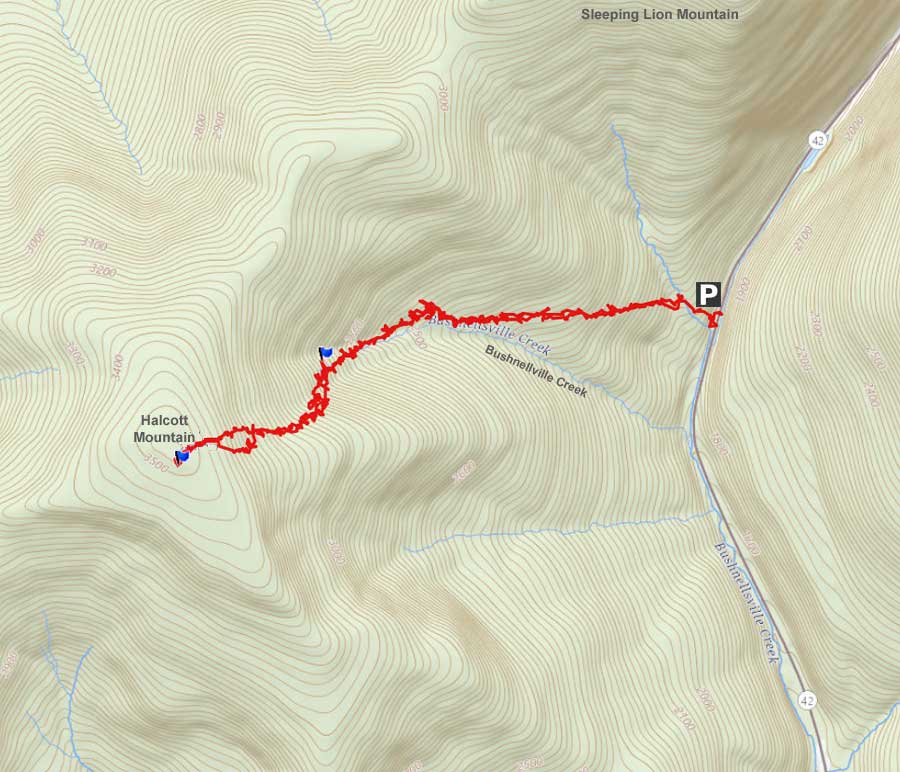
MILEAGE CHART |
| | Mile Point | Altitude | Notes |
| | 0.00 | 1,867 | Parking Lot on Rt 42. |
| | 0.04 | 1,867 | Walk past the green road barrier. |
| | 0.18 | 1,959' | Take right onto small trail after walking up hill. |
| | 0.40 | 2,002' | Take a right onto old dirt road. |
| | 2.00 | 3,520 | Summit of Halcott Mountain |
| | 4.00 | 1,784' | DEC Parking Lot |
|
 |
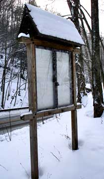
This DEC parking lot is directly on Rt 42. It is about a mile past the summit of Rt 42. It is located on the right side of the road. It can park about 8 cars.
After leaving your car, you want to head towards Halcott Falls, and past this DEC board. Once you get to the Falls, you want to walk up the right side of the Falls. When you get to the top of the Falls, you want to cross the stream and head south. You will be parallel to the road. |
 |
|
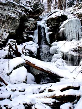 |
The picture on the left is Halcott Falls. It is a small water fall.
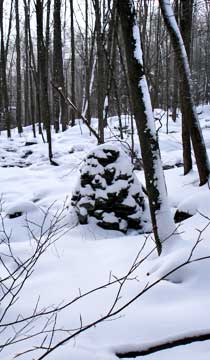
At mile post 0.18 you will see large piles of rocks along the trail. You want to continue on the direction you were on. |
 |
|
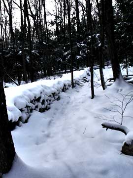 |
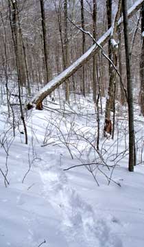
You want to continue forward and walk parallel with the stone wall.
At mile post 0.40, you will come to a major stream. At this point you want to take a RIGHT and follow the ridge of the stream uphill. You will notice that there is a small trail that you can follow at some points. You want to follow the stream up to the headwall. |
 |
|
 |
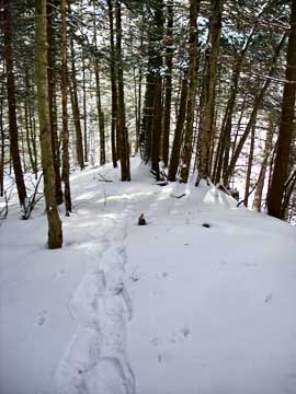
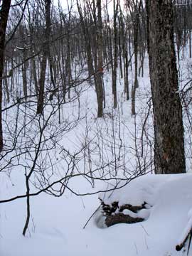
The picture on the left shows what the terrain looks like on the way up to the head wall. .
When you get to the head wall of Halcott Mountain, the stream will come to an end. If you look at the head wall, find the easist path up the head wall. The easist place is left of the stream, so you may have to move south several hundred feet depending upon where you arrived at the head wall. Once you get to the top, move back to the right and continue uphill to the summit of Halcott Mountain. At this point the terrain is fairly level with a little elevation gain. |
 |
|
|
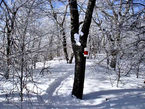
The canister is on the western side of the summit peak. Please note that the canister is moved from time-to-time. |
|
|
S E C T I O N S
|
W E A T H E R
|
O T H E R
|
|
Copyright 1994-2024 www.catskillmountaineer.com
ALL RIGHTS RESERVED
|