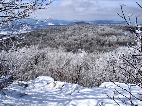
Bearpen Mountain from Heisinger Road |
 |
| |
| |
|
OVERVIEW |
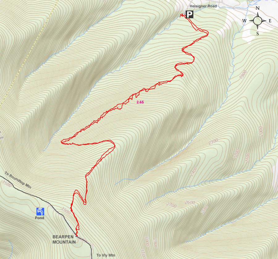
| | Distance: | 5.30 miles round trip from the DEC Gate almost at the end of Heisinger Road. |
| | Time: | Average 4.50 hours round trip in the Summer - 4.50 hours round trip in the Winter |
| | Elevation Gain: | 1,733' feet from the Heisinger Road to the summit of Bearpen Mountain. |
| | Best Time to Hike: | Anytime. |
| | Difficulty: | Easy |
| | Catskill Highest: | #27 |
| | Summit Elevation Bearpen: | 3,612' |
| | |
| | | USGS Official Names: | Bearpen Mountain (ID: 943334) |
| | GPS Bearpen: | 42.265233, -74.473917 (WGS84 - DEC) |
| | GPS Bearpen: | N42 15 54, W74 28 26 (Long/Lat) |
| | GPS Bearpen: | N42 15.914, W74 28.435 (GPS) |
| | GPS Bearpen: | 18N 543388 4679359 (UTM) |
| | USGS Official Elevation: | 3,530' (*See notes below*) |
| | USGS Official GPS: | *See notes below |
| | |
| | | USGS Official Map: | Prattsville Topographical Map (free) |
| | |
| | | DEC Map: | DEC Bearpen Wild Forest Map (free) |
| | |
| | | Digital Mapper: |
Topo
Terrain
Satellite |
| | |
| | | Access Methods: | Foot, ski, mountain bike, snowmobile, and snowshoe (ATV's not allowed) |
| | |
| | USGS Elevation Note: The 1903 USGS map incorrectly showed Bearpen Mountain where North Bearpen Mountain is located. The official elevation and gps location of Bearpen Mountain has never been officially resolved with USGS. Some of the newer USGS digital maps now show the summit of Bearpen Mountain moved back. To learn more about the story behind the many discrepancies, read the link listed at the bottom of this page about the Princeton Ski Bowl. |
|
|
Maps & Profile |
 |
|
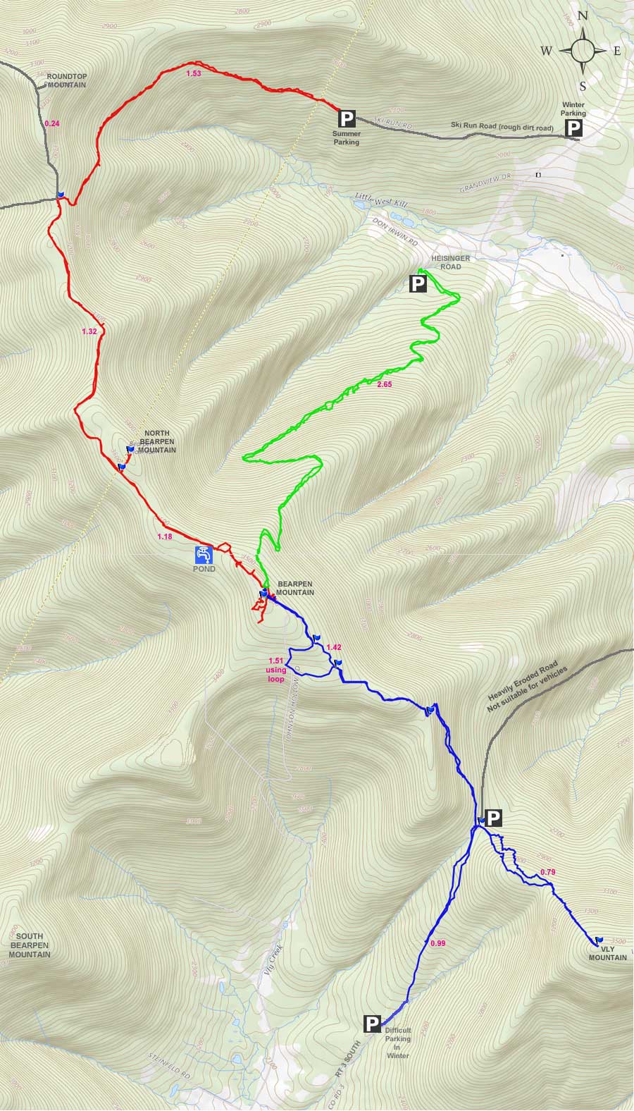
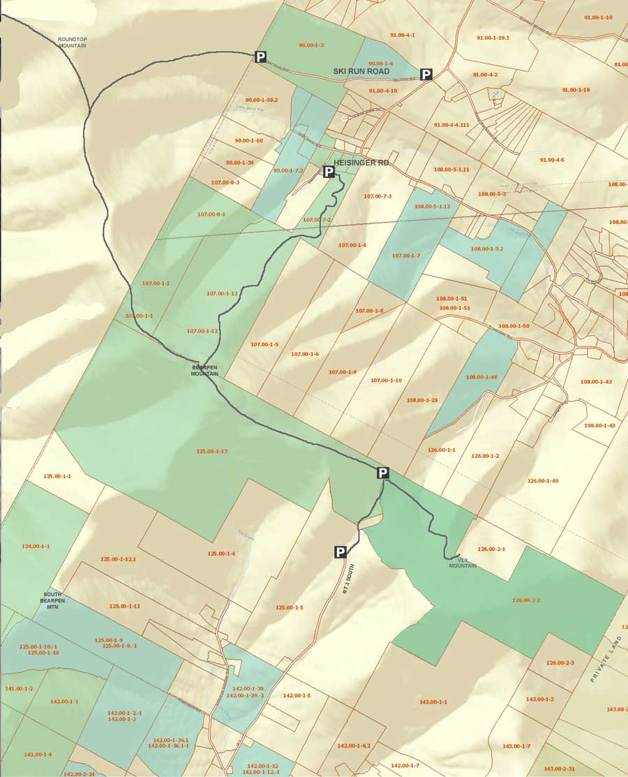 Public & Private Land Ownership around Bearpen & Vly Mountain
(Greene County Only - Delaware County not available)
Tan=Private Land
Green=DEC Public Land
Lite Blue=DEP NYC Public accessible land
* Land ownership is ONLY shown for Greene County *
|
|
|
|
| | DIRECTIONS TO TRAIL HEAD |
| | DEC Parking Lot: Elevation 1,870 feet |
| | GPS Coordinates to DEC Parking Lot: 42.283533, -74.462067 (WGS84 / DEC) |
| | GPS Coordinates to DEC Parking Lot: N42 17 00, W74 27 43 (Long/Lat) |
| | GPS Coordinates to DEC Parking Lot: N 42 17.012, W 74 27.724 (GPS) |
| | GPS Coordinates to DEC Parking Lot: 18N 544352 4681397 |
| | |
| | Take New York State Thruway to Exit 21 (Catskill). |
| | Take a LEFT out of the NYS Thruway toll booths. |
| | Take a RIGHT onto Rt 23 westbound |
| | Go 33.3 miles until the intersection of Rt 23a and Rt 23 |
| | Take RIGHT and continue on Rt 23 for another 1.5 thru Prattsville |
| | After passing thru Prattsville, you will cross over the Schoharie Creek over a Green Bridge |
| | Take LEFT onto Rt 23 as soon as you come off the bridge |
| | Go 3.2 miles on Rt 2 |
| | Take Right onto Don Irwin Road - Go 0.2 miles |
| | Take LEFT onto Heisinger Road - Go 0.2 miles to almost the end |
| | Park on the side of the road. All the land from Rt 2 to Heisinger road is State Land. |
| | The road is plowed in the winter, and you can park on the side of the road anywhere on Heisinger Road. Do NOT block the driveway at the very end of Heisinger Road. The trail is about 50' before the end of the road on the LEFT side of the road. Look for the steel gate. |
|
|
SPECIAL CIRCUMSTANCES ABOUT THIS HIKE |
| | This hike is located on the very western edge of Greene County. Bearpen Mountain is about 1 mile east of the Delaware and Greene County line. The hike is outside of the blue line of the Catskill Mountain Park. This is a quick way to the top of Bearpen Mountain. There are quite a few view points, and the views from Bearpen Mountain are spectacular. This hike is also one of the easier hikes in the Catskill Mountains.
The is the shortest way to the top of Bearpen Mountain. The road from Heisinger Road to the summit of Bearpen Mountain is completely on State land.
There is NO registration box. This is a wild forest, so you can find snowmobiles running around in the Winter. But, we never see many, and the few we see break the trail for us. Bearpen Wild Forest does get more snow then the rest of the Catskill Mountains.
The road up to the summit is a nice 12% incline that runs pretty steady. The road is wide enough for a truck. While climbing up to the ridge, you can see over the valley as you hike up the road. But, only in the Winter when the leaves are not on the trees. The road to the ridge is 2.65 miles long.
There are numerous great views from the summit of Bearpen Mountain. Take the time to find most of them. Most of the views are spectacular. This mountain is a favorite of snowshoers and cross-crountry skiers.
|
|
|
MILEAGE CHART |
| | Mile Point | Altitude | Notes |
| | 0.00 | 1,870 | Parking Area near the end of Heisinger Road. |
| | 2.65 | 3,612 | Summit of Bearpen Mountain. |
| | 5.30 | 1,870 | Parking Area near the end of Heisinger Road. |
|
|
|
Hike to Bearpen Mountain and North Bearpen Mountain |
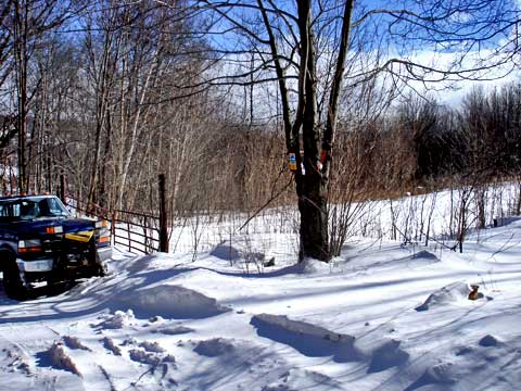 |
The land on both sides of Heisinger Road is State Land. Only the driveway at the end of the road is privately owned. Do NOT block their driveway. The steel gate you see in the picture is the beginning of the trail to the top of Bearpen Mountain. You need to walk about 25 feet right of the gate to get past the fence. There is a break in the fence. You can park along any part of this road. You can also park in the field on the side of the road. |
|
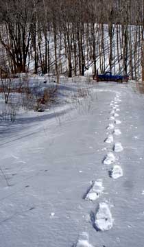 |
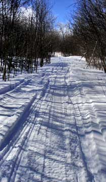
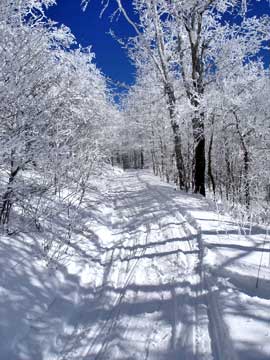
The trail starts off running perpendicular to the road. This picture is looking backwards. It will then turn right and start heading up the hill in a series of switchbacks.
This is what the trail looks like. |
 |
|
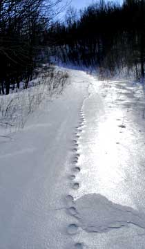 |
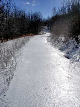
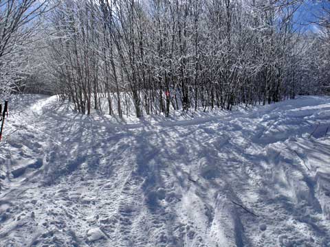
The road up to Bearpen is steeper then the trail up Ski Run Road. The average grade of this road is 12.4%. Still pretty easy as comparied to other trails in Catskill Mountains. The road is between 10-25 feet wide. This picture shows tracks of a Bobcat.
Not long after you start up the trail, is a section that is prone to drifting snow. It is a short section, so if you have to break the trail, it should not last long. |
 |
|
 |
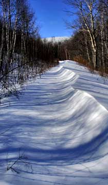
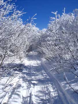
As you head up the road thru a series of switchbacks. Part way up, you will see Bearpen Mountain summit in the background. In this picture, you can see the rime covered Bearpen Mountain. |
|
 |
Part way up, you will come to the first of many intersections. Some maps show these two trails coming back together further up. But, in reality you want to take the trail on the LEFT. The trail on the right will meet up again, but only after a very steep ascent. Going right will be regretable mistake. |
|
 |
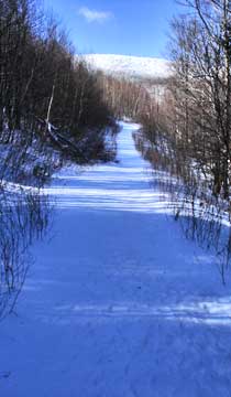
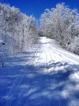
Beyond the first intersection, the road continues to climb at a steady rate. This section is one of those long straight sections with Bearpen Mountain in the background.
After the long straight away, will be another sharp turn. This is where the trail meets up from the Y intersection. If you look over the bank, you will be thankful for going left instead of right. The picture shows the trail after the trail turns for another switchback. |
 |
|
 |
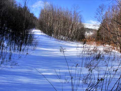
On the way up, you will often have limited views in the Winter months. Here is an example. |
|
 |
Again, this is another picture of the road to the top. You can also start to get views, when you look backwards. |
|
 |
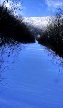
Again, this is another intersection. Again, you want to go LEFT. Right will take you to the other side of Bearpen Mountain. |
|
 |
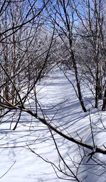
The road starts to narrow as you get closer to the top. In the summer the leaves can get tough. |
 |
|
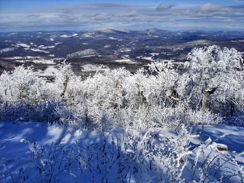 |
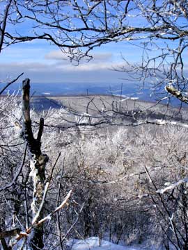
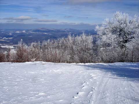
This is just shy of the summit. It is one of the old ski slopes. You can see the incredible view. |
|
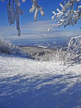 |
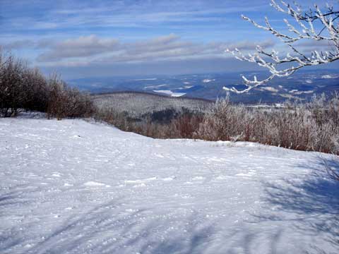
Here is another picture from one of the ski slopes. If you look in the picture you can see Schoharie Reservoir |
|
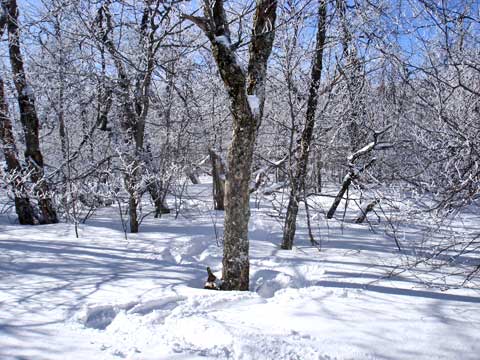 |
The summit is close to the previous picture. The top of Bearpen Mountain is very flat, and finding the exact summit is a little difficult. Most of the top of the mountain is very flat and doesn't change in elevation by more then a couple feet. This is a picture of the top of the mountain. The summit is at GPS: N42 15.914 W74 28.435. From here there are a number of great view points on the summit of bearpen mountain. They are listed below: |
|
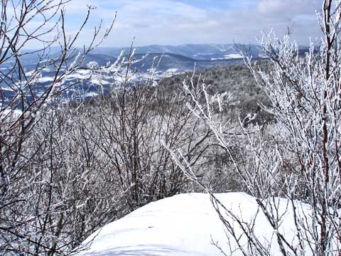 |
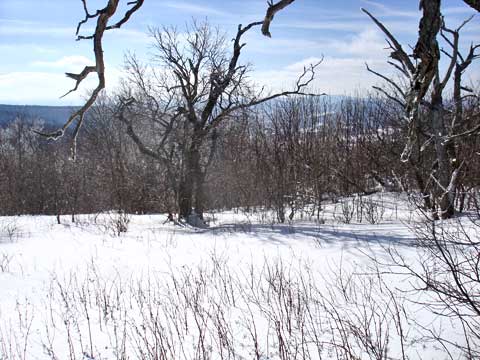
Here is a view point from the northwest side of Bearpen Mountain. |
|
|
Here is a view point from the northwest side of Bearpen Mountain. |
|
 |
Here is a view point from the northwest side of Bearpen Mountain. |
|
 |
Here is a view point from the northwest side of Bearpen Mountain.. It is a little enclosed and limited, but still nice.
The trail from the northwest side to the southeast side is overgrown and needs to be pruned. This is what it looks like. |
 |
|
 |
Part way across the summit is another view point. Again, it is very nice. This is one of the old ski runs. |
|
 |
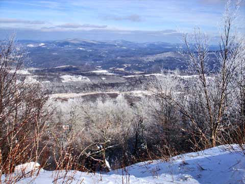
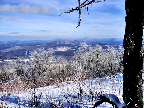
This is the next view point. It is the wides view point. Again, it is another ski run. It is on the north side of bearpen mountain. In the distance you can see Huntersfield Mountain, Ashland Pinnacle, and Richmond Mountain. |
|
 |
This is the same view point, but from a different angle. In the distance you can see the Schoharie Reservoir. |
|
 |
This is the last view point while heading east. Going past this point will cause you go head back down the mountain. |
|
 |
This is the same view point but slightly to the east (right). |
|
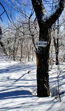 |
This is one of the few signs left marking one of the old ski trails. It was named Ed West Trail. |
|
 |
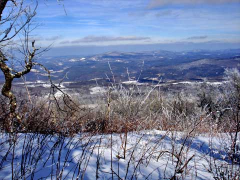
This is the last view point. It is located on the south east side of the summit. The trees are becoming quite dense. There are loads of prickers, so visiting in the summer would be quite difficult. Off in the distance is Red Kill Ridge. You might also be able to see South Bearpen Mountain.
At this point, you just need to reverse your course back to your car. The path back to your care is pretty much downhill. |
|
|
S E C T I O N S
|
W E A T H E R
|
O T H E R
|
|
Copyright 1994-2024 www.catskillmountaineer.com
ALL RIGHTS RESERVED
|