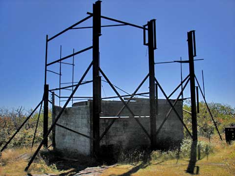
Graham Mtn & Balsam Lake Mountain Fire Tower
|
|
|
|
Overview of this Hike: |
| Distance: 9.84 miles round trip from the DEC Parking Lot on Mill Brook Road. |
| Time: Average 6.50 hours round trip |
| Elevation Gain: 1,284’ for Graham and 380' for Balsam Lake Mtn from the DEC Parking Lot and the summit. |
| Best Time to Hike: Morning. |
| Difficulty: Moderate |
| VO Map No: 62 & 83 & unmarked trail on private land |
| Catskill Highest: #6 |
| Peak Elevation: 3,868' |
| Digital Mapper: Topo
Terrain
Satellite |
| Attractions: Nice walk year around - common winter snowshoe and ski trail |
| Attractions: Spectacular views from the top of the fire tower on a clear day. |
| Dangers: None known. |
| Common Animals: birds. |
| Risky Animals:
Rattlesnakes (none known),
Bears (Low),
| | Access Methods: Foot, ski, and snowshoe |
|
Directions to Trail Head from New York State Thruway (Easist, not the shortest): |
| GPS Coordinates to DEC Parking Lot: N42 04.243 W74 34.416 - Elevation is approximately 2,584 feet |
| Take New York State Thruway to Exit 19 (Kingston). |
| Take a right out of the NYS Thruway toll booths onto Rt 28. |
| Go approximately 50 miles west on Rt 28 |
| Take a left onto Rt 49A at Highmount (Belleayre Ski Center) |
| Go 5 miles to the end of Rt 49A. |
| Take a LEFT onto Rt 49/7A/Dry Brook Road |
| Go appoximately 1.25 miles to Mill Brook Road. |
| Take a RIGHT onto Mill Brook Road |
| Go approximately 2-3 miles on Mill Brook Road |
| The DEC Parking lot is on the RIGHT side of the road |
|
Special Circumstances about this Hike |
| A good part of this hike passes over Private Land. Do NOT leave the trail. Please respect the owner's land. This is a great hike any time of the year. It is also a common hike in the Winter. |
|
| Mile Point | Altitude | Notes |
| 0.00 | 2,584’ | DEC Parking Lot - N41 56.139 W74 19.692 - Walk across the street to the trailhead. |
| 0.37 | 2,794’ | Registration Box. |
| 1.33 | 3,234' | Faint trail junction to peak of an un-named peak. |
| 2.17 | 3,357' | Trail Junction to Graham Mountain |
| 4.15 | 3,830' | Summit of Graham Mountain |
| 6.17 | 3,358' | Trail Junction to Graham Mountain |
| 6.31 | 3,340' | Trail Junction to Balsam Lake Mountain and Fire Tower |
| 7.06 | 3,738' | Summit of Balsam Lake Mtn - Fire Tower - Ranger Station |
| 9.84 | 2,584’ | DEC Parking Lot. |
|
|
Hike to Graham Mountain & Balsam Lake Mountain |
 |
The picture on the left is the DEC parking lot off of Mill Brook Road.
You will find this sign in the parking areas. |
 |
|
|
Hike to Balsam Lake Mountain |
 |
The picture on the left is the DEC parking lot off of Mill Brook Road. The Trailhead is inbetween the tree stump on the left and the telephone pole on the right. It is a jeep trail.
The trailhead is actually down the street. It follows an old jeep trail on private land. There is some mild elevation gain in the beginning of the hike. |
 |
|
 |
The picture shows some Chicken Mushroom that we found near the beginning of this hike.
At mile post 0.37 you will find the Registration Box. We suggest that you register. The more people who register, the more money is devoted to maintenance of the trial. |
 |
|
 |
The picture shows what the jeep trail looks like.
The first 1.3 miles has some easy uphill sections. The trail will go up and then level off. Then it will go up again and level off. Then for the next mile, it will be level for the most part.
At mile post 1.33 (elev 3234') you will find a small faint side trail. This side trail runs up to a small peak. |
 |
 |
At mile post 2.17 you will come to this Trail Junction. This picture is take AFTER passing the trail junction and looking back. The trail junction will take you to Graham Mountain. It is easy to miss this trail junction. If you go too far, the next trail junction is 750 feet away, which will take you to the fire tower. Straight will take you to the Balsam Lake Mountain Fire Tower. Take a sharp LEFT. |
|
 |
The picture shows you a sample of the trail. This trail is not maintain, so it has a tendency to be slightly overgrown towards the end of the summer.
Another example of the trail to Graham Mountain. For the first mile, the trail actually descends about 200 vertical feet. The next mile will climb at a moderate rate. It will climb 600 vertical feet to the summit of Graham Mountain. |
 |
 |
Some parts of the trail will be fairly overgrown. Especially with blackberries.
Towards the end of September, you will find some good staches of Blackberries towards the top of Graham Mountain. |
 |
 |
At mile post 4.15 you will arrive at the summit of Graham Mountain. On the summit you will find the ruins of an old tower installation. |
|
 |
This is another picture from the summit of Graham Mountain. The mountain in the picture is Balsam Lake Mountain. If you look carefully, you can see the Fire Tower.
After enjoying the summit, return the 2 miles back to the trail junction. Then take a LEFT. |
|
 |
750 feet up the trail, you will come to this Trail Junction (mile post 6.31). Right will take you up to the Fire tower and summit. Straight will take you down the other side of the mountain. Go RIGHT. |
|
 |
There are two signs at this Trail Junction. Both are shown here.
|
 |
|
 |
After 200 feet up the trail, you will come to a gate. You should go around the gate. The gate is there to keep vehicles from going up the trail. Most of the trail coming up to the Trail Jucntion is private land.
After the gate the trail becomes steeper and goes thru a series of switchbacks. |
 |
|
 |
The picture on the LEFT shows the conifers after the steep climb. The trail is cut thru the thick conifers.
Just before reaching the summit, you will encounter the Ranger Station. The ranger station is shown on the right. |
 |
|
 |
At the summit is the Fire Tower shown in the picture. The Fire Tower has been restored. This includes a stainless steel roof and new windows. The view from the fire tower is excellent. You can also see the Pepactan Reservoir. |
|
|
|
Copyright 2001-2010 www.catskillmountaineer.com
ALL RIGHTS RESERVED
|
| | |