Balsam Lake Mountain |
 |
| Balsam Lake Mountain Fire Tower |
| |
| |
|
OVERVIEW |
| | Trail Name: |  Dry Brook Ridge Trail (From Balsam Lake Mountain to Balsam Lake Mountain PA
 |
| | Trail Name: |  Balsam Lake Mountain Trail (to Balsam Lake Mountain
 |
| | | |
| | Forest: | Balsam Lake Mountain Wild Forest |
| | Parking Area : | 20 spaces directly off Mill Brook Road in the Dry Brook Parking Area |
| | Winter Access: | Dry Brook Parking Area |
| | Camp sites: | NO Camp Site locations |
| | Lean-to sites: | Two Lean-to (Balsam Lake Mountain Lean-to & Dry Brook Lean-to) |
| | Access: | Hike or snowshoe |
| | | |
| | Trail Length: | 5.70 (round-trip) |
| | Trail Type: | 100% Double-Track Trails |
| | Hiking Time: | Average 4 hours (round-trip) |
| | Lowest Elevation: | 2,607' (A) |
| | Highest Elevation: | 3,745' (A) |
| | Views : | One view spot - Balsam Lake Mountain Fire Tower |
| | Difficulty: | Easy |
| | |
| | | USGS Official Map: | Seager Topographical Map (free) |
| | |
| | | DEC Trail Map: | DEC Balsam Lake Mtn Wild Forest Map (free) |
| | |
| | | Digital Mapper: |
Topo
Terrain
Satellite |
|
|
Maps for hike To Balsam Lake Mountain |
 |
|
|
|
Directions to Trailhead for the Balsam Lake Mountain Fire Tower Hike |
| | Dry Brook Parking WGS84 (DEC): 42.070717, -74.5736 - Elevation is approximately 2,584 feet |
| | Dry Brook Parking Deg/Min/Sec: N42 04 14, W74 34 24 - Elevation is approximately 2,584 feet |
| | Dry Brook Parking GPS: N 42 04.243, W 74 34.416 - Elevation is approximately 2,584 feet |
| | Dry Brook Parking UTM: 18N 535274 4657716 - Elevation is approximately 2,584 feet |
| | Take New York State Thruway to Exit 19 (Kingston). |
| | Take a right out of the NYS Thruway toll booths onto Rt 28. |
| | Go approximately 33 miles west on Rt 28 |
| | Take a left onto Rt 49A at Highmount (Belleayre Ski Center) |
| | Go 5 miles to the end of Rt 49A. |
| | Take a LEFT onto Rt 49/7A/Dry Brook Road |
| | Go approximately 1.25 miles to Mill Brook Road. |
| | Take a RIGHT onto Mill Brook Road |
| | Go approximately 2.0 miles on Mill Brook Road |
| | The DEC Parking lot is on the RIGHT side of the road |
|
|
Notes about the hike to Balsam Lake Mountain |
| | This is a great hike any time of the year. It is an easy hike with great views from the fire tower on the summit of Balsam Lake Mountain. There is also a Ranger Station on the summit of Balsam Lake Mountain. It is often open to the public on summer weekends. There is also a picnic table on the summit of Balsam Lake Mountain.
There is a Spring about 1/3 of a mile south of the summit of Balsam Lake Mountain, and the Balsam Lake Mountain Lean-to is a little more then a half mile south of the summit of Balsam Lake Mountain. At the Dry Brook Parking Area, there is the Mill Brook Lean-to another mile west (Mill Brook Road) of the parking area on. There is a third lean-to (Dry Brook Lean-to), but there is not a source for water.
The first two miles of the hike from the Dry Brook Parking Area goes over private property. So, you need to stay on the trail. Once you get the Balsam Lake Mountain Trail, you will be on DEC public property.
Graham Mountain is on Private Property. In the past, Graham Mountain was open to hiking with permission. The owner encountered too many problems, and closed both Graham Mountain and Double Top Mountain to the public. |
|
|
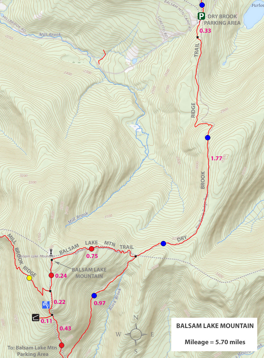
MILEAGE CHART for Balsam Lake Mountain from Dry Brook Ridge PA |
| | Mileage |
Mile Point |
Altitude |
Notes |
| | 0.00 | 0.00 | 2,584' | Balsam Lake Mountain Parking Area (25 cars) |
| | 0.33 | 0.33 | 2,790' | DEC Registration Box |
| | 1.77 | 2.10 | 3,365' | Trail Junction for Balsam Lake Mountain Trail |
| | 0.75 | 2.85 | 3,554' | Balsam Lake Mountain Summit & Fire Tower |
| | 2.85 | 5.70 | 2,584' | Balsam Lake Mountain Parking Area |
|
|
HIKE TO BALSAM LAKE MOUNTAIN |
 |
You want to park in the Dry Brook Parking Area. It is directly off Mill Brook Road.
|
|
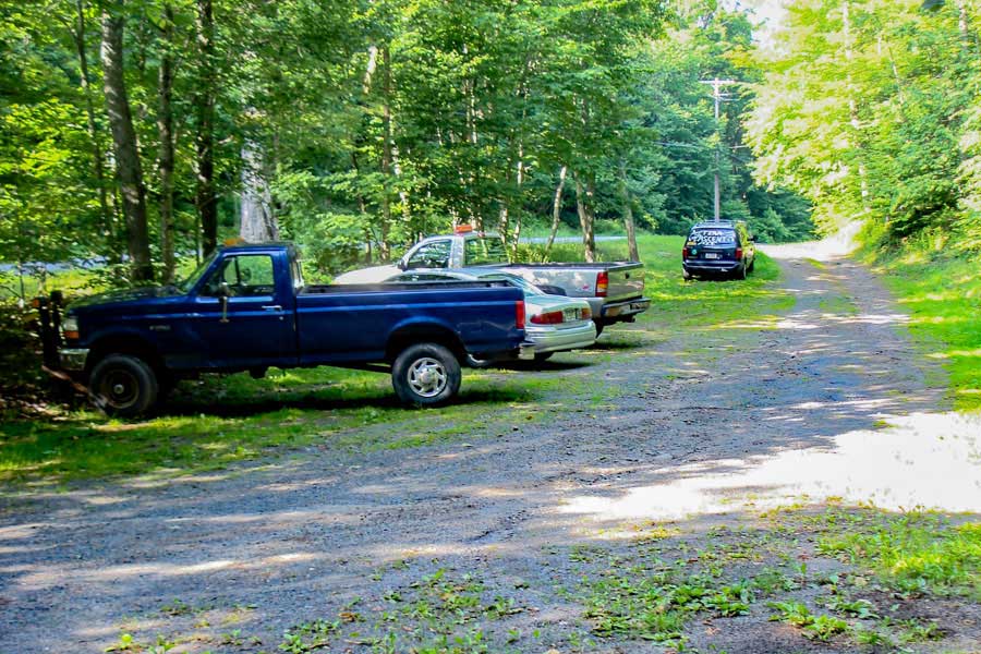 |
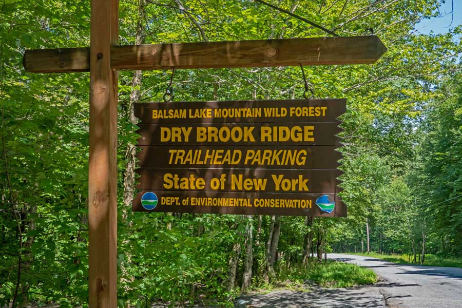
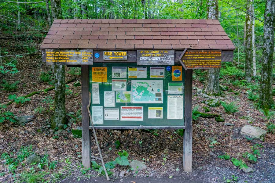
The Dry Brook Parking Area off Mill Brook Road. The Dry Brook Parking Area is for the Dry Brook Ridge, Balsam Lake Mountain Fire Tower, and the Mill Brook Lean-to (off Mill Brook Road).
|
|
 |
The Kiosk for the Dry Brook Parking Area off Mill Brook Road. Check for any important information about this area.
|
|
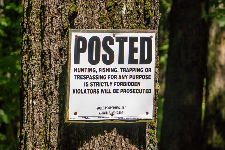 |
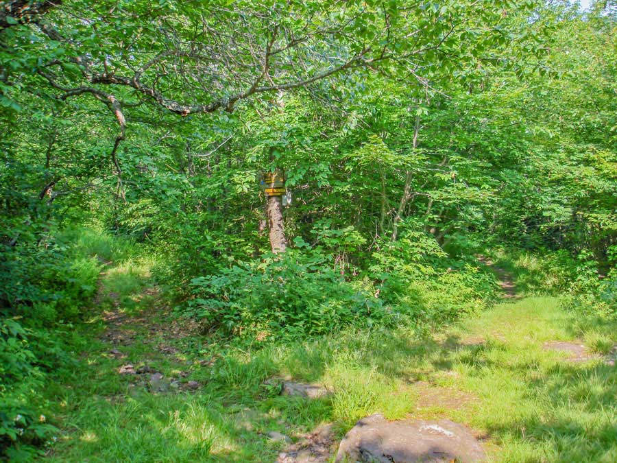
The trail from the Dry Brook Parking Area to the entrance to the Balsam Lake Mountain Fire Tower is on private property. Please stay on the trail until you reach the DEC gate at the Trailhead for the Balsam Lake Mountain Trail that will take you up to the Balsam Lake Mountain Fire Tower.
|
|
 |
 |
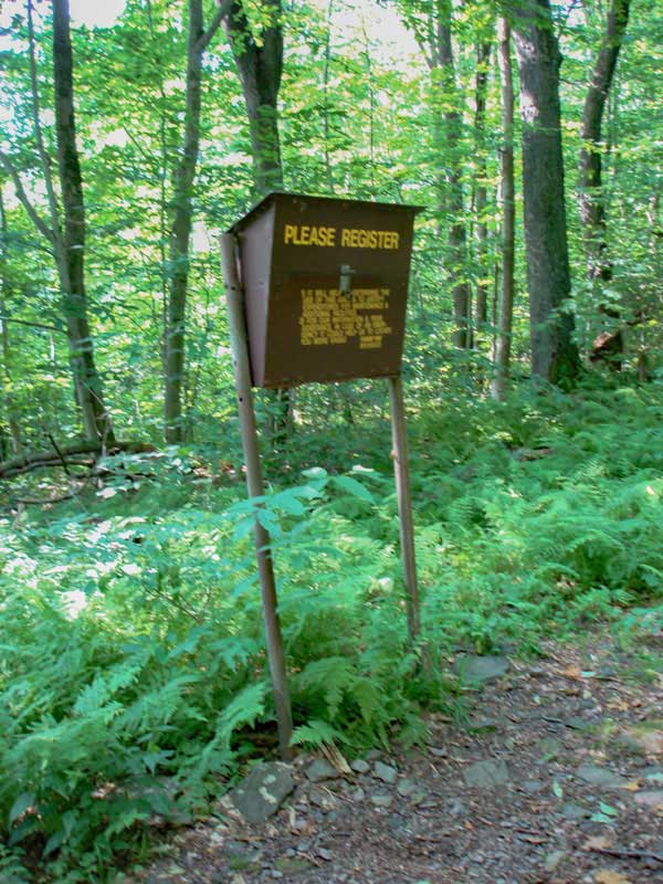
Please register for the Balsam Lake Mountain Fire Tower hike. If you are injured or lost, the DEC Rangers will use this information to help find you. Additionally, the amount of maintenance money allocated for this hike depends upon how many register for this trail. |
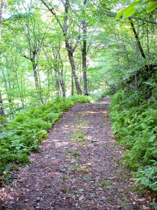
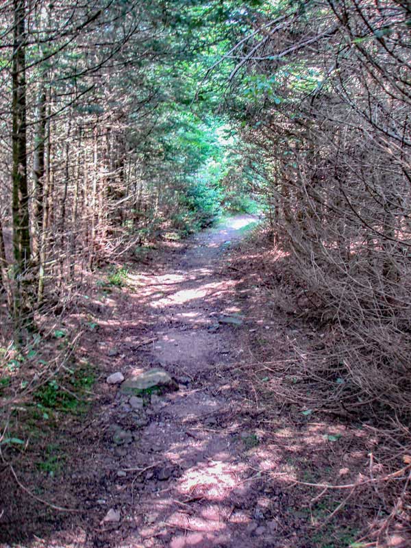
The trail is a double track trail from the Dry Brook Parking Area to the top of Balsam Lake Mountain. The trail for the next 2 miles will have a mild incline for pleasant hiking. Some hikers see Great-Horned Owls on this hike. |
|
 |
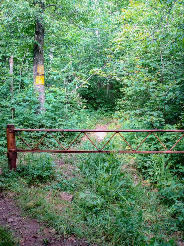
After about hiking 2 miles up the Dry Brook Ridge Trail, you will come to the trail junction. You want to go RIGHT.
Left will take you to the Balsam Lake Mountain Parking Area, Hardenburgh-Neversink Trail, and Willowemoc Wild Forest.
|
|
 |
 |
This is the Trailhead for the Balsam Lake Mountain Trail. Go around the gate and continue hiking. |
The trail continues to be a Double-Track Trail. The incline will increase until you get near the top of Balsam Lake Mountain. |
|
 |
 |
As you get closer to the summit of Balsam Lake Mountain, the forest will change to Balsam Fir Trees that the mountain is famous for. |
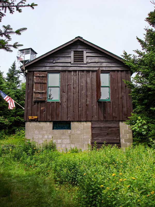
As you approach the summit of Balsam Lake Mountain, you will first encounter the Ranger Station, and you will see the Balsam Lake Mountain Fire Tower peaking out to the left of the Ranger Station. On summer weekends, the Ranger Station is sometimes open. |
|
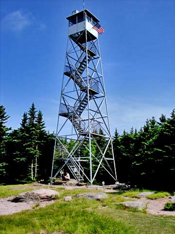 |
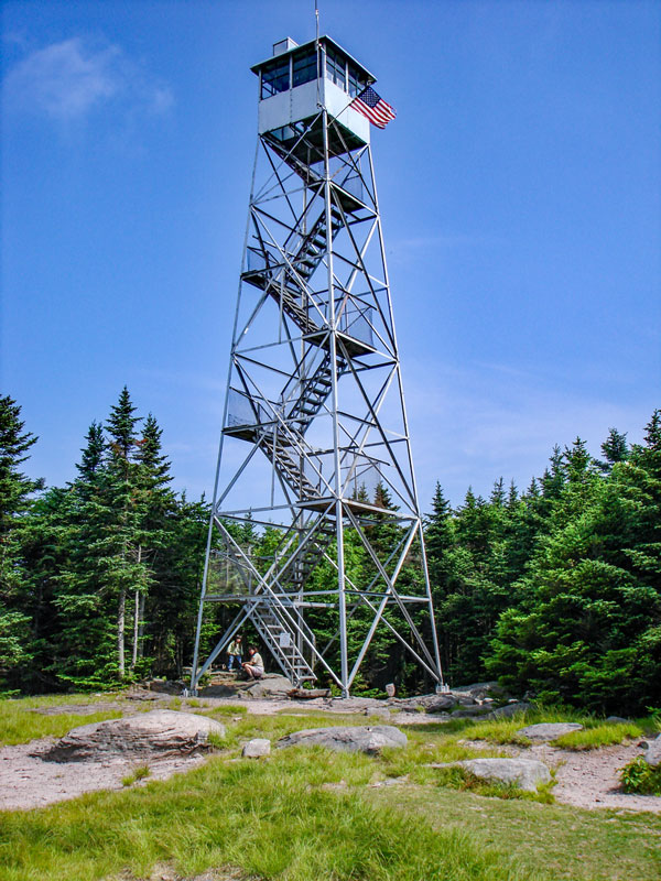
At the summit is the Fire Tower shown in the picture. The Fire Tower has been restored. This includes a stainless steel roof and new windows. The view from the fire tower is excellent. You can also see the Pepactan Reservoir.
There is also a picnic table on the summit for those want to eat lunch.
There is also the Balsam Lake Mountain Lean-to and water source south of Balsam Lake Mountain.
On some Summer weekend, the Ranger Station is open to the public. Additionally, they usually open the cabin at the top of the fire tower.
This is the end of your hike. You can return back to your car in the Dry Brook Parking Area where your car is parked, or venture off elsewhere. Hope you enjoyed this hike. |
|
|
S E C T I O N S
|
W E A T H E R
|
O T H E R
|