Fir Mountain |
 |
| |
| |
|
OVERVIEW |
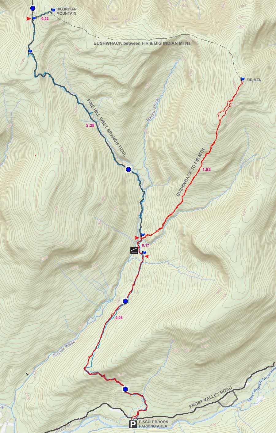
| | Distance: | 7.80 miles round trip from the DEC Parking Lot (Biscuit Brook) on Rt 47 (Oliverea Road). |
| | Time: | Average 4.00 hours round trip in the Summer - 5.00 hours round trip in the Winter |
| | Elevation: | 3,627' |
| | Elevation Gain: | 1,539' feet from the DEC Parking Lot to the summit. |
| | Best Time to Hike: | When leaves are off the trees |
| | Difficulty: | Moderate |
| | Catskill Highest: | #25 |
| | |
| | | USGS Fir Summit-Elevation: | 3,629' (USGS) |
| | USGS Fir Summit: | 42.0275916, -74.4690414 (DEC-WGS84) |
| | USGS Fir Summit: | N 42 01.655, W 74 28.142 (GPS) |
| | USGS Fir Summit: | 18N 543954, 4652976 (UTM) |
| | USGS Fir Summit: | N42 01 39, W74 28 08 (Degree, Min, Sec) |
| | |
| | | USGS Official Map: | Shandaken Topographical Map (free) |
| | USGS Official Map: | Seager Topographical Map (free) |
| | USGS Official Map: | Peekamoose Topographical Map (free) |
| | |
| | | DEC Information: | Big Indian Wilderness Information |
| | DEC Trail Map: | Big Indian Wilderness Trail Map |
| | DEC Interactive Map: | DEC Interactive Map |
| | |
| | | Acme Digital Mapper: |
Topo
Terrain
Satellite |
| | Attractions: | Easy bushwack with no ledges |
| | Attractions: | Nice walk across valley floor |
| | Attractions: | Moderate amount of wildlife |
| | Unattractions: | Many stream crossings with deep water at times |
| | Unattractions: | No views |
| | Dangers: | Falling into stream - high risk during high water conditions. |
| | Access Methods: | Foot, ski, and snowshoe |
|
|
Maps |
 |
|
|
|
| | DIRECTIONS TO TRAIL HEAD |
| | Coordinates to DEC Biscuit Brook Parking Lot: 41.99125, -74.484867 (DEC-WGS84) - Elevation is approximately 2,088 feet |
| | Coordinates to DEC Biscuit Brook Parking Lot: N 41 59.475, W 74 29.092 (GPS) - Elevation is approximately 2,088 feet |
| | Coordinates to DEC Biscuit Brook Parking Lot: 18N 542668, 4648933 (UTM) - Elevation is approximately 2,088 feet |
| | Coordinates to DEC Biscuit Brook Parking Lot: N41 59 28, W74 29 05 (Degree, Min, Sec) - Elevation is approximately 2,088 feet |
| | |
| | Take New York State Thruway to Exit 19 (Kingston). |
| | Take a right out of the NYS Thruway toll booths onto Rt 28. |
| | Go approximately 40.0 miles west on Rt 28 |
| | Take a left onto Rt 47 at Big Indian |
| | Go approximately 13 miles South on Rt 47 |
| | The Biscuit Brook DEC Parking lot is on the LEFT side of the road. |
|
|
SPECIAL CIRCUMSTANCES ABOUT THIS HIKE |
| | The hike of Fir Mountain is located in Ulster county. There are a number of different routes that can be taken to get to the summit of Fir Mountain. But, all of them require a bushwack to get to the summit. Some routes run over marked DEC trails at the beginning of the hike. Others are bushwacks from the beginning. There are pros and cons to each direction depending upon the time of year, and the experience you are looking for. The nice part of this hike is the easy climb to the summit. The hike is moderate in ability. There are numerous tream crossings on the shown route. During high water periods, they may not be crossable or safe.
Route #1 - Hike from Biscuit Brook DEC Parking Lot - Straight Route - This route is outlined on this page. It is fairly easy hike, and moderate in ability. It does have some stream crossings that can only be crossed during normal water heights. During high water marks it can be very dangerous.This is the most common route used by most hikers.
Route #2 - Hike from Seagar DEC Parking Lot - Follow Ridge Line - This route involves hiking to Big Indian Mountain first. Then bushwhacking over to Fir Mountain.
Route #3 - Hike from Slide Mountain DEC Parking Lot - This route goes over three mountains instead of one. It is more remote then the other routes. The beginning of the route requires that you climb up a steeper incline to get to the top of the ridge line. This is probably the least used route.
Route #4 - Hike from Big Indian Mountain - This route requires that you climb Big Indian Mountain first, and then hike over to Fir Mountain. It will add a couple miles to the hike. The col in between the two mountains is known for deep winter snow drifts, so keep this in mind if you hike this route in the Winter. Most people start at the Seagar parking area, or do a loop from the Biscuit Brook parking lot.
Route #5 - Hike from Burnham Hollow Road off Rt 47 - This route follows some old roads up the mountain, that come out near the col of Big Indian Mountain and Fir Mountain. This is only if you keep to the left as you take the old roads up the mountain. See maps for routes up the complex of dirt roads.
When you start out from the Biscuit Brook DEC parking lot on Rt 47. Biscuit Brook DEC parking area is about 4 miles past Slide Mountain DEC parking area. After parking your car, walk about up Rt 47 (towards slide mountain PA) about 100 feet, and you will find the trail head directly across the street. Look for a sign directly on the Rt 47. After walking up the trail about 500 feet you will see the DEC registration box. Get registered and started.
After the registration box, the incline starts to go uphill, and runs across the hillside to the south. The trail is moderate in difficulty. It is also very rocky. When you get to the top of the hill, the incline levels out, and the trail into the valley is very nice. At the top of the hill, is where you would leave the trail if you want to do Route #2.
For the next mile, the trail actually drops about 200-300 feet in elevation over the mile, so the hike is real easy. In the Winter you can see Doubletop Mountain (elevation 3868') off to your left (in the distance). You can only see the top of the mountain. Another steep looking mountain (elevation 3372') on the other side of the valley floor. It doesn't have a name. Off to the right is another un-named peak with elevation of 3211'. Straight ahead of the trail is Fir Mountain. This is our goal of the hike.
About 2 miles into the hike, you will see the Lean-to or the sign to the Lean-to on the left side of the trail. the lean-to is right next to the creek, but sits about 15-20 feet above the creek. Just after the Lean-to, you will cross a fairly good stream with steep banks down to the stream. This stream runs perpendicular to the trail. After you walk up the opposing bank, this is where you will want to leave the marked trail and start bushwacking towards Fir Mountain.
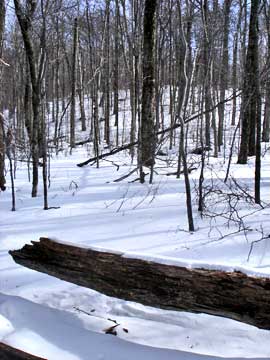
As soon as you leave the trail, the incline is moderate in difficulty. But, the incline doesn't last lone. Soon, you will be on a fairly flat area. Directly ahead is a big gully where the stream comes down, and off in the distance is a steep mountain bank. You now want to turn left 90 degrees and start climbing up the easy incline of the ridge line. You will be walking parallel to the stream in the large deep gully. You will climb up this long incline for about 1.5 miles. Near the top, you will come to a steeper incline section. It isn't a ledge, but there are some large rocks on the bank. After climbing up this section, the incline will level off again. A couple times just before the summit, you will see some views off to the right, but only when the leaves are not on the tree.
The summit doesn't have any views, and is very flat. Some people report that the 3500 canister is hard to find. It is on the north side of the tree. Reverse your course back to the car.
|
|
|
MILEAGE CHART |
| | Mile Point | Altitude | Notes |
| | 0.00 | 2,088 | Biscuit Brook DEC Parking Lot |
| | 0.03 | 2,092 | Trail head on Rt 47. |
| | 2.05 | 2,370 | Lean-To. |
| | 2.22 | 2,411 | Leave Trail and start bushwacking. |
| | 4.05 | 3,627 | Summit of Fir Mountain. |
| | 7.80 | 2,088 | Biscuit Brook DEC parking lot. |
|
 |
When driving down Rt 47, you will see this sign on the left side of the road. You want the Biscuit Brook DEC parking lot just after this sign. Remember that the Slide Mountain Parking Lot also has a similar sign before it. This parking lot is AFTER the Slide Mountain Parking lot.
This is the DEC sign next to the Biscuit Brook parking lot. |
 |
|
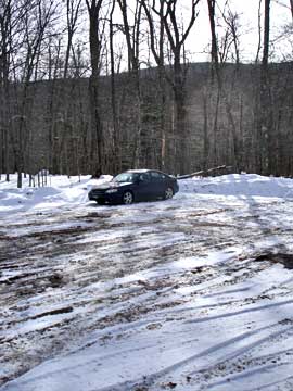 |
This is the Biscuit Brook DEC parking lot.
After parking your car, you need to walk back up the street. About 100 feet up the street, you will find the trail head on the opposite side of the street.
 | |
|
 |
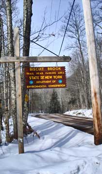
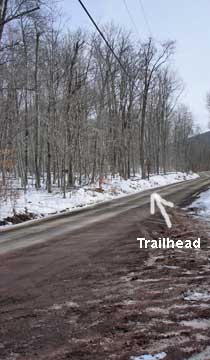
This is the sign by the Trail Head on Rt 47.
The DEC Registration Box is a short distance from Rt 47. It is about 1/10 of a mile from the Biscuit Brook DEC parking lot. |
 |
|
 |
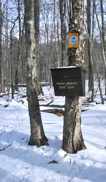
After registering at the DEC registration box, the climb will increase. The trail runs across the hillside, so the climb isn't so bad. But, it is rocky.
When you get to the top of the climb, the trail becomes flat. In fact, it goes downhill slightly. At this point, you are about a mile into the hike. This is an important point for one of the alternative routes to the top of Fir. If you take a right off the trail, this will follow the long ridge line to Fir Mountain. For this hike, we will continue straight down the DEC marked trail for now.
|
 |
|
 |
This is the route up the long ridge line to Fir Mountain
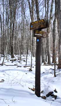
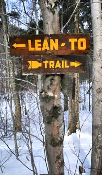
After walking down the marked trail into the valley, you will come to a sign in the picture. This side path will take you to the DEC Lean-to. The lean-to is next to the creek. |
 |
|
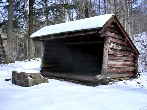 |
This is the picture of the DEC lean-to. It is right next to the creek, but it sits up about 15-20 feet above the creek. It should be safe during high water periods. |
|
 |
Shortly after you leave the Lean-to, you will come to a stream that you have to cross. You have to go down the stream bank, and then back up. Once you get up the other side of the stream bank, you want to leave the trail. Take a RIGHT into the woods and climb the steep bank.
When you get up the steeper bank, you will see a mountain. This is NOT Fir Mountain. Once you get to the stream gully, you want to turn LEFT 90 degrees and start to climb the easy incline. This climb will be about 1.5 miles. |
 |
|
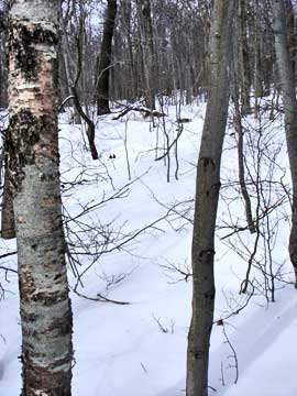 |
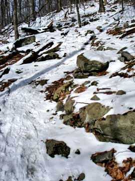
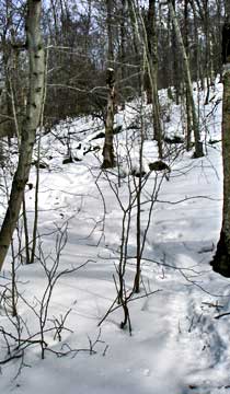
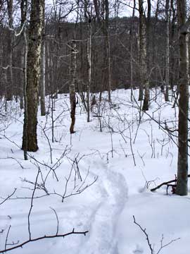
The picture on the left shows you want the trail looks like for most of the trip. There are NO ledges to climb. Just a steady easy incline. For such a talk Catskill Mountain, the grade is very nice. |
|
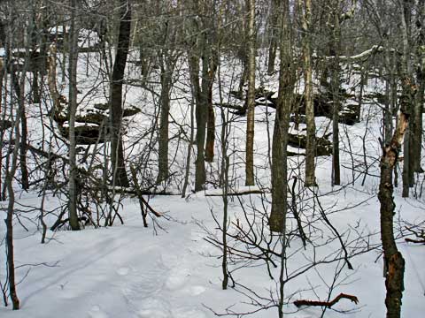 |
As you get near the top of Fir Mountain, you will come to this more difficult section. It really isn't that hard. But, it is the hardest section of the hike. You can climb it in a number of routes. It is about 30 feet high. It can be climbed with snowshoes. |
|
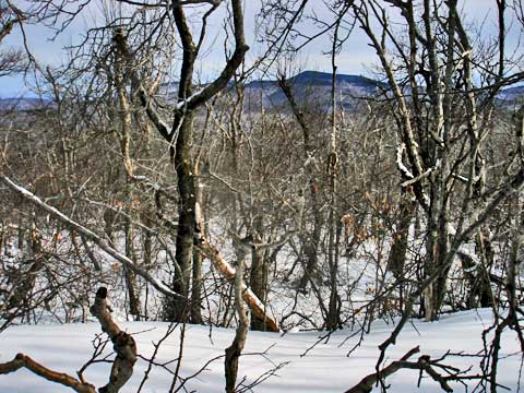 |
Just before the peak of Fir Mountain, you will encounter a place on the east side of Fir Mountain that will give you this view. |
|
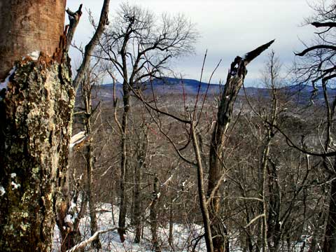 |
Here is another view from near the summit of Fir Mountain. This view is a little nicer. In the summer, you probably will not have a view. |
|
|
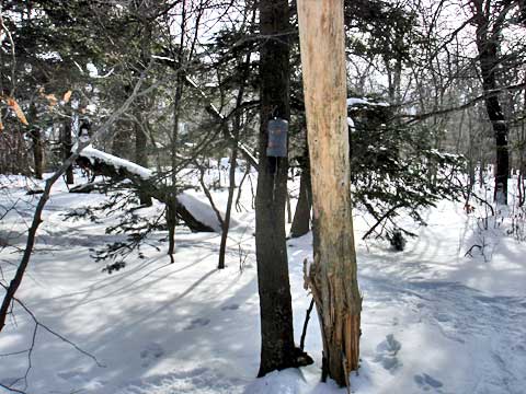
At mile post 4.05, you will come upon the canister. At the time this page was created the canister is facing north, so you have to look backwards as you move forward to find it. |
|
|
|
Copyright 2001-2021 www.catskillmountaineer.com
ALL RIGHTS RESERVED
|