Hike Eagle Mountain from Seager |
 |
| |
| |
|
|
|
Maps of Big Indian Wilderness |
 |
|
|
|
| | DIRECTIONS TO SEAGER TRAILHEAD |
| | Seager Parking Area: 42.05785, -74.539267 (DEC-WGS84) - Elevation is about 2,009 feet |
| | Seager Parking Area: N42 03.471 W74 32.356 (GPS) - Elevation is about 2,009 feet |
| | Seager Parking Area: 18N 538122, 4656302 (UTM) - Elevation is about 2,009 feet |
| | Seager Parking Area: N42 03 28, W74 32 21 (Degree, Min, Sec) - Elevation is about 2,009 feet |
| | Take New York State Thruway to Exit 19 (Kingston). |
| | Take a right out of the NYS Thruway toll booths onto Rt 28. |
| | Go approximately 30.4 miles west on Rt 28 |
| | Take a left onto Rt 49A at Highmount (Belleayre Ski Center) |
| | Go apprximately 5.5 miles on Rt 49A to the end of the road. |
| | Take a LEFT onto Dry Brook Road |
| | The DEC Parking lot is at the very end of Dry Brook Road |
|
|
NOTES ABOUT THIS HIKE |
| | PLEASE NOTE: For the first 2.1 miles, you are on PRIVATE PROPERTY! - PLEASE STAY ON THE TRAIL!
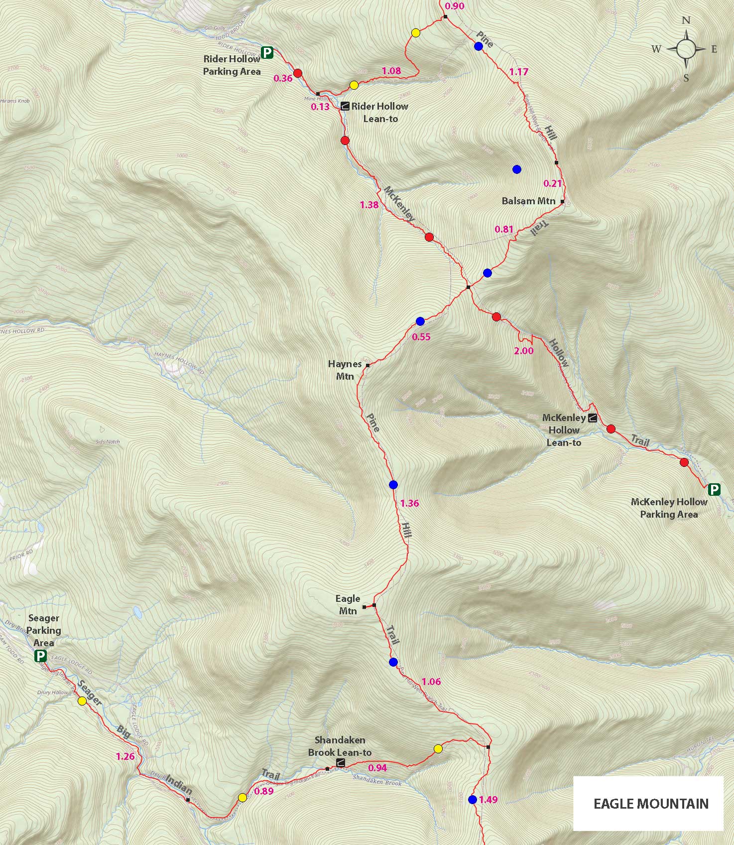
The hike to Eagle Mountain is in Ulster county. The hike can be done in a number of different directions. It can be accessed from Rider Hollow Road, Dry Brook Road (Seager) (easiest to get lost), McKinley Hollow Road (most vertical), and Biscuit Brook (longest). There are pros and cons to each direction depending upon the time of year. The trail to Eagle Mountain is poorly maintained, so some people like to hike it in the Winter with Snowshoes. The hike is moderate in ability. In the summer the numerous stream crossings are fun, but in the Winter they are a concern. This hike has one of the most plentiful wildlife sections of the Catskill Mountains. Many of the species of animals were killed off in the 1800's. Many have not recovered. But, this section has recovered fairly well. We saw plenty of black bear scat.
Hiking it from Dry Brook Road can be difficult. It is easy to get lost on the Dry Brook Road route because of the trails and roads that shoot off the trail. The path from McKinley Hollow Road has the most amount of vertical. It has another 400 vertical foot climb then the other two routes. The path is steeper and more difficult. If you want a challenge, then this route might be better. It has almost the same mileage. The route from Biscuit Brook is the longest by far. It is approximately 13-14 miles round trip.
When you start out from the DEC parking lot at the very end of Dry Brook Road, the walk is fairly flat. You will be walking next to the creek, and will cross it a number of times. Because of Hurricane Irene in 2011, parts of the trail were washed away, so there have been a few changes. You need to pay attention for the first 1-1/4 miles.
After you cross the Dry Brook Stream, you need to look for a sign on the right side of the trail. When you see the sign, there will be a trail on the LEFT side of the road. You want to take this trail. If you continue up the road, you will get lost. People do get lost here often, so pay attention to the mileage if you have a GPS.
When you leave the road and start walking up the trail, the incline will increase slightly. Almost a mile later, you will come to the Lean-to. There is a small stream by the Lean-to. This small stream has a ravine about 5-10' deep. There is a pipe that empties into the small stream. It is a very good water source. During the drought of 2012, it continued to flow well. Even after the stream completely dried up.
After the Lean-To, the incline increases to a moderate level to the col. Once at the col, you will take a LEFT to Eagle Mountain. The hike up to Eagle is pretty easy. A couple small little climbs, but nothing difficult.
When you approach the summit of Eagle Mountain, you will have to take an unmarked trail on the right to the summit of Eagle Mountain. The summit is about 250 feet off the marked trail. Again, there is NO views. The summit isn't obvious, but you will see a small clearing. When you get done, reverse your course back to the car.
|
|
|
MILEAGE CHART |
| | Mile Point | Altitude | Notes |
| | 0.00 | 2,209 | DEC Parking Area and Trailhead
For the first 2.1 miles you are on Private Property - Stay on the trail! |
| | 1.26 | 2,206 | Cross Dry Brook Stream
| | | 1.28 | 2,217 | NOTE: VERY EASY TO MISS! |
| | 2.15 | 2,476' | DEC LeanTo |
| | 3.09 | 3,168' | Trail Junction - Take LEFT. |
| | 4.15 | 3,608' | Take a LEFT - and walk up to the summit |
| | 4.20 | 3,613 | Summit of Eagle Mountain - hard to tell that you are on the summit. |
| | 8.40 | 2,209 | Return back to Seager DEC Parking Lot on Dry Brook Road. |
|
|
Hike to Eagle Mountain from Seager Parking Area |
 |
 |
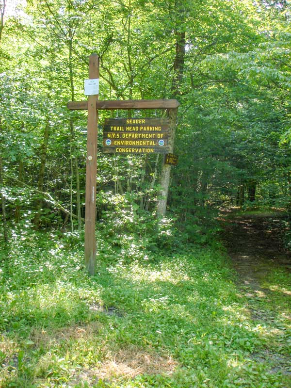
This a picture of the Seager Parking Area at the very end of Dry Brook Road. The DEC registration box is right at the beginning of the trail. There is a red gate about 100' past DEC registration box. Elevation is about 2,009 feet.
NOTE: The land around the parking area and the first 2 miles of the Seager Big Indian Trail are on private land. So, please stay on the trail.
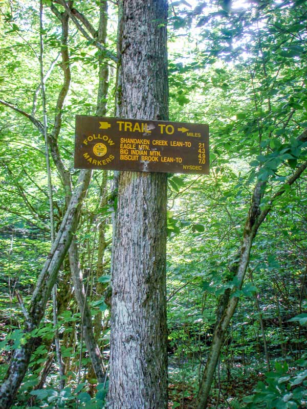
There is a DEC sign showing the mileage to distance locations. It is located right by the DEC parking area.
|
|
 |
 |
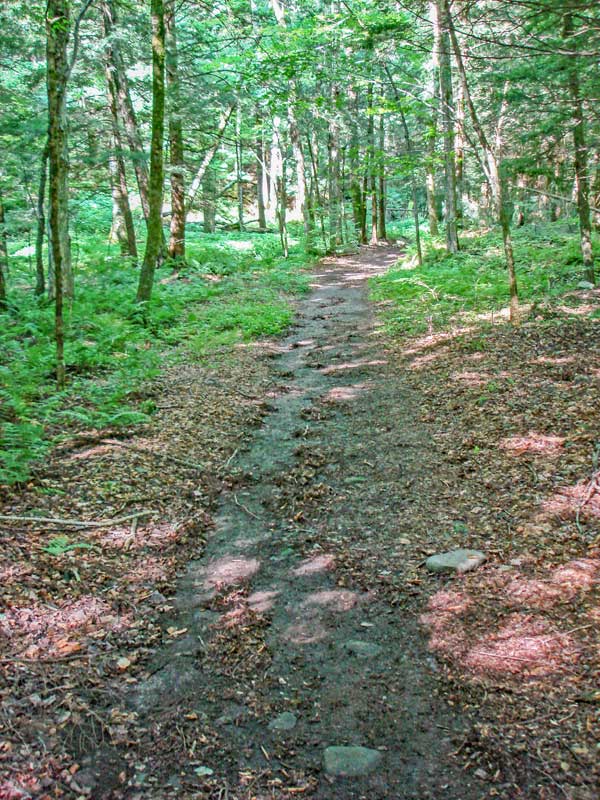
The dirt road leads up to the Dry Brook stream. You will not walk very far until you reach the stream. Parts of the The Seager Big Indian trail was damaged by Hurricane Irene in 2011. The Seager Big Indian trail continues up the RIGHT side of the stream.
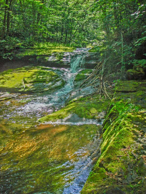
The picture on the right shows the a nice looking small cascade waterfall.
|
|
 |
 |
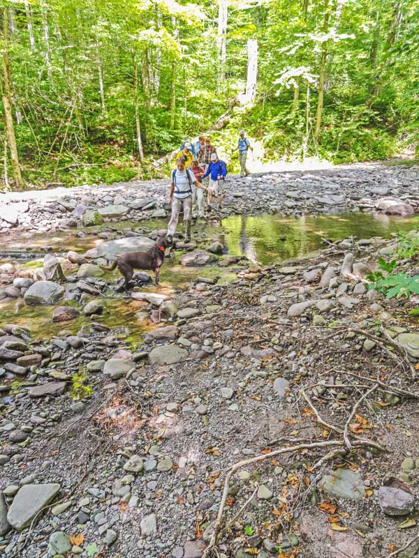
Just before you leave the trail/road along Dry Brook Stream, you have to cross the Dry Brook stream. This stream can only be crossed at low water. At normal water levels the stream can be challenging to cross without getting wet. Over time, the rocks shift around in the stream. At high water, this stream will be raging and unsafe to cross.
After crossing the Dry Brook Stream, you want to go RIGHT.
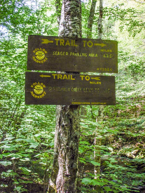
About 100' after crossing the Dry Brook stream, there is a trail junction. You want to go LEFT. There is a sign on the right side of the road. If you look to the left, you will see the trail to Eagle and Big Indian Mountains. It is VERY EASY to miss this side trail. It is 0.90 miles after the DEC parking lot.
There is a different stream that will run parallel to the Seager Big Indian Trail called the Shandaken Brook.
|
|
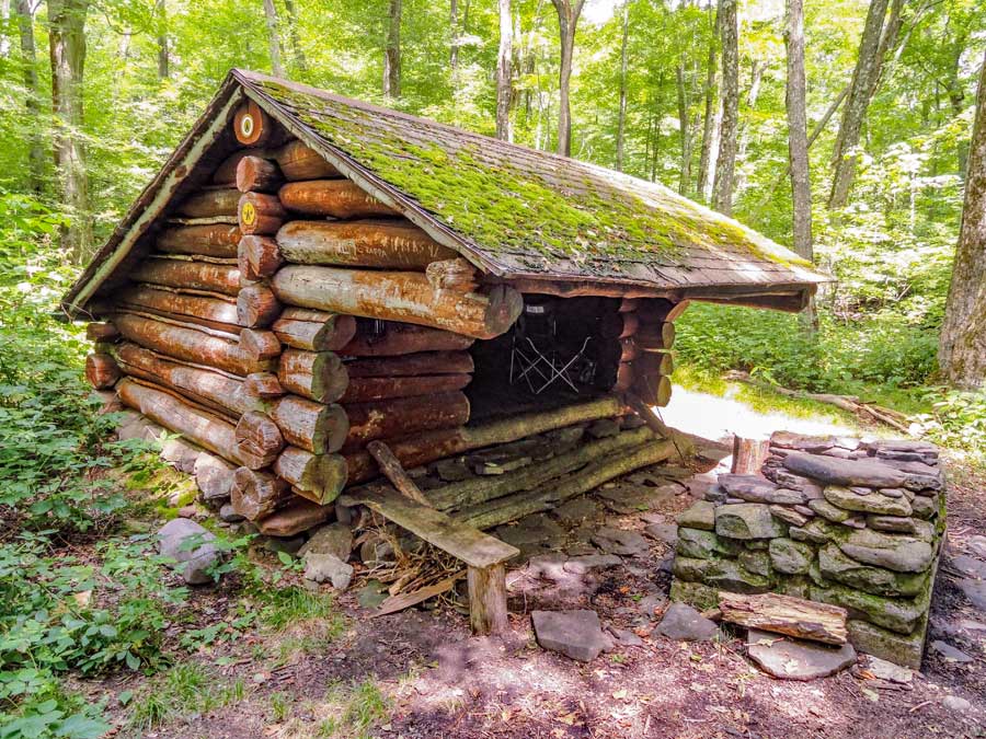 |
This is the DEC Shandaken Brook Lean-to on the way to the Col between Eagle Mountain and Big Indian Mountain. The Shandaken Lean-to sits close to the Shandaken Brook, and is a very good water source. There is also another waters source where there is a pipe that drains into the brook. It continues to flow well during droughts. There are a lot of stinging nettles around the Lean-to. The Lean-to is approximately 2.1 miles from the Seager Parking Area at the end of Dry Brook Road.
|
|
 |
 |
After visiting the Shandaken Brook Lean-To, the Seager Big Indian Trail will start to climb up at a moderate rate. Once you get near the Col, the trail levels off again. At the Col, you want to take a LEFT to go to Eagle Mountain. Right would take you to Big Indian Mountain and finally to Biscuit Brook Parking Area.
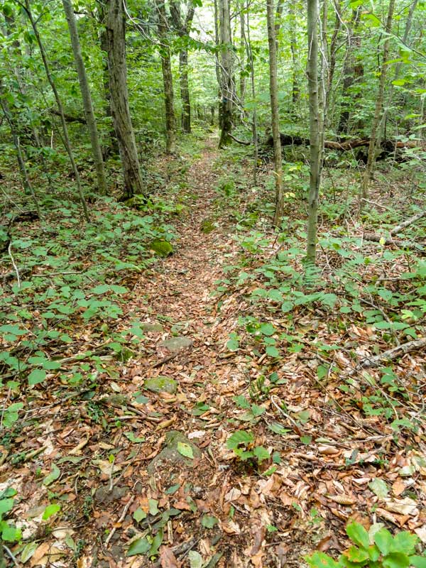
This is the trail near the Col to Eagle Mountain and Big Indian Mountain. You will encounter some conifer trees along the trail. The nettles will disappear once you get up to the Pine Hill Trail (Western Branch). There are a few small little climbs up on some rocks, but fairly easy hiking compared to other hikes in the Catskill Mountains. After hiking up the Pine Hill Trail a little over a mile, there is a side trail on the left. This side trail goes to the summit of Eagle. The Eagle Mountain summit is about 250' from the Pine Hill Trail via the side trail.
|
|
|
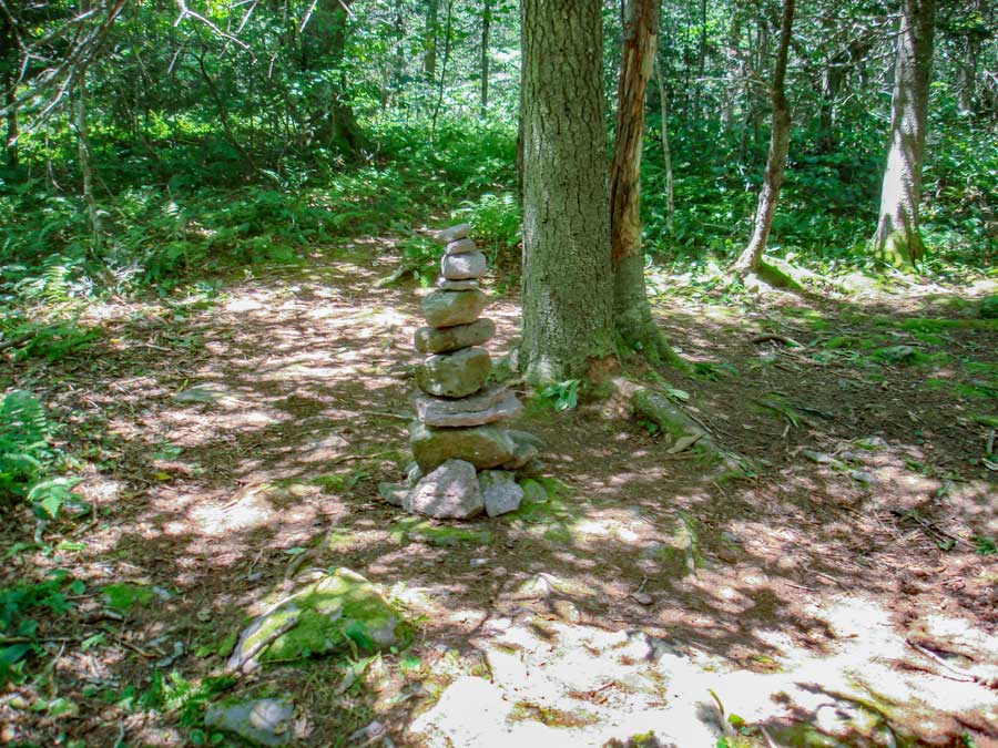
This is the summit of Eagle Mountain. The summit is very flat so it can be hard to tell that you are on the summit. Once you get done, reverse your hike back to the Seager Parking Area on Dry Brook Road. |
|
|
S E C T I O N S
|
W E A T H E R
|
O T H E R
|