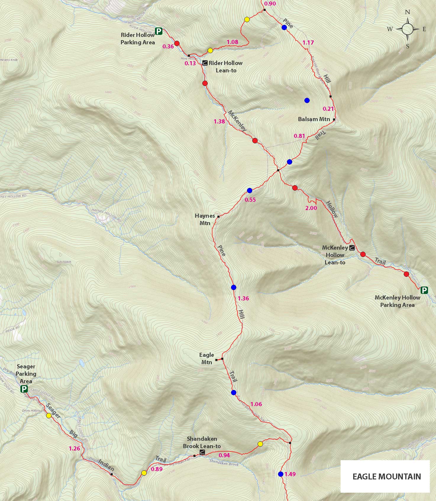
Eagle and Haynes Mountain |
 |
| Summit of Eagle Mountain |
| |
| |
|
|
|
Maps |
 |
|
|
|
| | DIRECTIONS TO TRAILHEAD |
| | Rider Hollow Parking Area: 42.10205, -74.516667 (DEC-WGS84) - Elevation is about 1,973 feet |
| | Rider Hollow Parking Area: N 42 06.123, W 74 31.000 (GPS) - Elevation is about 1,973 feet |
| | Rider Hollow Parking Area: 18N 539965 4661220 (UTM) - Elevation is about 1,973 feet |
| | Rider Hollow Parking Area: N42 06 07, W74 31 00 (Degree, Min, Sec) - Elevation is about 1,973 feet |
| | Take New York State Thruway to Exit 19 (Kingston). |
| | Take a right out of the NYS Thruway toll booths onto Rt 28. |
| | Go approximately 30.4 miles west on Rt 28 |
| | Take a left onto Rt 49A at Highmount (Belleayre Ski Center) |
| | Go 5.1 miles on Rt 49A. |
| | Take a LEFT onto Rider Hollow Road Road |
| | Go approximately 2.2 miles to the VERY END of Rider Hollow Road. |
| | Drive until you cannot drive any further - Will be blocked by Yellow DEC gate |
| | Road will change from a 2-lane road to a 1-lane road that looks like a driveway - keep going to very end of road. |
| | The DEC Parking lot is at the very end of Rider Hollow Road |
|
|
NOTES ABOUT THIS HIKE |
| | The hike to Eagle Mountain is in Ulster county. The hike can be done in a number of different directions. It can be accessed from Rider Hollow Road, Dry Brook Road (Seager), McKinley Hollow Road (most vertical), and Biscuit Brook (longest). There are pros and cons to each direction depending upon the time of year. The hike is moderate in ability. In the summer the numerous stream crossings are fun, but in the Winter they are a concern.
Hiking it from Dry Brook Road can be difficult. Some parts of the trail can become overgrow in the Summer. It is about the same distance from Dry Brook Road as from Rider Hollow Road. It is easy to get lost on the Dry Brook Road route because of the side-trails that shoot off the trail. So, it is often better to take the Rider Hollow Road. The path from McKinley Hollow Road has the most amount of vertical. It has another 400 vertical foot climb then the other two routes. The path is steeper and more difficult. If you want a challenge, then this route might be better. It has almost the same mileage. The route from Biscuit Brook is the longest by far. It is approximately 13-14 miles round trip.
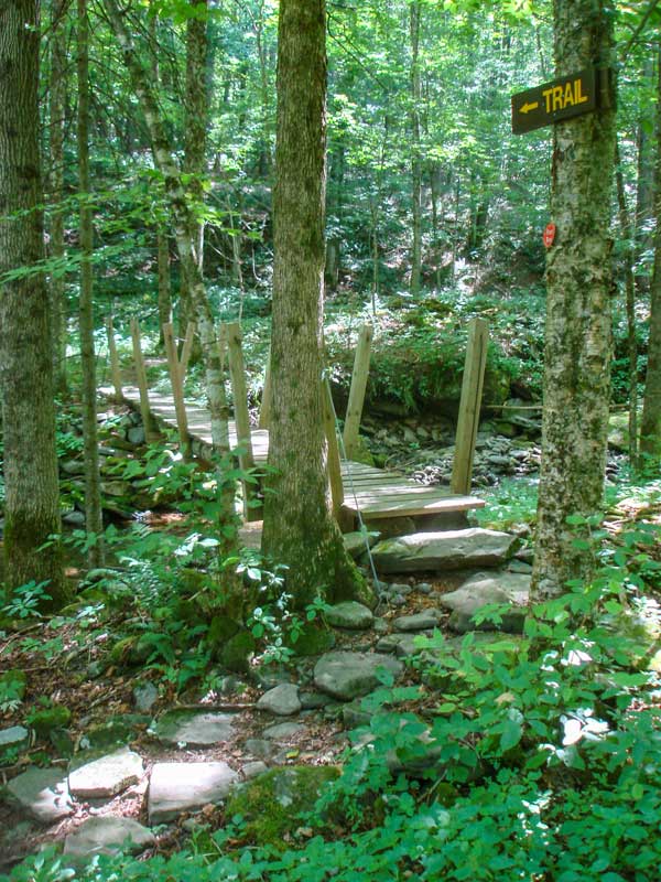
When you start out from the DEC parking lot at the very end of Rider Hollow Road, the walk is fairly flat. You will be walking next to the creek, and will cross it a number of times. In the beginning, it will be over bridges. Later you will make quite a few stream crossings. During high water, you may not be able to take this route. This route is generally used during lower water.
After you cross the steel bridge you will encounter the Lean-To. It is about a 1/2 mile from the DEC Parking Lot. As you move further down the trail you will cross the stream quite a few times. In the summer you have to be careful of the weeds near the stream. Some have horrible prickers on the shafts of the weeds. They are very painful and plentiful. The further up you go, the steeper the trail gets.
At the col, you will then take a right up the hill.
Then you will arrive on the summit of Haynes Mountain, the highest point is about 50 feet off the trail. There is NO view point. After you leave the summit and head to Eagle Mountain, you will descend the steepest part of the hike.
When you approach the summit of Eagle Mountain, you will have to take an unmarked trail on the right to the summit of Eagle Mountain. The summit is about 200 feet off the marked trail. Again, there are NO views. When you get done, reverse your course back to the car.
|
|
|
MILEAGE CHART |
| | Mile Point | Altitude | Notes |
| | 0.00 | 2,055 | DEC Parking Lot & Registration Box |
| | 0.37 | 2,133 | Water Pipe next to stream - across stream on the bank. |
| | 0.38 | 2,135' | Trail Junction - Take RIGHT over steel bridge |
| | 0.51 | 2,172' | Lean-To by Stream |
| | 1.89 | 3,072 | 4-Way Trail Junction - Go RIGHT up hill |
| | 2.44 | 3,425 | Summit of Haynes Mountain. |
| | 3.80 | 3,603 | Trail to the Summit of Eagle Mountain. |
| | 3.84 | 3,613 | Summit of Eagle Mountain. |
| | 7.86 | 2,055 | DEC Parking Lot. |
|
|
Hike to Haynes and Eagle Mountains |
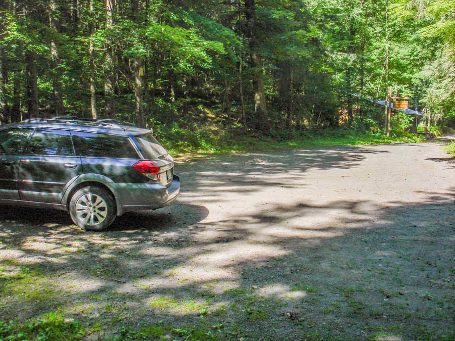 |
This is the Rider Hollow Parking Area. It is located at the very end of Rider Hollow Road.
This picture is taken while looking from the gate looking back down Rider Hollow Road. You will notice that the road is very narrow (one lane road).
|
|
 |
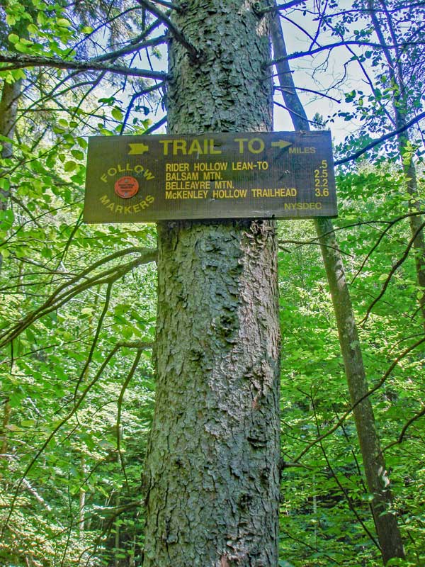 |
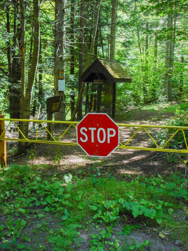
The yellow gate is the Trailhead for the McKenley Hollow Trail. If you look just left of the yellow gate you will see the DEC registration box. Make sure that you register so that this trial will get the necessary funds for maintenance.
The picture on the right shows the sign by the beginning of the trailhead.
|
|
 |
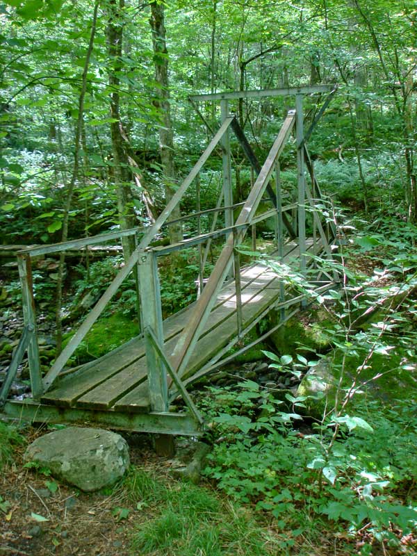 |
This is just the first of many creek crossings you will have to do. This route is a bad choice at high water. In the beginning, you will have bridges, but later on you will have to find a way to get across the creek.
|
|
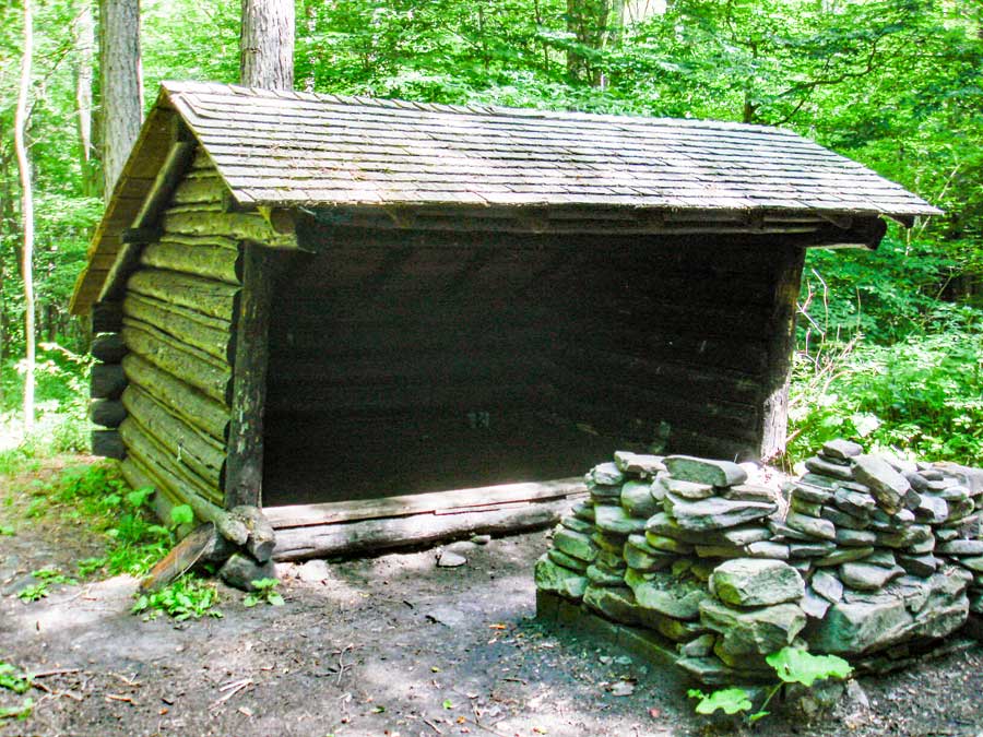 |
After you cross the creek you will come to the Rider Hollow Lean-To. There is a nice fire ring for a good fire. |
|
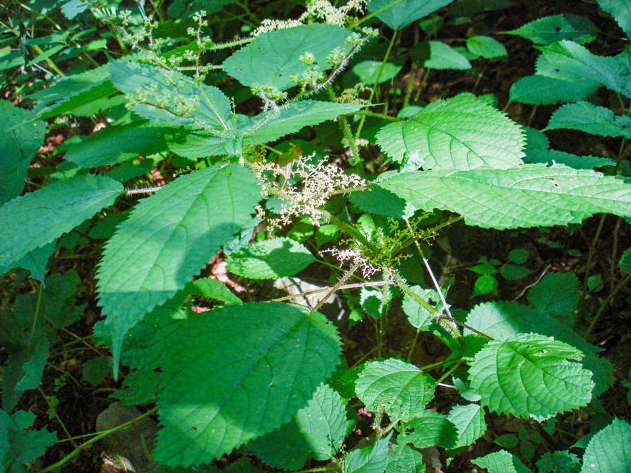 |
In the summer, you will see a lot of Stinging Nettles along the trail (Urtica dioica). These plants look harmless, the the shafts have thousands stiff prickers. If you rub up against them, it will be a bad experience. It will intensely burn and itch for about 30 minutes. During the middle of the summer, the Stinging Nettles will be overgrown well into the path. This is not the kind of path you want to do in sandels. The Stinging Needles are found predominately around the stream. Since the path follows the stream, you will encounter a lot of them on this hike. Once you get up to the col, the Stinging Needles will stop growing. |
|
 |
 |
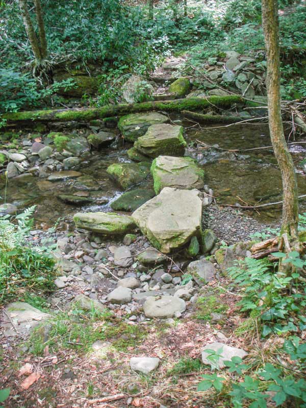
At this point, you will have some rock steps to help you across the creek. When it gets below freezing, these rocks get slippery, so you should carry microspikes or snowshoes.
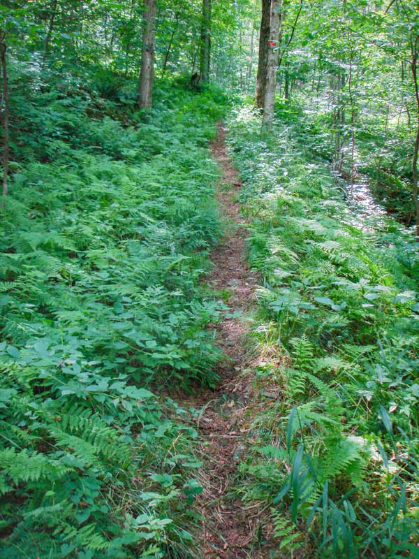
After passing the Lean-to the trail will get steeper. The closer you get to the col, the steeper it gets. |
|
 |
 |
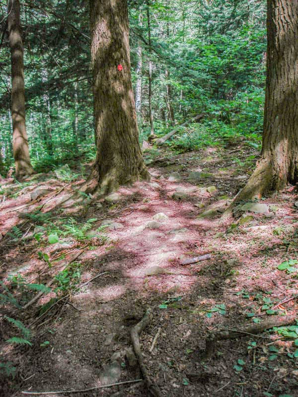
Near the top there is a small section of conifer forest.
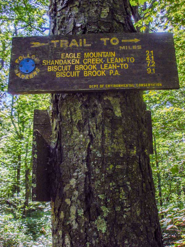
When you get to the col, you will see a number of signs. At this point you want to take a RIGHT and head up the hill.
Haynes Mountain is a little over a 1/2 mile from this point, and Eagle Mountain is a little less then 2 miles away. |
|
|
This is another picture of the trail.
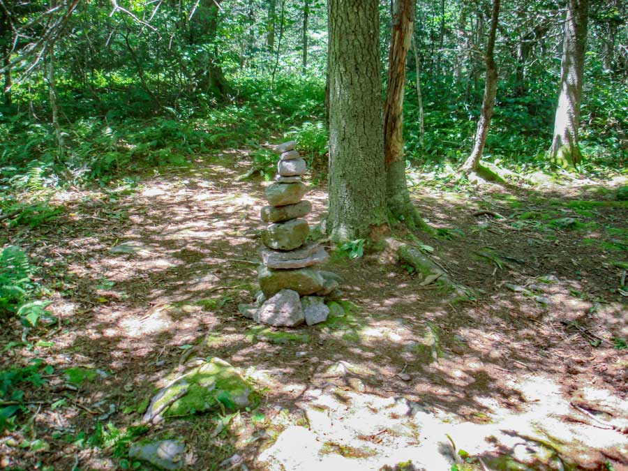
When you get to the top of Eagle Mountain, there is a trail on the right. Take that trail. In about 200 ' you will reach a rock cairn that marks the top of Eagle Mountain. |
|
|
S E C T I O N S
|
W E A T H E R
|
O T H E R
|