Hike Balsam Mountain from Rider Hollow Road |
 |
| |
| |
| |
|
OVERVIEW |
| | Trail Name: |  McKenley Hollow Trail (DEC changed Rider Hollow Trial to McKenley Hollow Trail)
 |
| | Trail Name: |  Mine Hollow Trail
 |
| | Trail Name: |  Pine Hill Trail - West Branch
 |
| | Trail Name: |
McKenley Hollow Trail |
| | | |
| | Forest: | Big Indian Wilderness |
| | Parking Area : | DEC land for approximately 5 cars |
| | Winter Access: | Parking Area is Plowed. |
| | Access Methods: | Foot and Snowshoe |
| | Best Time to Hike: | Any time of year |
| | Difficulty: | Moderate |
| | | |
| | | Trail Length: | 5.51 miles (round-trip) |
| | Type of Trail: | 100% single track trail |
| | Parking Area : | DEC land for approximately 3 cars |
| | Lean-To: | (1) located 1/2 mile from the Rider Hollow Parking Area |
| | Winter Access: | Parking Area is Plowed. |
| | Lowest Elevation: | 1,430' |
| | Highest Elevation: | 3,601' |
| | Views : | One view spot |
| | Difficulty: | Moderate |
| | | |
| | | USGS Official Map: | Shandaken Topographical Map (free) |
| | | |
| | | USGS Official Map: | Seager Topographical Map (free) |
| | |
| | | DEC Information: | Big Indian Wilderness Information |
| | | |
| | | DEC Trail Map: | Big Indian Wilderness Trail Map |
| | |
| | | Acme Digital Mapper: |
Topo
Terrain
Satellite |
|
|
MAPS FOR BALSAM MOUNTAIN |
 |
|
|
|
| | DIRECTIONS TO TRAIL HEAD |
| | Rider Hollow Parking Area: 42.10205, -74.516667 (DEC-WGS84) - Elevation is about 1,973 feet |
| | Rider Hollow Parking Area: N 42 06.123, W 74 31.000 (GPS) - Elevation is about 1,973 feet |
| | Rider Hollow Parking Area: 18N 539965 4661220 (UTM) - Elevation is about 1,973 feet |
| | Rider Hollow Parking Area: N42 06 07, W74 31 00 (Degree, Min, Sec) - Elevation is about 1,973 feet |
| | Take New York State Thruway to Exit 19 (Kingston). |
| | Take a right out of the NYS Thruway toll booths onto Rt 28. |
| | Go approximately 33 miles west on Rt 28 |
| | Take a left onto Rt 49A at Highmount (Belleayre Ski Center) |
| | Go 5.1 miles on Rt 49A. |
| | Take a LEFT onto Rider Hollow Road Road |
| | Go appoximately 2.2 miles to the VERY END of Rider Hollow Road. |
| | Drive until you cannot drive any further - Will be blocked by Yellow DEC gate |
| | Road will change from a 2-lane road to a 1-lane road that looks like a driveway - keep going to very end of road. |
| | The DEC Parking lot is at the very end of Rider Hollow Road |
|
|
NOTES for hike to BALSAM MOUNTAIN |
| | The hike for Balsam Mountain in Ulster county is a loop hike. The hike can be done in clockwise or counter-clockwise direction. There are pros and cons to each direction depending upon the time of year. The nice part of this hike is the beautiful long summit walk with one great view point. The hike is moderate in ability. In the summer the numerous stream crossings are fun, but in the Winter they are a concern.
The first decision to be made is whether you will do the loop clockwise or counter-clockwise. Clockwise will help you avoid the stream crossing until the end of the hike. If you fall into the water at the beginning of the hike when it is cold, the hike is over. In the Summer it might be nice to get your feet wet at the beginning of the hike. Going clockwise will also put the sun in your eyes when walking across the summit. While not terrible, the summit walk is better when done counter-clockwise. Going clockwise breaks up the climb into sections with a couple flat sections.
When you start out from the DEC parking lot at the very end of Rider Hollow Road, the walk is fairly flat. You will be walking next to the creek, and will cross it a number of times. In the beginning, it will be over bridges. Once you get to the first trial junction at 0.35 miles, you have to decide whether you are going to do the hike clockwise or counter-clockwise. On our hike was done clockwise.
After going left, you will start to climb in elevation. The incline is moderate in rate. The trail does go up at an angle in some places. In the Winter this angle makes it more difficult to hike in snowshoes. The trail does zig-zag up the hillside. When you get close to the ridge, the incline will start to level off. This is a sign that you are coming up to the 2nd trail junction. Just before you reach the 2nd trail junction, you will come Rock Shelter. Rock Shelter is a couple of large rocks.
Just after Rock Shelter, you will come to the second trail junction. This trail junction is on the ridge and is on flat land. If you go left, it will take you to Belleayre Mountain. But, you want to go Right to Balsam Mountain. In the beginning the trail is flat. This section is often windy, and there are snow drifts in the Winter. After a short period of time, the trail will actually head downhill. In the Winter you can see Balsam Mountain off in the near distance. Then, you will start to climb uphill at a moderate rate. Then you will come to the steepest part of the hike, which isn't that bad. It is only difficult in the winter when it is icy. The trail moves up the ledge at an angle. This makes it difficult on snowshoes. Once you get to the top, the trail levels off, but still continues to climb. You will also start to encounter conifer trees.
Then you will arrive on the summit ridge. This ridge is long and very nice. In the Winter you can see off to the left thru the trees. When you first arrive, you will think that you have arrived at the summit. But, it is actually a false summit. It is actually 8 feet lower then the real summit. If you don't have a GPS, you wouldn't know this. Keep walking. After going down slightly, you will come to a small ledge with a great view. This is the best view of the hike. Enjoy it. Then you will continue again, but will start to go back up in elevation slightly. Just before you start to head down at a moderate rate, this is the summit of Balsam Mountain. The highest point is actually about 50 feet off to left.
After the summit, you will descend down at a moderate pace. There will be times, where the trail will level off flat. Once at the bottom, you will come to a 4-way trail junction. Left will take you to McKinley Hollow Road. Straight will take you to Eagle Mountain. Right will take you back to Rider Hollow Mountain where your car is parked. So go RIGHT. The trail will descend down at a moderate rate.You will have to do numerous stream crossings.
After the incline levels off, you will come to the Lean-To, and finally to the bridge. Once you cross the bridge, you want to go LEFT at the trail junction. Your car is just 0.35 miles away. After a few more stream crossings, you are done. Make sure you log out of the registration box.
|
|
|
MILEAGE CHART |
| | Mile Point | Altitude | Notes |
| | 0.00 | 1,973' | DEC Parking Lot & Registration Box - 42.10205, -74.516667 (DEC-WGS84) |
| | 0.00 | 1,973' | DEC Parking Lot & Registration Box - N 42 06.123, W 74 31.000 (GPS) |
| | 0.00 | 1,973' | DEC Parking Lot & Registration Box - 18N 539965 4661220 (UTM) |
| | 0.00 | 1,973' | DEC Parking Lot & Registration Box - N42 06 07, W74 31 00 (Degree, Min, Sec) |
| | 0.35 | 2,058' | Water Pipe next to stream - across stream on the bank. |
| | 0.36 | 2,060' | Trail Junction |
| | 1.44 | 2,988' | Trail Junction to Bellearye & Balsam Mtn |
| | 2.44 | 3,595' | False Summit |
| | 2.61 | 3,521' | Great Views from small ledge. |
| | 2.82 | 3,601' | Summit of Balsam Mountain. |
| | 3.11 | 3,491' | 3,500 sign. |
| | 3.63 | 3,055' | 4-way Trail Junction - McKinley Hollow Road - Eagle Mtn - Rider Hollow Road. |
| | 5.01 | 2,104' | Lean-To. |
| | 5.14 | 2,058' | Bridge over Creek. |
| | 5.51 | 1,973' | DEC Parking Lot. |
|
|
Hike of the Balsam Mountain Loop |
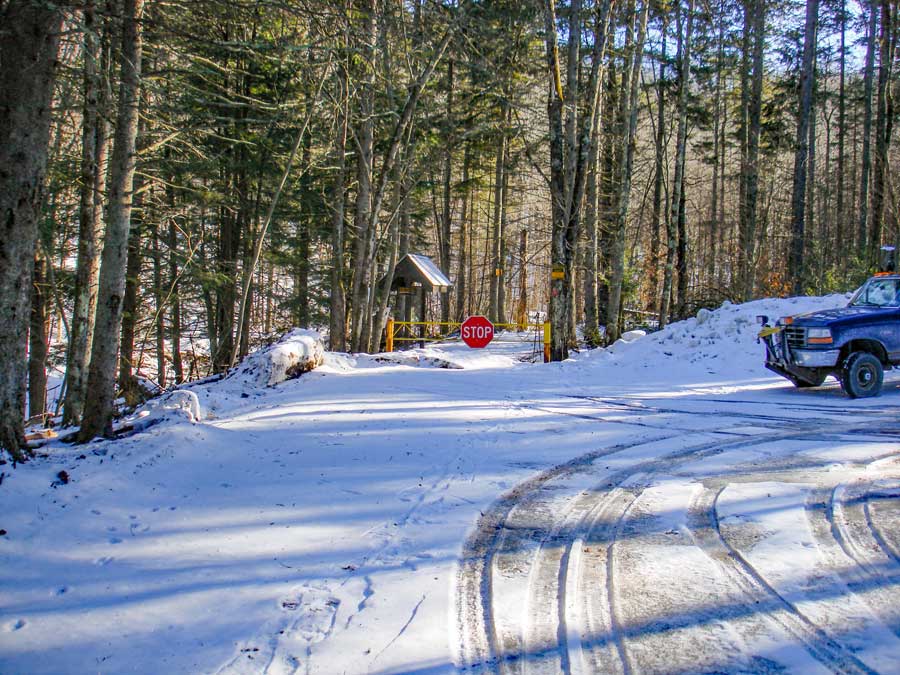 |
The picture on the left is the DEC parking lot at the very end of Rider Hollow Road. The yellow gate with the stop sign is the beginning of the trail.
This picture is taken while looking from the gate looking back down Rider Hollow Road. You will notice that the road is very narrow (one lane road). |
|
 |
|
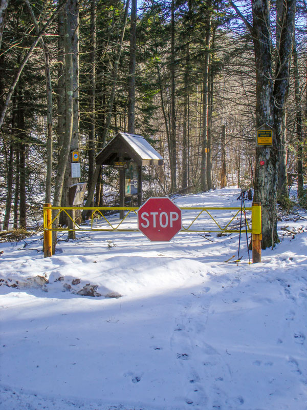
If you look just left of the yellow gate you will see the DEC registration box. Make sure that you register so that this trail will get the necessary funds for maintenance.
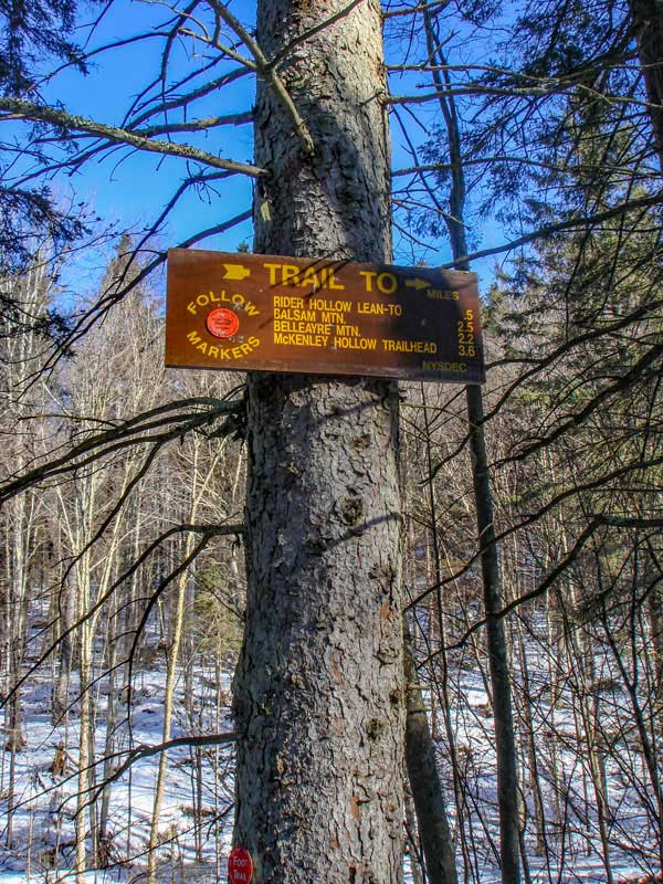
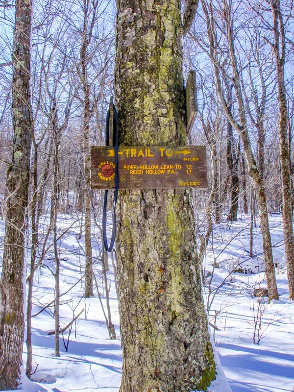
The picture on the right shows the sign by the beginning of the trail head. You will notice that the sign is very high up the tree.
|
|
 |
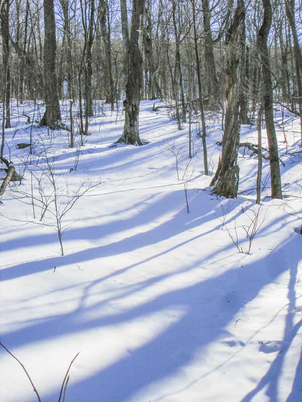
In the beginning the trail is flat and easy. Once you approach the stream it has a wooden bridge across it. |
|
 |
 |
After going over the wooden bridge you have to decide if you want to go clock-wise or counter-clockwise on the Balsam Mountain Loop Trail. Going counter-clockwise will allow you to enjoy the best part of the hike with the sun to your back.
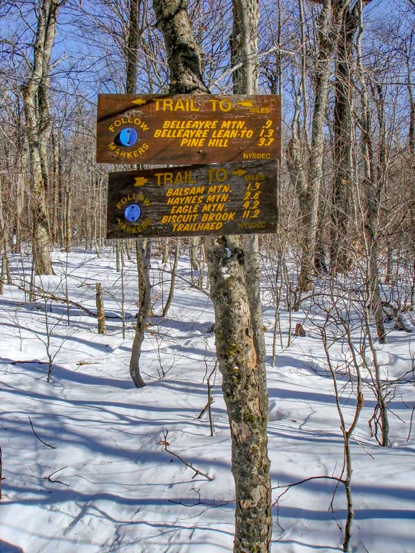
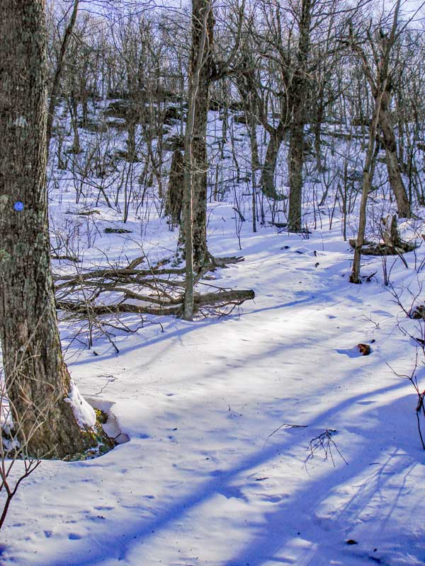
Shortly after leaving the trail junction, the trail will start to move uphill at a moderate incline. After a while the incline will level off. This means you are approaching the ridge line and trail junction.
|
|
 |
 |
The picture on the left is the next trail junction. Going left will take you to Bellearye Ski Resort. Going right will take you to Balsam Mountain. You want to go RIGHT.
The picture on the right show what the trail looks like after the trail junction. In the Winter snow drifts up here. The ridge is fairly flat so it isn't that bad. After a while you will actually go downhill for a while before heading up Balsam Mountain. |
|
 |
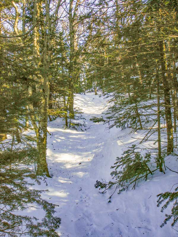 |
After going down hill the trail will then start to go uphill at an incline. It is the most difficult ledge during the hike. It is not that it is steep or difficult, but the trail runs up the ledge at an angle.
Once above the ledge, the trail continues to climb at an easy incline. You will also start to encounter Balsam Fir trees, which the mountain is named after. The trail at this point becomes quite peaceful and tranquil.
|
|
 |
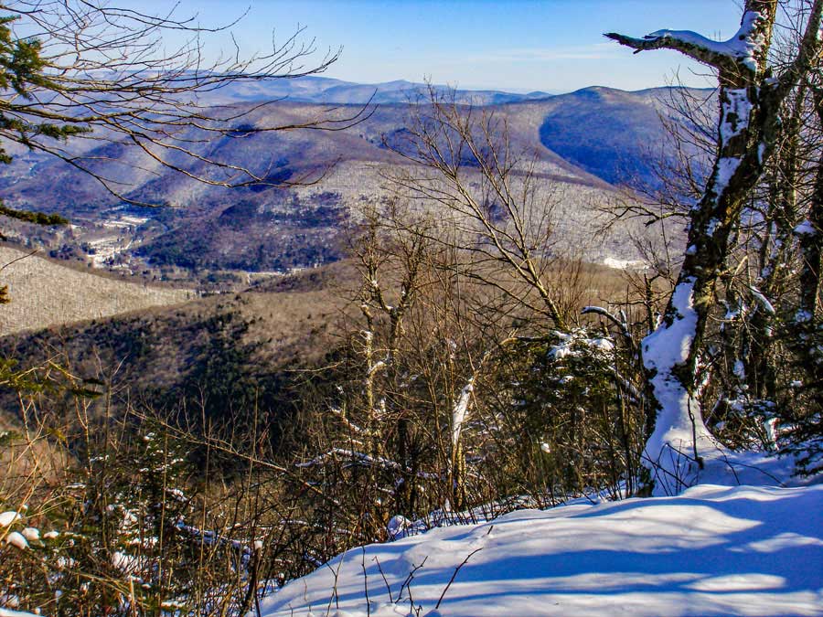
This picture shows the false summit of Balsam Mountain. It is actually 8 feet below the actual peak, and looks like a peak. There is some nice areas around this point. A good place to camp in the Winter. But, you cannot camp here in the Spring, Summer, and Fall. The walk continues to be nice, with views off to the left in the Winter. Unfortunately, the sun will be in your eyes on this part of the hike. Until you pass a ledge with great views, you have not reached the summit. |
|
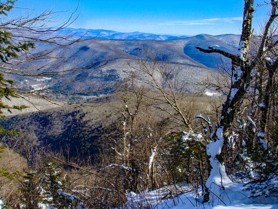 |
As you walk across the long summit area, you will be able to see a nice view off to the left when the leaves are not on the trees. On some parts of the summit walk, the elevation will drop about 30 feet. Enjoy the walk. This is one of the factors that makes this hike magical. |
|
 |
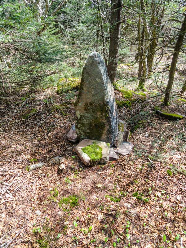
The picture on the left shows the highest point on the long summit walk. It is at mile post 2.82. It is just before you start to descend downhill. There is a pointed rock that is about 50 feet off the trail. In the winter it can be covered up by snow. |
|
 |
 |
This pointed rock is considered to be the summit of Balsam Mountain. In the winter, deep or drifting snow can cover it up.
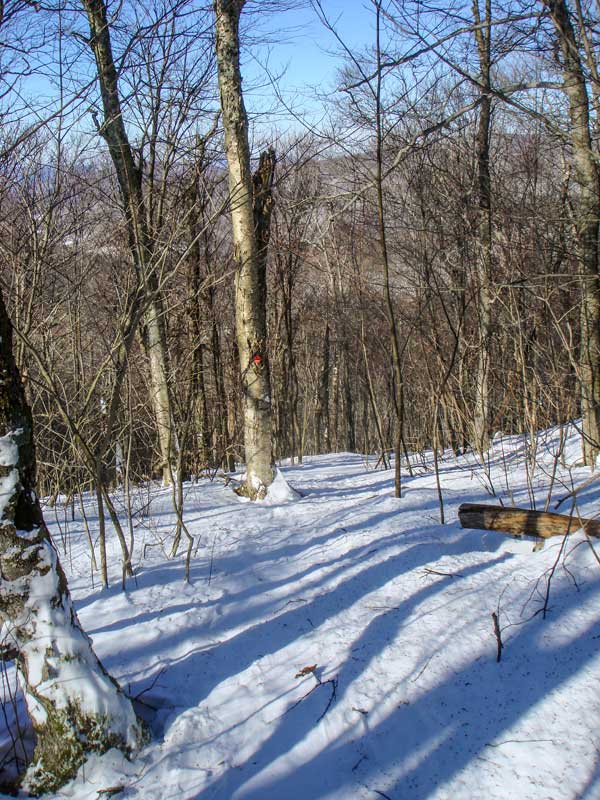
The trail will continue to descend at an easy-to-moderate pace. There will be a few flat sections before descending again.
|
|
 |
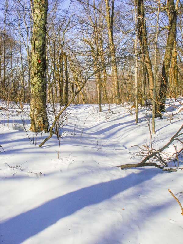 |
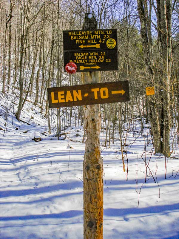
You will come to a 4-way trail junction. You want to go RIGHT down to Rider Hollow.
Left will take you to McKenley Hollow Parking Area. Straight will take you to Hayes Mountain, Eagle Mountain, Big Indian Mountain, and finally to Biscuit Brook Parking Area.
This is the beginning of the trail back to Rider Hollow Road DEC Parking Area.
|
|
 |
 |
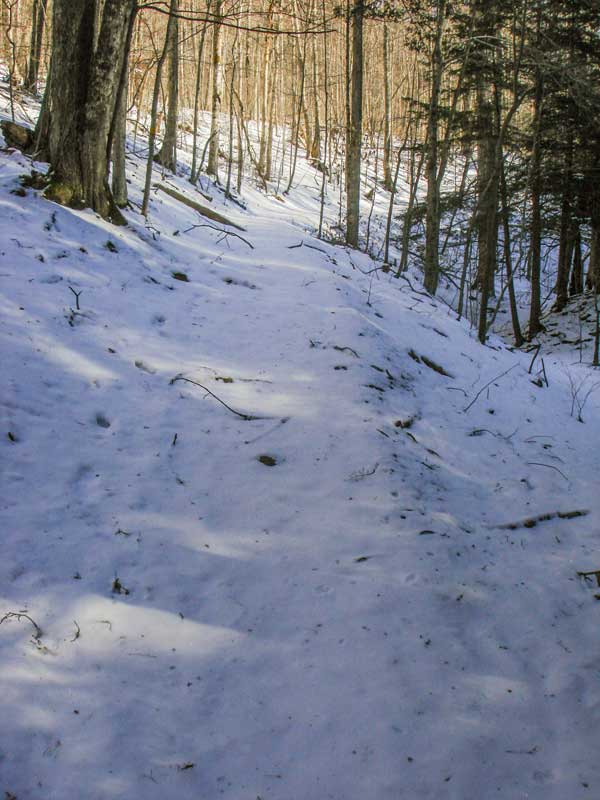
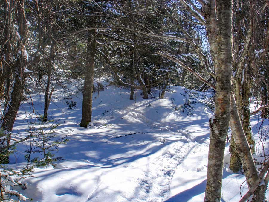
As you can see from the picture, it is hard to see where the trail is. But, if you are careful and pay attention you shouldn't have a problem.
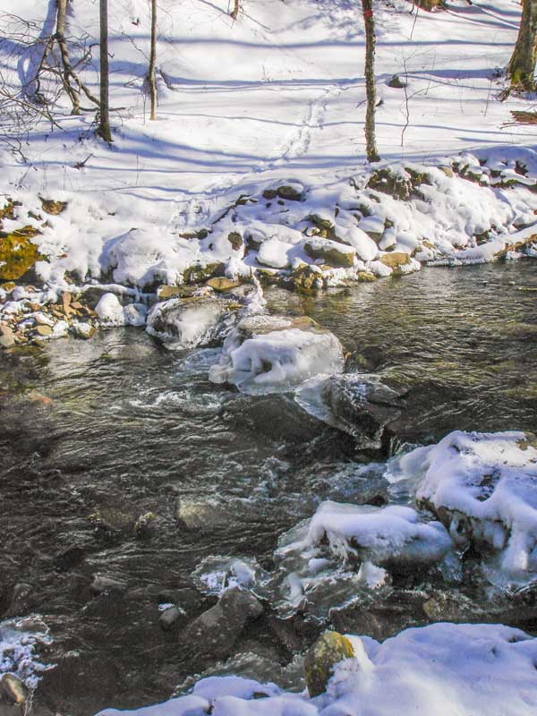
This downhill section is where you will cross the creeks multiple times. Most stream crossings do not have bridges, so you have to be careful in the Winter time. This particular crossings has rocks across the stream. But, as you can see the rocks are ice encrusted and are slippery. The water on each side of the rocks is about 1-1/2 feet deep. Without Microspikes, snowshoes, or cramp-ons, you should not attempt this stream crossing.
|
|
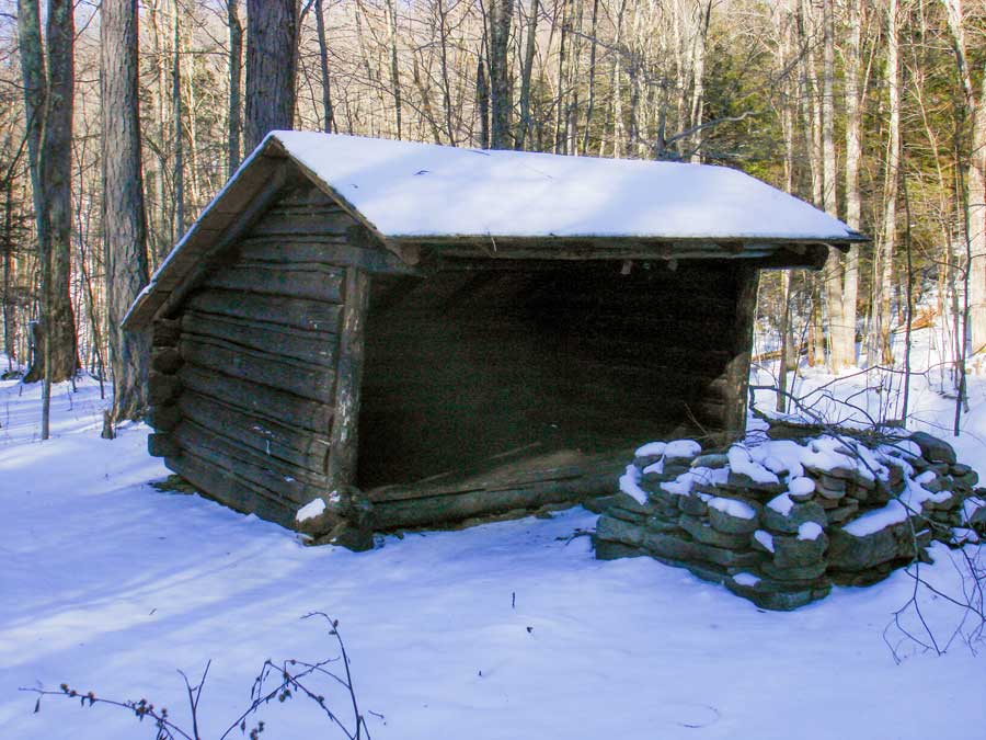 |
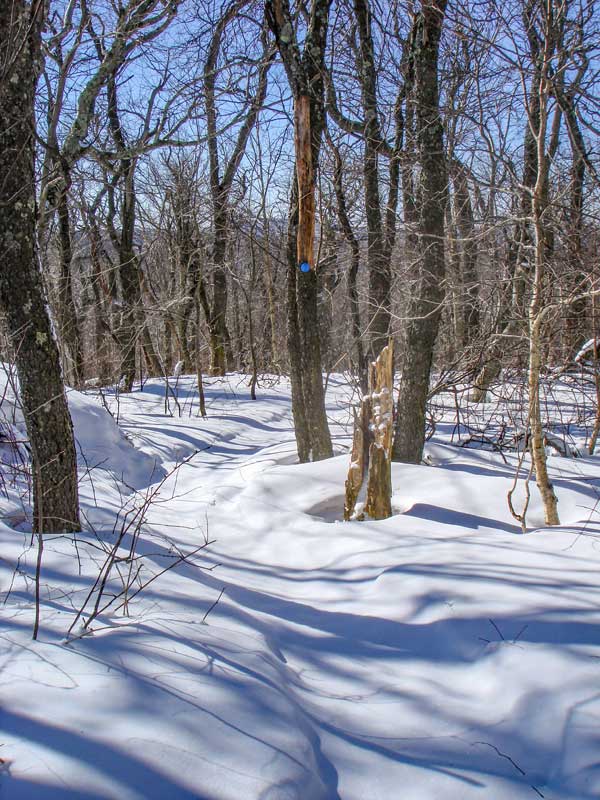
At mile post 5.01 (elev 2,104') you will encounter the DEC Rider Hollow Lean-To. It is about 1/2 mile from the parking lot and about 1,000 feet from the Trail Junction. The Lean-to is next to the stream.
|
|
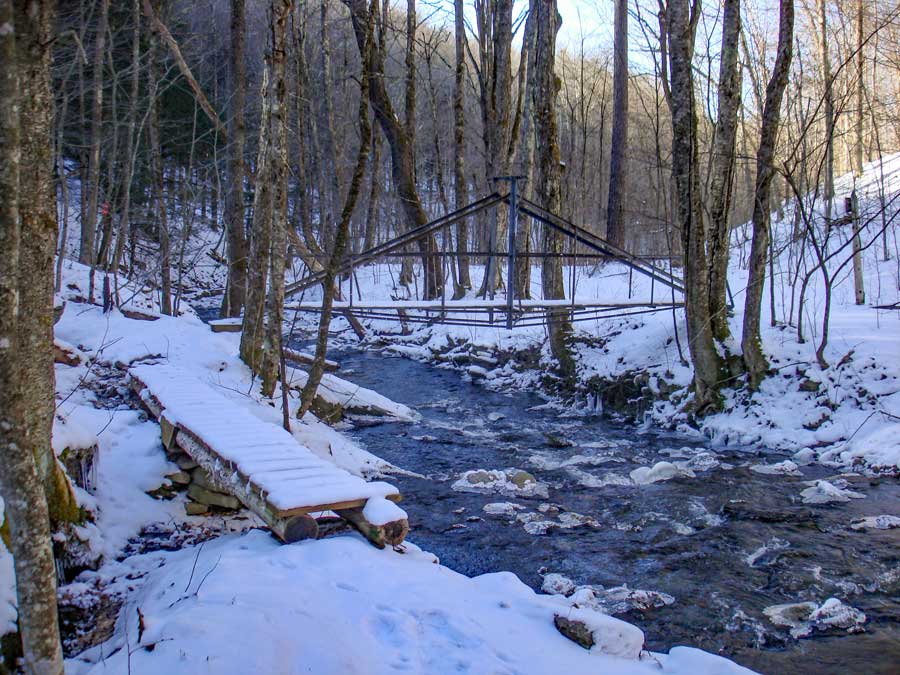 |
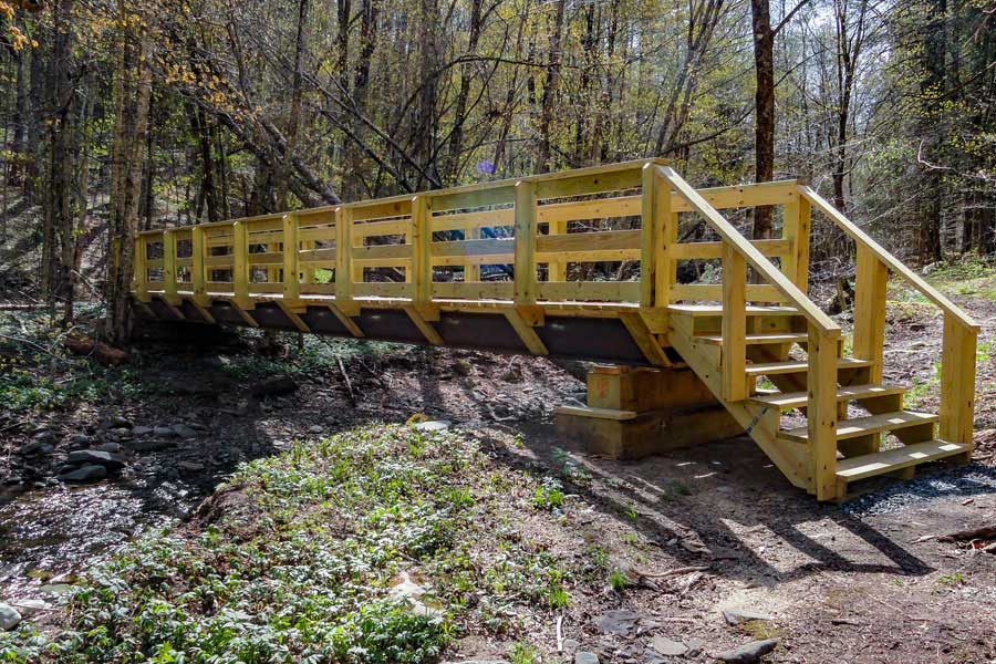
At mile post 5.14, you will come to this bridge. After you cross the bridge, you will come to the Trail Junction. You want to take a LEFT to get back to the Rider Hollow parking lot.
|
|
|
S E C T I O N S
|
W E A T H E R
|
O T H E R
|